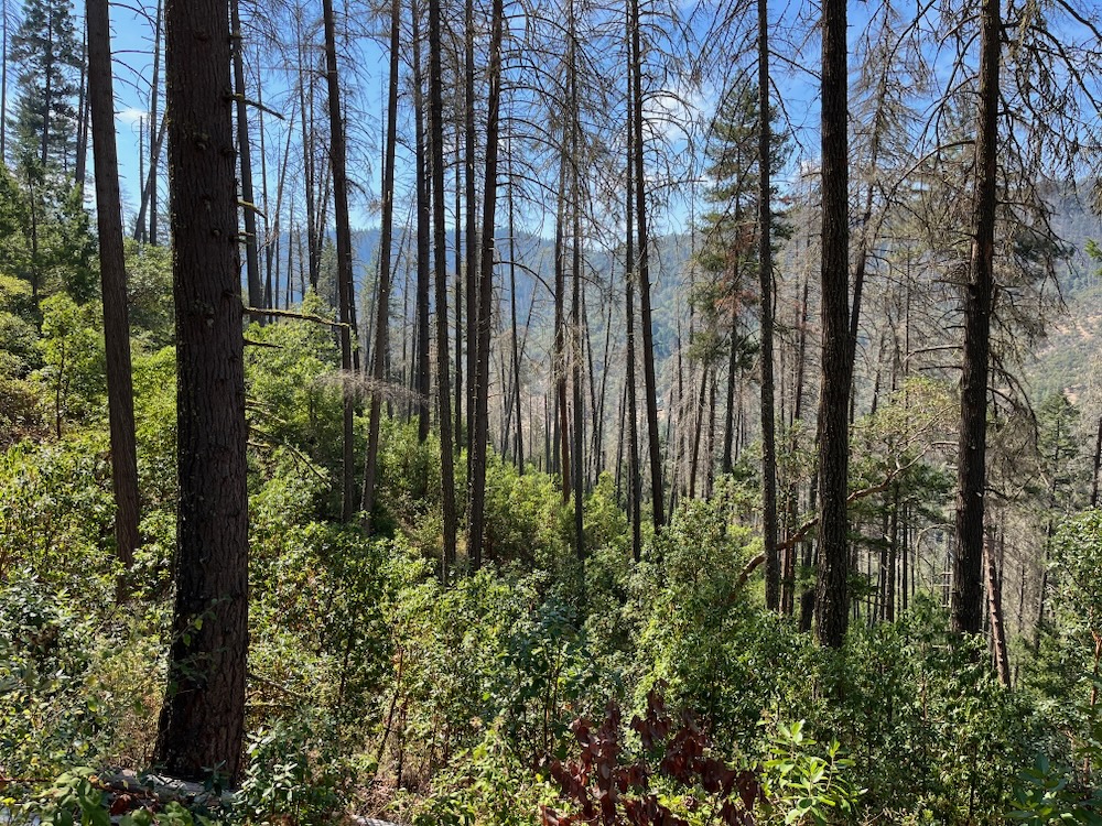
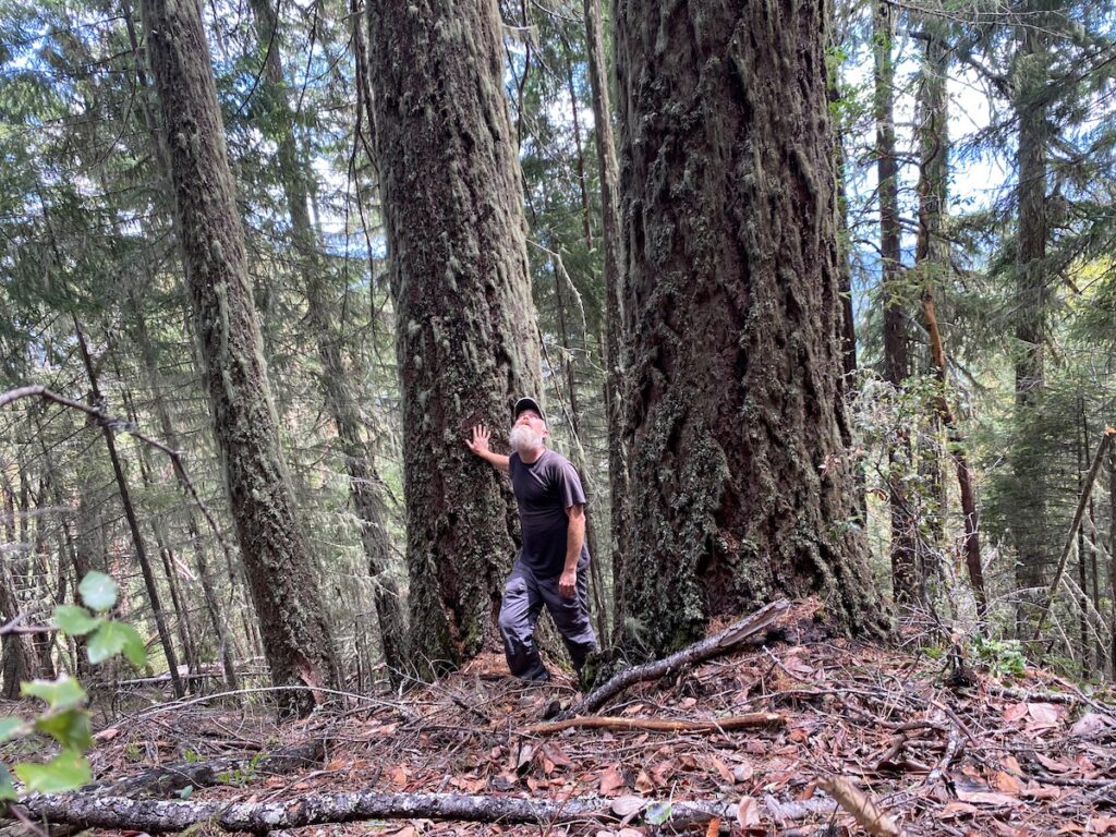
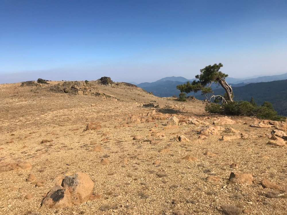
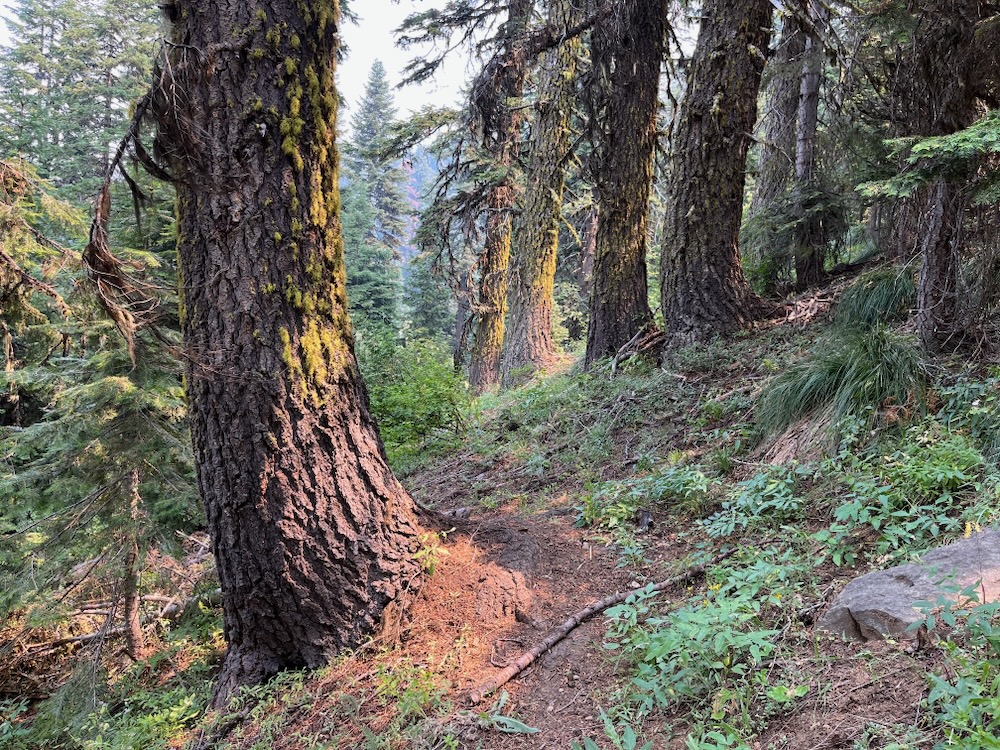
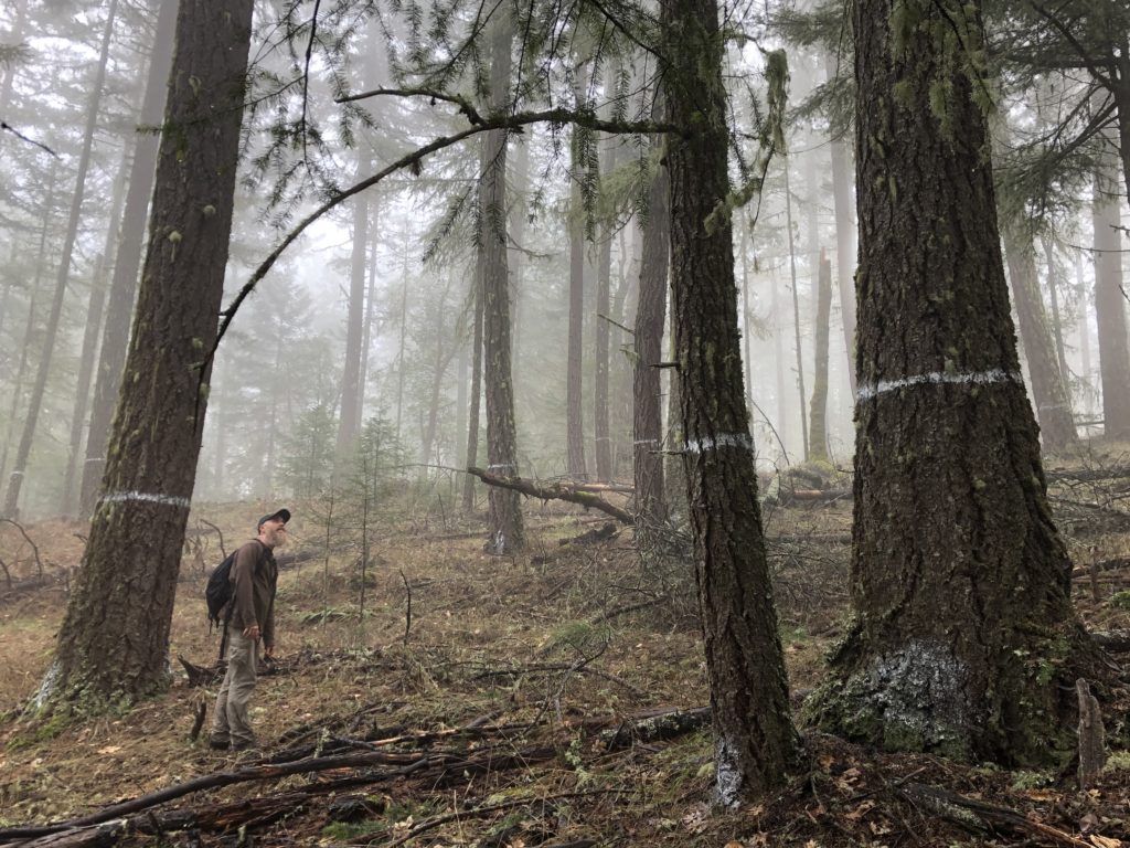
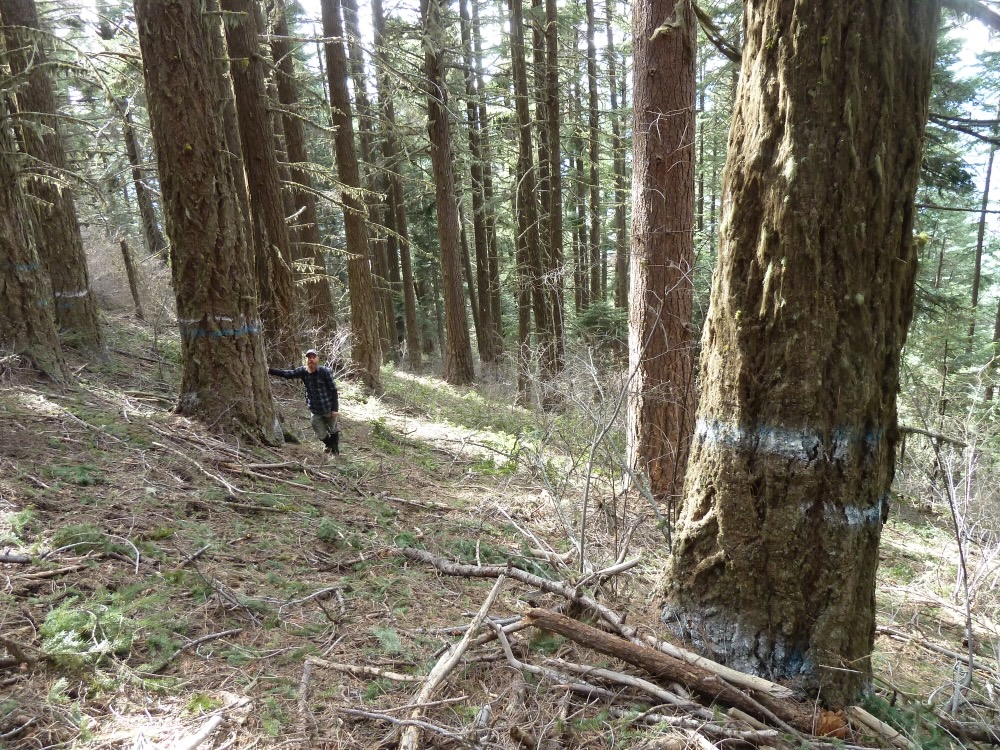
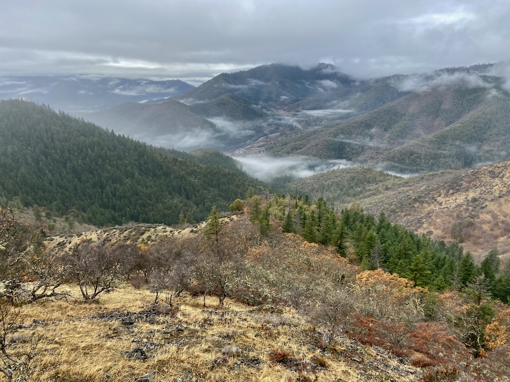
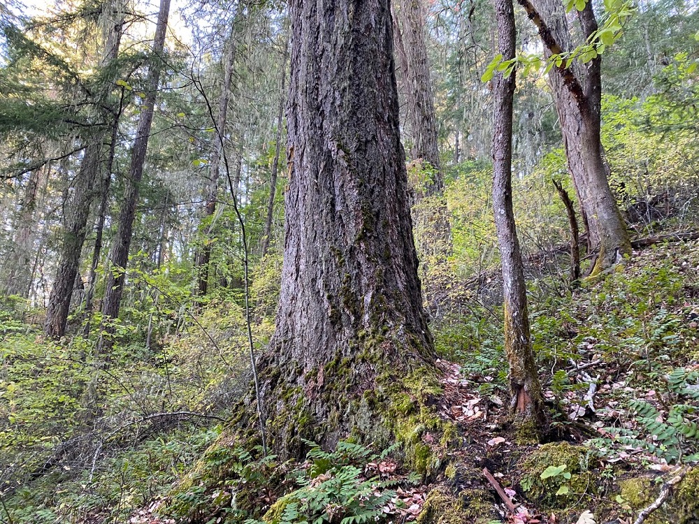
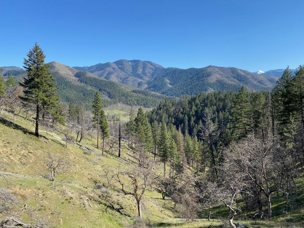
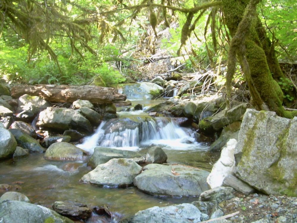
Flat headed fir borer mortality on Ferris Gulch in an area commercially thinned for “forest health” in the 1990s. Previous “forest health” thinning operations throughout the Applegate Valley are now sustaining high levels of beetle mortality.
Flat headed fir borers, engraver beetles, and other wood and bark boring insects
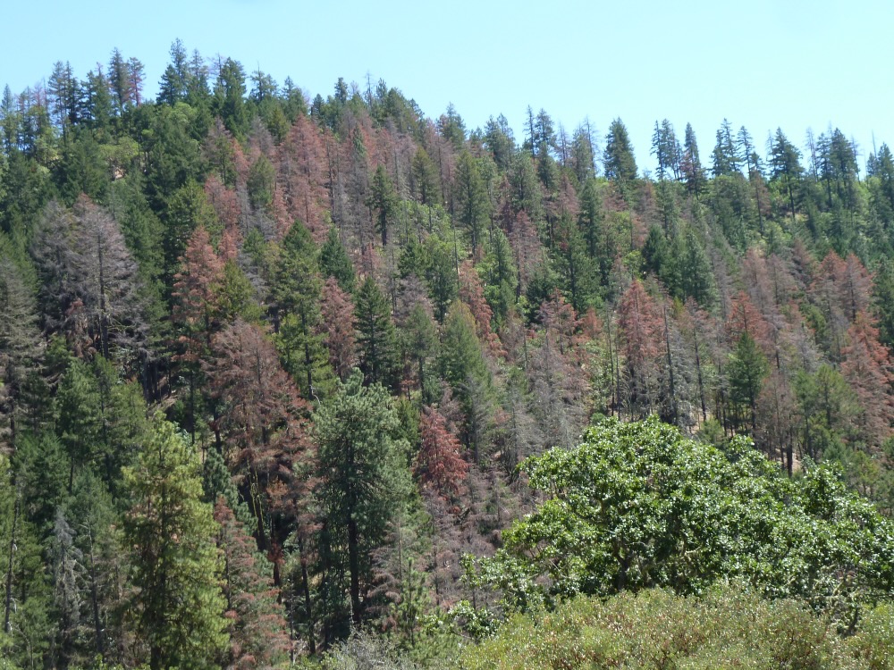
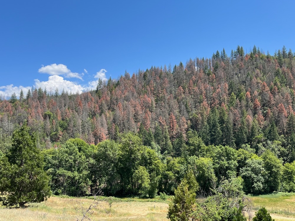
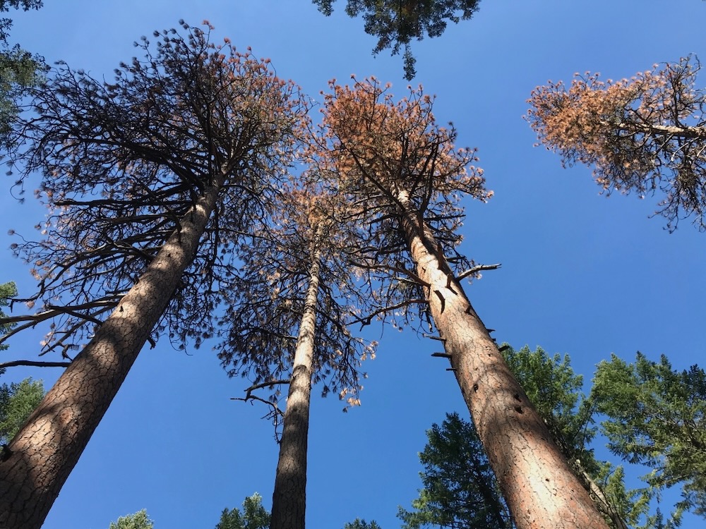
Triggered by extended droughts, a significant lack of persistent winter cold snaps, stifling summertime heat domes, and a changing climate, flat headed fir borers and fir engraver beetles have become very active across interior southwestern Oregon. In fact, populations of these native wood boring beetles have exploded in recent years, creating significant Douglas fir mortality throughout the region.
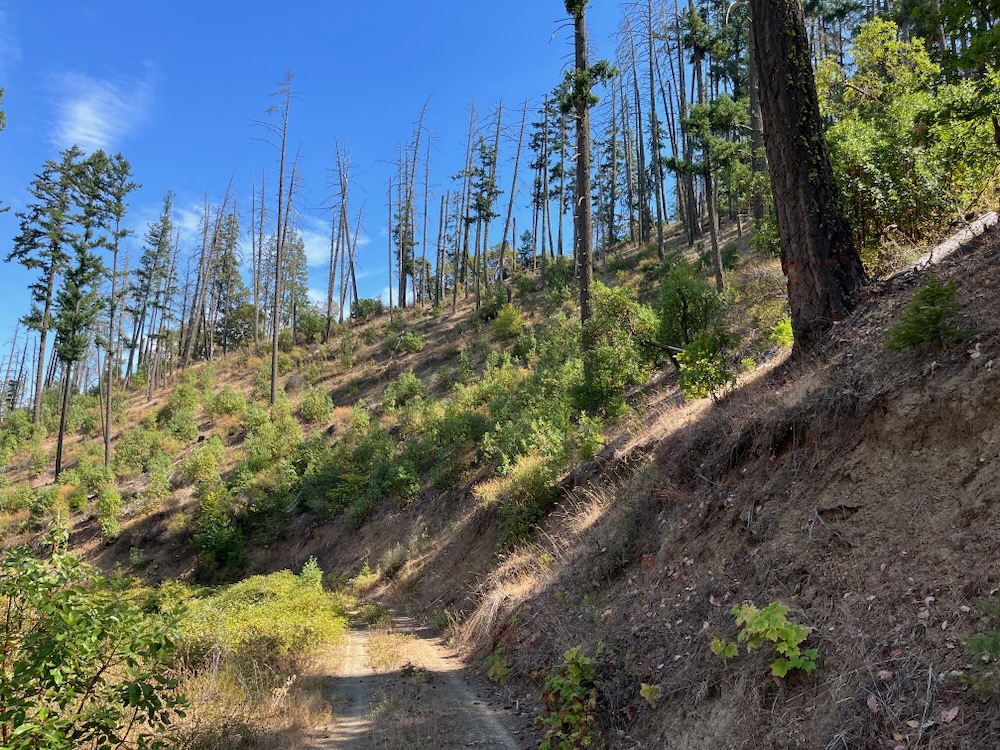
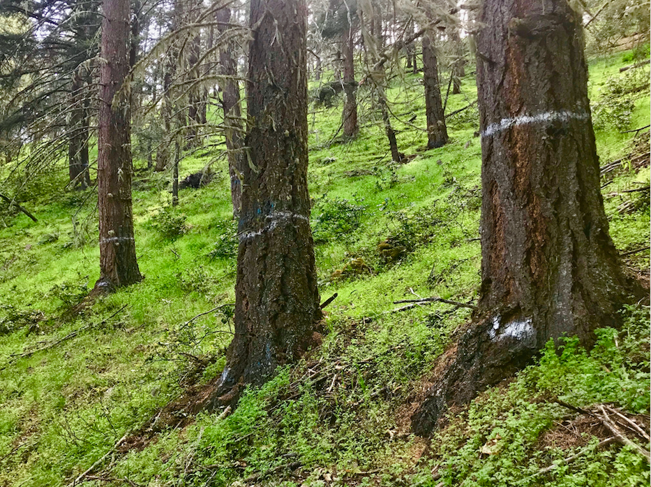
Flat headed fir borer mortality in the Little Applegate Valley.
A visceral sign of climate change, the mortality reached epidemic proportions in 2022 and 2023, when flat headed fir borers could literally be heard chewing through stands of Douglas fir in the foothills of southwestern Oregon.
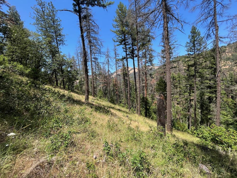
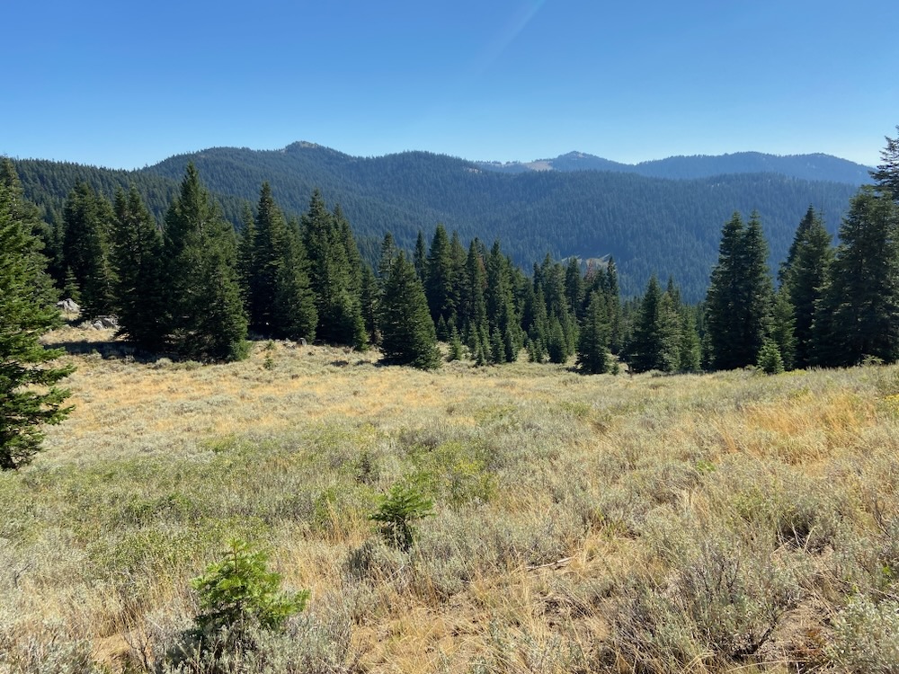
Mortality was occurring in large patches at lower elevations, especially on droughty sites, harsh exposures, sites with poor soils, sites more conducive to oak woodland, chaparral, or mixed hardwood stands, and in many previously implemented “forest health” logging or commercial thinning projects.
Since the 1990s, the Medford District BLM and Rogue River-Siskiyou National Forest have been implementing landscape-scale logging, or commercial thinning projects, intended specifically to increase “forest health” and resilience to both drought and beetle mortality; however, in many locations these “restoration” thinning projects have had the opposite effect, and both the false claims used to justify the logging, and the forested habitats they have “treated” have begun to unravel.
Old-growth ponderosa pine killed by pine beetles in a unit commercially thinned during the Ashland Forest Resiliency Project by the Lomakatsi Restoration Project. Located in the Ashland Research Natural Area, an area designated to study old-growth pine habitats, the units were logged to supposedly increase resilience to drought, beetles and fire, yet many of the stand’s old-growth pine have succumbed to beetle mortality and significant drought stress since the logging has occurred.
At best, the previous commercial thinning treatments failed to create the resilience or restoration predicted by the BLM and USFS in each timber sale’s scientific analysis and approval documents (e.g. Environmental Analysis, Decision Record, etc.), and the agencies need to stop promising outcomes they can’t actually create through logging.
At worst, the logging was actually responsible for the scale of the beetle outbreak by weakening whole stands of trees, and the agencies need to stop large-scale commercial logging that is contributing to the loss of regional forests.
The reality is likely somewhere in between. Climate conditions can trigger the outbreak, while in some places previous commercial thinning or logging operations have damaged soils, damaged trees, increased aridity, increased edge effect, increased air temperatures, made stands more susceptible to beetle impacts, encouraged beetle populations to expand, and contributed quite significantly to the mortality event.
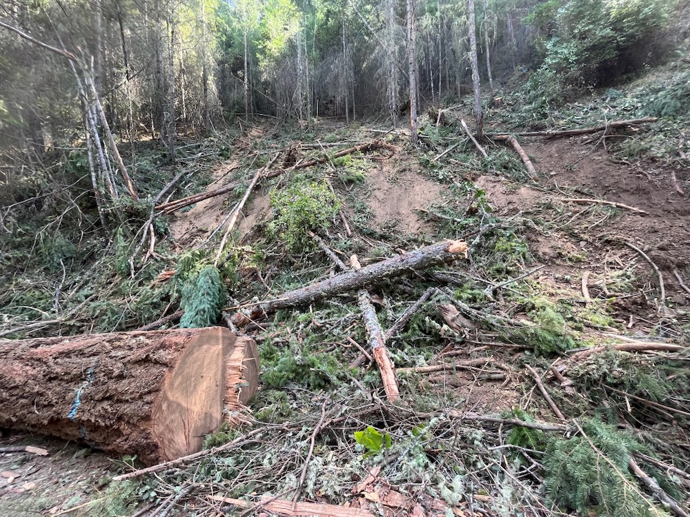
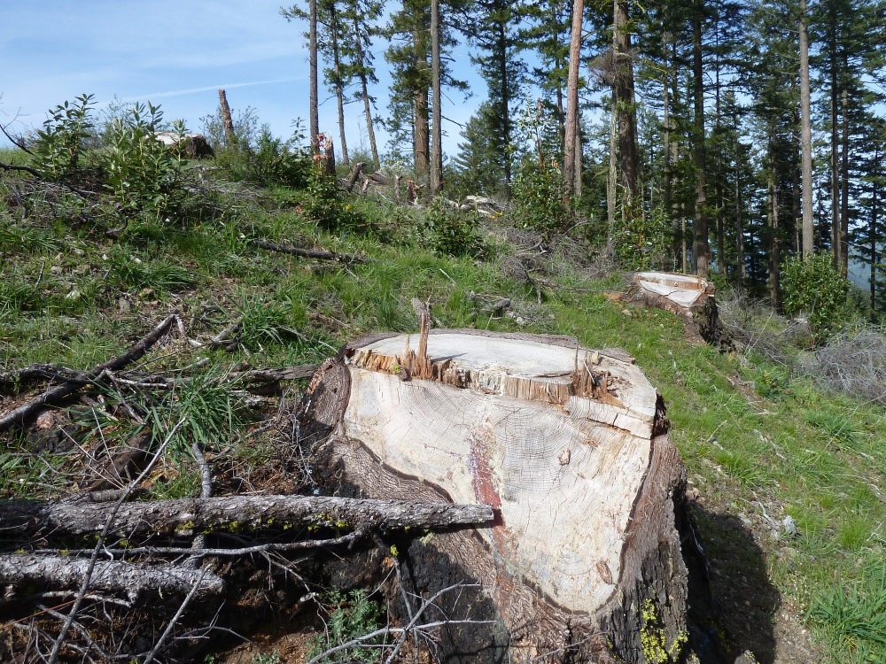
Flat headed fir borer mortality is extensive in units thinned in the Lick Stew Project by the Lomakatsi Restoration Project. Implemented to “increase stand health and resilience,” the area is now being logged in the Lickety Split Salvage Project by the BLM. Over the course of a decade, this once forested stand was heavily logged using “restoration forestry,” sustained significant beetle mortality following the logging treatments, is now being subjected to post-disturbance logging, and has been deforested and/or converted to grassland.
In many ways, the BLM has been an active contributor to both the current climate crisis and the recent beetle mortality event, by creating extensive logging related carbon emissions that fuel climate change. Recent research found that commercial logging and timber manufacturing is the largest contributor of greenhouse gas emissions in the state of Oregon (Law. 2018), while regional research shows that commercial logging is responsible for 80% of the Forest loss in Oregon and Washington combined. It also found that logging in Oregon and Washington constitutes 67% of all forest loss in the 11 Western states where fire and beetle mortality are most acute. This makes logging, not beetle mortality, the most significant threat to the forests of the West, and in particular the most significant threat to forests in the Pacific Northwest. (Berner. 2017).
BLM’s Response: The SOS Project
The impact of post-disturbance or “salvage” logging of dead and “dying” trees on Ferris Gulch in the Applegate Valley.
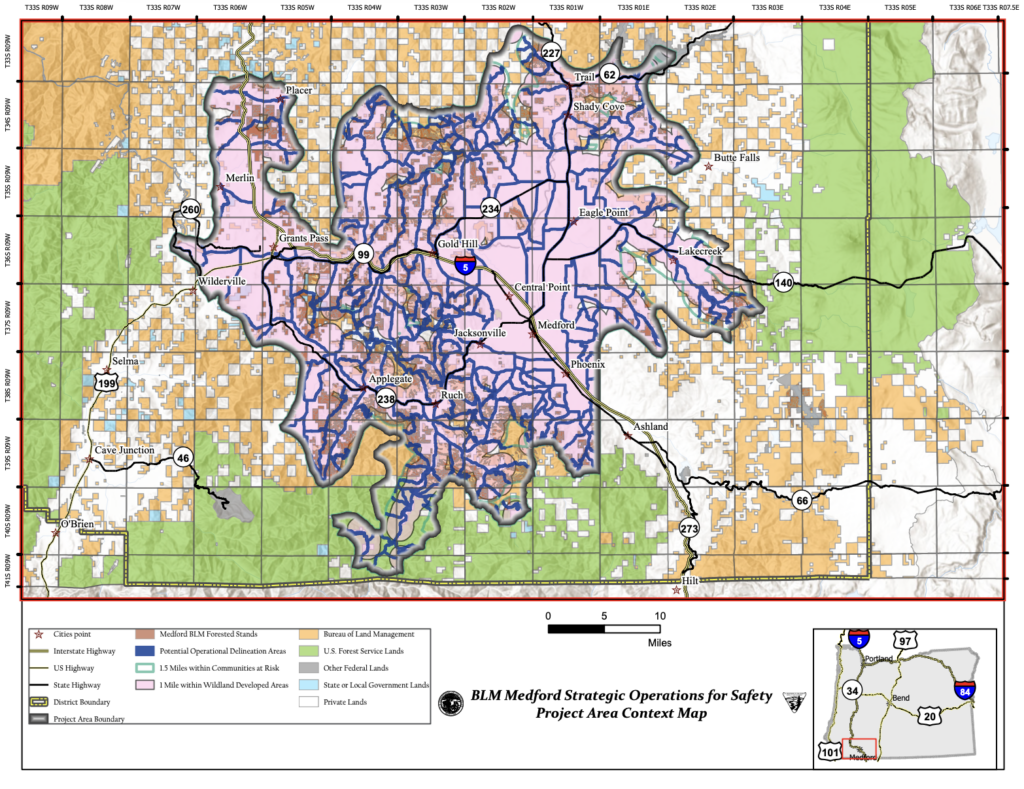
Currently the BLM has identified a massive planning area sprawling across the BLM lands surrounding both the Rogue and Applegate Valley. Unfortunately, what the agency has not done, is identify where within this vast landscape that post-disturbance logging would actually occur. According to the Scoping Notice for the Strategic Operations for Safety Project (SOS Project), the BLM would log approximately 5,000 acres in still undisclosed locations.
The SOS Project and its proposed post-disturbance logging would take place somewhere in the area identified on the map above. No site-specific units have been identified, making both credible scientific analysis and meaningful public comment nearly impossible.
These operations could occur along BLM roads, in what the BLM calls Potential Operational Delineation (POD) areas, and within 1 mile of developed areas or homesteads. They could also be implemented in Riparian Reserves, Late Successional Reserve (LSR) forests, along hiking trails and in recreation management areas, degrading the values these areas were designated to protect.
The agency claims this logging is benign or even beneficial, and is necessary for both public safety and future fire containment. Yet, the agency proposes logging over 500′ on either side of BLM roads and so-called POD areas, far beyond what can be credibly called “hazard tree” logging, and far beyond what is necessary for future fire containment. As currently designed the project is an excuse to log, not a valid public safety or fire risk reduction project.
The BLM also proposes logging both dead standing, beetle killed snags, and live, green trees that survived the beetle outbreak. Yet, these surviving trees contain either high genetic resistance, or grow in favorable microclimate conditions, allowing for their survival and persistence. Removing these trees will generate short-term profits for the industry, and provide board footage for the BLM’s annual timber quota, but will undermine long-term forest and climate resilience.
These photo above was taken adjacent to the photo below on Ferris Gulch in the Applegate Valley. The stand depicted above supports structurally complex, early seral habitat subjected to severe flat headed fir borer mortality, but not post-disturbance logging. The stand supports abundant hardwood regeneration, important biological legacies, snag habitat, and the building blocks for future forest or woodland complexity. The stand in this photo lacks structure and diversity, resembles a clearcut, contains few biological legacies, supports far less regeneration than the stand above, and will lack complexity for many decades following the removal of dead and supposedly dying trees. The stand was “salvage” logged in the Squishy Bug Salvage Project on Ferris Gulch in the Applegate.
Snags provide important wildlife habitat and are the foundation of both stand recovery and future forest or woodland complexity. In fact, research conducted in southwestern Oregon following the 1987 Galice Fire found that large downed wood retained “tremendous quantities of water… Even after 77 days without rain and an intense wildfire.” The researchers literally wrung water out of downed logs which had 25 times more moisture on a weight basis than did soil samples. Researchers suggested that this moisture “may help pioneering plants become established where soil moisture is low,” making it “a requisite for maintaining long term forest growth” in the region. The author explains, “in the Klamath Mountains conifer seedling performance can depend on the ability of the soil to retain moisture and support nitrogen fixing and ectomycorhizal organisms. Removal of large amounts of organic material may result in difficult reforestation of these thin, droughty, and infertile sites.” (Amaranthus, 1990)
Following a significant mortality event, snags become the only large wood this system will produce for decades or even centuries, creating structure, diversity, habitat and favorable growing conditions for young, regenerating forests. Large, relatively rot resistant species can persist, provide continuity, and play functional roles in the regenerating ecosystem for centuries, if not removed in post-disturbance logging operations.
The reality is, that the BLM has a stocking requirement after “regeneration” logging. This usually means that they have to plant trees after clear cutting an area. This means that the “regeneration” logging proposed in the SOS project will be followed by tree planting and plantation development, creating dense, young, heavily simplified, and highly flammable vegetation that has been proven in multiple regional wildfires to increase fire severity and spread.
As currently designed the SOS Project will leave a lasting biological impact, provides little public safety benefit, and will produce low value timber that can only be implemented at a deficit to the taxpayer. Our forests and climate are sending out an SOS, and unfortunately, the BLM is responding in the only way it knows how: with a new timber sale to supposedly “fix” the problems the last one created. An endless cycle that needs to end for the sake of our forests and climate.
COMMENT NOW on the SOS Project.
Talking points for public comment:
The project proposal lacks specificity, precluding meaningful public comment, agency analysis, and the disclosure of impacts as required by the National Environmental Policy Act (NEPA). Site specific unit boundaries must be identified to conduct a valid scientific and public analysis.
The proposed logging of dead or dying trees up to 500′ from roads and PODS serves no public safety purpose. No trees in our area grow 500′ tall, and therefore, cannot pose a safety risk to roads 500′ away. Tree and snag felling for public safety and fire suppression purposes should occur no more than 150′ from main system, high-use BLM roads.
Logging dead or dying trees up to 1 mile from developed areas serves no public safety purpose and will not reduce fire risks unless the the tree felling is limited to areas within 150′ of homes or developed areas, and within 150′ of ingress/egress roads.
Tree removal from the site is unnecessary and serves no public safety purpose. Once felled, a valid hazard tree 150′ or less from a high-use BLM road has been fully mitigated of all public safety risks. Trees that pose actual public safety risks could be felled, but tree yarding and removal is necessary, especially because much of the low value dead standing material will be sold at a loss to the public. Trees felled into the road could be removed if necessary, but trees felled onto the slopes should be retained and left on site for biological values.
Standing snags and large downed trees are important for carbon storage, soil development, forest and woodland regeneration, habitat, water retention, and are the foundation for future forest complexity. These biological legacies should be retained on site whenever possible. Large downed wood has been show to be essential for stand regeneration and serves to dampen fire activity.
No live trees that survived the recent beetle outbreaks should be felled or removed in the project area. These trees likely contain genetic or situational advantages, that allow for beetle and drought resilience. These are the most site-adapted trees, will encourage resilience and are preferable for forest or woodland reestablishment. The BLM should maintain these living trees for seed production and regeneration as well as habitat value.
Tree felling and removal should not take place in Riparian Reserves, and only valid hazard tree felling within 150′ of high-use BLM roads should be considered in Late Successional Reserve (LSR) forest.
The BLM should not build new roads in the SOS Project.
Over the past year Applegate Siskiyou Alliance (ASA) has been working hard to address the immediate threats of today while building a vision for the future of the Applegate Siskiyou region. As an organization, we have focused on increasing our capacity, outreach and impact, while actively organizing within the community and through various environmental coalitions to support campaigns for permanent protection, and to stop projects proposed on federal lands that threatened the area’s unique biodiversity, spectacular wildlands, intact watersheds, and important wildlife habitats.
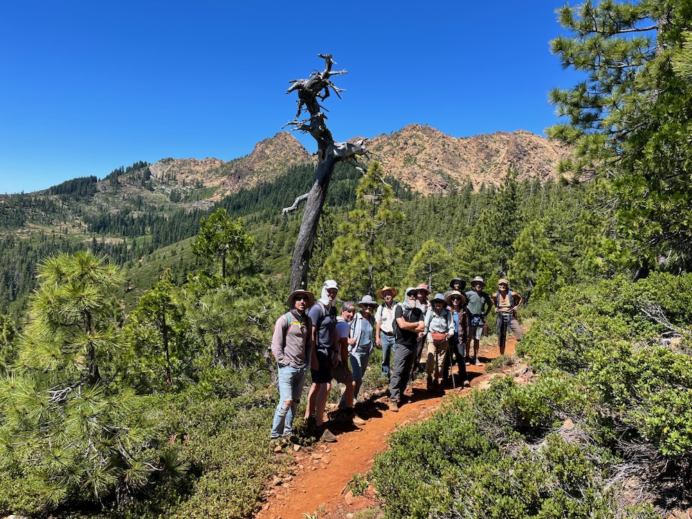
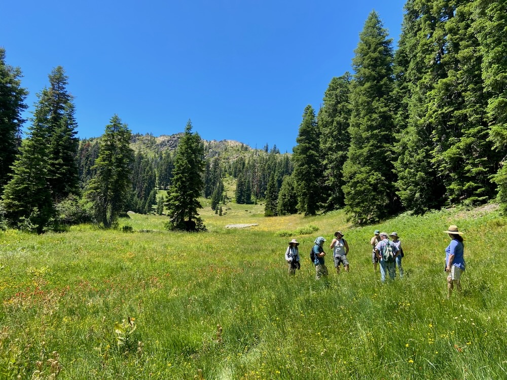
An ASA led hike to Lily Pad Lake and the Red Buttes Wilderness for the Siskiyou Crest Festival.
This includes monitoring federal land management activities across the region, reviewing those projects on the ground, writing detailed public comments and objections, and preparing for litigation if necessary. It also includes organizing local communities; leading public campaigns; hosting educational opportunities; lobbying in Washington DC; engaging elected officials, and increasing awareness for both the threats to this spectacular region and its incredible biological values.
While working to protect these wildlands from immediate threats, we also understand that we need a long-term strategy and a comprehensive vision for the Applegate Siskiyou region. This strategy includes permanent habitat protections, broad shifts in federal land policy, and strong grassroots support for conservation in the area. To achieve these goals, we have begun working on a local, national and regional level through environmental coalitions and by organizing our local communities to more actively support the permanent protection of wildlands in our region.
Below are major projects undertaken in 2023 by ASA and our supporters in southwestern Oregon.
Addressing the Threats of Today
IVM/Late Mungers
These 37″ and 40″ diameter Douglas fir trees are proposed for logging in unit 5-1 of the Late Mungers Timber Sale.
For the past three years ASA has been opposing the massive IVM Project which would approve a series of timber sales allowing up to 20,000 acres of commercial logging and 90 miles of new road construction per decade on BLM lands. In particular, the project would target Late Successional Reserve forests set aside to protect habitat for the threatened Northern spotted owl. These reserves contain mature and old-growth forests with complex, closed canopy conditions, cool, moist habitat associations, large trees, large snags and large downed wood, important for carbon storage and climate moderation. They also provide vital habitat for the northern spotted owl.
Yet instead of protecting and maintaining old forest habitat for the owl, the BLM has proposed to log these areas using heavy industrial logging prescriptions that would downgrade or remove northern spotted owl habitat by logging large trees up to 36” in diameter and reducing canopy to as low as 30%. The proposal would also approve group selection logging, a form of staggered clearcut logging, that removes whole groves of mature forest, in patches up to 4 acres at a time and on up to 20% of a forest stand. To make matters worse, projects could be implemented with no meaningful public involvement and with very minimal, if any site-specific scientific analysis.
The first major timber sales proposed under the IVM Project are located above the communities of Williams and Murphy in the western Applegate Valley, and would log large old trees in some of the last old forests remaining in the Williams and Murphy Creek watersheds.
In opposition to both the IVM Project and the Late Mungers/Penn Butte Timber Sales above Williams and Murphy we filed suit on August 10, 2023 challenging this project in the Oregon District Court, Medford Division. ASA is being represented in the lawsuit by the Colorado University Natural Resource, Energy and Environmental Law Clinic, with local Applegate and Williams residents as standing declarants in the case.
Our suit brings forward claims that the BLM violated the National Environmental Policy Act (NEPA) and the Federal Lands Policy and Management Act (FLPMA) by failing to provide sufficient site specific NEPA analysis, failing to comply with the BLM’s 2016 Resource Management Plan (RMP), and failing to adequately consider numerous relevant issues. We hope to prevail in court and protect the last old forests above Williams and Murphy, as well as old forests throughout the Medford District BLM that could be targeted for logging under the IVM Project.
Bear Grub Timber Sale
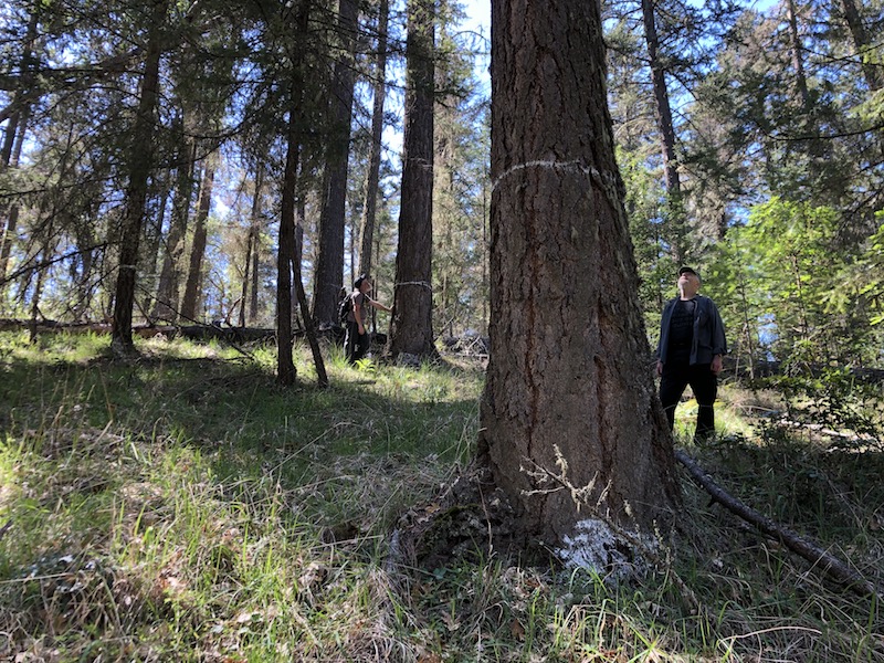
A large, dominant tree marked for logging in the Bear Grub Timber Sale.
Unfortunately, after three years of opposition and the cancellation of the Bear Grub Timber Sale in response to official Administrative Objections filed by ASA and our allies, Bear Grub is back! In June 2023, the Medford District BLM again proposed the Bear Grub Timber Sale in all the same inappropriate locations, in all the same mature and old-growth stands and with the same damaging group selection logging prescriptions.
The project proposes logging in mature, fire resistant forests dominated by large, old trees directly adjacent to or in the immediate viewshed of the popular East Applegate Ridge Trail (East ART), in the Wellington Wildlands (an over 7,000-acre roadless area), as well as in the forests of Sterling Creek, the Little Applegate River, and around Ruch, at the heart of the Applegate Valley.
We expect BLM to make a final decision on this project sometime in 2024 and will remain vigilant in our efforts to save these spectacular forests, wildlands and important recreation areas from staggered clearcut forestry, euphemistically called “group selection” logging.
Siskiyou Mountains Fuel Break Project
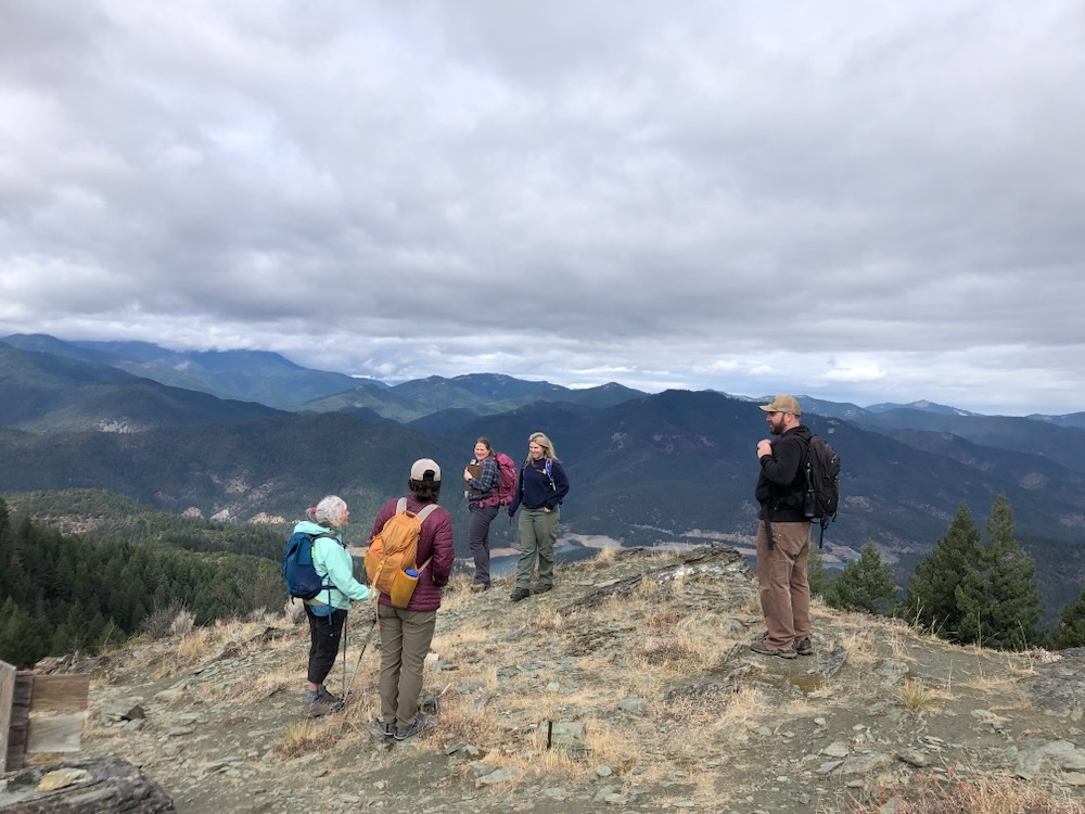
On a field trip with the Forest Service on Elliott Ridge.
The Rogue River-Siskiyou National Forest has proposed a large scale fuel break project in the mountains of the Applegate River watershed, including some of the most intact roadless areas, Special Interest Areas, and Botanical Areas in the region, and along some of the area’s most beloved hiking trails.
The Siskiyou Mountains Fuel Break Project would conduct manual thinning treatments on 4,290 acres along the entire Stein Butte/Elliott Ridge Trail above the Applegate Reservoir in the citizen-identified Elliott Ridge Roadless Area, along the McDonald Peak and Wagner Butte Trails in the McDonald Peak Inventoried Roadless Area and McDonald Peak Botanical Area, and along the Sevenmile Ridge Trail in the citizen-identified Big Red Mountain Roadless Area. These treatments would take place from the canyon bottoms to over 6,800’ on the Siskiyou Crest in very sensitive habitats that neither contain a significant fire risk nor would benefit from manual thinning treatments.
ASA visited thousands of acres of public land monitoring this project, attended three field trips with the Forest Service, submitted an extensive 108-page public comment on the project, and proposed our own alternative that would reduce impacts on wildland areas, while focusing more appropriately on low elevation habitats adjacent to private residences or communities, and in previously impacted ecosystems that might benefit from thoughtful and strategically implemented restoration treatments.
In 2024, we will continue monitoring this fuelbreak project and advocating for the protection of wildland habitats, intact plant communities, undisturbed non-motorized recreational values, Botanical Areas, Roadless Area and other important values found throughout the Siskiyou Mountains Fuel Break Project. We believe we can make this project better with direct and strong engagement during the planning process and will continue to do so in 2023.
Off-Road Vehicle Closures
Visiting an off-road vehicle closure site in the Mt. Ashland/Siskiyou Peak Botanical Area with the Forest Service
For the past decade ASA has been monitoring off-road vehicle damage throughout the public lands of the Applegate River watershed and the Siskiyou Crest region. We have been using this monitoring information to advocate for the closure of illegal motorized routes in designated Botanical Areas, in sensitive habitats, and in areas that impact the Pacific Crest Trail along the Siskiyou Crest.
In 2023 this work finally began to pay dividends with closures being installed at the Klamath Meridan Overlook in the Mt. Ashland/Siskiyou Peak Botanical Area, and with the initial supply of large boulders being delivered that will create additional closures near Bearground Springs on the northeastern flank of Big Ridge, at Sheep Camp Spring in the Observation Peak Botanical Area, at Mud Springs near Condrey Mountain, and in other areas on the Siskiyou Crest. We are also in the process of working with partners to secure additional closures near Big Red Mountain in the Big Red Mountain Botanical Area, near Observation Peak in the Observation Peak Botanical Area and at other locations on the Siskiyou Crest.
In 2024, we will continue both our monitoring and advocacy and hope to secure additional off-road vehicle closures on both BLM and Forest Service lands in the Applegate watershed and Siskiyou Crest regions.
Building a Vision for the Future
Siskiyou Crest Coalition
An ASA hike on the Butte Fork Applegate River in the Kangaroo Inventoried Roadless Area.
The Siskiyou Crest is a regionally significant connectivity and climate migration corridor, with world-class biological diversity and significant wildland habitats. Yet the region remains both underappreciated and under-protected. Working with the Siskiyou Crest Coalition, we are taking a very active role in the campaign to protect the Siskiyou Crest region, and this past summer, along with numerous conservation partners, we helped organize the Celebrating the Siskiyou Crest Festival. The festival was organized to bring attention to the region, it’s incredible biodiversity, and the need for increased habitat protections. ASA is working with the Siskiyou Crest Coalition to build support for these protections in the grassroots, with elected officials, within the conservation movement, and in local communities. Our ultimate goal is the permanent protection of deserving portions of the Siskiyou Crest region.
Wild and Scenic River Designation
An ASA hike down Butte Fork Applegate River trail, along what should be a Wild and Scenic River.
For almost four years now, ASA has been working to support the designation of new Wild and Scenic River segments on tributaries of the Applegate River under Senator Wyden’s River Democracy Act. Working with the Oregon Wild and Scenic River Coalition, we nominated streams in the Applegate River watershed and are working to secure protection for these streams under the Wild and Scenic River Act. Streams currently proposed for protection in the River Democracy Act include public lands at the headwaters of Slate Creek, on Pipe Fork, in the Little Applegate River canyon, on tributaries of the Upper Applegate River, and portions of Carberry Creek. Unfortunately, the wild California portions of the watershed are not included in this legislation and we are seeking other opportunities to protect these stream under California-based Wild and Scenic River legislation.
Non-Motorized Trail Development
A volunteer trail crew building the Tallowbox Trail.
ASA is currently working to build the Tallowbox Trail, a hiking trail that would extend from Ladybug Gulch, a tributary of Star Gulch, to a ridgetop saddle east of Tallowbox Mountain. It would also be the only official trail in the Burton-Ninemile Lands with Wilderness Characteristics (LWC).
We have conducted multiple volunteer trail building events with residents from the surrounding communities. We have also secured a small grant from the Ashland Food Coop to fund more technical segments of trail construction. Currently, the trail is cleared and tread construction is approximately half finished. We hope to open this trail in time for spring wildflowers in 2024, but will need local volunteers to get this done. Watch for opportunities to participate in the construction of the Tallowbox Trail.
We are also working on additional trail proposals in the Wellington Wildlands, known as the Wellington Mine Trail. This non-motorized trail would convert old mine road on the north-facing slope of Wellington Butte into a community trail. Please sign our petition to support this trail.
Federal Rulemaking
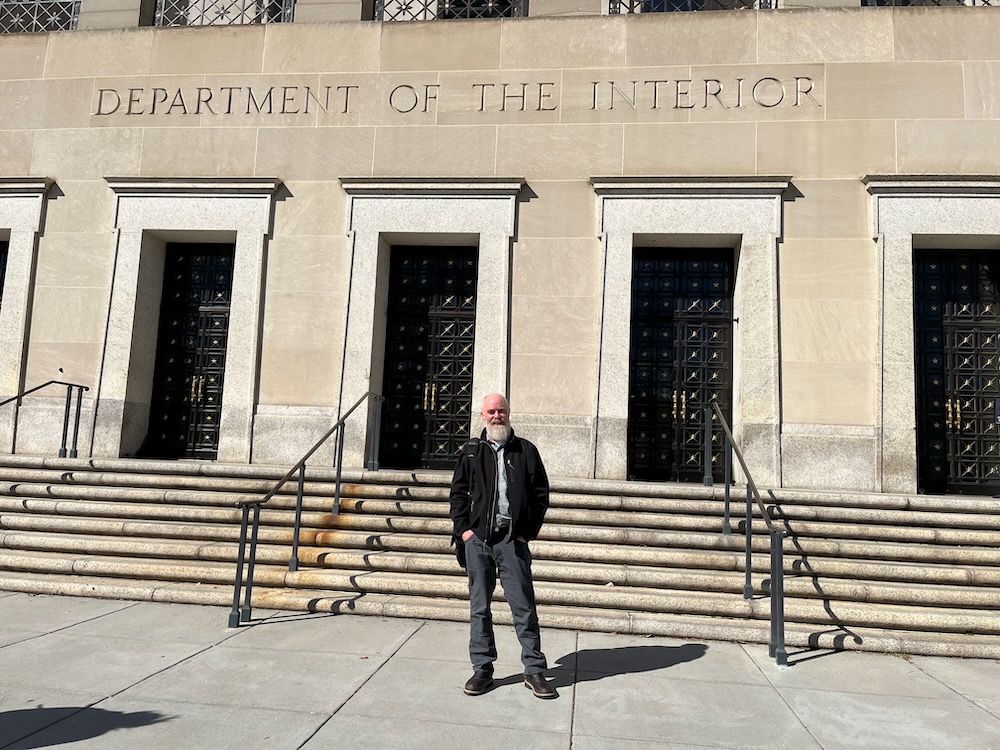
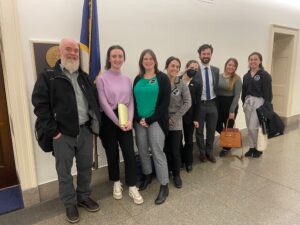
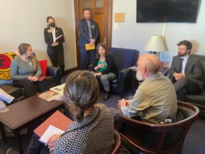
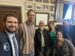
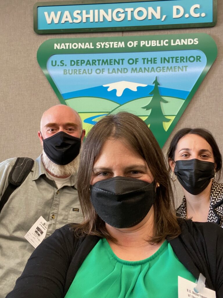
ASA Executive Director, Luke Ruediger, at the Department of Interior in Washington DC in March 2023, lobbying for the protection of mature and old-growth forests.
ASA has been engaging in federal rulemaking processes affecting all National Forest and BLM lands. Currently, the Biden Administration has released Executive Orders to both protect mature and old forests for climate mitigation and carbon storage, and to support the 30X30 Initiative, which proposes to protect 30% of our nation’s land and waters by 2030. To implement these Executive Orders, federal land managers are preparing new federal policy intended to protect mature and old forests on public lands, and these policies would be implemented through new federal rulemaking processes to protect forests and other intact, natural habitats.
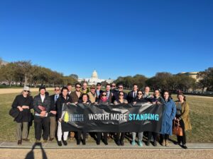
We have been working closely with numerous non-profit organizations and nationwide coalitions to inform these proposals and to support policies that would protect mature and old forests from commercial logging and our nation’s last intact wildland habitats. We have submitted extensive, detailed public comments and documented local mature and old forest logging proposals in our region, which in turn have been identified as some of the worst commercial logging projects currently proposed in the entire nation. We have also traveled to Washington DC and the halls of our Capital to lobby for these protections with senate and congressional staffers, at the Department of Interior, and at the Council for Environmental Quality.
In 2024, we will continue working towards durable, long-lasting protections for intact natural environments and mature or old-growth forests on federal lands. We will also continue documenting local timber sales, opposing those timber sales through both local and national campaigns, and working to promote better policies to protect them from future logging projects and for future generations.
Siskiyou Ecological Research Project
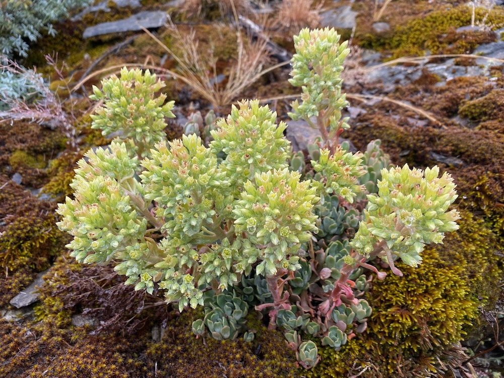
ASA is working to document rare and endemic species in our area, such as the Applegate stonecrop (Sedum oblanceolatum).
This past year, ASA started the Siskiyou Ecological Research Project, a citizen-based science project documenting the biodiversity of the Siskiyou Mountains. More specifically, we have started publishing the Siskiyou Crest White Paper Series to disseminate information about the region’s biodiversity and unique natural habitats.
The goal is to fill in the gaps in the current academic literature, contribute to scientific knowledge surrounding the incredible biodiversity found in the region and build more appreciation for the area’s biodiversity. Due to the area’s rugged, remote terrain, distance from population centers and academic institutions, much of the region’s unbelievable biodiversity remains undocumented, poorly documented, or underappreciated. We hope to change that by documenting unique species, habitats, and biological values in the area. We also hope to attract interest from academic institutions, universities, non-profit organizations and government agencies who might contribute to the exploration and documentation of the region’s biodiversity and other biological values.
The program is volunteer-based, and our goal is to make the reports both academically meaningful and accessible to the general public. We are interested in working with citizens, botanists, naturalists and biologists of all sorts to highlight the biodiversity of the region through the Siskiyou Crest White Paper Series. If you would like to participate, please contact us at: luke@applegatesiskiyou.org
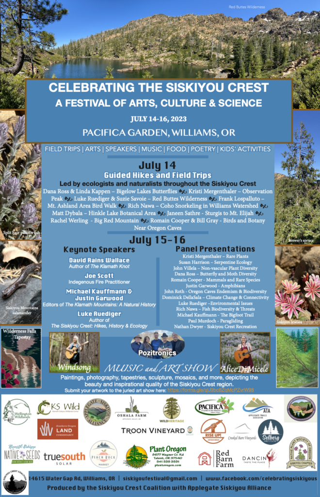
Siskiyou Crest Festival
David Rains Wallace delivering his keynote presentation at the Siskiyou Crest Festival.
This past summer, we worked with our partners at the Siskiyou Crest Coalition to sponsor the Celebrating the Siskiyou Crest Festival. The festival focused on the arts, culture and science of the Siskiyou Crest region with a large multimedia art show, music, a series of 10 hikes and field trips, and excellent speakers from across the region. The event was held at Pacifica Gardens in Williams, with hikes being offered from the Illinois, Rogue and Applegate watersheds.
The festival included extremely high quality presentations by top scientists and naturalists around the region. This included excellent keynote speakers such as longtime advocate for the region, David Rains Wallace, author of the Klamath Mountain classic book, The Klamath Knot. Additional keynote speakers included Joe Scott, a Siletz tribal member and active cultural practitioner, Michael Kauffman and Justin Garwood, biologists and editors of the The Klamath Mountains: A Natural History, and ASA’s own Executive Director, Luke Ruediger. The event was a huge success and we believe it enhanced the public’s understanding and appreciation for this spectacular region. We also believe it helped increase interest in protecting the region and its unique natural values.
Looking ahead in 2024
Our focus in 2024 will be on both opposing projects that damage the biological values of the region and working to better protect those values in the future. We will continue working towards creative, proactive solutions to achieve these goals, while also addressing immediate threats as they arise throughout the Applegate Siskiyou region and on our local public lands.
Please support our work with a generous year-end donation. To continue growing and expanding our programs, our influence, and our effectiveness throughout the region, we need increased financial support in 2024. Please make a tax-deductible donation. Any donation helps, and all are highly appreciated, but reoccurring donations made monthly, quarterly or annually are particularly helpful. In addition, larger donations of over $1000 will help us build the capacity we need to achieve our broad, bold goals for the Applegate River watershed. Join us as we work to protect the Applegate Siskiyou!
The proposed Wagner Fuel Break extends through large high elevation sagebrush clearings in the McDonald Peak Inventoried Roadless Area and Botanical Area along the Wagner Butte and McDonald Peak Trails.
Would you be concerned if your favorite backcountry trail was proposed as a 1000′ wide fuel break without adequate public involvement or environmental review? Do you think intact roadless areas, botanical areas and Forest Service recreation areas should be turned into “fuel breaks” far from homes and communities, even if they do not represent fire risks? That is exactly what is being proposed by the Rogue River-Siskiyou National Forest along the spectacular McDonald Peak and Wagner Butte Trails, the Elliott Ridge/Stein Butte Trail, and the Sevenmile Ridge Trail near Big Red Mountain.
The agency has released a Scoping Notice for the Siskiyou Mountains Ranger District Fuel Break Project which would build many miles of fuel breaks across the Applegate River watershed, on the face of some of the Siskiyou Crest’s highest peaks, and in some of the region’s most intact habitats. Proposed to take place up to 500′ on both sides of roads and backcountry trails, the fuel breaks would affect a wide variety of ecosystems from high to low elevations.
What the scoping notice does not do is describe what will be done in these sites and along these popular and well-loved recreational trails. How would these diverse ecosystems be “treated”? We simply do not know, and based on the information currently available, the Forest Service intends to approve these projects using Categorical Exclusions, meaning they will be largely excluding the public involvement process and the necessary environmental and scientific reviews, in some of the most botanically diverse places in the region.
The Sevenmile Ridge Fuel Break follows the Sevenmile Ridge Trail through vast high elevation meadows, wetlands and alder glades with relatively little fire risk.
Although these so-called treatments would include only non-commercial thinning, they would still have significant impacts to these intact ecosystems, especially in mid to low elevations in chaparral, montane chaparral, live oak woodland, oak woodland and mixed hardwood habitats. Plant communities at high elevations would also be impacted, including unique sagebrush clearings and aspen groves, ancient mountain mahogany groves, serpentine influenced Jeffrey pine woodlands, and montane snow forests, including mountain hemlock and red fir at up to over 6,800′ elevation on the face of McDonald Peak, and over 6,400′ at Wrangle Gap and around Wrangle Camp.
What little we know about the project, is that four large fuel breaks are proposed sprawling across many, many miles of National Forest land and consisting of up to 4,290 acres of public land.
This includes fuel breaks:
Along Elliott Ridge and Yellowjacket Ridge from Silver Fork Gap to the Applegate Reservoir, including the Elliott Ridge/Stein Butte Trail;
In the Wagner Butte/McDonald Peak area along the entire McDonald Peak Trail and the upper half of the Wagner Butte Trail;
On Sevenmile Ridge along the Sevenmile Ridge Trail and adjacent to Big Red Mountain;
From O’Brien Creek to Palmer Ridge in the upper portions of Carberry Creek and the Upper Applegate.
What we also know is that these proposed fuel breaks would be located on the Siskiyou Crest, and in surrounding areas far from homes or communities. They are not being proposed where they could most effectively protect communities. Yet, they are proposed in some of the most cherished recreational areas on the Siskiyou Mountains Ranger District, in some of the most intact lands, some of the most diverse plant communities, and in some of the district’s most scenic landscapes.
Below is the little we know about each individual fuel break proposed in the Siskiyou Mountains Ranger District Fuel Break Project:
Wagner Butte/McDonald Peak Fuel Break
The proposed Wagner Fuel Break would follow one of the highest elevation ridge systems on the Siskiyou Crest from McDonald Peak to Wagner Butte through broad sagebrush clearings, intact forests and a very wide variety of ecosystems in the McDonald Peak Inventoried Roadless Area.
The Forest Service has proposed turning the southern slopes adjacent to the McDonald Peak Trail into a 500′ wide fuel break for the entire length of the trail, from south of McDonald Peak to the Wagner Butte Trail. This portion of the trail extends through high elevation sagebrush clearings, montane chaparral, and montane conifer forest between 6,400′ and 6800′ elevation. This includes habitats at the headwaters of McDonald Creek, Split Rock Creek, Jim Creek, Corral Creek and Greeley Creek.
We are concerned that chaparral clearing in proposed fuel breaks would damage the area’s unique ecosystem and the protected plant communities in the McDonald Peak Botanical Area, an area specifically designated to protect the area’s unique botanical resources and rare plant species. It will also impact recreational values in a large Special Interest Area intended specifically to protect the scenic values of the Siskiyou Crest.
The proposal also includes a swath 500′ wide on both sides of the upper Wagner Butte Trail from Wagner Glade Gap to near the summit of Wagner Butte. This section contains unique plant communities with a significant “east side” or Great Basin influence in the Siskiyou Crest Special Interest Area. The area was also a candidate Botanical Area due to the usual east side plant communities, biodiversity and rare plant species.
Plant communities affected would include the trail’s charismatic mountain mahogany groves, sagebrush clearings, quaking aspen groves and montane snow forests of mountain hemlock and red fir. These plant communities are the highest elevation subalpine habitats in the Siskiyou Mountains and are not well adapted to frequent fire or manual fuel treatments. Instead, these habitats are adapted to a mixed severity fire mosaic and continue to maintain very healthy, diverse and dynamic ecosystems with relatively low fire risks and abundant fire refugia. These areas do not need and will not benefit from fuel reduction treatments.
Curly leaf mountain mahogany along the Wagner Butte Trail.
The entire length of this proposed fuel break is also located in the McDonald Peak Inventoried Roadless Area, an approximately 10,000 acre wildland at the headwaters of Ashland Creek and the Little Applegate River. This large intact area is important for habitat connectivity, contains many rare plant populations and unique plant communities, and includes some of the most beautiful and accessible high country in the Siskiyou Crest region.
Together these two trails are among the most popular and well-loved in the region, yet the proposed fuel break would significantly impact the area’s wild, natural setting, intact scenic value and recreational qualities, while degrading unique plant communities and introducing disturbance adapted non-native plant species. It will also degrade the area by surrounding the trail in plastic covered burn piles, sterilizing the soil and destroying vegetation as the piles are burned, leaving black charcoal pits that take years to revegetate, and leaving fragments of black plastic from burn piles scattered throughout the trail corridor. This is an unfortunate, yet common site along trails in the Applegate watershed, where plastic remnants from burn piles are frequently left as garbage after “fuels treatments.”
Quaking aspen along the Wagner Butte Trail.
The McDonald Peak and Wagner Butte areas have been designated specifically to promote scenic, recreational, botanical and biological values, and to many local residents they are cherished backcountry trails. They should not be managed as fuel breaks that degrade the natural habitats and scenic qualities people from across the region come to enjoy, and the agency’s Land and Resource Management Plan specifically tells the Forest Service to protect.
The McDonald Peak/Wagner Butte Fuel Break should be canceled and a more effective approach implemented that focuses directly on protecting communities, public safety and infrastructure from wildfire impacts. These efforts should be located near homes, rather than remote, high elevation, backcountry habitats far removed from the values at risk.
Elliott Ridge & Yellowjacket Ridge Fuel Break
The Elliott Ridge Trail contains vast stands of chaparral, knobcone pine and live oak on extremely rocky, rugged slopes. The clearing of these plant communities in proposed fuel breaks would damage what is likely one of the best examples of intact habitat in the region. It would also significantly impact the trail’s scenic values.
Elliott Ridge is a long east-west spur ridge dividing the Elliott Creek and Teel Creek watersheds, and an extremely popular backcountry recreation area, accessible by the Elliott Ridge/ Stein Butte Trail system. Starting at Seattle Bar and extending for many miles through the citizen identified Elliott Ridge Roadless Area, the Elliott Ridge/Stein Butte Trail is among the most popular recreational trails in the Siskiyou Mountains Ranger District.
Generally accessible year-round, the trail climbs steeply up switchbacks above Seattle Bar at the south end of Applegate Reservoir through relatively open mixed conifer forest to the rocky spine of Elliott Ridge. The trail alternates back and forth from the forested north-facing slopes of Elliott Ridge to the rocky, sunbaked southern face covered in montane chaparral, stump sprouting hardwoods, live oak woodland, patches of mixed conifer forest and large stands of knobcone pine. The area is highly scenic, largely intact, and well-loved by local residents.
Due to the location of the trail, its steep switchbacks and its movement back and forth from the north to south facing slopes, it makes for a very ineffective and unsafe fireline, that in reality would never be used for fire containment. Fire managers simply would not place firefighting hand crews on fire containment lines with switchbacks or that alternate across the ridgeline. Thus, the ability of this fuel break to serve its intended purpose and act as a fire containment feature in future wildfires is both unrealistic and highly unlikely. From a practical standpoint, this fuel break provides almost no effective use.
A view from the Elliott Ridge Trail across the Elliott Creek canyon to the Siskiyou Crest. The area is a vital connectivity corridor connecting low elevation and high elevation habitats in the Siskiyou Crest region.
Ironically, it also supports numerous plant communities adapted to mixed and even high severity fire that respond poorly to manual fuel reduction and “restoration” treatments. These are not plant communities adapted to frequent low severity fire and open grown vegetative conditions. In fact, rather than restoring habitat conditions through manual treatments, the opening of these habitats for fuel reduction has been shown to damage natural vegetative structure, increase non-native grasses and noxious weeds, impact wildlife habitats and have generally non-restorative effects. At the same time, damaging these plant communities will significantly impact the intact character of the land, its scenic qualities, and important recreational values.
This proposal would turn the entire Elliott Ridge Trail and 500′ on either side into a fuel break for approximately 7 miles from Seattle Bar, past Stein Butte and east to the headwaters of Mallard Gulch. Yet, the proposal does not end there, it would continue for 500′ along both sides of the road along Elliott Ridge, traversing the south slope of Elliott Ridge, then switching back to the northern face before winding back to Maple Dell Gap. From Maple Dell Gap the fuel break would continue an additional 3 miles along the southern face of Yellowjacket Ridge transitioning into montane conifer forests, serpentine influenced slopes below Yellowjacket Mountain, and ending up at Silver Fork Gap.
A natural, unthinned live oak stand along the Grouse Loop Trail with woodland form and very little understory fuel. A stand directly adjacent to the photograph above that was thinned approximately 10 years ago in the UAR Project near Applegate Reservoir. Notice the dense stump sprouting shrub form live oak in the understory and the dramatic increase in density. Removing canopy shade and thinning woodland form stands damages habitat and increases fire risks by making stands hotter, dryer and by generating dense, highly flammable vegetation in the understory.
We believe the Elliott Ridge Trail section is an ineffective fuel break, would badly impact chaparral and woodland habitat along the trail, degrading the recreational experience for generations to come, and increasing fire risks when tree form live oak resprout into thickets and highly flammable non-native grasses invade previous chaparral and woodland sites. The Elliott Ridge Trail section of the fuel break should be canceled, and as one of the area’s most popular recreational trails, we hope the Forest Service can maintain the irreplaceable biological, scenic, and recreational qualities of the Elliott Ridge Trail.
Sevenmile Ridge Fuel Break
Extremely low fire risks characterize the upper Sevenmile Ridge Trail proposed for fuel break construction. The area contains a diverse mixture of bunchgrass clearings, montane forest, wet meadows and alder glades at the headwaters of Glade Creek.
The proposed Sevenmile Ridge Fuel Break would start along the Little Applegate River, wind into Glade Creek, and climb Sevenmile Ridge to the western flank of Big Red Mountain on the old Sevenmile Ridge Trail. The proposed fuel break then switches back past Wrangle Camp to Wrangle Gap at over 6,400′ elevation on the Siskiyou Crest.
The proposal extends through mixed conifer forests and hardwood stands at mid-elevations and through high elevations and montane forest habitats, including large areas of moist meadow, high elevation bunchgrass clearings, alder glades, serpentine barrens, picturesque Jeffrey pine woodlands, and other highly fire resistant habitats near Wrangle Camp, on the western flank of Big Red Mountain.
Big Red Mountain is a broad red mound of serpentine rock and supports naturally sparse montane vegetation. Covered in snow much of the year, the area sprawls across the headwaters of Glade Creek and the Little Applegate River. Already an effective natural fuel break, these habitats and the fire refugia they create cover a large area, and have refused to burn in the 1987 Quartz Fire, the 2001 Quartz Fire and the 2018 Hendrix Fire. Each fire burned on the slopes below, but was naturally “contained” in the sparse vegetation and broad, rocky slopes extending down the flanks of Big Red Mountain. The mountain is already both a natural and highly effective fuel break.
The upper reaches of Big Red Mountain are a mile wide, highly effective natural fuel break that has stopped numerous wildfires burning on the slopes below.
It is also a spectacular biological wonder, known for its unique serpentine geology, unusual serpentine plant communities, rare plant species, and highly scenic natural habitats. Big Red Mountain has been designated as a large Research Natural Area in the Monogram Lakes Basin, a Botanical Area, and a Special Interest Area. These areas are intended to protect the biological values, intact natural environments, unique plant communities, and recreational values of the region.
The proposal includes a 500′ fuel break on either side of the Sevenmile Ridge Trail (1,000′ total), despite large portions of the trail having very little fire risk. Much of the upper trail is proposed to run through large bunchgrass clearings, wet meadows, seeps, springs, headwater streams and moist alder glades. Additional portions extend through beautiful, fire resilient old-growth forests, montane forest, and relatively open spaced Jeffrey pine woodland. The trail and proposed fuel break would also extend through both snag forests burned at high severity and forests underburned in the 2001 Quartz Fire and the 2018 Hendrix Fire. Neither of these areas currently support significant fire risks or are heavily altered environments in need of restoration.
We believe significant trail maintenance alone this long unmaintained trail would suffice as a fuel break along the Sevenmile Ridge Trail. This would provide as much of a fuel break as the typical handline used to suppress wildfires. Given the fire refugia and minimal fire risks on this section of trail, it would be a potentially successful and appropriate treatment for the area, while enhancing public access to the important scenic, recreational and biological values of the Sevenmile Ridge Trail.
Open, fire resistant Jeffrey pine woodland along the Sevenmile Ridge Trail has very low fire risks and already acts as a natural fuel break. Fuel break construction is simply not necessary given the conditions on the ground.
The lower portions of the proposed fuel break would follow road systems on lower Sevenmile Ridge down to the Little Applegate River near Brickpile Ranch. These portions include both plantation stands and mature, relatively open pine, fir and cedar forests growing on serpentine influenced soils. These areas have already largely been “treated” with non-commercial fuel reduction thinning and also maintain fairly minimal fire risks. In the years since the initial treatment, shrubs and regenerating trees have recolonized the understory and could be burned in a patchy prescribed fire intended to reduce, but not eliminate this young vegetation. This would create a mosaic of vegetation, would reduce the flammable fuels in the forest floor, regenerate native herbaceous vegetation and restore fire as a long suppressed natural process in these forests.
The lower section of Sevenmile Ridge could benefit from some strategic maintenance burning and manual thinning around the private inholding at Brickpile Ranch. These areas have been logged, leaving dense patches of skinny young trees, scattered old trees and large, open spaces filled with stumps from previous commercial logging operations and dense shrub species. These areas have not burned in recent history, and having been both heavily logged and lie adjacent to the private land inholding at Brickpile Ranch, they would be a far more appropriate location for fuel reduction than the intact lands above on the Sevenmile Ridge Trail.
We recommend trail maintenance on the Sevenmile Ridge Trail and judicious, non-commercial thinning in the lower sections of Sevenmile Ridge where heavy historic logging and unnatural habitat conditions surround the residence at Brickpile Ranch.
Grayback Fuel Break
The proposed Grayback Fuel Break would start at the O’Brien Creek Trailhead on O’Brien Creek Road and extend downstream along road 1005 to its intersection with Carberry Creek Road. The proposed fuel break would then drop into Carberry Creek and climb back up road 1010 to Youngs Gap, a low saddle between Carberry Creek and Brush Creek near Steamboat Mountain. The fuel break would then again drop back into Trail Creek and extend along the Brush Creek canyon before again climbing to the ridgeline dividing Thompson Creek from the Upper Applegate.
Winding along backcountry roads, this fuel break does not follow natural, containment features that would be utilized as fireline during future wildfire events. Instead, this proposed fuel break would be ineffective and dangerous from a fire suppression standpoint, being both unsafe for fire crews and difficult to hold as fireline. In reality, no fire manager would use this fuel break as a fireline, although some portions of it could be utilized in smaller fire events.
The area contains montane conifer forests and intact mixed conifer forests on O’Brien Creek in the Kangaroo Inventoried Roadless Area, low elevation conifer forests on Brush Creek, large knobcone pine stands, live oak woodlands, mixed hardwood stands and unique chaparral communities.
The manual thinning treatments proposed would badly damage the non-forest plant communities found near Youngs Gap, in the Brush Creek watershed, and on the ridgeline divide. Like in some many other locations these plant communities are naturally dense and support a mixed severity fire regime with a significant high severity fire component. Treating these communities to open habitats for fuel break construction will degrade these naturally resilient plant communities.
Unthinned, woodland form live oak stands along the proposed Grayback Fuel Break.A live oak stand recently thinned in the UAW Project and within the proposed fuel break area. Notice how the large piles are likely to scorch the retention tree when burned. The project will convert live oak woodland into a hot, dry, brushy patches of dense resprouting live oak. These very dense, low statured resprouting live oak contain ample volatile oils and will dramatically increase the flammability of this stand, while also badly degrading woodland habitats.
Additionally, large portions of the proposal are located in Riparian Reserves along O’Brien Creek, Trail Creek and Brush Creek in locations where fire danger is already relatively low compared to the surrounding terrain.
We recommend altering this proposed fuel break to eliminate the extensive riparian reserve thinning and either exclude areas of chaparral, hardwood groves and live oak stands or treat them to maintain canopy cover and reduce stump sprouting by minimizing tree removal. In many locations, previous fuel reduction treatments on the Siskiyou Mountains Ranger District have increased fire risks, reduced scenic values, and damaged important habitats in these ecosystems. We hope the agency will not repeat these mistakes.
Conclusion:
At Applegate Siskiyou Alliance, we question the strategy and effectiveness of backcountry fuel breaks, when unprepared communities are burning to the ground. We also question the utility of fuel reduction treatments in high elevation fire refugia, areas with low fire risks, far from communities, and in some of our last intact environments. Fuel reduction and community fire safety efforts should be focused on homes, communities and critical infrastructure. This project fails to address the critical concerns surrounding home ignition and community wildfire safety during fire events. Fiddling in the backcountry while our communities burn is unacceptable, and a more effective, nuanced, appropriate approach should be taken on the Rogue River Siskiyou National Forest.
Should this intact, fire adapted old-growth forest along the Sevenmile Ridge Trail be prioritized for fuel reduction, while far higher fire risks directly adjacent to communities remain unaddressed?
We are concerned that the Forest Service is proposing this massive, fuel break project in extremely intact areas and conservation/recreation based land use allocations on the Siskiyou Crest. We are also concerned that the agency is “scoping” all these projects at once and will not be doing either a full public involvement process or environmental analysis to analyze our concerns, disclose potential impacts and consider the potential environmental effects. This means that treatments implemented in some of the most cherished wildland habitats and most popular backcountry trails would be done with less analysis and less public involvement than regular federal land projects.
Are intact high elevation habitats like those in the McDonald Peak Roadless Area the biggest fire risk on our landscape? We strongly urge the Forest Service to address the real fire risks and conduct fuel reduction where it is appropriate, directly adjacent to communities.
The Forest Service is also considering the declaration of a wildfire emergency in the Siskiyou Mountains Ranger District, despite currently having no large wildfires and only two large wildland fires in the last 22 years (2017 Abney Complex and 2001 Quartz Fire. This “emergency declaration” would serve to eliminate administrative remedies, shield the project from regular legal processes and expedite the project’s implementation, while minimizing public involvement. We do not believe this approach is honest, acceptable, or collaborative and should be withdrawn from further consideration.
The Wagner Fuel Break along McDonald Peak and the Wagner Butte Trail should be canceled.
The trail sections of the proposed Sevenmile Ridge Fuel Break should be canceled and trail maintenance implemented instead.
The western portions of the proposed Elliott Ridge Fuel Break on the Elliott Ridge/ Stein Butte Trails should be canceled.
The agency must fully analyzed and disclose the impact of proposed project activities on Inventoried Roadless Areas, Botanical Areas, Special Interest Areas, wildlife habitat, native plant communities, wildland habitats, connectivity, rare plant species and other issues of concern in an Environmental Assessment.
Declaring a wildfire emergency to eliminate public involvement, environmental analysis and legal processes is unacceptable and creates incentives for the Forest Service to circumvent normal legal and administrative processes.
A Categorical Exclusion would not allow for sufficient public involvement, does not adequately address the broad range of potential impacts, the importance of the lands proposed for treatment, or the consistency of proposed project activities with the regulations and land use allocations in existing management plans. At a minimum an Environmental Assessment should be prepared individually for each proposed fuel break.
The use of emergency declarations and Categorical Exclusions for this project is inconsistent with the mandates of the Applegate Adaptive Management Area (AMA) which promotes and encourages community based collaboration and robust public involvement. The approach taken on this project is inconsistent with the mandates of the Applegate AMA and should be restructured to maximize, not minimize public involvement.
Chaparral, oak woodland, live oak woodland and madrone stands must be protected from project activities that are not restorative and either increase non-native grasses and/or increase understory fuels through excessive stump sprouting. This requires maintaining hardwood canopies and retaining large, dense patches of contiguous chaparral.
The Forest Service should be conducting fuel reduction near homes and communities where it is both needed and effective, not in remote backcountry habitats.
The trees marked with white paint throughout this blog post would be logged under the Bear Grub Timber Sale. This often includes whole groves of mature trees and some of the largest trees in a stand.
From October 2019 to August 2022, Applegate Siskiyou Alliance and residents across southwestern Oregon opposed the Bear Grub Timber Sale, a large BLM timber sale in the mountains of Sterling Creek and the Little Applegate Valley, along the East Applegate Ridge Trail, in the beloved Wellington Wildlands, and on Woodrat Mountain above Ruch, Oregon.
Much of the timber sale proposes “group selection logging,” a form of staggered clearcut logging that removes whole groves of mature trees up to 36″ in diameter. Implemented only in mature forests, this type of logging “treatment” creates “openings” or “canopy gaps” up to 4 acres in size and across up to 30% of a mature forest stand.
What will be left for future generations?
Group selection logging damages old forest habitat, degrades the climate refugia our wildlife depends on, and releases abundant carbon stored in the old forests and trees this form of logging targets for removal. Additionally, the removal of these large, fire resistant trees combined with increased aridity, stronger winds, and the young, dense, highly flammable growth this type of canopy removal creates has significant impacts to future fire risks. In fact, according to BLM’s own analysis, this form of logging will increase fuel loading, fire intensity, rate of fire spread, and resistance to wildfire control for a minimum of 5 to 20 years, making fires burn hotter, faster and more severely.
Everything goes! The BLM has proposed logging this entire stand of mature, open grown Douglas fir below the East Applegate Ridge Trail.
Yet, despite these implications, BLM approved the project and immediately sold the timber sale to Timber Products company. It also received 18 Administrative Protests from environmental organizations, including Applegate Siskiyou Alliance, and local residents in the Applegate Valley and beyond. These protests officially challenged the projects authorization and questioned the validity of the underlying scientific analysis. In response, the BLM withdrew the timber sale in August 2022, and acknowledged that they had not adequately considered the project’s effects on the Pacific fisher, a rare forest mammal that uses mature and old-growth forests for hunting, denning, and raising their young.
Although we had hoped the Bear Grub Timber Sale would be permanently withdrawn and we would never see these special places proposed for logging again, we also know all to well, unfortunately, that the Medford District BLM has a singular focus on timber production. Rather than shelve this controversial, environmentally damaging, climate change fueling project, the BLM has doubled down and Bear Grub is back. The agency simply changed some of the language in its analysis and re-proposed the Bear Grub Timber Sale in all the same inappropriate locations, in all the same mature and old forest stands, and with the same damaging group selection logging proposal.
Unit 13-6 directly adjacent to the East Applegate Ridge Trail proposes removing whole groves of mature, fire resistant forest.
The Bear Grub Timber Sale proposes logging stands of mature, fire resistant forest dominated by large, old trees directly adjacent to and in the immediate viewshed of the East Applegate Ridge Trail, a spectacular and extremely popular non-motorized trail built by Applegate Trails Association and the local community. It also proposes logging beautiful and spacious old stands of Douglas fir at the headwaters of China Gulch in Wellington Wildlands, a 7,526-acre roadless area located between Humbug Creek and Ruch, Oregon. The Bear Grub Timber Sale would also log the face of Woodrat Mountain, the hills of Sterling Creek, on the flank of Bald Mountain near the headwaters of the Little Applegate River, and in some of the last mature forests in the heavily clearcut mountains above Talent and Phoenix in the Rogue Valley.
Unit 8-2 of the Bear Grub Timber Sale contains open, fire resilient forest proposed for group selection logging at the headwaters of China Gulch in the Wellington Wildlands outside Ruch, Oregon.
Please consider commenting on this project and let BLM know that clearcutting our public forests, under misleading euphemisms like “group selection logging,” is unacceptable. Below are talking points to help inform your comments.
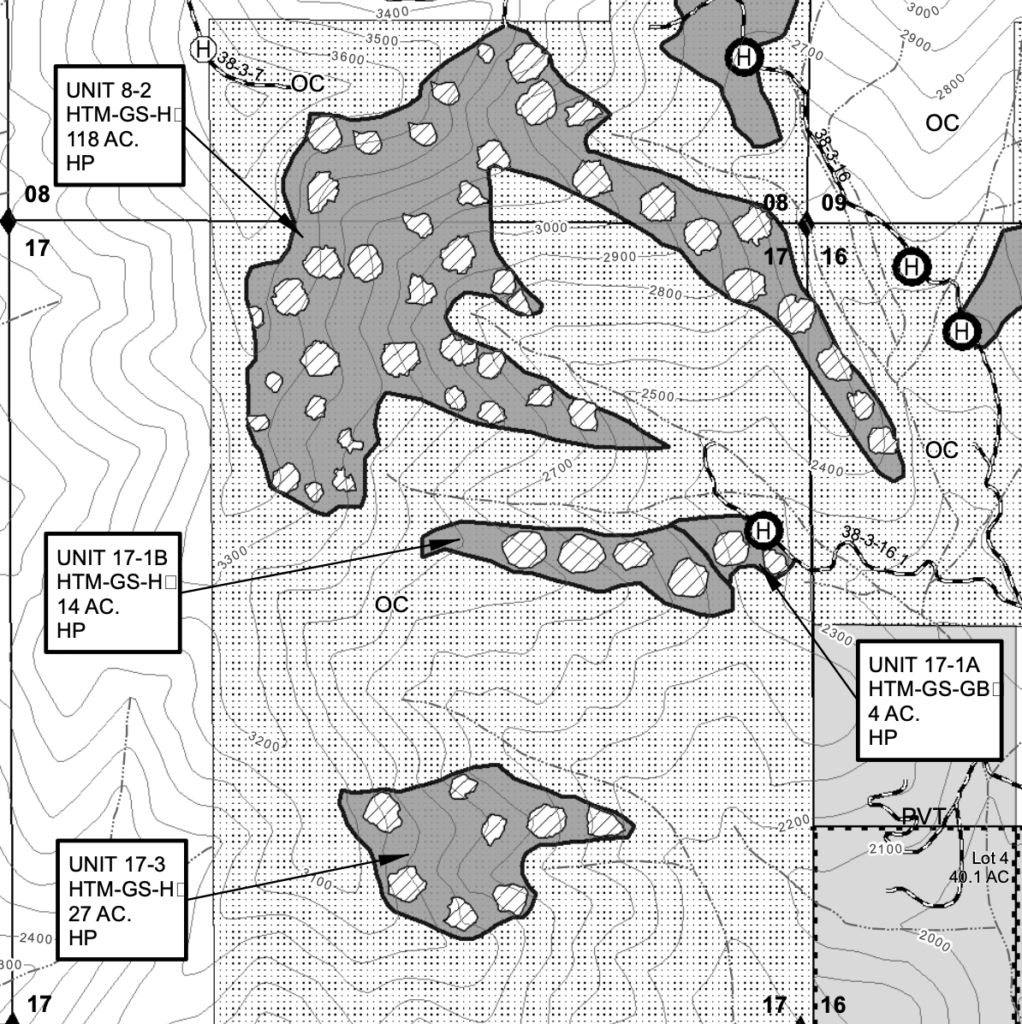
This map show the proposed “group selection openings,” that would be clearcut into mature forest in the Wellington Wildlands at the headwaters of China Gulch under the Bear Grub Timber Sale. The timber sale unit is identified inside the grey polygon and labeled with the unit number and the acres proposed for logging. The staggered clearcuts would be located within the embedded lighter polygons and would constitute a significant portion of each stand.
Additionally, in an attempt to further reduce the voice and involvement of the public, BLM has allowed only 18 days to comment on this controversial old forest logging project. Currently the comment period ends on June 26, 2023. Please contact Medford District Manager, Elizabeth Burghard (eburghar@blm.gov) immediately and ask her to encourage public involvement by extending this shortened comment period to at least the customary 30 days or more.
Talking Points
The Bear Grub Timber Sale is inconsistent with the Biden Administrations climate and forest policy (Executive Order 14008 and Executive Order 14072), as well as the recently proposed BLM rulemaking intended to increase conservation “use” on public lands, maximize carbon storage and encourage natural climate solutions such as intact forest habitats.
BLM must withdraw the controversial Bear Grub Timber Sale from further consideration and work with the surrounding communities to address fire risks, increase carbon storage, and protect important mature and old forest habitats.
Cancel all “group selection” logging and maintain all northern spotted owl habitat by retaining at least 60% canopy cover and implementing a 20″ diameter limit across the entire project area.
Cancel all timber sale units within the 7,526 acre citizen-identified Wellington Wildlands. This must include units: 8-1, 8-2, 17-1b and 17-3.
Cancel all timber sale units adjacent to or in the direct viewshed of the East Applegate Ridge trail. This must include units: 13-1, 13-5, 13-6, 13-7, 13-10 and 14-2
Cancel all timber sale units on Bald Mountain including units 27-4 and 27-8. These forests are simply to precious and are among the last mature and old-growth forest habitats remaining in the Wagner Creek drainage.
Build no new roads either “temporary” or permanent.
Comments can also be sent to: BLM_OR_AFO_VMP@blm.gov with “Attention: Bear Grub VMP” in the subject line
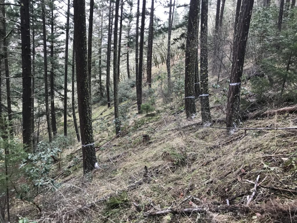
ASA board member, Marty Paule speaking about the Bear Grub timber sale in his backyard
We’ve been protesting the BLM’s Bear Grub Timber Sale since the pandemic, and since Applegate Siskiyou Alliance was formerly named Applegate Neighborhood Network. It’s been years now!
Wildlife in the Bear Grub Timber Sale
Bear Grub Timber Sale unit 13-6 along the East Applegate Ridge Trail
Bear Grub Timber Sale Auction Rally (Under the revised Bear Grub Timber Sale, if approved, BLM will still award the sale and rights to log these beloved Applegate forests to Timber Products Company, the same company that bought the sale at this auction two years ago!)
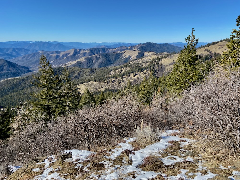
A spectacular view from the proposed Bald Mountain ACEC in the Little Applegate River watershed.
As part of our work with the Climate Forests Coalition, Applegate Siskiyou Alliance has been working hard to encourage the Biden Administration to protect our nation’s last climate forests. These include a wide variety of carbon-rich, mature and old-growth forest habitats spread out across the country, including right here in the Applegate River watershed. These forests mitigate the worst effects of climate change by storing carbon, providing habitat and climate refugia for wildlife, protecting watersheds and water supplies, and safeguarding biodiversity.
Although the Biden Administration has technically embraced the 30X30 concept, to protect 30% of our country’s land and water by 2030, very little meaningful action to implement this ambitious proposal has occurred. On Earth Day 2022, the administration also announced its intent to conserve mature and old-growth forests as natural climate solutions, by maximizing carbon storage on federal lands. Yet, the administration has also taken no meaningful action to provide lasting protections for these forested habitats, and federal land managers are actively working in the opposite direction.
Currently, both the BLM and Forest Service are working to increase timber production and old forest logging under the guise of “fuel reduction” and/or “forest restoration.” This includes logging larger trees, removing more canopy cover and implementing these “treatments” across much broader areas. The loss of habitat, stored carbon and forest resilience associated with these federal land logging practices is expanding exponentially across the landscape with devastating consequences for our global climate, local watersheds, regional wildlife, and biodiversity.
Logging large trees like those marked with white paint in this photograph is characterized as “restoration” by local BLM land managers.
Fortunately, in response to President Biden’s Executive Orders on forests and climate, both the Department of Interior (BLM) and the Department of Agriculture (Forest Service) finally released their first nationwide inventory of mature and old-growth forest habitats. The inventory found 110 million acres of mature and old-growth forests remaining on federal lands, include over 32 million acres of old-growth. This includes the lush rainforests of the Pacific Northwest and Alaska, the dry pine forests and pinon-juniper woodlands of the interior West, the boggy forests of the Southeast and the vast, productive hardwood forests of the East Coast. These forests represent a potentially powerful climate solution and conservation opportunity. They store vast quantities of carbon and support irreplaceable habitat. Unfortunately, however, the mature and old forest inventory only identifies these important forests, it does not protect them.
According to the Biden Administration, protecting mature and old-growth forests would be achieved by implementing the recently published draft “conservation” rules meant to create new public land policy on both BLM and Forest Service lands in the United States. Both agencies have initiated comment periods on new planning rules emphasizing forests as natural climate solutions and a need for new management and protection strategies. This blog will focus on the BLM planning rule with a second post to follow that will cover the Forest Service process. Both the BLM and Forest Service are accepting comments until June 20, 2023, so get your comments in as soon as you can to take action to protect mature and old-growth forests.
The Proposed BLM Planning Rule
Old-growth forest in the proposed Wellington Wildlands ACEC near Isabelle Springs on Medford District BLM lands.
The initially released BLM draft planning rule includes numerous positive things, some that are so basic that much of the public likely believes such rudimentary conservation measures are already in place; some that could be used to support broad-scale conservation across federal lands; and some, that if not properly implemented could do more harm than good. Other provisions are downright concerning, and are likely to encourage poor land management practices and a more pronounced corporate influence on federal lands.
Interestingly, for the first time, this draft planning rule finally proposes to put conservation “on par” within the agency’s multiple use mandate, in theory, making the protection or preservation of these lands as important to BLM land managers as the extractive industrial uses they have historically encouraged, including logging, mining, grazing and oil development. Some might be surprised that for the very first time conservation could actually be part of the BLM’s mission, rather than something that can be considered only after their logging, mining, grazing and oil development priorities are met.
Although very basic, this new mandate could lead to significant improvements on federal land, but only if we speak up during this comment period, demand meaningful change, and work to make this planning rule more robust and effective.
According to the BLM, the proposed planning rule would:
Move forward the BLM’s multiple use mandate by prioritizing the health and resilience of ecosystems across BLM lands.
Protect intact landscapes, restore degraded habitats, and encourage science-based management.
Apply land health standards to all BLM-managed public lands (currently this applies only to so-called rangelands).
Elevate conservation as a valid “use” of BLM lands within the multiple use framework.
Implement existing, long standing, but underutilized regulations by prioritizing the designation and protection of Areas of Critical Environmental Concern on BLM lands
promote the use of so-called conservation leases, allowing industry groups, corporations, non-profits and other entities to lease and manage federal lands for supposed “restoration” and to mitigate otherwise damaging projects
While many of these proposed changes sound positive at face value, they also depend heavily on the strength of the final federal rulemaking and on the integrity of implementation by the BLM and local land managers. Unfortunately, neither local, regional or national BLM managers have historically, voluntarily applied conservation measures or implemented conservation mandates. For example, nearly the entire BLM Conservation Lands System has been designated by Congress or by Presidential decree under the Antiquities Act, and very little, if any meaningful conservation-based protections have been implemented by local BLM districts.
This 36″ diameter Douglas fir is proposed for logging in unit 26-1A of the Penn Butte Timber Sale despite being designated Late Successional Reserve forest. This unit is “leave-tree marked” meaning only the trees that are marked with yellow will remain after logging.
Unfortunately, this proposed rulemaking would leave implementation up to local land managers during Resource Management Planning (RMP) processes, but in places like western Oregon, where the BLM’s most carbon rich mature and old-growth forests still exist, an RMP was approved in 2016 that is encouraging heavy industrial logging in mature and old-growth stands. This includes both the Timber Harvest Landbase and so-called “reserve” designations, such as Late Successional Reserve (LSR) forests which were set aside to protect and restore old forest habitat for the imperiled northern spotted owl. Currently, these LSR forests are being logged at an alarming rate and with particularly damaging levels of intensity under projects like the Medford District BLM’s IVM Project.
Although we can support some of the general concepts put forward, we are concerned that the necessary protections will not be put in place to achieve the true conservation and climate benefits envisioned, and we are also concerned that some of the most important benefits of this rulemaking will not be realized.
Additionally, although the BLM claims to be focused on achieving ecosystem resilience, they completely fail to mention the major contributors to ecosystem declines, biodiversity loss, and carbon pollution on BLM lands in the proposed rulemaking documents. These major contributors include logging, mining, grazing and oil development, and it remains extremely dubious that BLM is proposing to prioritize the health and resilience of ecosystems, protect intact habitats, restore degraded habitats, and elevate conservation to a valid use of public lands, without addressing the very practices that created many of the problems in the first place. Sadly, these damaging extractive uses continue to degrade BLM lands, but are not directly curtailed or adequately addressed in this proposed rulemaking.
Area of Critical Environmental Concern (ACEC) designation
Applegate Siskiyou Alliance has proposed a major expansion of the ACEC network as part of this rulemaking process, including significant additions to the existing Dakubetede ACEC in the Little Applegate River watershed.
This proposed rulemaking would encourage an increase in Area of Critical Environmental Concern (ACEC) designations. ACECs have historically been designated on federal lands to both protect intact landscapes and provide special management for historical, cultural and scenic resources, high quality fish and wildlife habitats, dynamic natural processes, and to protect natural hazards such as geologically unstable areas. Currently, on the approximately 1.2-million acre Medford District BLM, only 3% or 36,194 acres are protected as ACECs.
While we support the increased use of ACEC designations and have proposed a comprehensive network across the Medford District BLM as part of our comments on this proposed rule, we are also concerned that the current rulemaking will water down their protection. Currently, the Federal Lands Policy and Management Act (FLPMA) gives “priority to the designation and protection of Areas of Critical Environmental Concern,” and proposes this designation to “protect and prevent irreparable damage to important historic, cultural, or scenic values, fish and wildlife resources or other natural systems or processes, or to protect life and safety from natural hazards.”
Under this rulemaking, BLM would alter these clear directives to designate, protect, and prevent resource damage, and instead proposes to prioritize the “designation and management” of ACECs. In western Oregon, we know what BLM management means, and it almost always translates to heavy commercial logging.
The proposed Wellington Wildlands ACEC in the foothills of the Applegate Valley.
We support the designation of a more robust ACEC network on BLM lands, including the original emphasis on “protecting and preventing irreparable damage” to natural, cultural or historic resources. Our proposal includes the expansion or designation of 36 ACECs on 208,065 acres of BLM land. With the existing 28 ACECs, this would bring the total ACEC network to 244,259 acres, or 20% of Medford District BLM lands. Additionally, we propose that all old-growth and mature forests inventoried by the federal government be protected with ACEC designation. This would start to put conservation “on par” with other extractive uses on public lands and would enable the BLM to sufficiently focus on their climate and conservation mandates for the first time since it was established in 1946.
Under this proposal protecting at least 30% of BLM lands would be achievable and would include the most intact and diverse landscapes, with rare and unusual plant species or plant communities, along with all mature and old-growth forests, significant climate refugia, and important habitat connectivity corridors. The designation of these ACECs directly addresses President Biden’s policy support for the 30X30 concept, the biodiversity crisis and the climate crisis in one robust, comprehensive action. If done across BLM lands it could become one of the most consequential conservation action available to the BLM, preserving our imperiled environment and climate. We strongly urge high level officials at the BLM to direct local BLM land managers to protect at least 30% of all BLM lands with robust, well connected ACEC networks.
Conservation Leases
This rulemaking also proposes “conservation leases,” which are both a privatization scheme and appear to get the BLM off the hook for management actions that BLM is already required to take. It would allow entities with enough money to lease federal lands, “for the purpose of ensuring ecosystem resilience through protecting, managing, or restoring natural environments, cultural or historic resources, and ecological communities, including species and their habitats.” These leases would be for “conservation use” that would involve either “restoration or land enhancement” or “mitigation.”
These so-called conservation leases would be used to justify environmental damage by mitigating the impact to intact environments by other land management activities. The stated goal would be to “restore” habitat and encourage management activities under the guise of restoration. We are concerned that many of these activities would have the opposite effect.
The Medford District BLM calls “group selection” logging forest restoration, like this unit in the Sterling Sweeper Timber Sale. In reality, this logging released significant carbon pollution, degraded old forest habitat for species like the northern spotted owl, and in the years following, logging treatments will fill in with dense, highly flammable young vegetation.
For example, we know that logging mature and old-growth forest with staggered clearcuts (e.g. “group selection”), down to 30% canopy cover and trees up to 36” diameter in LSR forest is identified as “restoration” by the Medford District BLM in their IVM Project. Yet, once these so-called “restoration” projects are implemented, the public can and will only identify these “treatments” for what they are: commercial logging projects focused on producing timber for the agency’s industrial partners. The “restorative effects” of this commercial thinning on BLM lands often does not materialize, and in many cases the loss of large, fire resistant trees and canopy cover is actually increasing fire risks.
That is not to say that positive and regenerative management activities could not take place on some previously damaged BLM lands, but as long as BLM refuses to acknowledge the disproportionate impact of its own extractive management practices, fails to require local land managers to protect these important landscapes, and promotes a shameless greenwash of their current management activities, that potential is minimal at best. You simply cannot make positive steps forward while you refuse to acknowledge the problem and you continue contributing to it.
Please help us make this once-in-a-lifetime opportunity the best it can be, and comment on the BLM’s draft planning rule. We hope to improve the final rule and we need your support to do so.
A view from the summit of Bolt Mountain in the proposed Bolt Mountain ACEC.
Require local land managers to meaningfully curtail extractive or damaging land management activities such as logging, mining, grazing, oil development and off-road vehicle use on BLM lands.
Curtail these damaging activities by codifying robust permanent protections for mature and old-growth forests and trees through ACEC designation. This is required to comply with President Biden’s recent Executive Order 14008 and 14072.
Require land managers to upgrade existing Lands with Wilderness Characteristics areas to Wilderness Study Area designations, and in particular, re-inventory all wilderness quality lands in western Oregon with President Biden’s recent Executive Orders on climate and land protection, as well as this proposed rulemaking in mind. The previous inventory in the 2016 RMP for SW Oregon was not conducted in a manner consistent with the agency’s new policy direction.
Follow the above-mentioned upgrade and reinventory with recommendations to Congress for Wilderness Designation in all Wilderness Study Areas.
Increase the use of Area of Critical Environmental Concern (ACEC) designation by mandating specific levels of protection (a minimum of 30%) rather than limiting it to the discretion of local BLM managers.
Require that all lands protected as ACEC or other conservation-based designations be withdrawn from mineral entry to protect them from future mining impacts.
Support and designate an ACEC network on the Medford District BLM, as proposed by Applegate Siskiyou Alliance and Klamath Forest Alliance.
Specifically identify additional conservation based “uses” in the BLMs multiple use framework, including carbon storage and sequestration, quiet landscapes, darkness, archeology, biodiversity, connectivity, intact lands, backcountry, old forest reserves, climate refugia, etc.
Discontinue the proposed Conservation Lease program and instead create policies to encourage conservation on BLM lands and adequately fund them.
Ensure that all conservation activities apply to O&C Lands in Western Oregon. Recent court rulings surrounding the Cascade-Siskiyou National Monument have affirmed that conservation is a valid use of O&C lands.
In March, Applegate Siskiyou Alliance Executive Director, Luke Ruediger, went to Washington DC with the Climate Forest Campaign, a national coalition of 119 climate and environmental organizations from across the country. Our goal is to protect mature and old-growth forests as a natural climate solution and mitigation strategy. Protecting mature and old-growth forests on federal lands is an important first step in combating climate change by preserving some of the country’s most effective terrestrial carbon sinks, which store carbon for centuries in large living trees, large diameter snags, coarse downed wood, and in complex forest soils.
The lobbying effort included activists from across the country working to protect mature and old-growth forests on federal lands in their region. Each attendee provided a unique, local voice with real-world examples of federal land logging projects that either logged, or propose logging mature and old-growth forests and trees. Luke brought over two decades of experience monitoring federal land logging projects throughout the Applegate River watershed and the Klamath-Siskiyou Mountains. Other advocates brought experience from their regions, including the forests of the arid southwest, the hardwood forests of the East Coast, the high elevation forests of the Rocky Mountains, the pine forests of the Black Hills in South Dakota, and the conifer forests of the Pacific Northwest.
At Congresswomen Val Hoyle’s (D-OR) office.Lobbying the halls of Congress.At Congresswomen Matsui’s (D-CA) office at the capital. The Climate Forest Campaign after a day of lobbying at the Capital in Washington DC.
Collectively, we attended over 40 meetings in two days, lobbying lawmakers in both the House and Senate, as well as officials from the Department of Interior, Bureau of Land Management, and the Council for Environmental Quality. Our immediate goal was to build support for a national rulemaking process that would protect mature and old-growth forests on federal lands, and in many ways our work has already led to significant progress!
Within less than a month, 28 members of the House of Representatives signed a letter, sent to Secretary of Agriculture, Tom Vilsak, and Secretary of Interior, Deb Haaland, supporting mature and old forest protections. This letter was sponsored by Congresswomen Doris Matsui and Representative Jared Huffman, both from California, and Representative John Sarbanes from Maryland — we are grateful for their leadership on this issue.
The Oregon delegation for the Climate Forest Campgain included Luke Ruediger, Applegate Siskiyou Alliance, Alexi Lovechio, KS Wild & Chandra LaGue, Oregon Wild!
Approximately two weeks later, the Department of Interior released a proposed rulemaking, that for the first time, will place conservation “on par” with other multiple use objectives on BLM lands like logging, mining, and ranching. This rule also proposes to manage mature and old-growth forests on federal lands to “promote their continued health and resilience; retain and enhance carbon storage; conserve biodiversity; mitigate the risk of wildfires; enhance climate resilience; enable subsistence and cultural uses; provide outdoor recreational opportunities; and promote sustainable local economic development.”
The rulemaking is currently subject to a 75-day public comment period (ending on 6/20/23), and our task now is to make the proposed protections as strong as possible by ending mature and old-growth forest logging on federal lands. Please provide comments on this proposed rule by documenting the impact of mature and old-growth forest logging on federal lands and asking for permanent administrative protections for these important carbon rich forests for both Forest Service and BLM logging projects.
Additionally, just two days before Earth Day, the Department of Interior (BLM) and the Department of Agriculture (Forest Service) released the first federal inventory of mature and old-growth forests across the country. Although just a preliminary step, this inventory lays the groundwork for mature and old-growth forest protections across the country. Yet for these forests to be adequately protected and preserved for future generations, we must participate in the upcoming comment period and advocate for the protection of these carbon rich, climate forests.
ASA will continue pushing for the protection of our last intact forest habitats on federal lands, but ensuring that these rules lead to lasting mature and old forest protections also depends on you and your voice in this process! Watch for upcoming posts on how you can get involved in the upcoming comment periods, as well as resources and talking points.
Our goal now is to let the Biden Administration know that our last mature and old-growth forests need lasting protections that will mitigate the worst affects of climate change, provide habitat for imperiled species, preserve our watersheds for future generations, and eliminate the threat of old forest logging on public lands.
Mature and old-growth logging is a major and persistent threat to carbon rich, climate resilient forests like these 37″ and 40″ diameter Douglas fir trees proposed for logging in unit 5-1 of the Late Mungers Timber Sale above Williams. The Biden Administration should protect the last old forests remaining on federal lands with a new rule preserving mature and old-growth forests and trees.
Worth More Standing! Stop Old Forest Logging on Federal Lands!
ASA sponsors the Siskiyou Crest Coalition to advocate for the old forests, biodiversity, connectivity and isolated wildlife habitats in the wildlands of the Siskiyou Crest region.
In recent years Applegate Siskiyou Alliance (ASA) has been refining our vision, creating new connections, and bringing our advocacy to new levels. Our goal is to permanently protect the wildlands, old forests, biodiversity and wild rivers of the Applegate Siskiyou region. We have been working towards these goals by monitoring federal land management projects and filing lawsuits, objections and appeals, by organizing our community, joining national grassroots coalitions, advocating for legislative protections, supporting administrative policy changes that protect old forests across the board, educating the public, and traveling to Washington DC to lobby elected officials and federal agencies for these changes.
The citizens of the Applegate Valley and southwestern Oregon have a long tradition of forest activism and environmental advocacy, and their successes are written across the landscape wherever old forests still stand, unroaded landscapes still exist, and wild streams still run clear, cold and unencumbered by dams or other impediments. In recent years, residents in the area have worked tirelessly to oppose a seemingly endless barrage of BLM timber sales targeting old forest habitats across the Applegate River watershed and beyond. Yet, we have also found that as important and necessary as this activism is for the forests that surround us, we also need to adopt a more proactive approach advocating for stronger environmental policy, regulations, and habitat protections in our region.
The spectacular old forests in the foreground of this photograph were proposed for logging in the Picket West Timber Sale which was withdrawn by the BLM after significant community opposition. The Siskiyou Crest region has so much old forest to protect still, only because of decades of work by local residents and activists who have fought for the region. In their honor, we must finish what they started and permanently protect the incredible values of the Siskiyou Crest.
Although we have been relatively successful in recent years in stopping numerous damaging timber sales throughout the region, from the Little Applegate River and Upper Applegate River watersheds, to Thompson Creek, Ruch, Murphy, Grants Pass, Selma, and along the Wild and Scenic Rogue River. We understand that sustaining this level of success through community-based activism under the land management mandates of the Medford District BLM, means a continual battle over timber sales, old-growth forests and unroaded wildlands. We also understand that our successes are temporary when a timber sale is canceled or withdrawn and our losses are permanent when a timber sale is logged.
With both of these realities and the incredible scenic, biological, recreational, biodiversity and connectivity values of our region in mind, we have gathered a coalition of local advocates and non-profit organizations together to form the Siskiyou Crest Coalition, with the goal of advocating for durable habitat protections in the spectacular Siskiyou Crest region.
The Siskiyou Crest Coalition strives to build the grassroots and political support necessary to achieve these goals, by sharing our love for the region, documenting its exceptional biodiversity, demonstrating its biological importance as one of the Pacific Northwest’s most important connectivity corridors, and generating a sense of pride in place that enables us to sustain our efforts and achieve our long-term goals.
For more information on the Siskiyou Crest Coalition, please visit the beautiful new webpage exploring the Siskiyou Crest region and highlighting our work!
Celebrating the Siskiyou Crest: A Festival of Arts, Culture & Science
Additionally, the Siskiyou Crest Coalition is organizing a Celebration of the Siskiyou Crest Festival to highlight the art, science, ecology and culture of the Siskiyou Crest region and its many important attributes. The event will include a series of regional hikes and field trips on July 14, as well as a Siskiyou Crest themed art show, panel discussions by respected local ecologists, keynote speakers, music, food, libations, and a good time with neighbors and supporters of the Siskiyou Crest on July 15-16. The art show, speakers, and other activities on July 15-16 will take place at the beautiful Pacifica Gardens in Williams, Oregon.
Festival organizers are currently accepting Siskiyou Crest inspired art for the juried art show portion of the festival, including poetry, music, video, dance, visual, textile, ceramic and sculpture arts. For more information and the application form, follow this link.
Help us bring our advocacy to the next level!
Exploring the Hinkle Lake Botanical Area and the world-class biodiversity of the Siskiyou Crest region.
At ASA we believe advocating for the land or simply opposing the next public land timber sale is not enough, we also need to provide a vision for the future of the region and its human communities. We believe this vision must include protections for the world-class biodiversity, connectivity, and wildlands of our region. It must also include strong expressions of love for the region and a broad-based community of advocates who will act as its voice and support the protection of the Siskiyou Crest for future generations. Join us at the Siskiyou Crest Coalition and become a voice for the region!
Please support ASA as we strive to bring our work to a new level, provide a vision for the future of the Siskiyou Crest region, and organize our communities. Our goal is to both defend against immediate threats to our region and support its permanent protection. A generous donation, or recurring donation can help us build the capacity to achieve both these goals and continue leading the conservation community forward. Leave a lasting legacy for the Siskiyou Crest!
Applegate Siskiyou Alliance and our partners at Klamath Forest Alliance just released a short video about the Applegate Headwaters Wild and Scenic River proposal. The video highlights wild streams previously proposed for protection under Senator Wyden’s River Democracy Act, including the Middle Fork Applegate River, Butte Fork Applegate River, Cook and Green Creek, Whisky Creek, and Elliott Creek.
Unfortunately, Senator Wyden recently released a new version of his legislation and removed many streams in the Applegate River watershed from proposed protections, including all streams at the headwaters of the Applegate River in northern California. We are working to restore these streams to the River Democracy Act and support their protection as new Wild and Scenic River Segments.
Please sign our petition to protect these streams at the following link.
2022 was a busy year in the Applegate Siskiyous, with significant conservation victories and numerous emerging threats to the region. In 2023, Applegate Siskiyou Alliance (ASA) will continue responding to these threats and working to expand and multiply our victories.
Although we spend incredible amounts of time working to address the seemingly endless barrage of Bureau of Land Management (BLM) timber sales in the Applegate Valley, we also find time to work proactively, building support for long-term conservation goals through the Siskiyou Crest Coalition. We coordinate community-based, public land stewardship projects, work to approve and build new non-motorized trails, lead public hikes in the wildlands of the Applegate, and offer educational opportunities that build a stronger sense of place and a deeper appreciation for the Siskiyou Mountain’s unique biodiversity.
From the Applegate River’s confluence with the Rogue River to its headwaters on the Siskiyou Crest, no other organization works specifically to protect, defend, rewild and restore the entire Applegate River watershed and the Applegate Siskiyous!
All donations over $100 made between now and January 1, 2023 will receive an Applegate Siskiyou Alliance t-shirt (organic & fair trade). Please make sure to include your email address with the donation and we will contact you for sizing and mailing information.
Below are highlights from 2022 and ongoing projects we expect to continue working on throughout 2023:
Success in the Applegate Siskiyous!
Victory at Mt. Ashland!
A view of Mt. Ashland from near McDonald Peak.
In February of 2022 ASA and Klamath Forest Alliance filed suit to halt the proposed paving of Road 20 near Mt. Ashland and the Mt. Ashland summit road. Our lawsuit claimed that road 20 had never been paved and therefore the use of a Categorical Exclusion for “routine road maintenance” was inappropriate. Concerned by the implications of this project on the environment and its effect on the wild character of the region, our suit also claimed that the Klamath National Forest did not adequately analyze the project or provide sufficient public involvement.
In short order, the Klamath National Forest realized we were correct, the Categorical Exclusion being used to approve the project was invalid, and the road, in fact, had never been paved. The agency withdrew the project and we, in turn, withdrew our litigation. Following withdrawal of the project, the Forest Service used the funding available for road maintenance to regrade and re-gravel road 20, providing public benefit without paving paradise on the Siskiyou Crest.
Victory for the Bear Grub Timber Sale!
These forests in the Bear Grub Timber Sale have been saved for now, but more must be done in 2023 to ensure the timber sale is permanently canceled.
Since 2019 ASA has been working to stop the Bear Grub Timber Sale located in the mountains above Ruch and the Little Applegate Valley. This timber sale proposes nearly 1,100 acres of commercial logging, including 293 acres in the Wellington Wildlands, an over 7,500-acre roadless area between Ruch and Humbug Creek on BLM lands. It also includes logging units along the popular East Applegate Ridge Trail.
The timber sale proposed extensive “group selection logging,” a form of staggered clearcut forestry that would increase fire risks, degrade forest habitats, and impact both the scenic and recreational values of the Applegate Valley, the Wellington Wildlands and the East Applegate Ridge Trail.
Following the BLM’s approval of the Bear Grub Timber Sale, ASA, numerous local residents and other conservation organizations in the region filed Administrative Protests documenting the numerous project impacts that were not adequately considered, disclosed or analyzed in the Bear Grub Timber Sale. Fortunately, the BLM is required to resolve these Administrative Protests before the timber sale, which sold to the Timber Products Company at auction, can be officially awarded and logging can begin.
In August of 2022, the Medford District BLM finally addressed our Administrative Protests and was forced to rescind its previous decision. The agency stated that impacts to the Pacific fisher were not adequately addressed and must be reconsidered. This means the Bear Grub Timber Sale has been rescinded, but not permanently canceled, and the agency could simply reanalyze, reauthorize, and once again target the beautiful forests of the Applegate with old forest logging.
Although this is a massive victory for the forests of the Applegate, we need help to ensure it is more than temporary!
Integrated Vegetation Management for Resilient Lands (IVM) Project
Nearly every tree in this photograph is proposed for logging in the Penn Butte Timber Sale, authorized under the the BLM’s IVM Project.
For the past two years ASA has been opposing the BLM’s massive Integrated Vegetation Management for Resilient Lands (IVM) Project. Although cloaked in misleading euphemisms and the language of “restoration,” the project is not about “restoration” or land resiliency, and instead proposes widespread industrial logging across 800,000 acres of Medford District BLM lands in southwestern Oregon, including the Applegate Valley.
In fact, the IVM Project allows the BLM to log up to 20,000 acres and build up to 90 miles of new roads per decade without additional site-specific scientific review, public comment, public involvement or the disclosure of environmental impacts.
The intent of the project is simple: to increase timber production on BLM lands by cutting the public out of the process, and to make matters worse, the IVM Project specifically proposes this logging in Late Successional Reserve (LSR) forests set aside to protect old forest habitat for the Northern spotted owl.
ASA will continue our opposition to the IVM Project in 2023!
Late Mungers/Penn Butte Timber Sales
These 37″ and 40″ diameter Douglas fir trees are proposed for logging in unit 5-1 of the Late Mungers Timber Sale.
The Late Mungers and Penn Butte Timber Sales are the first projects to be proposed under the IVM Project. The projects target old forest habitats in the mountains between Williams and Murphy in the western Applegate Valley, including beautiful old forests and large, old trees that exceed the BLM’s 36” diameter limit.
ASA spent much of the last year monitoring timber sale units, advocating for old forests habitats, and spreading the word about these horrible old forest timber sales. We also held public meetings, field trips, protests and hikes into proposed timber sale units. We have engaged the media, our elected officials and residents throughout the region. We also worked with the Climate Forest Alliance to produce the Worth More Standing report, which identifies the IVM Project, Late Mungers and Penn Butte Timber Sales as some of the worst timber sales in the country from a climate perspective. Unfortunately, despite widespread public opposition, the BLM appears to be moving forward and a decision on these sales could be released any day.
In 2023, we are dedicated to protecting the old forests of the region and stopping both the Penn Butte and Late Mungers Timber Sale. Please sign our petition to stop the IVM Project, the Late Mungers Timber Sale and the Penn Butte Timber Sale before they damage our forests, increase fire risks and degrade wildlife habitats in the last old forests remaining in the watersheds of southwestern Oregon.
The Big Ben LSR Project is proposed in the mountains of the Middle Applegate between Upper Applegate, Ruch and Thompson Creek.
Recently, the Medford District BLM has proposed yet another timber sale in the Applegate Valley under the IVM Project framework, but is refusing to provide the public with information about the project. Located in the mountains between Upper Applegate, Ruch and Thompson Creek, the project proposes logging in the area surrounding Ben Johnson and Tallowbox Mountain.
Proposed under the IVM Project, this means the agency will fully design the timber sale, mark the trees for removal, and “finalize” the project before engaging the public in any way. Community concerns will not be incorporated into the proposal and environmental impacts will not be adequately disclosed to the public or analyzed in environmental documents.
What we do know, is that thus far, the BLM has chosen to implement the 800,000-acre IVM Project exclusively in the Applegate Valley alone, and in no other location in that massive area, avoiding public accountability, insulating itself from public opposition, and cutting the public out of the process.
The Applegate is tired of being the focus of the BLM’s timber sales. At any one time the Applegate has 2-5 BLM timber sales planned out of both the Medford District and Grants Pass District BLM offices, more than any other watershed or community in southwest Oregon. The Big Ben LSR Project will be yet another we have to fight.
ASA will continue opposing the IVM Project and all timber sales proposed under its provisions. We believe meaningful public engagement and a robust scientific review should be required for all federal land management projects, and we oppose the BLM’s secret, unaccountable logging plans in the Applegate Valley and throughout southwestern Oregon.
Rogue Gold Timber Sale
Old forest proposed for logging in the Rogue Gold Timber Sale.
The Rogue Gold Timber Sale is located in the mountains between Rogue River, Gold Hill and Jacksonville on the ridgeline divide between the Applegate and Rogue River watersheds. Located predominantly in Kane, Galls, and Foots Creeks, the project proposes to log the last old forest habitats remaining in these already heavily fragmented watersheds, and either remove, downgrade or degrade the last islands of suitable Northern spotted owl habitat in the area.
The removal of large, old trees up to 36″ DBH, the removal of significant forest canopy and the implementation of “group selection” logging will not only impact endangered species habitat, but it will also increase fire risks in the watershed’s last fire-resilient, old forest habitats.
In previous years, ASA conducted extensive on-the-ground monitoring of timber sale units and submitted extensive public comments in the BLM’s Scoping process. It appears that BLM may be looking to move this project forward in 2023, and we intend to continue tracking this project and advocating for the retention of old trees and old forests in the Rogue Gold Planning Area.
Proactive Habitat Protections
Wild and Scenic Rivers
The spectacular Middle Fork Applegate River and the Middle Fork Falls were removed from proposed protection in the River Democracy Act. ASA will be working to secure protection of this and other deserving streams.
For the past few years ASA and others across the state have been working with Senator Wyden’s staff to nominate streams for protection as new Wild and Scenic River segments. This process has led to the River Democracy Act, federal legislation that would protect thousands of miles of rivers and streams in Oregon watersheds as new Wild and Scenic Rivers.
Recently, Senator Wyden released a new version of the River Democracy Act, that now excludes some of the wildest and most scenic streams in the Applegate watershed, including all streams in California. Unfortunately, the newest version of the bill reduced the stream miles proposed for Wild and Scenic River designation in the Applegate from nearly 154 stream miles to 62.7 miles, a nearly 60% reduction in the Applegate River watershed.
Although we will continue to support the River Democracy Act and are appreciative of the streams still included in the legislation, we will also continue to vigorously advocate for the biggest, wildest, most worthy streams in the region at the headwaters of the Applegate River in California. This includes Middle Fork Applegate River, Butte Fork Applegate River, Cook and Green Creek, Whisky Creek, and Elliott Creek. We will also continue to advocate for the protection of Upper Pipe Fork, upper Whisky Creek, O’Brien Creek, and Brush Creek in the Oregon portion of the watershed.
Just because the Applegate’s wild headwaters are in California, it doesn’t mean they aren’t just as deserving of the same protections as other worthy streams that Oregon communities rely on for clean water and recreation.
Currently, our goal is to secure the inclusion of these streams in Senator Wyden’s River Democracy Act. Please sign our petition below.
A view west across the Siskiyou Crest and the headwaters of the Little Applegate River from McDonald Peak.
For the past two years ASA has been working to support the Siskiyou Crest Coalition, a collaboration of local conservation organizations and residents in the region working towards the permanent protection of the Siskiyou Crest. Currently, we are working to promote the region and support new Wild and Scenic River designations in our area through the River Democracy Act.
Organizing for future conservation campaigns, we are building appreciation for the region and its many important values, while documenting and highlighting the region’s unique biodiversity, spectacular wildlands, carbon rich forests, world class biological values, regionally significant habitat connectivity and incredible recreational values.
The Siskiyou Crest Coalition is a network of passionate local residents and experienced conservation advocates working to build a stronger sense of place in the Siskiyou Crest region, and more appropriate levels of habitat protection.
Private Timber Land Buyout
Old-growth forest proposed for public acquisition on Elliott Creek.
For many years ASA has been working with conservation allies to promote the public acquisition of private timber land on the Siskiyou Crest. These lands include old-growth forests in the Elliott Creek canyon, parcels at the headwaters of the Little Applegate River, sections of land on Yale Creek, Beaver Creek and near Big Red Mountain.
In recent years we have made significant progress towards finding willing sellers and large-scale land conservancy organizations interested in funding a significant conservation purchase. Our goal now is to entice Forest Service officials to work with this diverse coalition of industrial timber companies, local residents and conservation interests, towards a private industrial timber land buyout and the consolidation of public lands in the Siskiyou Crest region.
Please join us in encouraging our public land managers to embrace this proposal. The consolidation of public land on the Siskiyou Crest would provide significant public benefits and could very well be the most consequential conservation effort affecting the Siskiyou Crest region in many, many years. Help us secure this once-in-a-lifetime conservation opportunity and sign our petition to support the public buyout of private industrial timber lands on the Siskiyou Crest.
A view across the Upper Applegate Valley to Mule Mountain and Little Greyback from the proposed Upper Applegate Trail.
This past spring, ASA designed and laid out approximately 10 miles of new hiking trail on the west side of the Upper Applegate Valley, extending from Kanaka Flats, just below the Applegate Dam (where the salmon ceremony used to take place), to the Gin Lin Trail through the Collings-Kinney Inventoried Roadless Area and the surrounding wildlands in the Kanaka Gulch, Buck Gulch, Kinney Creek and Palmer Creek watersheds. Portions of the trail will follow old mining ditches, similar to other hiking trails in the Applegate.
This first step of designing and laying out the trail on the ground provides a template for future trail development and future environmental review. The Forest Service has committed, in writing, to working towards approval of this new non-motorized trail by conducting the appropriate level of environmental analysis and addressing any site-specific concerns that might arise.
We hope to see the agency follow through with this commitment by prioritizing the analysis, and hopefully the approval of the Upper Applegate/Palmer Ditch Trail in 2023.
Tallowbox Trail
The beautiful forests of Ladybug Gulch along the proposed Tallowbox Trail.
ASA has worked for numerous years on the Upper Applegate Watershed Restoration Project. During this process we advocated for pollinator and native plant restoration and responsible, low impact forest management geared towards habitat restoration and community fire risk reduction. We also proposed the Tallowbox Trail, a new non-motorized trail on Ladybug Gulch and on the south-facing slopes near Tallowbox Mountain in the Burton-Ninemile Lands with Wilderness Characteristics (LWC).
The Burton-Ninemile LWC is one of only two protected roadless areas, or at least somewhat protected roadless areas, on BLM lands in the Applegate Valley. The area encompasses the southern slopes of Burton Butte, Baldy Mountain, and Tallowbox Mountain above Star Gulch. It also includes a portion of Ninemile Creek, with its uncut forests near the headwaters of Thompson Creek.
Currently, the Burton Ninemile LWC contains no trails, but we saw an opportunity to provide responsible public access along a long decommissioned and partially recontoured road on Ladybug Gulch. The BLM approved the Tallowbox Trail as part of the Upper Applegate Watershed Restoration Project decision record, and currently, we are working to lay out the trail and hope to break ground on the Tallowbox Trail early in 2023!
Upper Applegate Pollinator and Native Plant Restoration
ASA volunteers planting native grasses and wildflowers on a beautiful winter day at Nick Wright Flat along the Upper Applegate River.
For the past six years ASA has been working on a pollinator and native plant restoration project in the Upper Applegate Valley at Nick Wright Flat. Located on Forest Service land, this project consists of planting and seeding native flowering plants in a dry clearing with oaks above the Applegate River. This fall we planted over 1,800 native plants at the site with 10 volunteers in November 2022.
We hope to continue working to restore native plant communities for the benefit of native pollinators and native plant conservation, as well as the surrounding community on this small, but rare piece of valley-bottom public land in the Upper Applegate Valley in 2023.
Looking Forward to 2023!
Although many troubling projects have been proposed in our watershed, ASA is rising to the challenge and commits to working everyday, to defend the wildlands of the Applegate Siskiyous. In 2023, we will advocate with the same passion, fight with the same tenacity, and move forward with the support of our community. Please support out work!
As mentioned in our previous blog post, Senator Wyden recently released new revisions to the River Democracy Act, legislation intended to protect Oregon watersheds through new Wild and Scenic River designations. Unfortunately, this new revision included significant cuts in every corner of the state. Yet, our corner of the state received the most significant cuts, including a reduction from 154 to 62.7 stream miles proposed for protection in the Applegate River watershed. This 60% reduction is approximately twice as steep as cuts made anywhere else in the state, and included many streams worthy of Wild and Scenic River protections.
Upper Whisky Creek flows through beautiful montane forest below Whisky Peak and was removed from the River Democracy Act under Senator Wyden’s newest revisions.
Disappointingly, these cuts were made by removing all tributaries of the Applegate River at its remote headwaters in northern California. They were also made by cutting tributary streams from worthy Wild and Scenic River segments in Oregon. This included cutting tributaries, but maintaining proposed protections for the mainstem of Little Applegate River, Mule Creek, Palmer Creek, Star Gulch, Pipe Fork, Steve’s Fork Carberry Creek and Sturgis Fork Carberry Creek. Cuts were also made to whole streams in the upper Applegate, like Kinney Creek.
Currently, Applegate Siskiyou Alliance is asking Senator Wyden and Senator Merkley, who co-sponsored the River Democracy Act, to restore proposed Wild and Scenic River protections to numerous streams in northern California, including Middle Fork Applegate River, Butte Fork Applegate River, Cook and Green Creek, Whisky Creek and Elliott Creek. Our recent blog post highlights these California streams, the value of their protection, and their importance to our watershed and to downstream communities.
A view down Brush Creek and across the Collings-Kinney Inventoried Roadless Area from the summit of Steamboat Mountain
We are also asking to include additional streams in Oregon, such as upper Pipe Fork Creek, upper Whisky Creek on the eastern face of Whisky Peak, and two tributaries of Carberry Creek, including Brush Creek and O’Brien Creek. If all these streams in both the Oregon and California portions of the Applegate were included in the River Democracy Act, the most spectacular and important streams in the Applegate River watershed would be proposed for protection and our watershed would receive the same level of protection and consideration as other watersheds around the state. We believe this is a matter of both equity and biological integrity, because the streams in the Applegate are as deserving, diverse, wild and well-loved as any in the region.
Although we are grateful for the protections proposed in the Applegate River watershed and the beautiful streams currently included in the River Democracy Act, the legislation as currently drafted would not adequately protect our watershed and its many important attributes. Our goal is to encourage our elected officials to think like a watershed, and protect the wild streams of the Applegate River watershed. Some of our wildest, most intact streams still need protection under the River Democracy Act!
Protections for the following Oregon streams should be restored in the River Democracy Act:
Upper Pipe Fork Creek
Pipe Fork is the last intact stream in the Williams Creek watershed, perhaps the largest remaining old-growth forest, and an important source of clean, cold mountain water for coho salmon downstream on the mainstem of Williams Creek and the Applegate River. The headwaters of Pipe Fork was removed from the newly revised River Democracy Act and its proposed Wild and Scenic River protections, we believe it should be added back into the legislation.
During Senator Wyden’s recent revision process a headwater fork of Pipe Fork Creek was removed from proposed protection in the River Democracy Act; however, we believe this important stream should receive Wild and Scenic River designation. Currently, the lower reaches of Pipe Fork Creek are proposed for protection, but the western headwaters that drain the northern slopes of Big Sugarloaf Peak were not.
Pipe Fork is an island of rain forest, located in the more arid mountains of the Applegate Siskiyou. Pipe Fork Creek contains the easternmost population of Port Orford-cedar in Oregon and this lush headwater stream is important in maintaining local stream flows, microclimate conditions, and regional Port Orford-cedar populations. The tributary in question is the highest elevation stream in the Pipe Fork drainage, and supports beautiful old-growth forests in the Kangaroo Inventoried Roadless Area and Pipe Fork Research Natural Area.
As the last intact tributary of Willams Creek, Pipe Fork is vital in sustaining adequate stream flows and maintaining cold water refugia for the last wild coho salmon, chinook salmon and steelhead in the watershed. Coho salmon, in particular need low gradient streams, and Williams Creek provides ample habitat, but suffers from water quantity and quality problems. Pipe Fork Creek is the most important contributor of clean, cold water in the East Fork Williams Creek watershed and should be protected as a Wild and Scenic River in the River Democracy Act.
Upper Whisky Creek
A view from Stricklin Butte across the upper Whisky Creek watershed to the snow covered Red Buttes Wilderness Area. Protecting the upper portion of the stream in Oregon, together with the lower reach in California, would ensure the undisturbed, scenic and spectacular wildland habitats of Whisky Creek could be preserved for future generations.
Upper Whisky Creek flows off the eastern face of Whisky Peak just north of the Oregon border, below the Whisky Peak Botanical Area and adjacent to both the Whisky Peak and Stricklin Butte citizen-identified roadless areas. Upper Whisky Creek contains montane forests and intact stream reaches that flow east into the Middle Fork Applegate River. Together, with other portions of Whisky Creek in California, Wild and Scenic River designation would help to protect the natural character and old-growth forest found in the region.
O’Brien Creek
Looking down O’Brien Creek from its headwaters in the Grayback Mountain Botanical Area. The area contains spectacular high mountain meadows, numerous rare plant species, and beautiful old-growth forests.
O’Brien Creek is a major tributary of Carberry Creek’s Sturgis Fork. The stream flows from the beautiful high country on the eastern flank of Grayback Mountain, located within the vast Kangaroo Inventoried Roadless Area.
Upper O’Brien Creek is accessible by the O’Brien Creek Trail which follows the stream through old-growth forests, intact mountain meadows, wetlands, glades, and rare plant populations. The historic Grayback Snow Shelter, built in the 1930s is located at the lower end of a long sloping meadow designated as the Grayback Mountain Botanical Area. At the head of the meadow and at the stream’s gurgling headwaters at Cold Spring, the O’Brien Creek Trail ties into the Boundary National Recreation Trail.
From Sturgis Fork to Grayback Mountain, O’Brien Creek contains beautiful forests, rugged canyons, and unique Siskiyou Mountains biodiversity that deserves protection.
Brush Creek
Brush Creek flows south into Carberry Creek through a canyon of mixed conifer forest and moss covered bedrock.
Brush Creek is a low elevation tributary of Carberry Creek. The stream flows between Steamboat Mountain and Burnt Peak at the edge of the Collings-Kinney Inventoried Roadless Area. The area contains rugged terrain with steep rocky slopes, beautiful mixed conifer forests, large stands of knobcone pine, interesting chaparral communities, flower filled rock outcrops, and large stands of both live oak and madrone.
An old mining cabin on Brush Creek.
Isolated from human populations today, Brush Creek flows through moss covered bedrock into small, clear pools as it winds through a significant historical district. The remains of old hardrock mines, mining equipment, old mining-era cabins, and mining infrastructure lie strewn about the canyon memorializing the area’s unique history. Very active in the early 1900s, this area contained significant gold deposits that fueled the boom town of Steamboat on Carberry Creek. The main producer was the Steamboat Mine on the southern face of Steamboat Mountain, but other mines were scattered throughout the mountains and canyons of lower Carberry Creek.
Protecting Brush Creek would allow for the preservation of both historic and biological values in the greater Carberry Creek watershed.
After signing our petition,please contact Senator Wyden and let him know you support the River Democracy Act, but would like to see more adequate protections for the Applegate River Watershed.
Suggested talking points:
Thank Senator Wyden for his leadership on the River Democracy Act and encourage him to do more to protect the Applegate River watershed.
The Applegate River watershed and its wild streams are important for their historical, biological, recreational and community based values. The residents of interior SW Oregon deserve to have our wild rivers, clear swimming holes, old-growth forests, and intact mountain streams protected, just like others in the state. Please restore additional stream segments to the final legislation.
Streams previously proposed for protection, but removed in the newest revisions should be restored to the legislation, including upper Pipe Fork Creek, upper Whisky Creek, O’Brien Creek, and Brush Creek in Oregon, and the Middle Fork Applegate River, Butte Fork Applegate River, Cook and Green Creek, lower Whisky Creek, and Elliott Creek in California.
By including all the above mentioned streams in the final version of the River Democracy Act, protections for the Applegate River watershed would be similar to those throughout the state.
All Applegate River streams currently included in the River Democracy Act should be protected in the final legislation.