Applegate Neighborhood Network (ANN) works at the intersection of community and conservation in the Applegate Valley. We strive to build a stronger sense of place in the Applegate River watershed, through education, stewardship, and activism.
Our goal is to inspire a culture of advocacy in the Applegate Siskiyous and to empower both friends and residents of the region to become a voice for all things wild.
As an organization and as individuals, we take pride in both the unique diversity of our region and the strength of our community. We are inspired each day by the region’s rugged beauty and have made a commitment to protect the lands that surround us. We are also inspired by our friends and supporters who make this work possible and share our passion for this spectacular landscape.
This post highlights our work throughout the Applegate Siskiyous in 2021 and our continuing efforts in 2022. Please support our work with a generous year-end donation.
Fighting for Forests
The Integrated Vegetation Management for Resilient Lands (IVM) Project
For the past two years ANN has been opposing the Bureau of Land Management’s (BLM) massive Integrated Vegetation Management for Resilient Lands (IVM) Project. Although cloaked in misleading euphemisms and language, the project is not about “restoration” or land resiliency, and instead proposes widespread industrial logging across 800,000 acres of Medford District BLM lands in southwestern Oregon. This includes forests in the Aplegate Valley, the Illinois River watershed, the Rogue Valley, in the Rogue River watershed, the Cow Creek watershed near Glendale and in many other locations throughout the region.
In fact, if approved, the IVM Project would allow the BLM to log up to 20,000 acres and build up to 90 miles of new roads per decade without additional site specific scientific review, public comment, public involvement or the disclosure of environmental impacts. By reducing or eliminating many of the processes intended to infuse public interest into public land management planning, the BLM is attempting to circumvent its obligation to the public under the National Environmental Policy Act (NEPA).
The intent of the project is simple: to increase timber production on BLM lands by cutting the public out of the process. Rather than allow the public to participate in the planning and approval process, under the provisions of the IVM Project, the BLM would approve timber sales before announcing them to the public, before providing meaningful information to the public about these timber sales, and without offering the public an opportunity to participate.
To make matters worse, the IVM Project specifically proposes this logging in Late Successional Reserve (LSR) forests set aside to protect old forest habitat for the Northern spotted owl and in other locations outside the current “timber harvest land base” identified in the BLM’s 2016 Resource Management Plan.
If approved, the IVM Project would allow the logging of trees up to 36″ DBH and over 150 years of age, the reduction of canopy cover to as low as 30%, and the implementation of “group selection” logging, a form of staggered clearcut logging that specifically targets mature forest habitats. These activities have been documented to increase fire risks, eliminate suitable Northern spotted owl habitat, and degrade scenic values that are important for the local recreation economy.
Please sign our petition to Secretary of Interior Deb Haaland, asking her to withdraw the IVM Project, maintain the NEPA processes and encourage meaningful public involvement on public lands. The IVM Project intends to eliminate the public’s influence by reducing public input, accountability, transparency and removing regulatory hurdles that promote the protection of biological values, endangered species habitat, and fire resilient old forests. Throughout the last two years ANN has been organizing against this vast and damaging timber project — this opposition will continue and intensify in 2022.
For more information read our recent blog: Managing for Resilience with Alternative Facts
Late Mungers and Penn Butte Timber Sales
Despite having no authorization to do so, the Medford District BLM, Grants Pass Resource Area, has already begun planning projects under the provisions of the IVM Project. This includes the Late Mungers and Penn Butte Timber Sales near Mungers Butte and in the mountains between Williams, Murphy, and Selma, Oregon.
These projects, located in proximity to rural communities in the Applegate and Illinois Valleys, would increase fire risks, damage habitat conditions, and impact carbon sequestration and storage, while degrading the scenic values for which these areas are known.
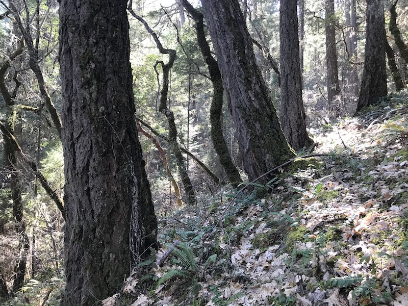
Located in a large Late Successional Reserve (LSR) forest and in an important connectivity corridor between the Red Buttes Wilderness, the Siskiyou Crest and the wildlands of the Kalmiopsis, the region contains high biological values, important old forests habitats, dense coastally influenced forests, and unique serpentine soils supporting intact plant communities, spectacular wildflower displays and open stands of sugar pine, western white pine, Jeffrey pine, incense-cedar and fir.
If the IVM Project is approved, both the Late Mungers and Penn Butte Timber Sales could be implemented without site specific scientific review, the disclosure of direct, indirect or cumulative impacts, adequate public involvement or meaningful public comment periods. The impacts would be devastating to the wildlands of the area and to the surrounding communities.
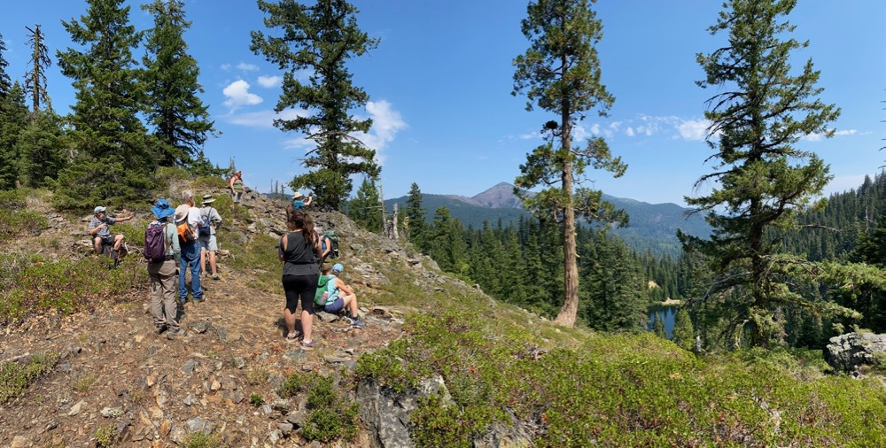
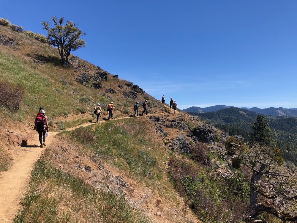
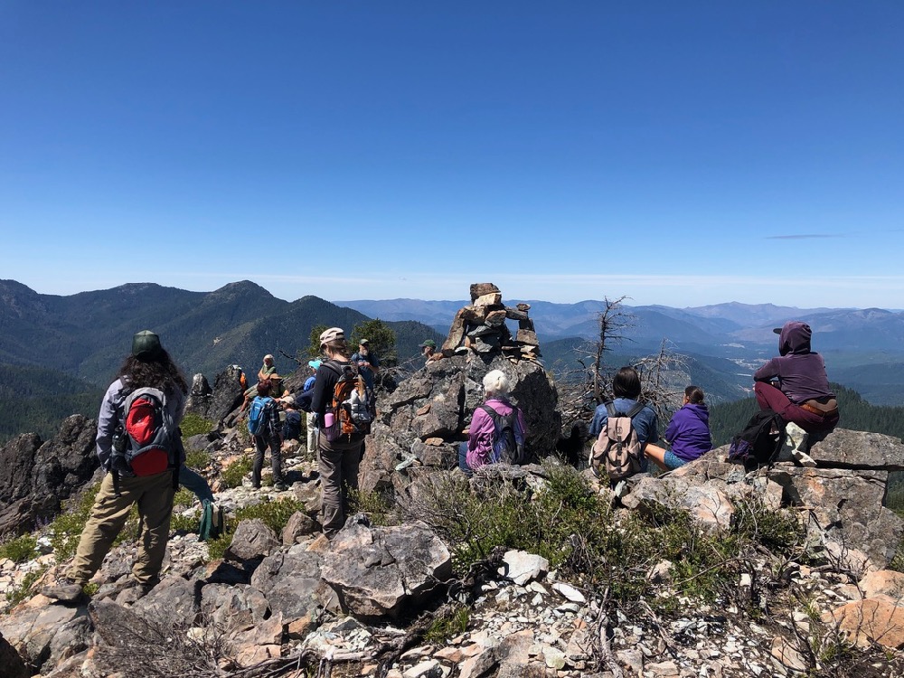
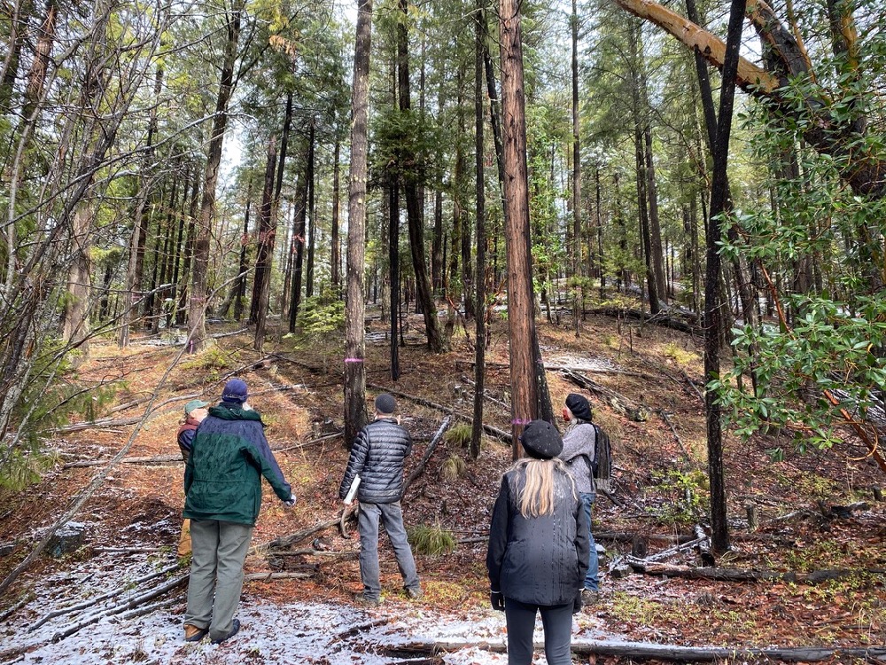
In 2021, we led public hikes into the area and conducted field monitoring to document the old forests targeted for logging. We also organized with local partners on the ‘Protect Mungers Wildlands’ campaign, and have been working to engage the affected communities to oppose the IVM Project and the associated timber sales. In 2022, ANN will continue focusing on our opposition to the IVM Project, the Late Mungers Timber Sale and the Penn Butte Timber Sale.
For more information on the IVM Project and Late Mungers Timber Sale visit our campaign website:
Save Pipe Fork
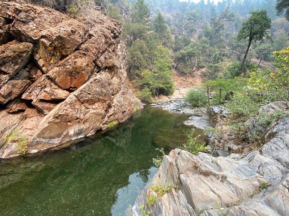
In late 2020, ANN and Klamath Forest Alliance worked to document the many important biological values of the Pipe Fork watershed, a tributary of East Fork Williams Creek. We then nominated the watershed for Wild and Scenic River protection in the River Democracy Act.
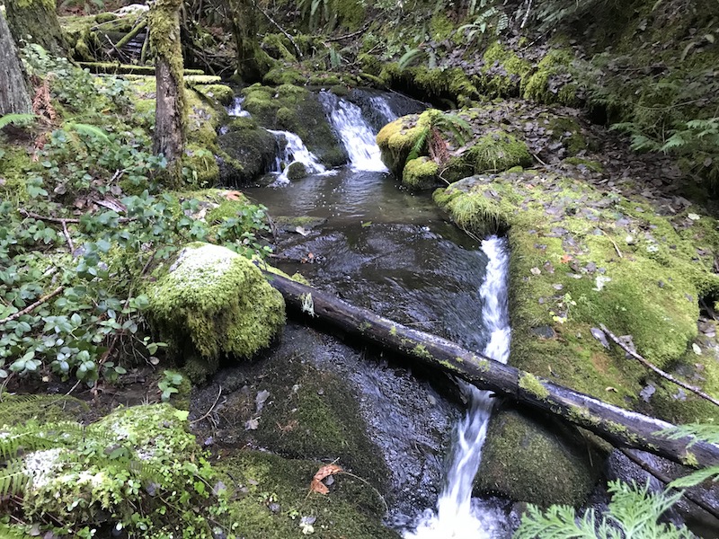
Located on the northern slope of Sugarloaf Peak in the Kangaroo Inventoried Roadless Area, the area is the most intact drainage in the Williams Creek watershed. The spectacular Pipe Fork begins at Larkspur Spring, then pours down bedrock cascades and over log jams as it rushes through slopes of old-growth forest into the easternmost stand of Port Orford-cedar in Oregon.
Large portions of the watershed are located within the Pipe Fork Research Natural Area intended to protect this rare stand of Port Orford-cedar from logging, development and infection with the deadly Port Orford-cedar root rot (Phytophthora lateralis). Port Orford-cedar stands across its limited range have become infected by this non-native pathogen and are dying en mass in many watersheds. Yet, the Pipe Fork watershed remains intact, largely unlogged and uninfected by this devastating pathogen.
Unfortunately, while we work to secure Wild and Scenic River protections for federal lands in the watershed, the Josephine County Forestry Department is heading in the opposite direction and has proposed clearcut logging on a 320-acre parcel along the stream’s lowest reach. Our partners at the Williams Community Forest Project (WCFP) have been working to secure a conservation buyout of these threatened private lands and stop Josephine County’s shortsighted timber sale plan. ANN has played a supportive role in this effort and we encourage our supporters to get involved with WCFP and the campaign to save the Pipe Fork.
In 2022, ANN will continue supporting the proposed conservation buyout on lower Pipe Fork. We will also continue working towards the permanent protection of the adjacent federal lands as a Wild and Scenic River segment in the River Democracy Act.
For more information on the threats to Pipe Fork, read our blog:
Rogue Gold Timber Sale
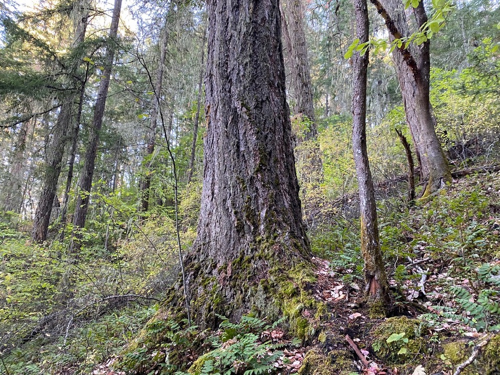
The Rogue Gold Timber Sale is located in the mountains between Rogue River, Gold Hill and Jacksonville, on the ridgeline divide between the Applegate and Rogue River watersheds and has been proposed by the Medford District BLM. Located predominantly in Kane, Galls, and Foots Creeks, the project proposes to log the last old forest habitats remaining in these already heavily fragmented watersheds, and either remove, downgrade or degrade the last islands of suitable Northern spotted owl habitat in the area.
The removal of large, old trees up to 36″ DBH, the removal of significant forest canopy and the implementation of “group selection” logging will not only impact endangered species habitat, but it will also increase fire risks in the watershed’s last, fire-resilient, old forest habitats.
In 2021, ANN conducted extensive on-the-ground monitoring of timber sale units and submitted extensive public comments in the BLM’s Scoping process. We intend to continue tracking this project and advocating for the retention of old trees and old forests in the Rogue Gold Planning Area in 2022.
Upper Applegate Watershed Restoration Project (UAW)
For the past five years, ANN has engaged in a collaborative process surrounding the Upper Applegate Watershed Restoration (UAW) Project, which was approved by the Forest Service (Siskiyou Mountains Ranger District) in July 2020. Throughout the planning process we worked to protect intact habitats, reduce impacts to the environment, and focus the project on the needs of the land and the community.
When the decision was released approving this project, we were happy with significant portions of the project and disappointed by others. We were disappointed by some of what was included, such as the highly controversial OHV trails on Beaver Creek that are inconsistent with the project’s stated “restoration” goals. We were also disappointed by some of what was not included, such as the pollinator and native plant restoration sites proposed by the community, and the Applegate River Ditch Trail, a proposed hiking trail that was also both envisioned and heavily supported by the community. Finally, we were hopeful that the agency would continue working with our community into the project implementation stage.
For the past year, our goal has been to improve the implementation of those portions of the project we do support, such as the extensive plantation thinning and fuel reduction treatments near communities in the Upper Applegate Valley. Yet, despite repeatedly promising to continue collaborating with our community, the Forest Service has been largely unresponsive since the project’s approval.
In late 2020 and early 2021, ANN organized a community implementation review team to monitor the fuel reduction and commercial logging units in the UAW Project. We visited the proposed thinning sites, led review team field trips and submitted a written document to the Forest Service outlining the portions of the project we support and the portions of the commercial logging mark that we believe could be improved. After almost a year, the Forest Service has yet to respond and the thinning projects are unfortunately moving forward without the promised community collaboration.
In 2022, we will continue our advocacy in the UAW Project area and continue striving for real community collaboration. We will also continue working to design, map and encourage the designation of the proposed Applegate River Ditch Trail. Our goal is to improve outcomes in the UAW Project for both the environment and residents of the Upper Applegate Valley.
Envisioning the Future of Conservation in the Applegate
Siskiyou Crest Coalition
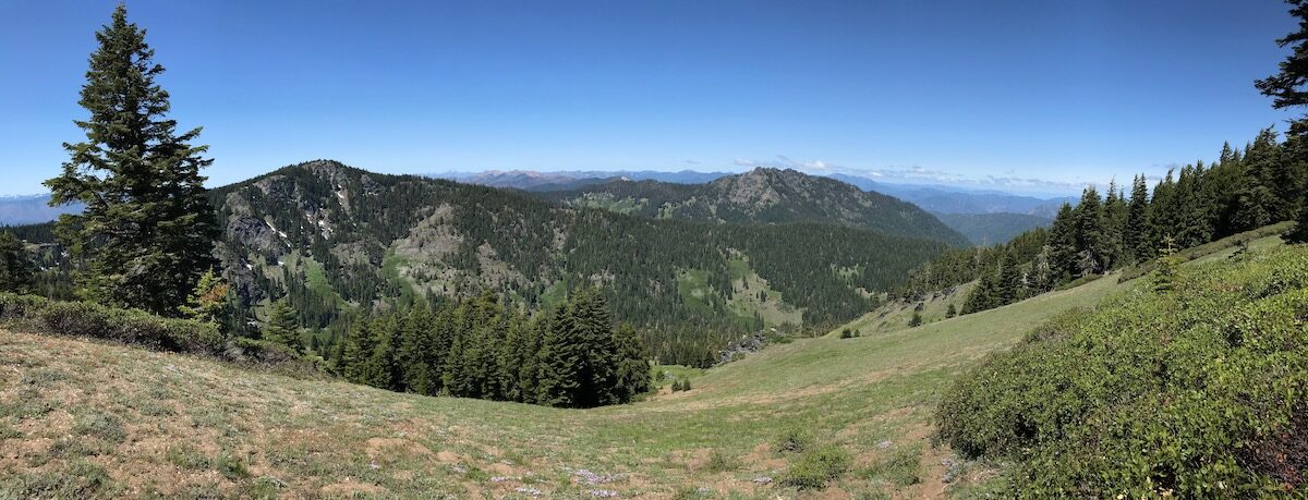
In 2021 ANN worked with partner organizations and supportive individuals to start the Siskiyou Crest Coalition. The goal of the Siskiyou Crest Coalition is to promote and secure permanent habitat protections for the Siskiyou Crest and the surrounding mountains.
Our vision for the future of the Applegate includes broad protected landscapes, rewilding projects, the restoration of natural processes, the maintenance of our region’s world-class biodiversity, thriving rural communities connected to the landscape that surrounds them, and sustainable outdoor recreation. We are actively working with rural communities in southwestern Oregon to promote this vision for the future
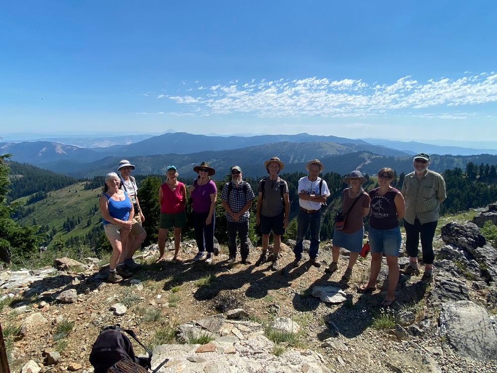
In 2021, ANN and the Siskiyou Crest Coalition joined forces on a series of public hikes into the wildlands of the Siskiyou Crest, sponsored online webinars exploring the area’s complex ecology, and hosted the premiere film showing of Sagebrush to Sea: A Journey Across the Siskiyou Crest.
In 2022, we will continue our advocacy for the Siskiyou Crest through coordination with the Siskiyou Crest Coalition.
Wild and Scenic River Legislation
After working to nominate numerous new Wild and Scenic River segments in the Applegate River watershed, we are now collaborating with both the Siskiyou Crest Coalition and the Oregon Wild and Scenic River Coalition to amplify our voice and more effectively promote our proposals.
Currently, public lands throughout the Applegate River watershed are proposed for permanent protection as Wild and Scenic River segments in Senator Ron Wyden’s River Democracy Act. The legislation calls for the protection of portions of the Middle Fork Applegate River, Butte Fork Applegate River, Elliott Creek, Carberry Creek, tributaries of the Upper Applegate River, the Little Applegate River canyon, Pipe Fork, Long Gulch and Slate Creek.
ANN will be working in 2022 to secure passage of the River Democracy Act and gain permanent watershed protections for these iconic Applegate River tributary streams.
For more information on our proposal read our blog:
Mt. Ashland Road Paving Project
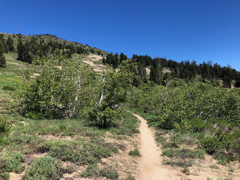
Although technically outside the Applegate River watershed, Mt. Ashland is the highest peak on the Siskiyou Crest and is threatened by a road paving project proposed by the Klamath National Forest. This project proposes paving Forest Service Road 20 from the Mt. Ashland Ski Area parking lot to Grouse Gap Shelter at the headwaters of Grouse Creek, and to the very summit of Mt. Ashland. We believe this project is not only completely unnecessary, but damaging to the environment, to numerous rare plant species, and to the current recreational uses in the area.
Paving these roads will create direct, indirect and cumulative impacts that were not adequately considered by the Klamath National Forest when they approved this project, with absolutely no public input or scientific analysis.
Our vision for the future of Mt. Ashland and the Siskiyou Crest does not include additional development, road paving, the encouragement of overuse, and/or the degradation of the unique natural values found on the highest peaks in the Siskiyou Mountains. We will continue working in 2022 to oppose this project and protect the many important biological and recreational values of the Mt. Ashland area.
For more information read our recent blog: No new pavement on Mt. Ashland: Stop the Mt. Ashland Road Paving Project
Take Action to stop the proposed road paving project on Mt. Ashland, sign our petition.
Donate to Applegate Neighborhood Network
In 2o21, ANN worked across the Applegate watershed advocating for conservation and community values. We opposed those projects that threatened our environment and our community, we led hikes to regional wildlands; we hosted educational presentations; we advocated for the permanent protection of regional rivers and streams, and began organizing to implement our vision for the future of the Applegate River watershed. We look forward to 2022, and working with you to protect, defend and restore the wildlands, wildlife and biodiversity of the Applegate Siskiyous!
The vast majority of ANN’s funding comes from supporters like you. Donate Now!