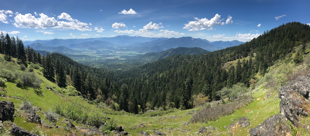
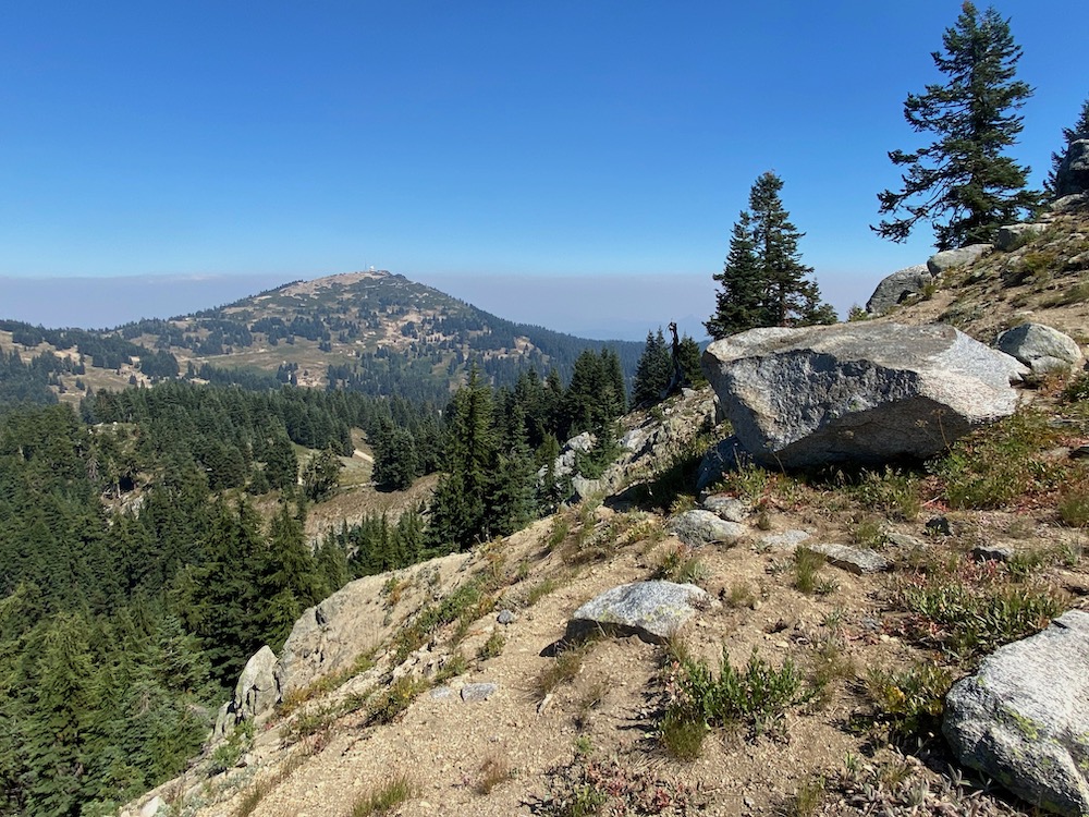
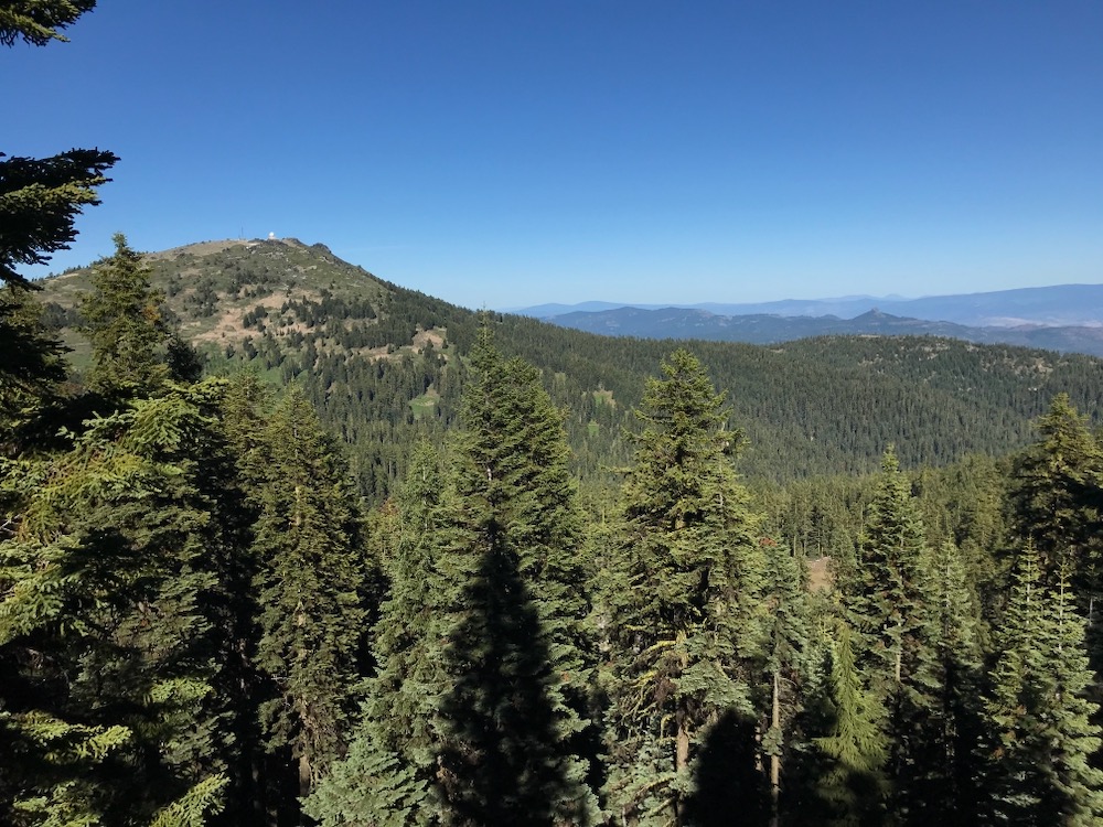
Although just outside the Applegate River watershed, at 7,532′ Mt. Ashland is the highest peak on the Siskiyou Crest, a botanical paradise, and one of the most beautiful and accessible landscapes in the region. Important as the gateway to the Siskiyou Crest, and located at its intersection with the Cascade Mountains in the nearby Cascade-Siskiyou National Monument, the area is also very important for its habitat connectivity and contains extremely high biological, botanical and scenic values. It is also a very popular recreation area, offering world-class hiking on the Pacific Crest Trail, mountain biking and hiking in the adjacent Ashland Creek Watershed, hiking in the McDonald Peak Roadless Area, incredible botanizing, pollinator viewing, and camping at the two primitive campgrounds, including the Mt. Ashland Campground and Grouse Gap Shelter, a CCC-era snow shelter built in the Grouse Creek Basin.
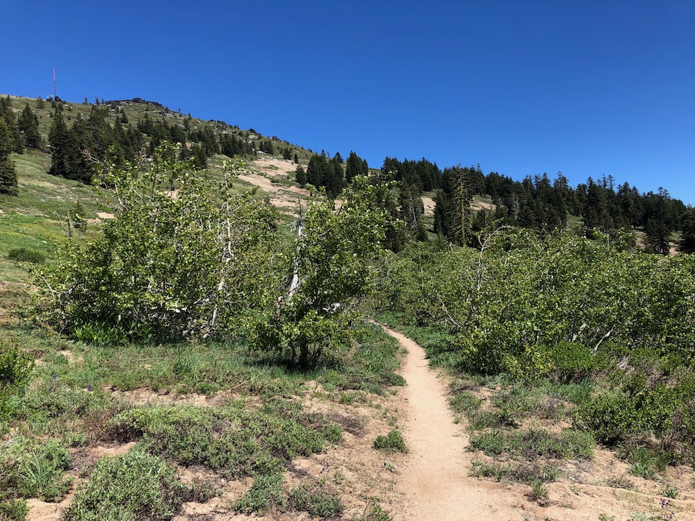
The area is wild and spectacularly beautiful despite being easily accessible from the town of Ashland, Oregon. It is only a short distance from Interstate 5 on the Mt. Ashland Ski Road to the Mt. Ashland Ski Area. However, the mountain’s southern face remains accessible only by gravel roads that extend from the pavement’s end at the Mt. Ashland Ski Area. This gravel road access helps to retain the area’s incredible backcountry charm and reduce the impact of overuse on both the ecology of the mountain and the recreational experience it provides.
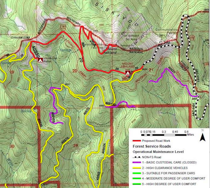
Unfortunately, the Klamath National Forest has proposed paving Forest Service Road 20 from the Mt Ashland Ski Area overflow parking lot, around the southern face of Mt. Ashland to the Grouse Gap Shelter, and up to the very summit of Mt. Ashland. This project, although completely unnecessary, comes at a high price to the region’s incredible botanical diversity, biological values, habitat connectivity, and recreational experience.
Currently Road 20 is particularly popular for dog walking, jogging, mountain biking and hiking directly on the gravel road surface, past the Mt. Ashland Ski Area overflowing parking lot. If paved, traffic and driving speeds would dramatically increase on Road 20, leading to a total loss of this currently popular recreational resource. Paving these roads will negatively impact Mt. Ashland’s two backcountry campgrounds. The traffic, increased driving speeds, noise, increased use and the loss of solitude in the area will also impact recreation on the Pacific Crest Trail and on adjacent trails in the Ashland Creek watershed, degrading one of southwestern Oregon’s most important recreational resources.
In addition, access to the area on the existing high standard gravel roads is already completely adequate. In fact, if anything the area is already perhaps too accessible and suffers from impacts associated with overuse. Rare native plants are routinely walked on, driven over and crushed along the road systems on Mt. Ashland. Paving will only increase this impact.
As described above, paving these roads will impact the currently very popular forms of recreation found in the area today; however, the impacts will also be quite severe to the region’s important biological values.
As the axis of connectivity between the Siskiyou Crest and the Cascade Mountains, the old-growth forests, subalpine parklands, wet meadows, rock gardens and aspen glades in the area are highly important as both wildlife habitat and for their intact and exceptionally diverse botanical values.
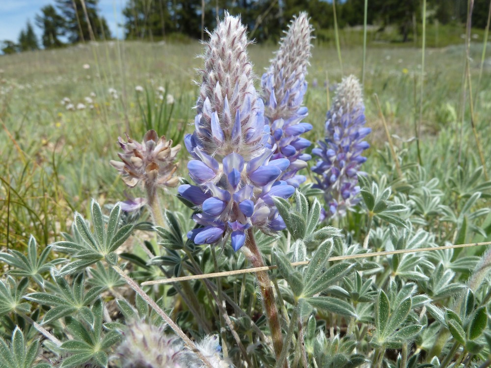
Designated as the Mt. Ashland-Siskiyou Peak Botanical Area, the region contains the world’s entire population of the Mt. Ashland lupine (Lupinus aridis ssp. ashlandensis), along with numerous other rare wildflowers and two rare conifer populations. These populations could easily be impacted directly by the proposed road paving project and will certainly sustain impacts associated with overuse in the future if the road is paved. These impacts have already begun to mount in the area, forcing Forest Service action by closing down unauthorized parking areas and user-created trails to reduce impacts on rare plant species.
Ecological impacts will multiply exponentially with the increased use facilitated by the proposed Forest Service Road 20 Paving Project. The additional traffic and recreational use will increase the destruction of vegetation associated with user-created trails and excessive trampling. Very little parking exists along this narrow road system, and parking on roadsides and unauthorized parking areas will undoubtedly increase with the proposed road paving, leading to further vegetation damage, soil compaction, accelerated surface erosion, and gully creation on fragile decomposed granite soils. These impacts are inconsistent with the mandates in the Fish & Wildlife Service’s Conservation Agreement for the Mt. Ashland lupine and other rare plant species found on the mountain and should not be authorized.
This includes impacts to numerous rare plant species that grow directly adjacent to the roadway. Species impacted could include the only population of Mt. Ashland lupine in the world, one of only 8 populations of the endemic Henderson’s horkelia (Horkelia hendersonii) which is found only on the Siskiyou Crest, and one of only 8 populations of Jayne’s Canyon buckwheat (Eriogonum diclinum) which is endemic to the Klamath-Siskiyou Mountains. Impacts to these species will be particularly severe along the Mt. Ashland Summit Road and on the summit itself, where many rare species grow, including these unique wildflowers, along with the only population of whitebark pine (Pinus albicaulis) in the Siskiyou Mountains — the population consists of only a few vulnerable trees — and one of only two populations of subalpine fir (Abies lasiocarpa) on the Siskiyou Crest.
In recent years, increased use has compounded the impact of recreation on Mt. Ashland, including impacts to the important plant species mentioned above. Likewise, just this past summer, staff on the Rogue River-Siskiyou National Forest removed graffiti from large granite boulders near the summit of Mt. Ashland. Unsightly impacts such as graffiti will increase if the roads are paved and Mt. Ashland is made even more accessible.
To date, the Klamath National Forest has provided no real justification for the so-called Forest Service Road 20 Project and the agency has also worked to ensure the public has no voice in this process. The agency approved the project with no public notification (besides one, single facebook post), no environmental or scientific analysis, no public comment period, no disclosure of direct, indirect or cumulative impacts, and with no attempt at public transparency.
The authorization for this large road paving project on Mt. Ashland was authorized through a paltry, one-page Categorical Exclusion (CE). Read the Road 20 Road Paving Project CE here.
ANN opposes the Forest Service Road 20 Project and we invite you to join us in making our voice heard. Please help us stop the Forest Service Road 20 Project that proposes to pave roads on Mt. Ashland by both signing our petition and sending the District Ranger for the Happy Camp/Oak Knoll Ranger District, and the Forest Supervisor for the Klamath National Forest an email expressing your concerns.
Since the agency did not ask for our input, we must take the initiative ourselves and advocate for Mt. Ashland, the Siskiyou Crest and the area’s many important biological values. We have one very simple message: No new pavement on Mt. Ashland!
Sign and share our petition at this link: https://ann.secure.force.com/petition?pid=Mt%20A
Send emails to the following Klamath National Forest officials:
Klamath National Forest Supervisor Rachel Smith: rachel.c.smith@usda.gov
Happy Camp/Oak Knoll District Ranger Roberto Beltran: roberto.beltran@usda.gov