Senator Wyden Releases a New Version of the River Democracy Act, but Leaves the Best of the Applegate Out!
For the past three years Applegate Siskiyou Alliance (ASA) and others across Oregon have been working with Senator Wyden’s staff to nominate streams for protection as new Wild and Scenic River segments. This public nomination process led to the River Democracy Act, federal legislation that would protect thousands of miles of rivers and streams in Oregon watersheds as new Wild and Scenic Rivers.
ASA proposed streams for designation across the Applegate River watershed and Senator Wyden’s original version of the River Democracy Act included approximately 154 miles of streams in the Applegate River watershed, including the headwaters of the Applegate River in northern California.
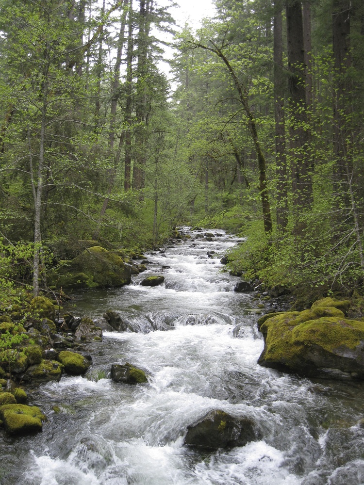
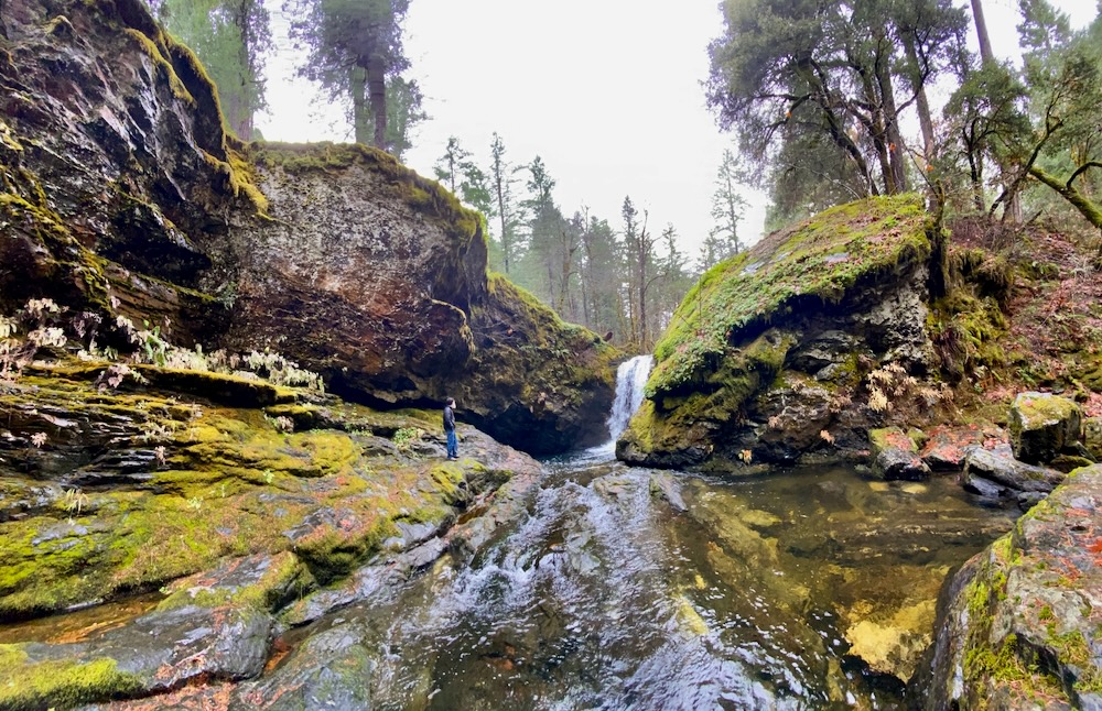
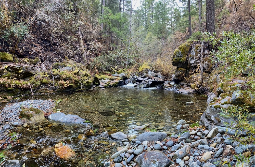
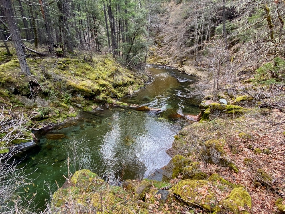
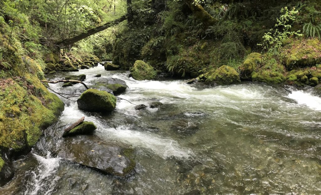
Elliott Creek is essentially the east fork of the Applegate River and its lower canyon contains deep clear pools popular for swimming, hiking and camping. Residents from across southwestern Oregon visit the Middle Fork and Elliott Creek canyons to escape the heat of the surrounding valleys in the summer.
Unfortunately, Senator Wyden recently released a revision of the River Democracy Act that dramatically reduced the stream miles proposed for Wild and Scenic River designation in the Applegate River Watershed. This included a reduction from 154 stream miles in the Applegate to 62.7 miles. This nearly 60% reduction in stream miles proposed for protection in the Applegate River watershed was the largest in the state on a watershed by watershed basis.
Much of this unfortunate reduction came by dropping tributary streams on the Little Applegate River, Palmer Creek, Star Gulch, Carberry Creek, Mule Creek, and Pipe Fork, while the mainstem of each stream remains proposed for Wild and Scenic River protection. Tragically, still more reductions came by removing all Applegate River streams located just over the border in northern California, including the Middle Fork Applegate River, Butte Fork Applegate River, Cook and Green Creek, Whisky Creek, Elliott Creek and many others.
Middle Fork Applegate River along the Middle Fork National Recreation Trail.
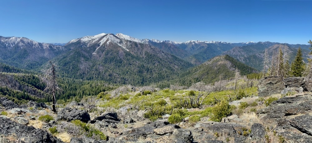
Clearly a political decision, these headwaters streams, although located in northern California, are by far the wildest and most scenic in our region. They also support the most intact habitats, with the most significant stream flows, the most popular recreation areas, the biggest stands of old-growth forest, and the largest, most spectacular wildlands surrounding the Red Buttes Wilderness Area. Despite being the heart of our proposal and the most worthy streams in the Applegate River watershed, these streams are unfortunately no longer proposed for protection in Senator Wyden’s legislation.
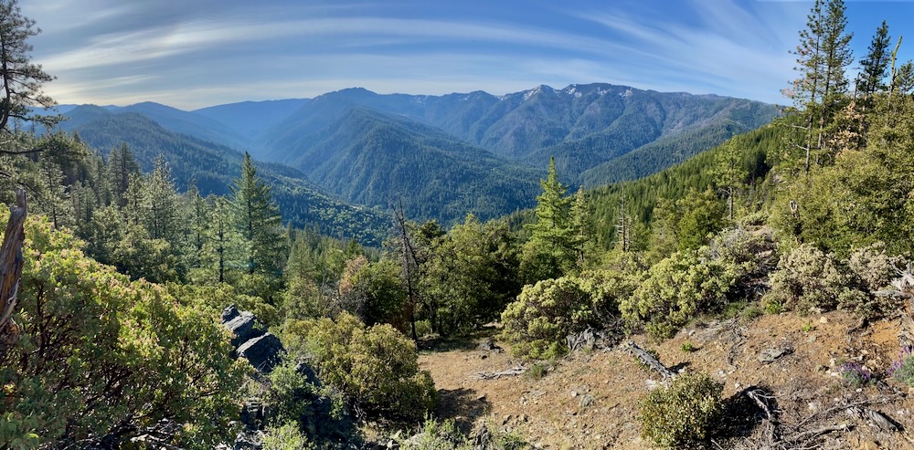
On a more positive note, this new version of the River Democracy Act did expand proposed protections in two important Applegate River watersheds. Although not included in the original legislation, the newest version extends protections to 5.5 miles of Silver Fork Elliott Creek, below Dutchman Peak in a deep forested canyon. It also includes an additional 5.5 miles on Slate Creek, in a beautiful red rock canyon filled with rare plants, Port Orford-cedar groves, old-growth mixed conifer forests, twisted Jeffrey pine woodlands and the Applegate River’s only population of the carnivorous cobra lily (Darlingtonia californica) west of Wilderville, Oregon.
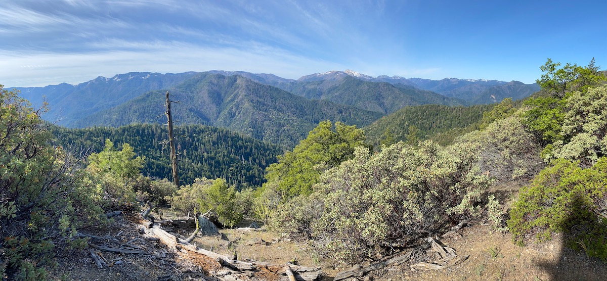
A view across the Slate Creek watershed which has been proposed by Senator Wyden for Wild and Scenic River designation. We applaud the Senator for including this deserving Applegate watershed in the protections proposed under the River Democracy Act.
Although ASA will continue to support the River Democracy Act and we are appreciative of the important streams still included in the legislation, we will also continue to vigorously advocate for the biggest, wildest, most worthy streams in our region at the headwaters of the river in California. This includes the Middle Fork Applegate River, Butte Fork Applegate River, Cook and Green Creek, lower Whisky Creek and Elliott Creek. It also includes upper Whisky Creek in Oregon near Whisky Peak, upper Pipe Fork on the northern slope of Big Sugarloaf Peak above the Williams Valley, as well as two additional tributaries of Carberry Creek including O’Brien Creek and Brush Creek.
Please sign our petition and support this effort to appropriately protect the headwaters of the Applegate River in California and other worthy streams throughout the watershed. Better yet, send a personal letter to Senator Wyden letting him know your love for the headwaters of the Applegate River, your relationship to these places, and your desire to protect more worthy streams in the Applegate River watershed. Please specifically ask him to include the Middle Fork Applegate River, Butte Fork Applegate River, Cook and Green Creek, lower Whisky Creek, Elliott Creek, upper Pipe Fork, Brush Creek, and O’Brien Creek.
Certainly Wild and Certainly Scenic: A Photo Gallery of Applegate Streams Not Protected in Senator Wyden’s River Democracy Act
Middle Fork Applegate River
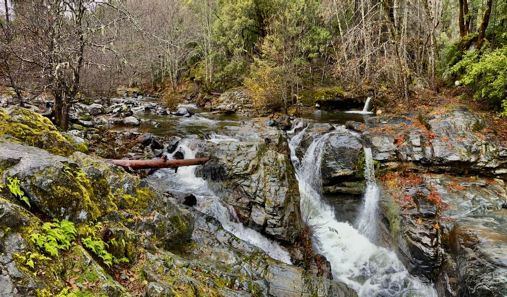
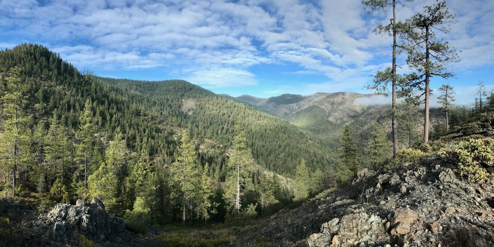
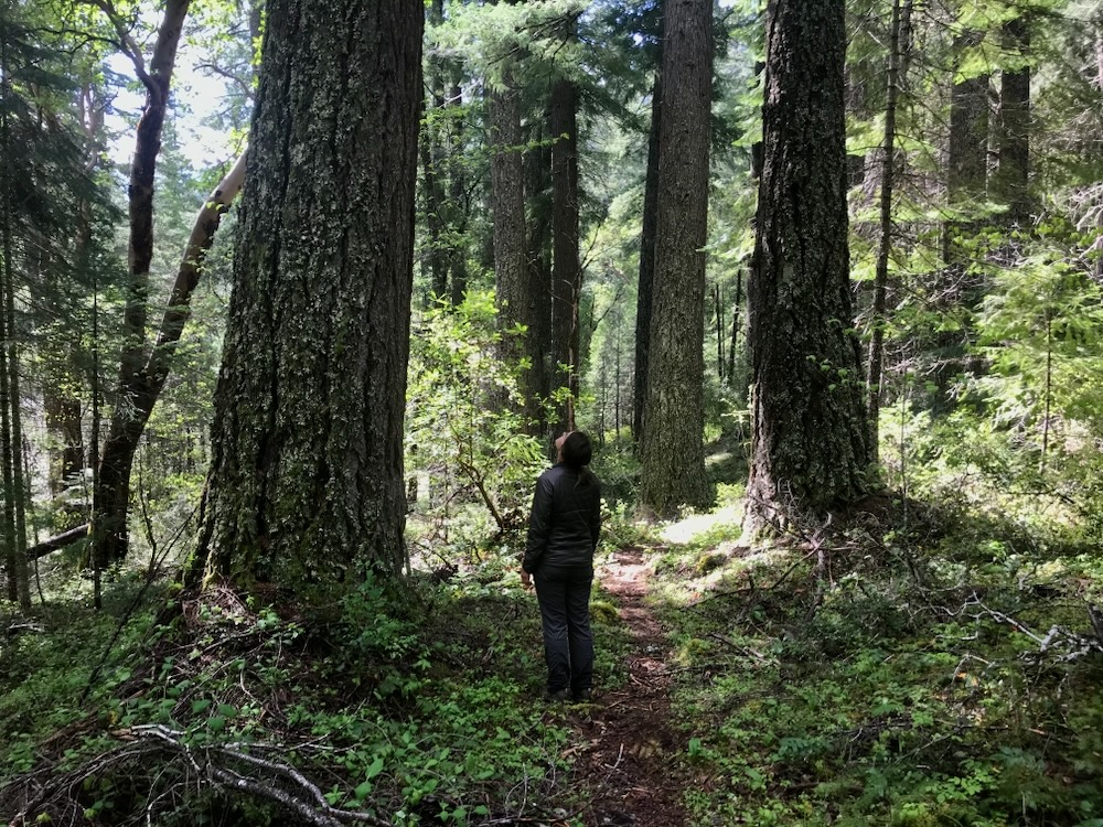
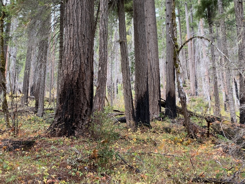
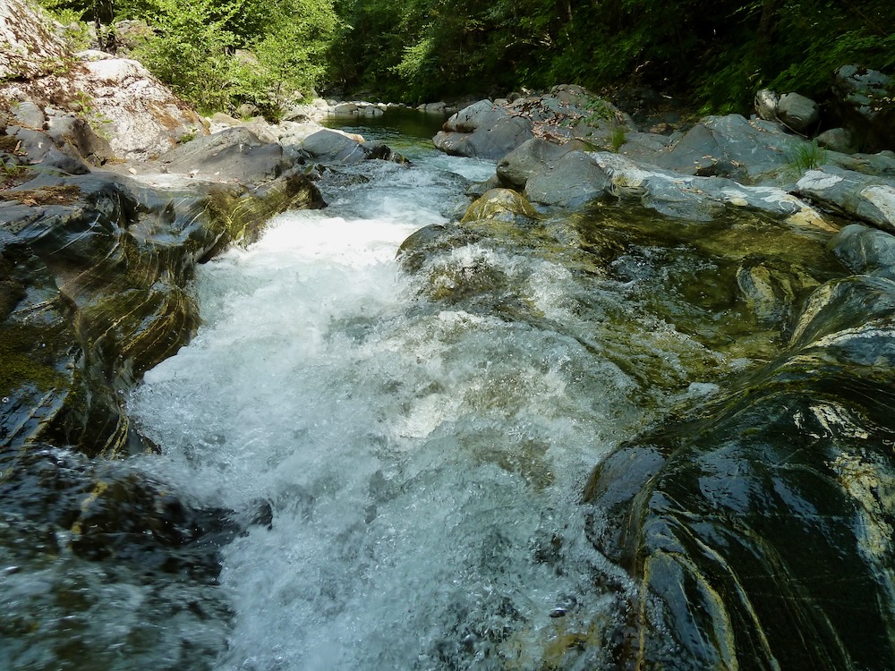
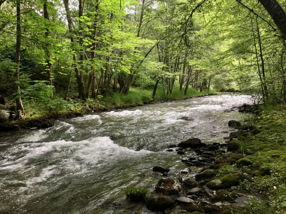
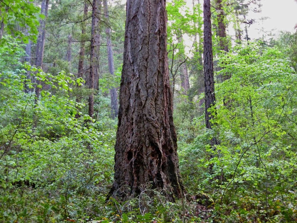
The Middle Fork Applegate River runs through a water polished bedrock gorge just downstream of Cook and Green Creek and is among the most wild and scenic streams in the Applegate River watershed, with bedrock gorges, thundering waterfalls, deep emerald green pools, and spectacular old-growth forests. Unfortunately it was recently left out of Senator Wyden’s revised version of the River Democracy Act.A view across the largely unbroken old-growth forests and high rocky summits of the Middle Fork Applegate River drainage. Can you get much more wild and scenic? Upper Middle Fork Falls is a popular swimming hole and dispersed campsite on the Middle Fork Applegate River. The area has been cherished by generations of southwestern Oregon residents who are disappointed by Senator Wyden’s recent decision to remove this wonderful stream from the River Democracy Act. The Middle Fork Applegate River contains some of the most extensive old-growth forest in the region, like these spectacular forests along the Middle Fork National Recreation Trail. Seven very popular hiking trails extend through old-growth forests from the unprotected banks of the Middle Fork Applegate River into the surrounding Kangaroo Inventoried Roadless Area and the Red Buttes Wilderness Area. The beautiful waters and towering forests of the Middle Fork are exactly what the River Democracy Act aims to protect, but these forests were excluded from potential protection in Senator Wyden’s newly revised River Democracy Act. The confluence of Middle Fork and Elliott Creek is popular for swimming, camping and day use with residents throughout southwestern Oregon. The next approximately six river miles of the Middle Fork Applegate River is the most popular dispersed recreation area on federal lands in the Applegate River drainage, but was left out of the newly revised River Democracy Act. The Middle Fork Applegate River is a broad stream with exceptional water clarity, spectacular scenery, and beautiful old forests.
Butte Fork Applegate River
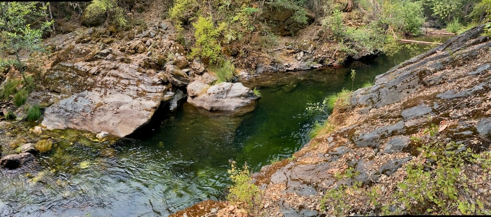
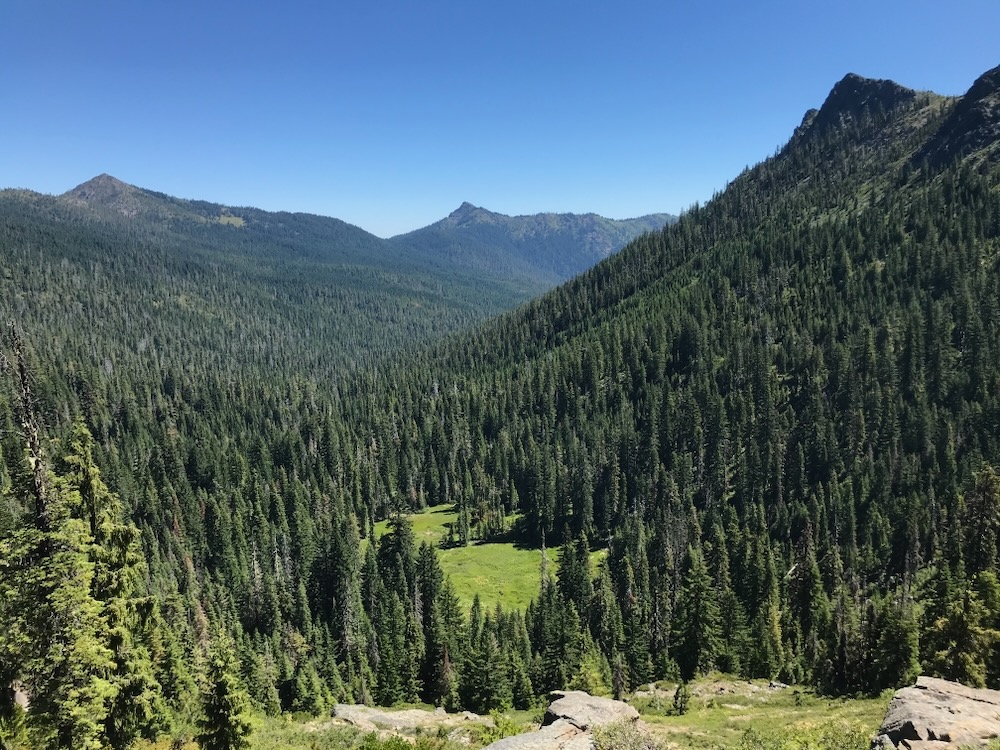
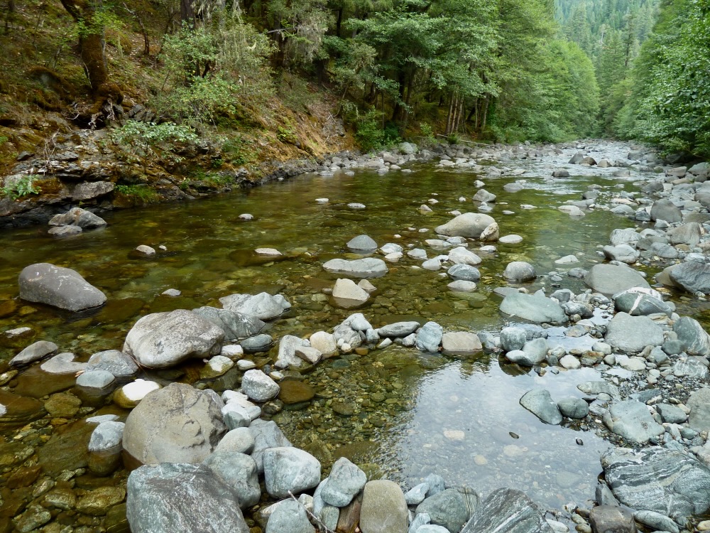
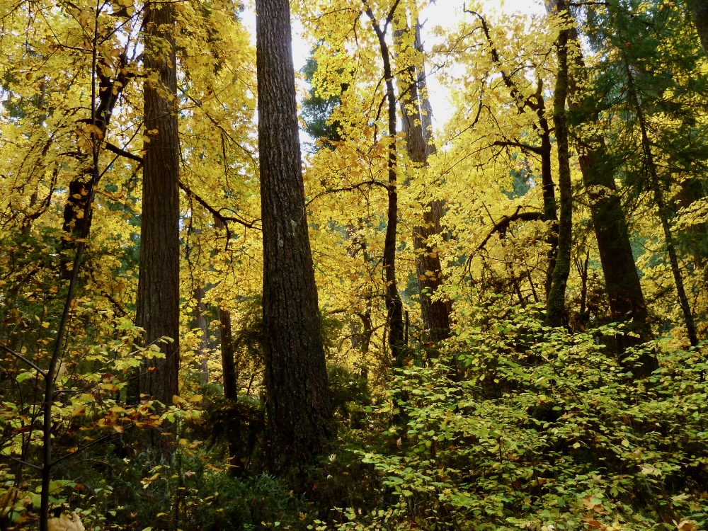
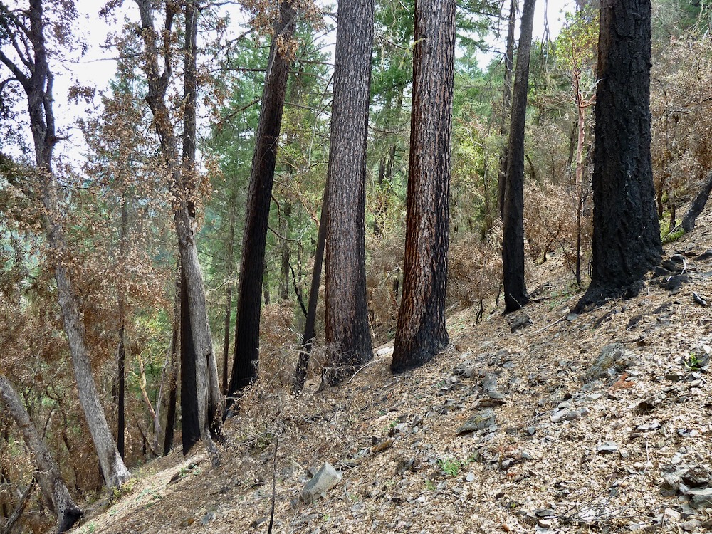
The Butte Fork Applegate River runs clear, cold and undisturbed from the headwaters of the Applegate River in the Red Buttes Wilderness into the spectacular old-growth mixed conifer forests below. These forests extend from the headwaters at Azalea Lake to the stream’s confluence with the Middle Fork Applegate River. The lowest portions of the stream are both unprotected and excluded from the newly revised River Democracy Act. The Butte Fork canyon is a stronghold for fire adapted old-growth forest, like this old forest on the Butte Fork Trail, just below the Red Buttes Wilderness boundary. The Butte Fork is the only drainage in the over 500.000 acre Applegate River watershed that from top to bottom has never been logged, roaded or otherwise disturbed by industrial activity. Mixed hardwood forests dominate the canyon below the Butte Fork Slide, a natural landslide that scoured out the lower Butte Fork canyon in the 1930s. The Butte Fork Slide is an impressive geologic feature that to this day heavily influences the habitat, geomorphology and character of the region. It also provides an excellent example of undisturbed ecosystem processes in the Siskiyou Mountains, vegetative recovery, and disturbance ecology.Fall color and old-growth forest in the Butte Fork CanyonThe lower Butte Fork Applegate River just above its confluence with the Middle Fork Applegate River is a wide, boulder lined stream deserving of Wild and Scenic River protections.
Cook and Green Creek
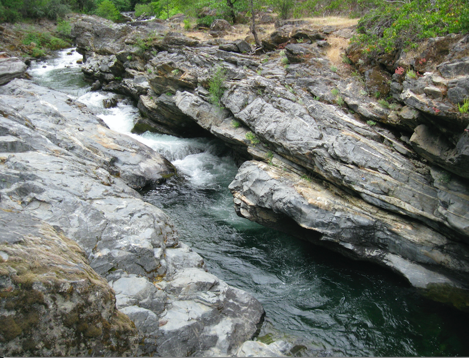
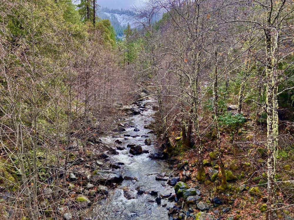
Cook and Green Creek is a major tributary of the Middle Fork Applegate River. Surrounded by tall, rocky summits, the rugged canyon is filled with spectacular uncut old-growth forest. It is also traversed by the popular Cook and Green Creek Trail which extends from the Pacific Crest Trail to the stream’s confluence with the Middle Fork Applegate River. This view from Windy Peak peers down into the Cook and Green Creek canyon with snow-capped Red Butte and Cook and Green Butte rising above. Healthy, fire-adapted mixed conifer forest is abundant along Cook and Green Creek and the Cook and Green Creek Trail. Cook and Green Creek runs through a bedrock gorge deep in the Kangaroo Inventoried Roadless Area. It is also one of the most important cold water tributaries of the Middle Fork Applegate River.
Whisky Creek
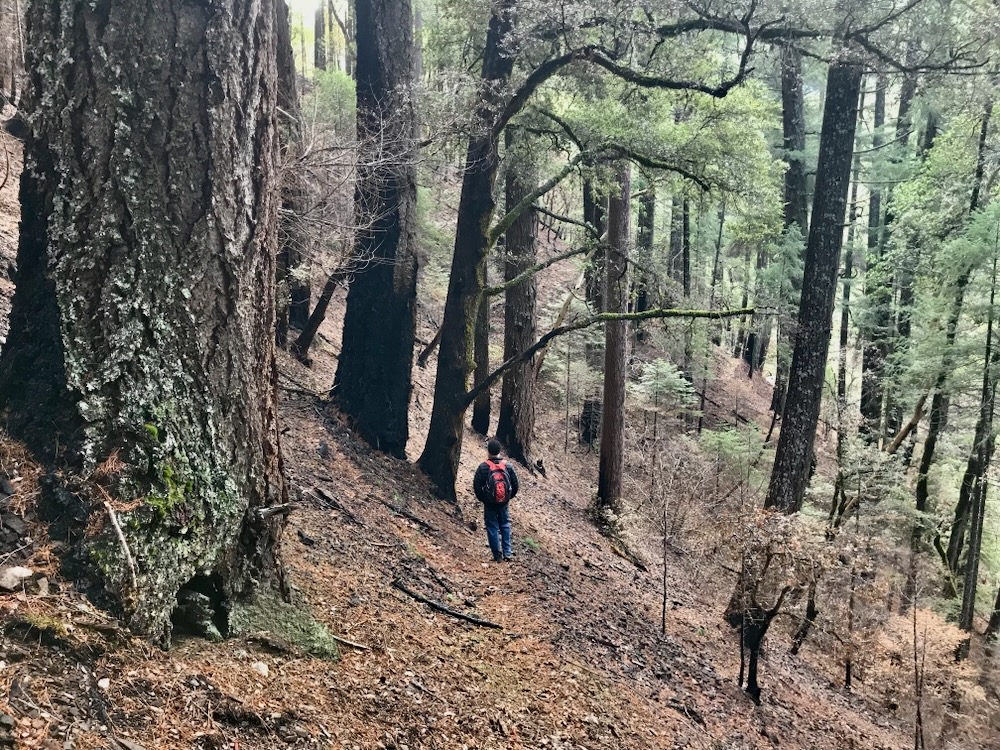
Whisky Creek is also a major tributary of the Middle Fork Applegate River with spectacular fire-adapted old-growth forest accessed by the Whisky Creek Trail. Forest Service research demonstrates that this canyon is important for the endemic Siskiyou Mountains Salamander and contains trees up to 500 years old. Whisky Creek runs through a spectacular forested canyon below Stricklin Butte in the unprotected and uninventoried Stricklin Butte Roadless Area. It also contributes significant cold water into the Middle Fork Applegate River in the summer months.
Elliott Creek
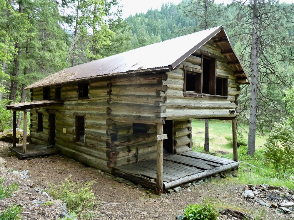
Elliott Creek is one of the most significant tributary streams in the Applegate River watershed, but was left out of Senator Wyden’s newly revised River Democracy Act. Supporting incredible old-growth forest, isolated wildlife habitat, beautiful bedrock gorges, rocky rugged canyons, boulder lined cascades and clear blue pools, Elliott Creek is surely both wild and scenic. Much of the stream is lined in moss covered bedrock and lush mixed conifer forests. This beautiful canyon is just upstream of Harlow Cabin on the Rogue River Siskiyou National Forest. Harlow Cabin is located on lower Elliott Creek and is the last mining-era cabin still standing on federal land in the Applegate River watershed. Protected under the National Historic Register and managed as a day-use area, the Forest Service has proposed restoring the cabin to historic standards and managing the site as a recreational rental. This could be a spectacular recreational opportunity, especially if located along a deserving and well protected Wild and Scenic River segment. Elliott Creek flows through miles of rugged canyon with lush riparian woodland and forest lining its banks. It is an oasis through the hot summer months in southwestern Oregon.Elliott Creek contains extensive old-growth mixed conifer forest, including massive old Douglas fir deep in the stream bottoms. Characterized by water clarity, steep mountainous terrain, lush stream canyons, and towering old forests, Elliott Creek is a gem in the Applegate River watershed and deserves permanent stream protections under the River Democracy Act. A view across the rugged and heavily forested Elliott Creek watershed with the Siskiyou Crest and the Condrey Mountain Inventoried Roadless Area rising to the south.