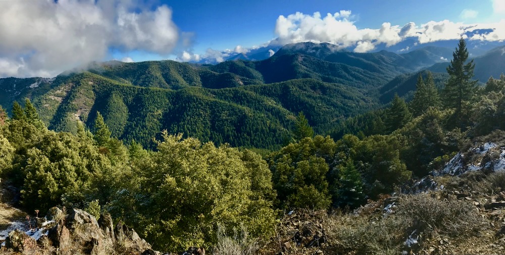
As mentioned in our previous blog post, Senator Wyden recently released new revisions to the River Democracy Act, legislation intended to protect Oregon watersheds through new Wild and Scenic River designations. Unfortunately, this new revision included significant cuts in every corner of the state. Yet, our corner of the state received the most significant cuts, including a reduction from 154 to 62.7 stream miles proposed for protection in the Applegate River watershed. This 60% reduction is approximately twice as steep as cuts made anywhere else in the state, and included many streams worthy of Wild and Scenic River protections.
Disappointingly, these cuts were made by removing all tributaries of the Applegate River at its remote headwaters in northern California. They were also made by cutting tributary streams from worthy Wild and Scenic River segments in Oregon. This included cutting tributaries, but maintaining proposed protections for the mainstem of Little Applegate River, Mule Creek, Palmer Creek, Star Gulch, Pipe Fork, Steve’s Fork Carberry Creek and Sturgis Fork Carberry Creek. Cuts were also made to whole streams in the upper Applegate, like Kinney Creek.
Currently, Applegate Siskiyou Alliance is asking Senator Wyden and Senator Merkley, who co-sponsored the River Democracy Act, to restore proposed Wild and Scenic River protections to numerous streams in northern California, including Middle Fork Applegate River, Butte Fork Applegate River, Cook and Green Creek, Whisky Creek and Elliott Creek. Our recent blog post highlights these California streams, the value of their protection, and their importance to our watershed and to downstream communities.
We are also asking to include additional streams in Oregon, such as upper Pipe Fork Creek, upper Whisky Creek on the eastern face of Whisky Peak, and two tributaries of Carberry Creek, including Brush Creek and O’Brien Creek. If all these streams in both the Oregon and California portions of the Applegate were included in the River Democracy Act, the most spectacular and important streams in the Applegate River watershed would be proposed for protection and our watershed would receive the same level of protection and consideration as other watersheds around the state. We believe this is a matter of both equity and biological integrity, because the streams in the Applegate are as deserving, diverse, wild and well-loved as any in the region.
Although we are grateful for the protections proposed in the Applegate River watershed and the beautiful streams currently included in the River Democracy Act, the legislation as currently drafted would not adequately protect our watershed and its many important attributes. Our goal is to encourage our elected officials to think like a watershed, and protect the wild streams of the Applegate River watershed. Some of our wildest, most intact streams still need protection under the River Democracy Act!
Protections for the following Oregon streams should be restored in the River Democracy Act:
Upper Pipe Fork Creek
During Senator Wyden’s recent revision process a headwater fork of Pipe Fork Creek was removed from proposed protection in the River Democracy Act; however, we believe this important stream should receive Wild and Scenic River designation. Currently, the lower reaches of Pipe Fork Creek are proposed for protection, but the western headwaters that drain the northern slopes of Big Sugarloaf Peak were not.
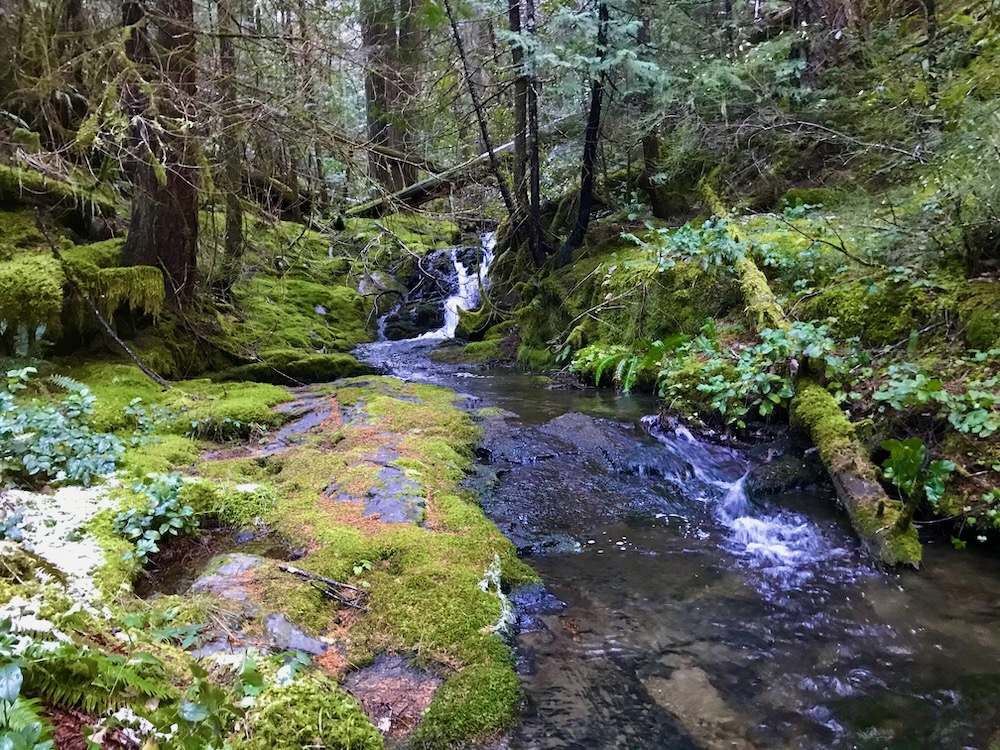
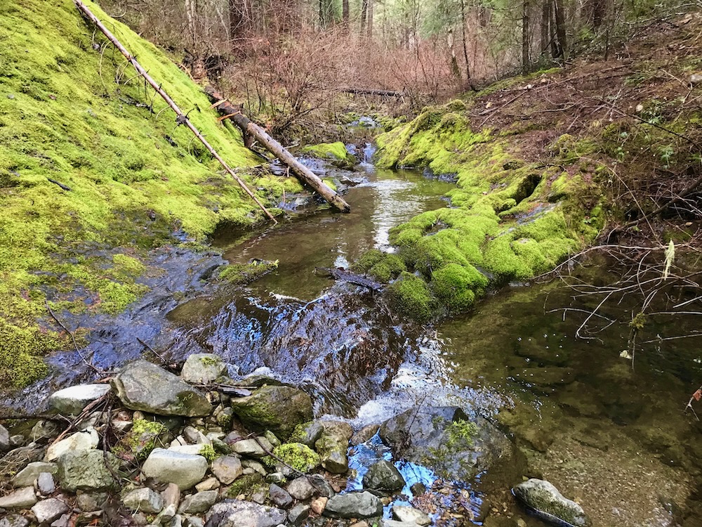
Pipe Fork is an island of rain forest, located in the more arid mountains of the Applegate Siskiyou. Pipe Fork Creek contains the easternmost population of Port Orford-cedar in Oregon and this lush headwater stream is important in maintaining local stream flows, microclimate conditions, and regional Port Orford-cedar populations. The tributary in question is the highest elevation stream in the Pipe Fork drainage, and supports beautiful old-growth forests in the Kangaroo Inventoried Roadless Area and Pipe Fork Research Natural Area.
As the last intact tributary of Willams Creek, Pipe Fork is vital in sustaining adequate stream flows and maintaining cold water refugia for the last wild coho salmon, chinook salmon and steelhead in the watershed. Coho salmon, in particular need low gradient streams, and Williams Creek provides ample habitat, but suffers from water quantity and quality problems. Pipe Fork Creek is the most important contributor of clean, cold water in the East Fork Williams Creek watershed and should be protected as a Wild and Scenic River in the River Democracy Act.
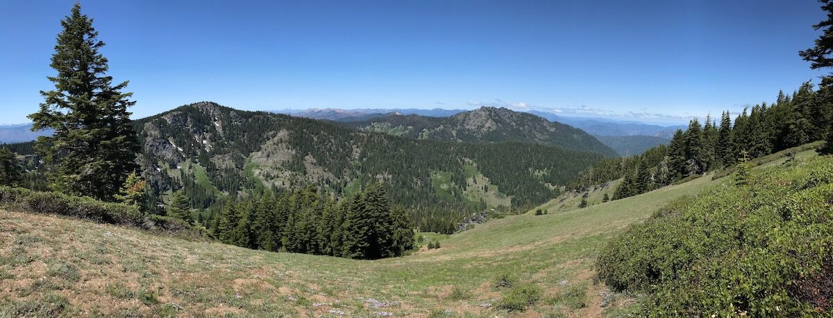
Upper Whisky Creek
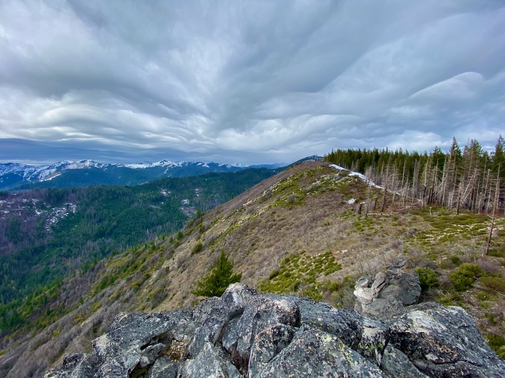
Upper Whisky Creek flows off the eastern face of Whisky Peak just north of the Oregon border, below the Whisky Peak Botanical Area and adjacent to both the Whisky Peak and Stricklin Butte citizen-identified roadless areas. Upper Whisky Creek contains montane forests and intact stream reaches that flow east into the Middle Fork Applegate River. Together, with other portions of Whisky Creek in California, Wild and Scenic River designation would help to protect the natural character and old-growth forest found in the region.
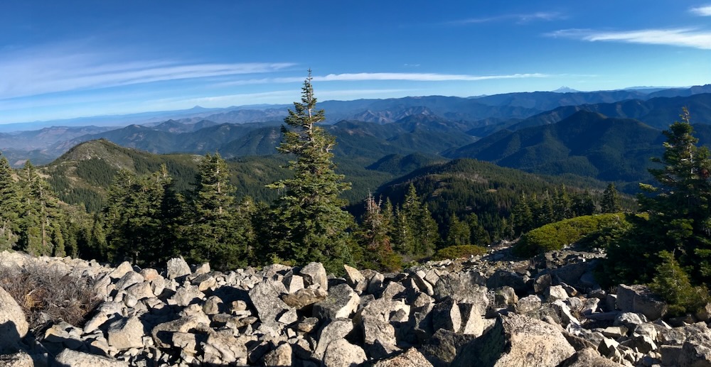
O’Brien Creek
O’Brien Creek is a major tributary of Carberry Creek’s Sturgis Fork. The stream flows from the beautiful high country on the eastern flank of Grayback Mountain, located within the vast Kangaroo Inventoried Roadless Area.
Upper O’Brien Creek is accessible by the O’Brien Creek Trail which follows the stream through old-growth forests, intact mountain meadows, wetlands, glades, and rare plant populations. The historic Grayback Snow Shelter, built in the 1930s is located at the lower end of a long sloping meadow designated as the Grayback Mountain Botanical Area. At the head of the meadow and at the stream’s gurgling headwaters at Cold Spring, the O’Brien Creek Trail ties into the Boundary National Recreation Trail.
From Sturgis Fork to Grayback Mountain, O’Brien Creek contains beautiful forests, rugged canyons, and unique Siskiyou Mountains biodiversity that deserves protection.
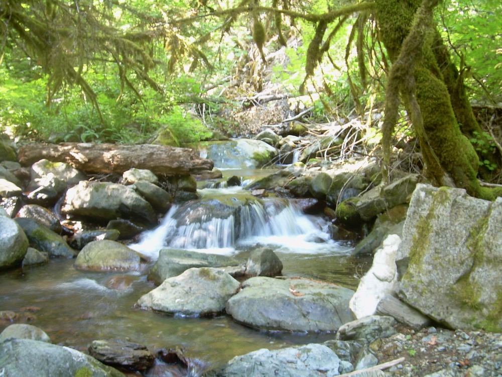
Brush Creek
Brush Creek is a low elevation tributary of Carberry Creek. The stream flows between Steamboat Mountain and Burnt Peak at the edge of the Collings-Kinney Inventoried Roadless Area. The area contains rugged terrain with steep rocky slopes, beautiful mixed conifer forests, large stands of knobcone pine, interesting chaparral communities, flower filled rock outcrops, and large stands of both live oak and madrone.
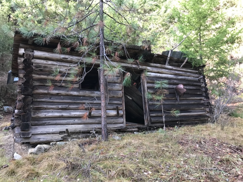
Isolated from human populations today, Brush Creek flows through moss covered bedrock into small, clear pools as it winds through a significant historical district. The remains of old hardrock mines, mining equipment, old mining-era cabins, and mining infrastructure lie strewn about the canyon memorializing the area’s unique history. Very active in the early 1900s, this area contained significant gold deposits that fueled the boom town of Steamboat on Carberry Creek. The main producer was the Steamboat Mine on the southern face of Steamboat Mountain, but other mines were scattered throughout the mountains and canyons of lower Carberry Creek.
Protecting Brush Creek would allow for the preservation of both historic and biological values in the greater Carberry Creek watershed.
After signing our petition, please contact Senator Wyden and let him know you support the River Democracy Act, but would like to see more adequate protections for the Applegate River Watershed.
Suggested talking points:
- Thank Senator Wyden for his leadership on the River Democracy Act and encourage him to do more to protect the Applegate River watershed.
- The Applegate River watershed and its wild streams are important for their historical, biological, recreational and community based values. The residents of interior SW Oregon deserve to have our wild rivers, clear swimming holes, old-growth forests, and intact mountain streams protected, just like others in the state. Please restore additional stream segments to the final legislation.
- Streams previously proposed for protection, but removed in the newest revisions should be restored to the legislation, including upper Pipe Fork Creek, upper Whisky Creek, O’Brien Creek, and Brush Creek in Oregon, and the Middle Fork Applegate River, Butte Fork Applegate River, Cook and Green Creek, lower Whisky Creek, and Elliott Creek in California.
- By including all the above mentioned streams in the final version of the River Democracy Act, protections for the Applegate River watershed would be similar to those throughout the state.
- All Applegate River streams currently included in the River Democracy Act should be protected in the final legislation.