It may seem obvious, but logging kills trees. If drought and insects are already killing Douglas-fir trees, why does the BLM want to kill more?
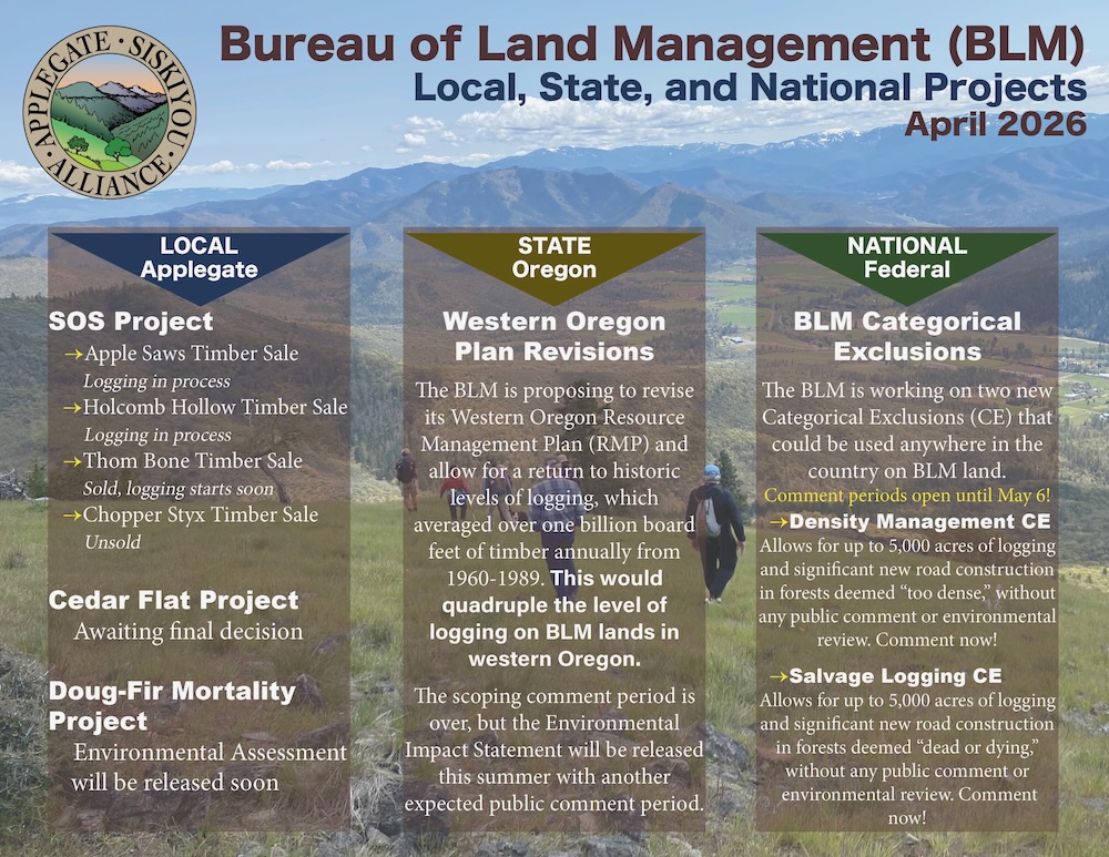
The Medford District BLM has released the aptly named Douglas Fir Mortality Complex, a sprawling Applegate Valley timber sale of epic proportions.
Information about how to TAKE ACTION is at the end of the blog!
Logging green, living Douglas-fir trees = BLM created Douglas-fir tree mortality
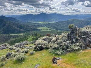
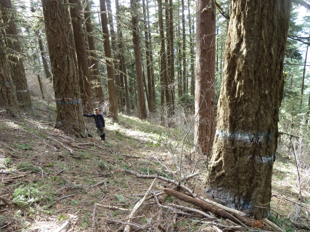
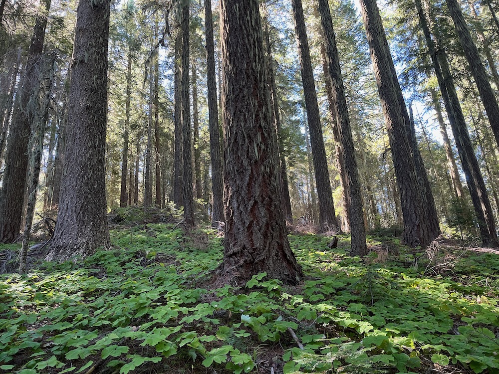
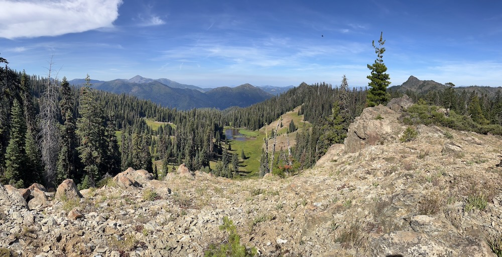
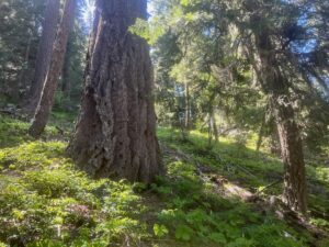
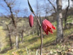
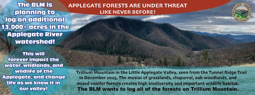
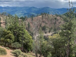
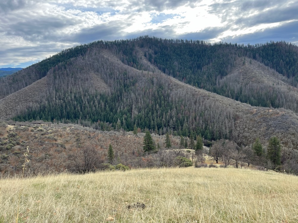
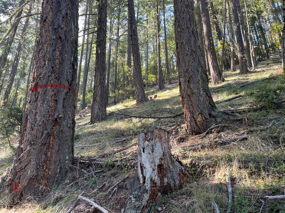
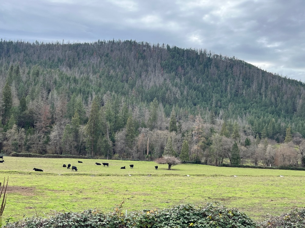
With the influence of climate change, recent heat domes, and flat-headed fir borer beetes, Douglas-fir trees have died in the Applegate Valley and throughout southwest Oregon. This is a just reality, however, in many locations, the process is naturally rejuvenating oak woodlands, creating habitat diversity, and supporting habitat complexity across the landscape. Unfortunately, BLM now wants to log both the trees that died in recent mortality events that are providing exceptional wildlife habitat, and many of the last living, green, Doug-fir/mixed conifer forests left on BLM lands in the Little Applegate River, Sterling Creek, and Upper Applegate River watersheds.
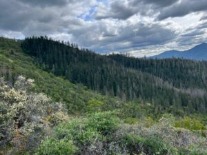
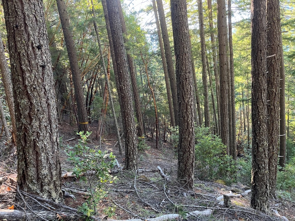
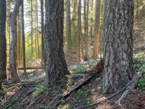
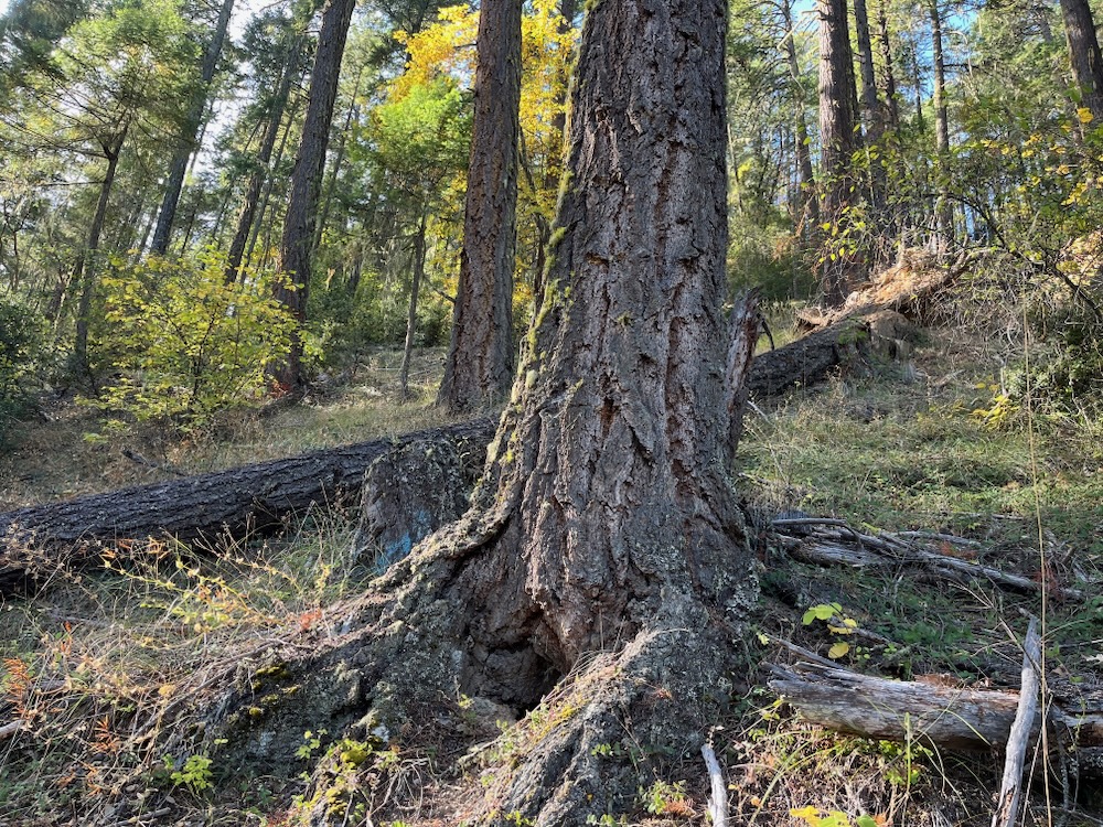
In these portions of the Applegate River watershed, plant communities are already shifting in response to climate change, and Douglas-fir trees are already dying on harsh and arid sites below 3,500′ in elevation and in areas with minimal rainfall. The BLM’s response is the Douglas Fir Mortality Complex logging project, which intends to log off the area’s biological legacies (snags) and thousands of acres of forested refugia habitat that survived recent mortality outbreaks. These forests and trees demonstrated relatively high levels of drought and beetle resilience; however, BLM intends to log these forests, leaving only scattered, exposed trees and more harsh, sunbaked, windswept, and arid habitat conditions.
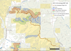
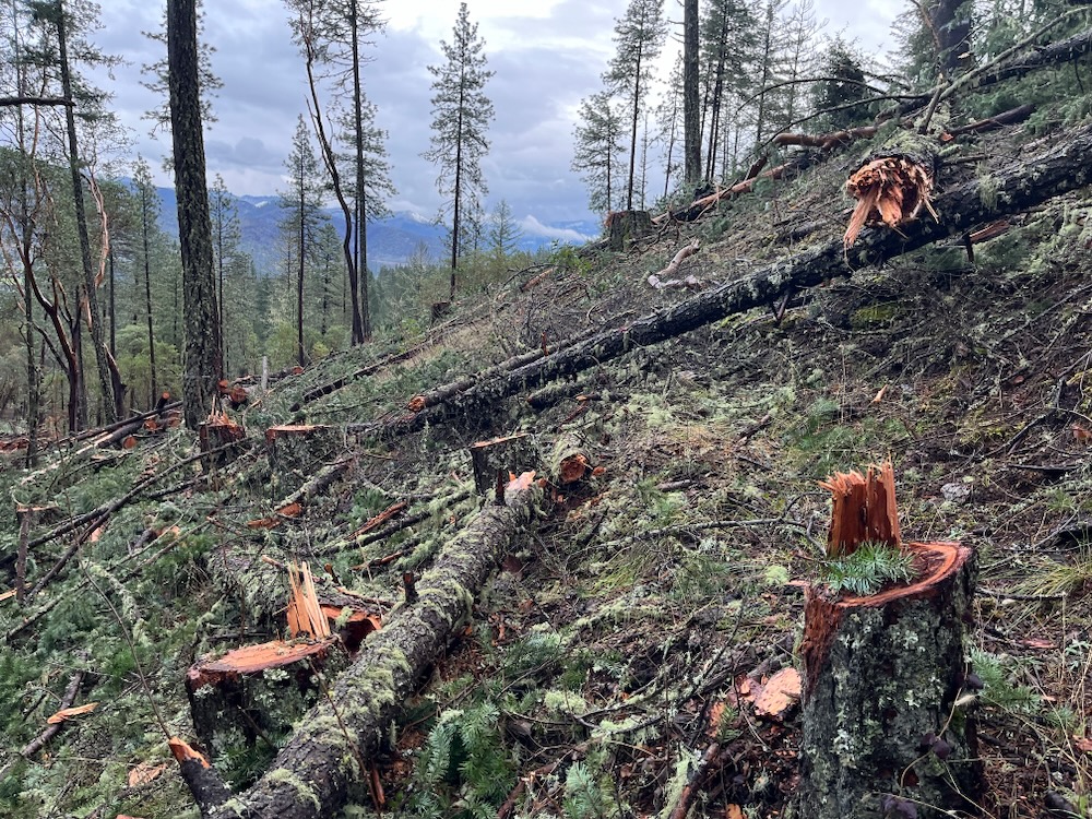
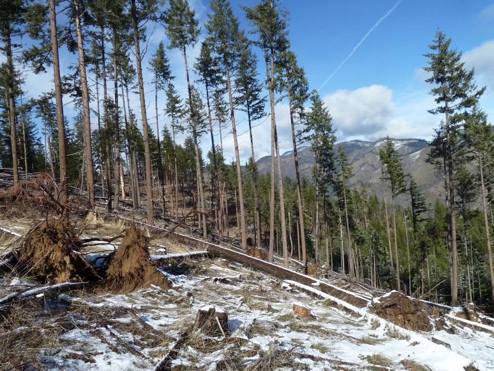
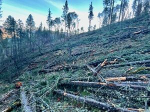
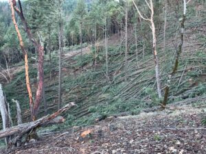
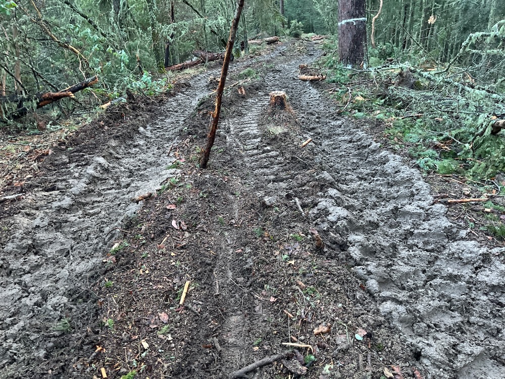
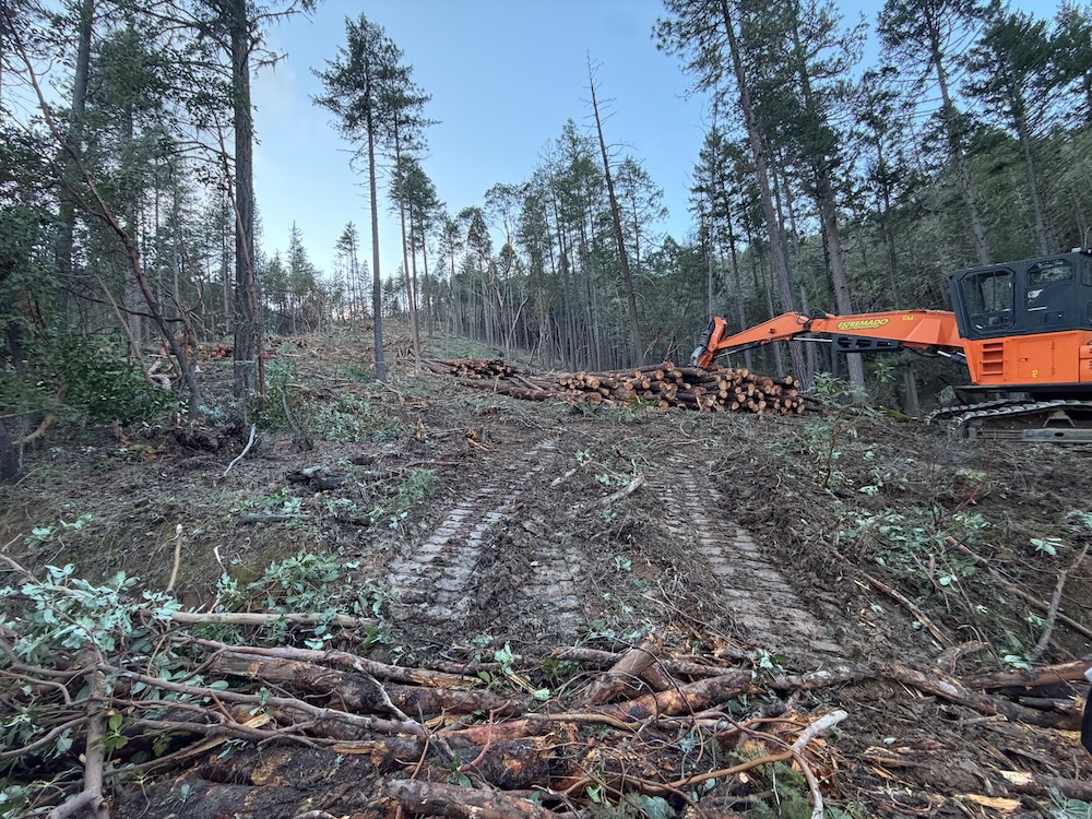
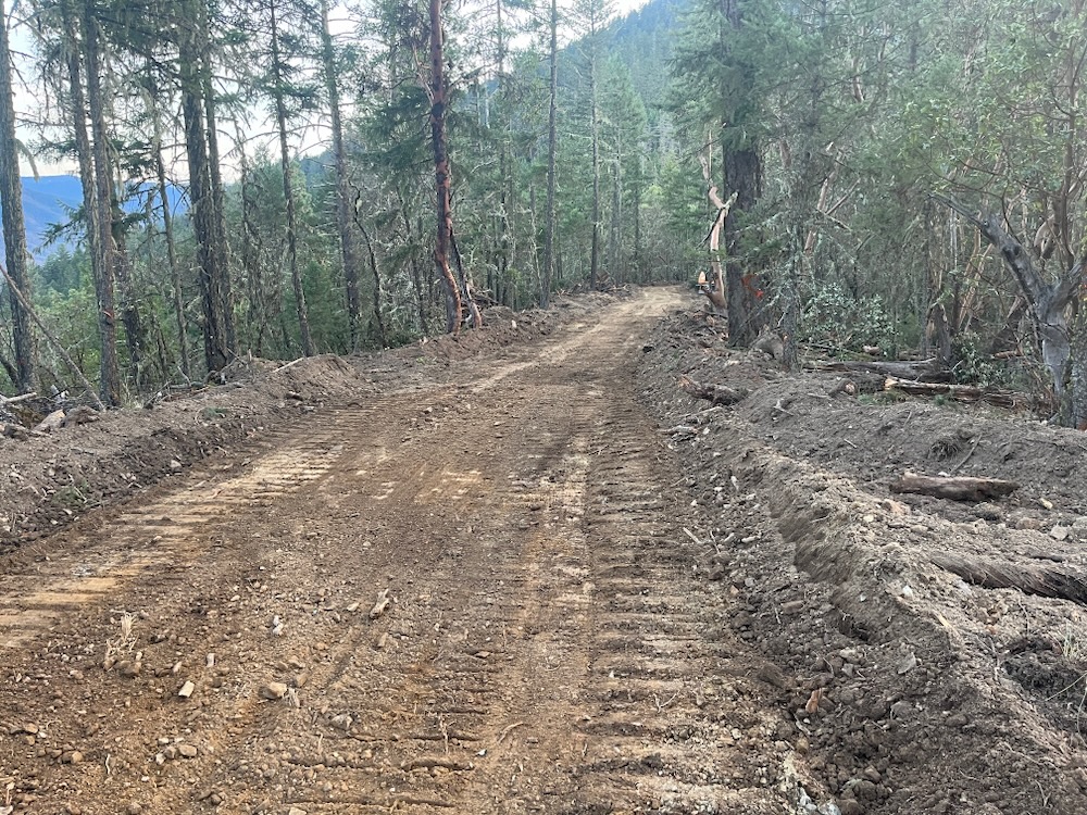
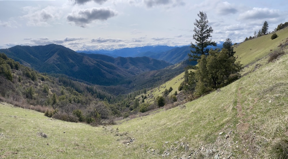
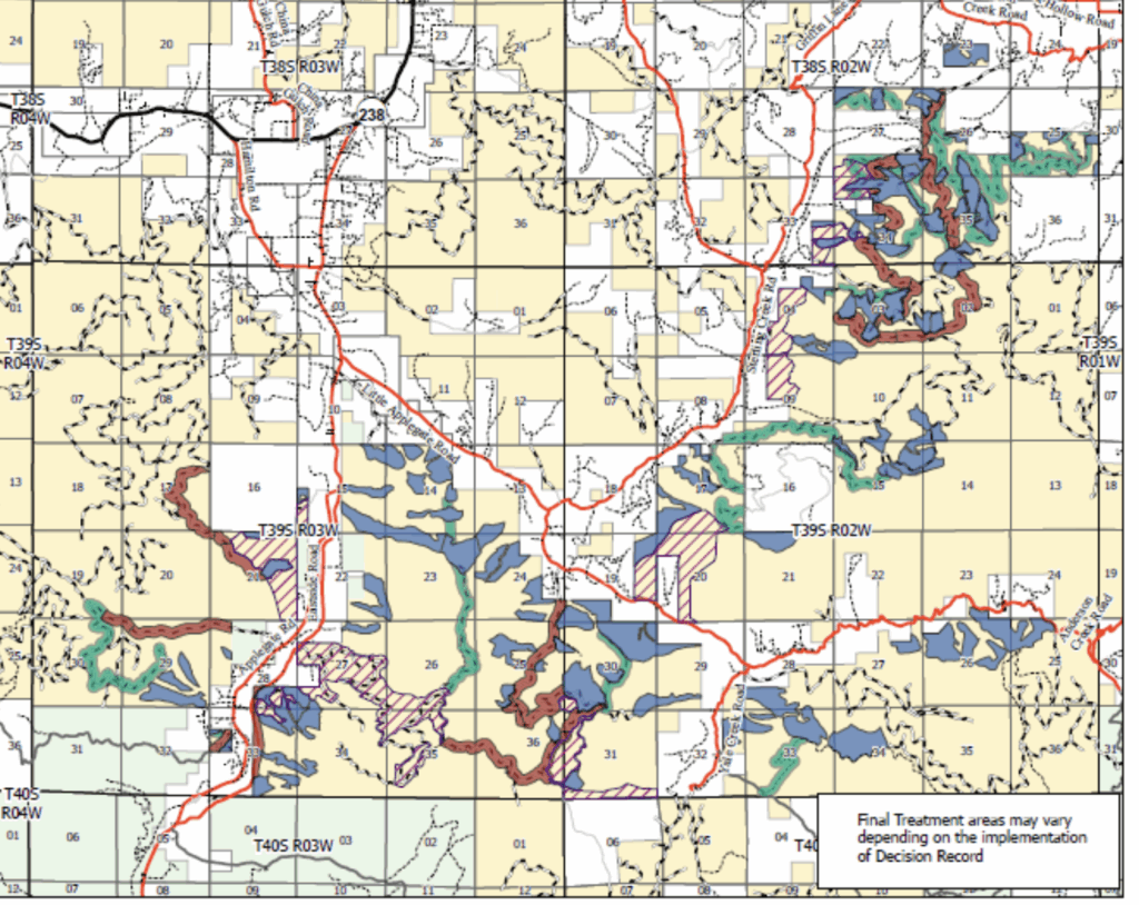
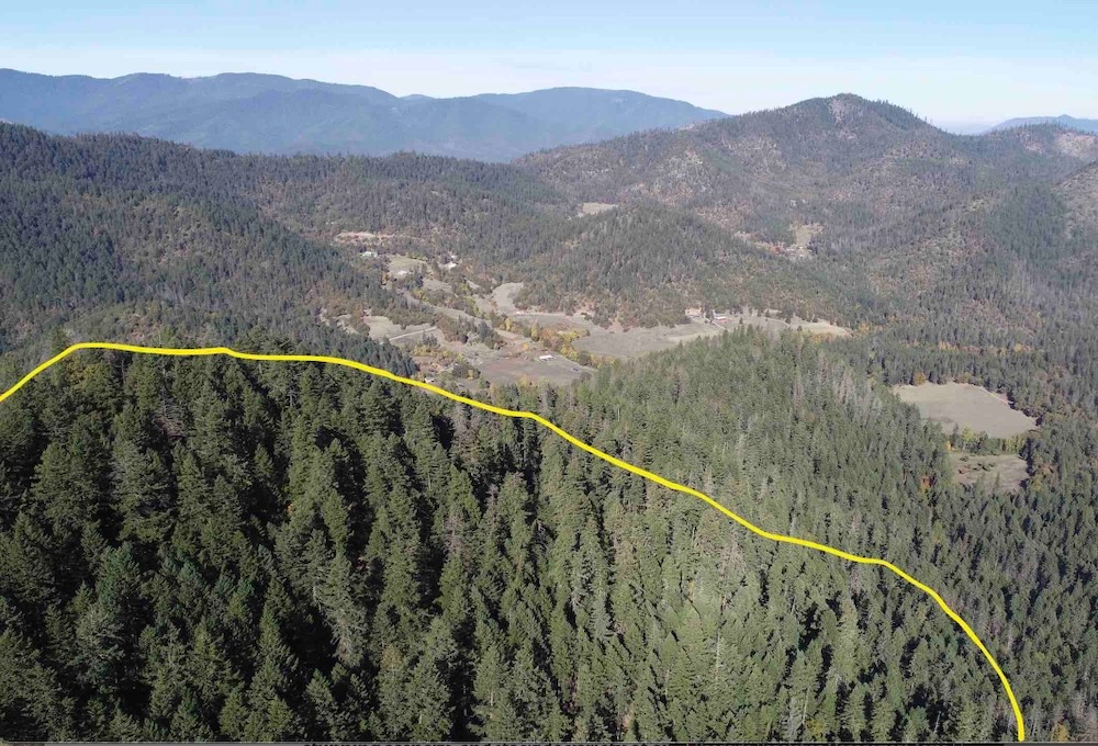
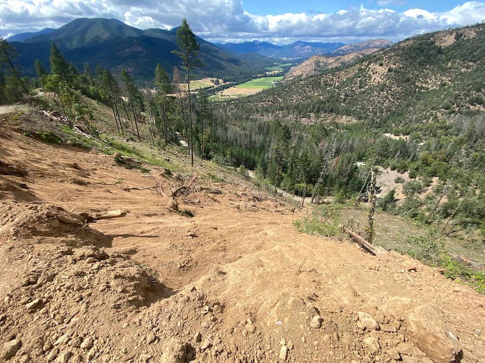
The Douglas Fir Mortality Complex project would log over 4,000 acres of forest and build up to 6.7 miles of new permanent road, scarring the beautiful Siskiyou Mountains surrounding the Applegate Valley, as well as the Lake Creek and Little Butte Creek areas east of Medford in the foothills of the Cascade Mountains.
In the Applegate Valley, the logging proposed would degrade forest habitats throughout the eastern portions of the Applegate Valley on lower Yale Creek, Sterling Creek, above Griffin Lane, in the Little Applegate River canyon, above the Little Applegate Valley and Buncom, up Grouse Creek, and on the flanks of Cinnabar Ridge. The logging would also impact Boaz Mountain , large areas above Eastside Road and lower Star Gulch in the Upper Applegate Valley.

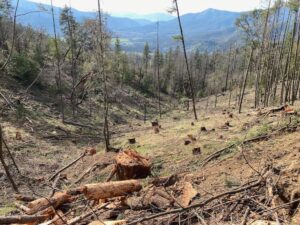
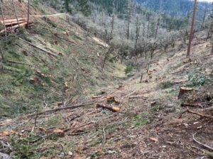
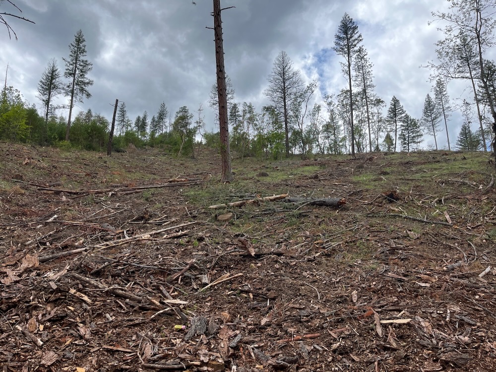
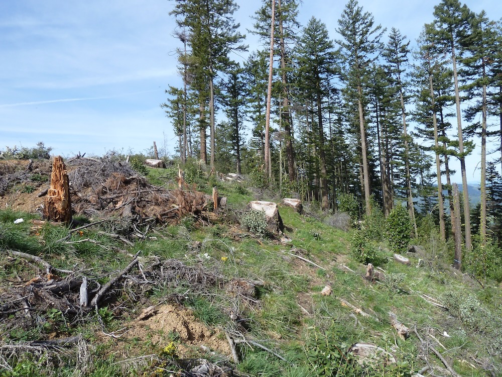
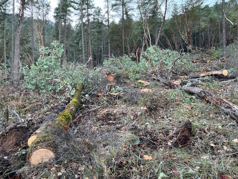
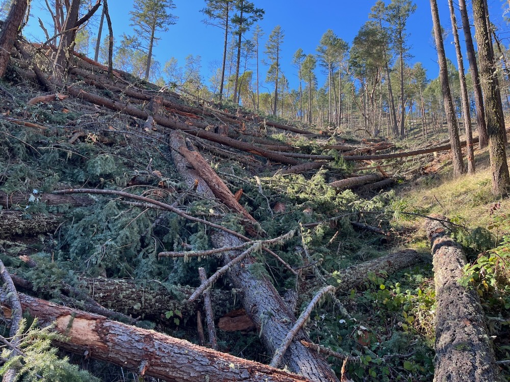
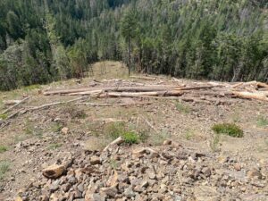
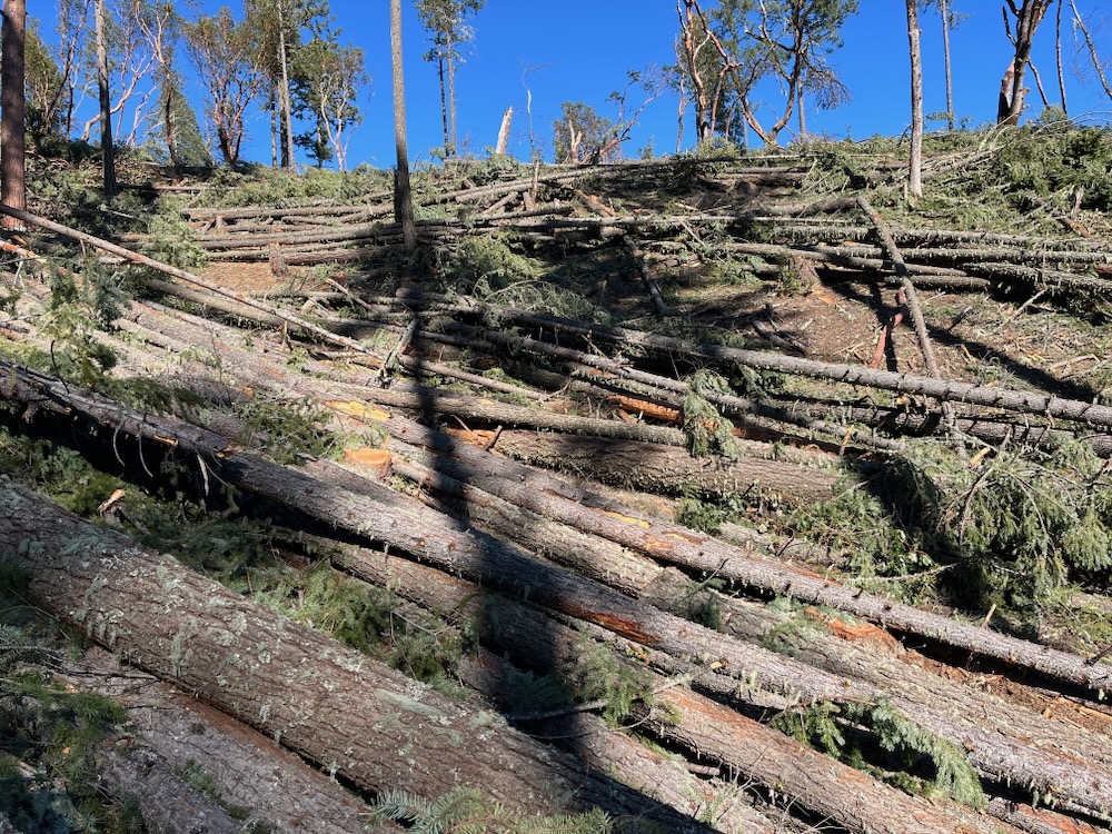
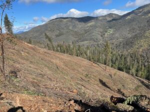
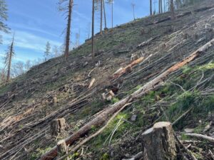
The proposed logging would create Douglas-fir mortality like the Applegate has not seen since the days of clearcut-and-run public land logging that extended from the 1950s into the early 1990s. Like these previous timber sales, the Douglas Fir Mortality Complex would leave a lasting impact on the Applegate landscape by creating heavily disturbed stump fields filled with logging slash, highly flammable non-native annual grasses, noxious weeds, churned forest soils, denuded slopes, and within a few years, dense regenerating forests choked with young trees, brush, sprouting hardwoods and abundant fine fuels.
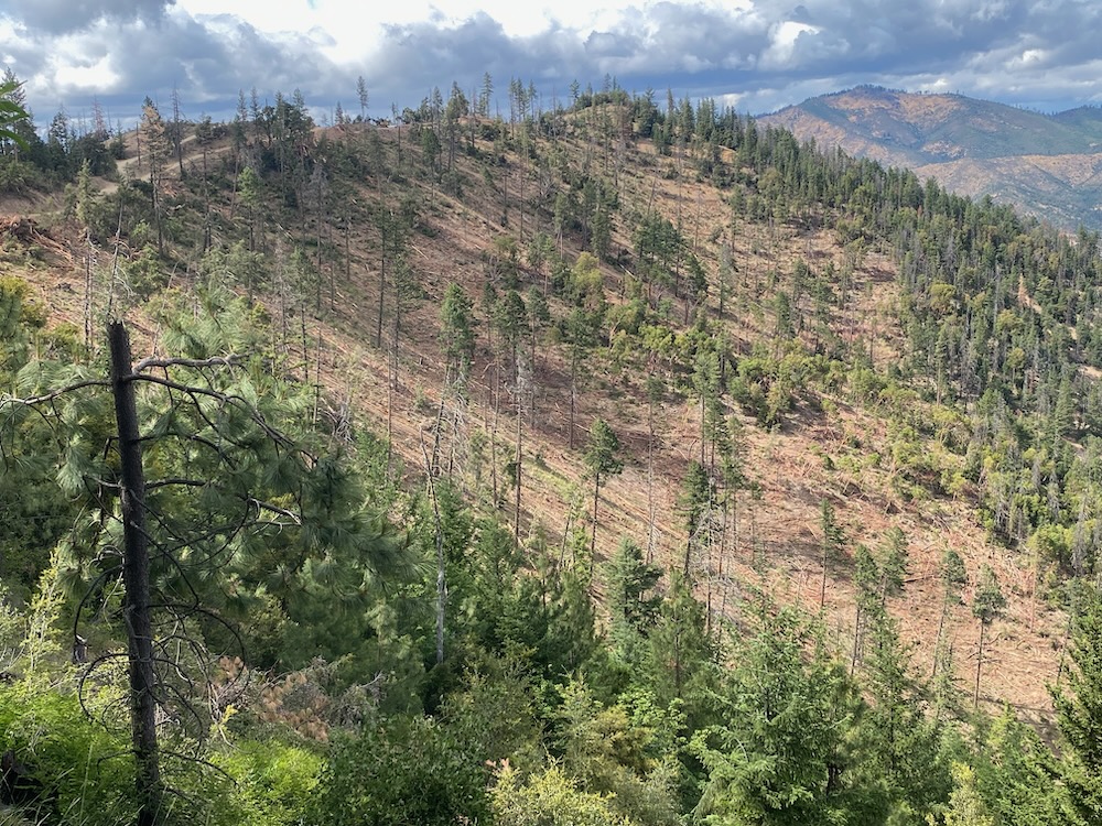
The patchwork of industrially logged habitats, newly constructed roads, historic clearcuts, and open, arid, windswept logging sites would dramatically increase fire risks, damage the scenic viewsheds of the Applegate Valley, degrade water quality, impact important wildlife habitats, and convert currently relatively resilient forest into simplified, early-seral habitats and semi-permanent shrub fields. The result would be to create conditions that tend to burn hotter, faster and with more burn severity than the closed forest stands they would convert through logging.
The process is simple and evident to anyone who has managed forests or woodlot in southwest Oregon, and to anyone who has spent time in the forests and mountains of the region. Yet it is somehow ignored by BLM timber planners and fire/fuel specialists. When forest canopy cover is dramatically reduced, dense, young, highly flammable plant communities and woody vegetation tend to regenerate and dominate for multiple decades following significant canopy and large tree logging operations.
According to BLM’s previous analysis of canopy reduction logging, “For the first 1 to 5 years after harvest, these stands would remain a slash fuel type until the shrubs, grasses, and planted trees become established. After the establishment of regeneration, these stands would move into a brush fuel type. Brush fuel types are more volatile and are susceptible to high rates of fire-caused mortality. Stands could exhibit higher flame lengths, rates of spread, and fire intensity. Fires started within these stands could be difficult to initially attack and control. For 5 to 20 years following planting, the overall fire hazard would increase in these stands.” (Clean Slate Timber Sale EA P. 192).
Implementation and On-the-Ground Results Matter More than the False Claims in the BLM’s Environmental Analysis
The BLM can conduct computer modeling simulations all it likes, but it does not change the physical realities on the ground. The BLM can simulate imaginary forests, run imaginary scenarios in its computer modeling programs, identify imaginary growth rates, and predict imaginary outcomes, all to claim a benefit to localized fire risks and a reduction in fuel loading; however, these computer models specifically do not include the abundant understory regeneration that occurs after logging operations, or its influence on stand level fire risks over time. This failure to analyze or model for young regenerating vegetation eliminates the single largest factor influencing future fuel development and long-term fire risks in the BLM’s Environmental Analysis and skews the analysis.
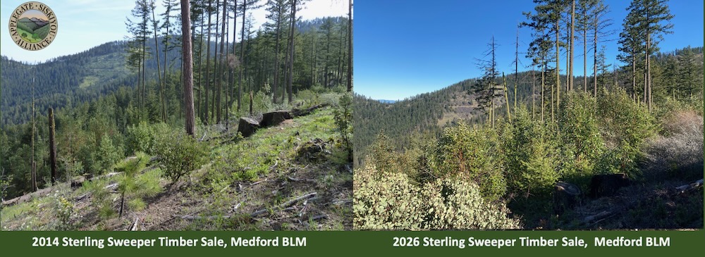
In fact, BLM modeling has consistently failed to match the realities on the ground or the repeated outcome of real-world, BLM timber sales. Timber sales recently implemented by the Medford District BLM are having far fewer positive effects than BLM modeling might suggest, and in many cases are instead reducing forest health, increasing vulnerability to drought and climate related impacts, increasing fire risks, slowing tree growth, introducing significant stress, compounding mortality events, and reducing these forest’s habitat value.
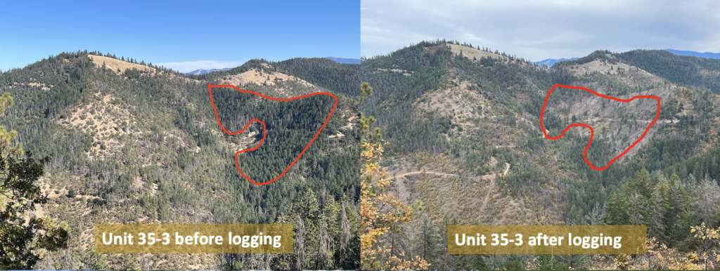
Unfortunately for the BLM, and for the public, the results of their recent logging operations are written across the landscape, in the form of gaping, denuded slopes, where vibrant green forests and diverse snag patches once stood. The most recent timber sales have steadily converted thousands of acres of mature, closed canopy forest habitats with little understory growth, into non-native annual grasslands, shrub fields, and young, highly flammable vegetation types.
The result is not to reduce mortality risks in the future, but to create mass mortality in the here and now, by logging up 80% of a given stand in habitats with as little as 10% mortality and by logging living trees that survived the recent beetle mortality outbreaks.
No matter how you look at it, BLM is adding to the mortality on the landscape and reducing forested acreage on a landscape scale. This logging is actively expanding and extending the mortality across the landscape, while creating conditions conducive to future mortality and habitat loss.
BLM Timber Sales Lead to Deforestation and Habitat Destruction
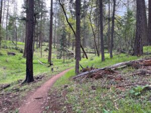
Recent BLM timber sales like the Lickety Split, Boaz Salvage, Forest Creek Salvage, Apple Saws and Holcomb Hollow Timber Sales represent textbook examples of deforestation and habitat destruction, not restoration or fuel reduction. These timber sales are now sacrifice zones, and with each successive BLM timber sale, our public forests are less resilient, less rich in wildlife habitat, less complex, and less attractive or appealing to local residents, visitors, and to outdoor recreation enthusiasts who utilize local trails and enjoy our currently spectacular public lands scenery.
Although the BLM justifies the impact of industrial logging by claiming a reduction in fire risks, the Douglas Fir Mortality Complex Environmental Assessment (EA) acknowledges that any logging below 40% canopy cover “could contribute toward more rapid live fuel loading accumulation in the moderate term (10-30 years).” (DMC EA P. 36). Yet, the Douglas Fir Mortality Complex proposes extensive and widespread logging-created tree mortality, and a reduction of canopy cover to well below 40% canopy cover.
In fact, only in Riparian Reserves would BLM require canopy cover retention above 30% in so-called “salvage” logging units. Recent BLM logging operations in the Applegate Valley under the SOS Project have reduced canopy cover to between 5% and 20%, leaving only a handful of trees per acre and heavily altering microclimates. If implemented as proposed, the BLM’s Douglas Fir Mortality Complex would have similar impacts across thousands more acres in the Applegate.
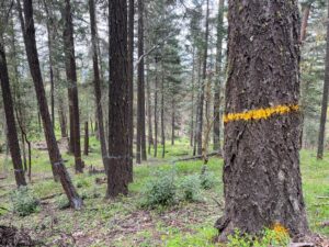
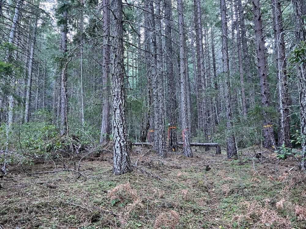
According to the BLM, approximately 2,875 acres would be subjected to only the logging of “dead and dying trees” in “salvage” logging units; however, the definition of “dead and dying” is rather loose, and has included extensive living tree removal in recent BLM timber sales. The Douglas Fir Mortality Complex Environmental Analysis discloses that a canopy cover of between 40%-60% “is most common,” across the project area and that areas with as little as 10% mortality have been selected for “salvage” logging treatments. This demonstrates that areas with minimal mortality are now sites of significant deforestation.

BLM Claims They Can Predict Which Trees Will Die by 2055! Ha!
Just like the recent SOS Project, the Douglas Fir Mortality Complex Project would log approximately 70% and 80% of all trees in each stand, including those with no signs of significant beetle infestation, a loss of vigor, or eminent tree mortality.
The BLM claims these trees are being removed based on predictions of future mortality — as many as 30 years in the future (2055) — when in reality they are being removed to increase timber volumes per acre and produce more profits for their timber industry “partners.” BLM cannot honestly say they can predict which trees will die by 2055 and no science supports these unfounded claims. Instead, they are being made to support increased timber production, ignore biological realities, and are contributing to widespread deforestation in our region.
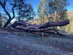
Additionally, high value wildlife snags, and future downed wood are proposed for widespread removal in areas where more significant beetle mortality took place. This strips the regenerating forests of habitat complexity and natural regeneration. It also disturbs forest soils, making them far more susceptible to noxious or non-native weed spread, and far more susceptible to elevated levels of soil erosion and stream sedimentation.
During the past two years, BLM has more than doubled timber production implemented under its 2016 Resource Management Plan, while heavily utilizing this faulty narrative of “dead and dying” tree removal. They have done so with devastating consequences to the forests, watersheds, and local communities in the the Applegate Valley, and in both the Cascade and Siskiyou Mountains of southwest Oregon.
BLM Timber Sales Do Not Prevent Flat-headed Fir Borer Beetle Outbreaks
The BLM acknowledges that once “widespread FFB [flat-headed fir borer] infestation begins in a forested stand, there has not been a clear solution in stopping the damage.” Thus, BLM is not logging to reduce further beetle mortality, they are leveraging the hysteria around recent beetle mortality events in southwest Oregon to promote increasingly severe logging treatments across bigger and broader landscapes. (Flat-headed fir borer beetles are native insects!)

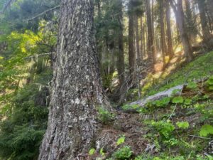
The Douglas Fir Mortality Complex would include stands that are currently maintaining irreplaceable refugia habitat for species like the northern spotted owl, great gray owls, pacific fisher, Siskiyou Mountains salamanders, Klamath black salamanders, black bear, and ungulates like deer and elk. All these species require thermal cover, temperature moderation, decadence, complex habitat structures, and/or mature or late successional forest characteristics to support portions of their diverse life cycles, and these values would be heavily impacted by Douglas Fir Mortality Complex timber sales.
These same forests also support watersheds, springs, seasonal streams, and important stream flows contributing water to the Little Applegate and Upper Applegate River watersheds, and they would be heavily impacted by not only soil disturbance, erosion, and sedimentation from logging and yarding operations, but also through the 6.7 miles of new permanent road construction proposed by BLM in this project.
BLM Logging is Taking the Applegate Back to the Cut and Run Logging Era
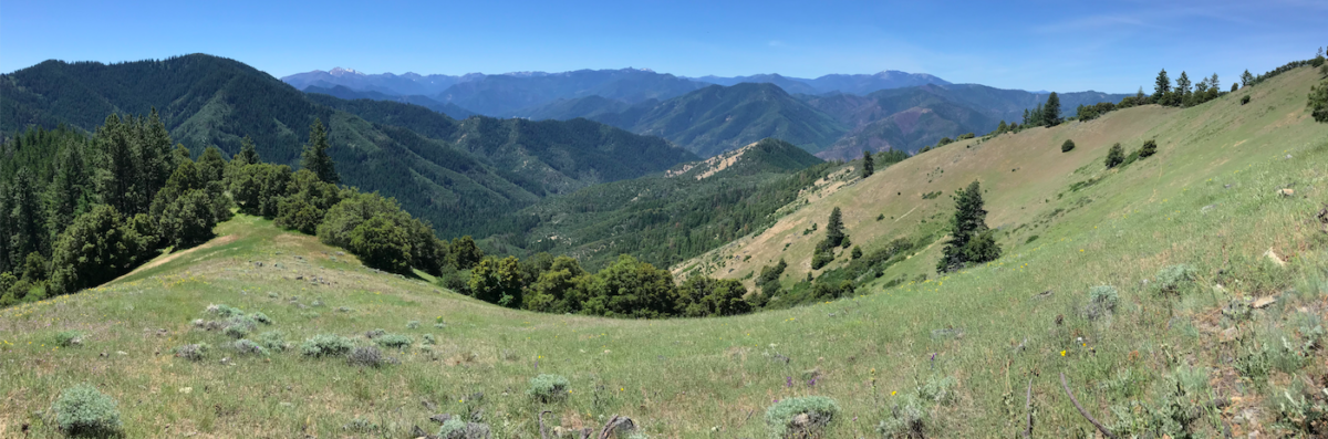
If implemented the Douglas Fir Mortality Complex would change the face of the Little Applegate and Upper Applegate Valleys forever, converting mixed conifer forests into non-native annual grasslands or permanent shrubfields. The forests, the views, the wildlife, the watersheds, the scenic beauty, and the habitat functionality of the region is under heavy threat by BLM logging operations.
Additionally, the safety of our families and communities during wildfire events is threatened as BLM increases fire risks on public lands adjacent to our homes. Protecting these community values depends on home hardening, defensible space work, ingress/egress efforts, and a home outward approach to community wildfire protection, while logging in remote locations and on public lands far from private residences, municipalities, or rural communities has no direct benefit to the resilience of these homes or communities.
The fact is that backcountry logging and manual fuel reduction in remote locations only draws resources away from more meaningful efforts to address community wildfire safety. In many cases, it also increases fire risks in the years following these logging operations as dense, woody vegetation fills in the canopy gaps and disturbed soils with even-aged young conifer regeneration, dense shrubs and stump sprouting hardwoods.
The Douglas Fir Mortality Complex, like the SOS Project before it, proposes to embed heavy industrial logging units directly adjacent to homes and communities making them less, not more secure during fire events.
The Douglas Fir Mortality Complex Project is not about supporting the resilience of local communities, it is about increasing the volume of timber offered to the timber industry from our public lands. It is about using the public’s fear of fire and misunderstanding of recent climate-induced, Doug-fir mortality events to log more forests, to implement increasingly more severe logging treatments, and to deliver unsustainable levels of timber to local mills .
The Medford District BLM is attempting to log every forest they can get their hands on under the Trump Administration’s pro-industry public land policies. Simply put, the Douglas Fir Mortality Complex proposal is Trump forestry in all its dishonesty, all its greed, all its arrogance, and all its indifference to the real, lasting environmental impacts.
From a biological perspective the project is incredibly misguided and would have lasting negative consequences. From a human perspective, the BLM is threatening the quality of life and the quality of habitat we enjoy here in southwestern Oregon. The Douglas Fir Mortality Complex Timber Sale would impact our communities, degrade our public lands and local watersheds, damage our recreation areas, and scar our hillsides with downright ugly logging scars.
This logging proposal is another excuse by the Medford District BLM to log off the public lands of southwest Oregon and the Applegate Valley. The agency has shown over many years to be solely fixated on the destruction of forest habitats in our region, and the production of private timber industry profit from everyone’s beautiful public lands.
During his confirmation hearings, Secretary of Interior Doug Burgham clarified that he views our public lands as a financial “asset” and referred to the resources on public lands as “America’s balance sheet.” Unfortunately, land managers at the Medford District BLM are obediently working to liquidate those assets, and they simply do not care who or what that might affect.
Recent BLM timber sales have led to landslides, debris flows, lawless, unregulated logging, type conversion to non-native annual grasslands and shrubfields, heavy stream sedimentation, dramatically increased fire risks directly adjacent to homes and communities, and real world impacts that BLM computer models and Environmental Assessments do not disclose or even consider.
The BLM is actively working to create timber sacrifice zones throughout the Applegate River watershed and we must actively oppose this destruction. Please join ASA as we fight the Douglas Fir Mortality Complex timber sales. Comments can be submitted until July 3, 2026 at the website below.
TAKE ACTION! COMMENT NOW
Talking Points:
- Maintain all live trees in “salvage” logging units. Do not log trees based on predicted or future mortality. BLM cannot predict which trees will die in 2055!
- Do not log in forested refugia habitats that survived recent beetle mortality events and maintain either closed forest conditions, late successional characteristics, mature stand conditions, natural stand development, or open forest conditions surrounded by high quality, complex early seral habitat.
- Build no new roads. No permanent or temporary roads.
- The BLM must fully disclose the impact of recent salvage logging timber sales on hardwood habitats, on soils, on slope stability, on stream sedimentation, on sensitive and endangered species, on fire risks, and on future late successional forest development. None of these issues were adequately considered in the existing Environmental Assessment.
- Maintain canopy cover and live trees in all stands. Focus any and all treatments on public safety by limiting felling operations to those that remove only true, dead standing, hazard trees threatening to fall into regularly used BLM roads, trailheads and other public infrastructure such as ingress/egress routes for local residents or the area’s recreational users.
- Implement non-commercial fuel reduction where necessary to support safe ingress/egress on BLM lands (150′ from regularly used roads).
- Do not implement “tethered assist” logging on steep, erosive slopes. Cabling on steep slopes has massive erosion impacts that impact native fisheries.
- Do not authorize Riparian Reserve logging and do not yard through any Riparian Reserves within the project area.
- Implement a 20″ upper diameter limit, to protect older, larger trees, to reflect the poor growing conditions, the lack of large diameter trees on the landscape, the significant age of relatively small diameter trees in the Applegate, and the need to maintain shade, microclimate and closed stand conditions where they have been persistent.