Closed to the public but open to the highest timber industry bidder
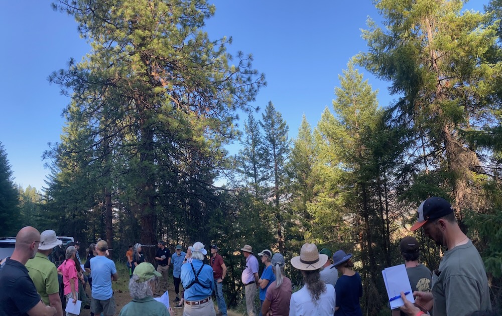
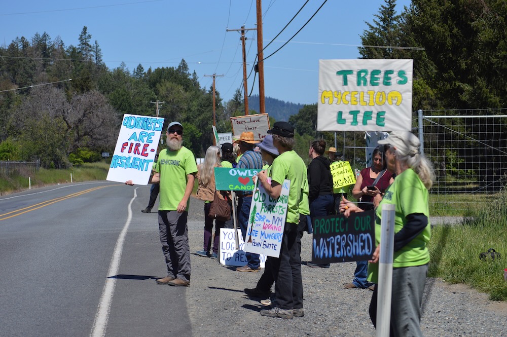
On September 25, 2025 the local BLM sunk to a new low in transparency and accountability by shutting the public and the media out of its public land timber sale auction in Medford, Oregon. Facing threats of arrest, public members and the media were barred from entry, while the agency sold our public forests behind closed doors.
Taking their cues from the Trump Administration, the Medford District BLM is seizing its opportunity to log off our public forest lands with little to no public accountability, and they are doing so behind locked doors, guarded by armed federal law enforcement. In this way, our local BLM is closed to the public, but open to the highest bidder during timber sale auctions.
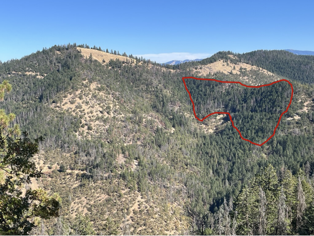
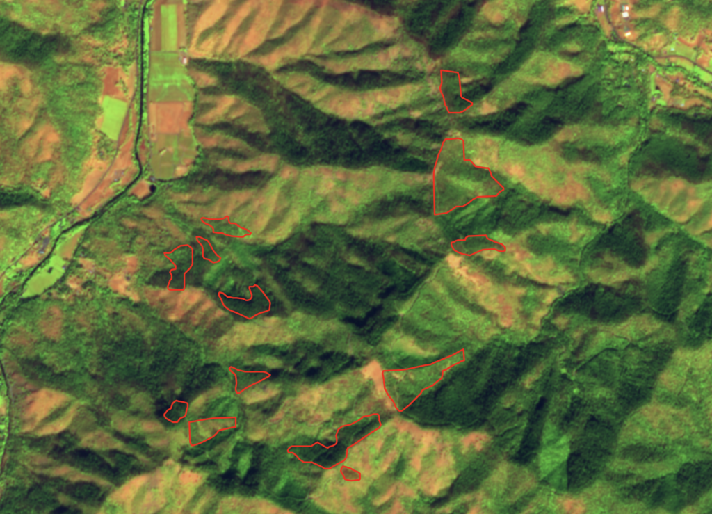
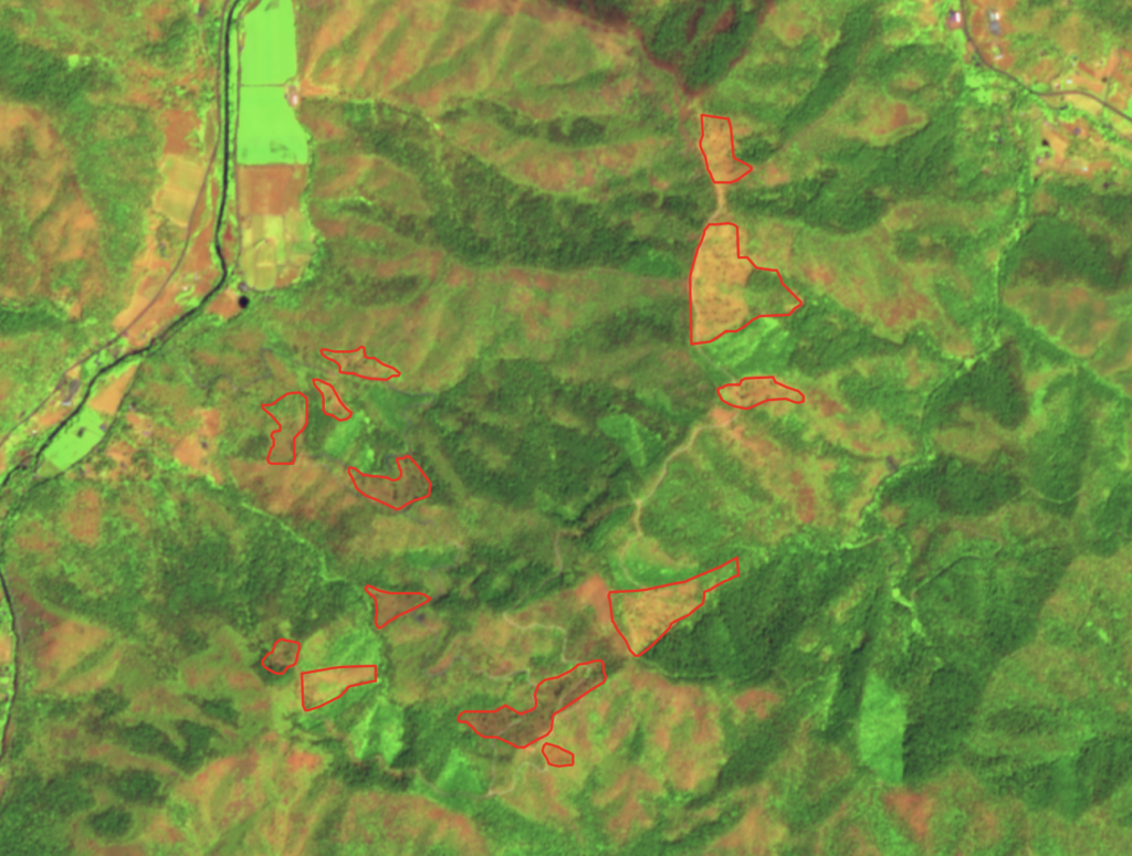
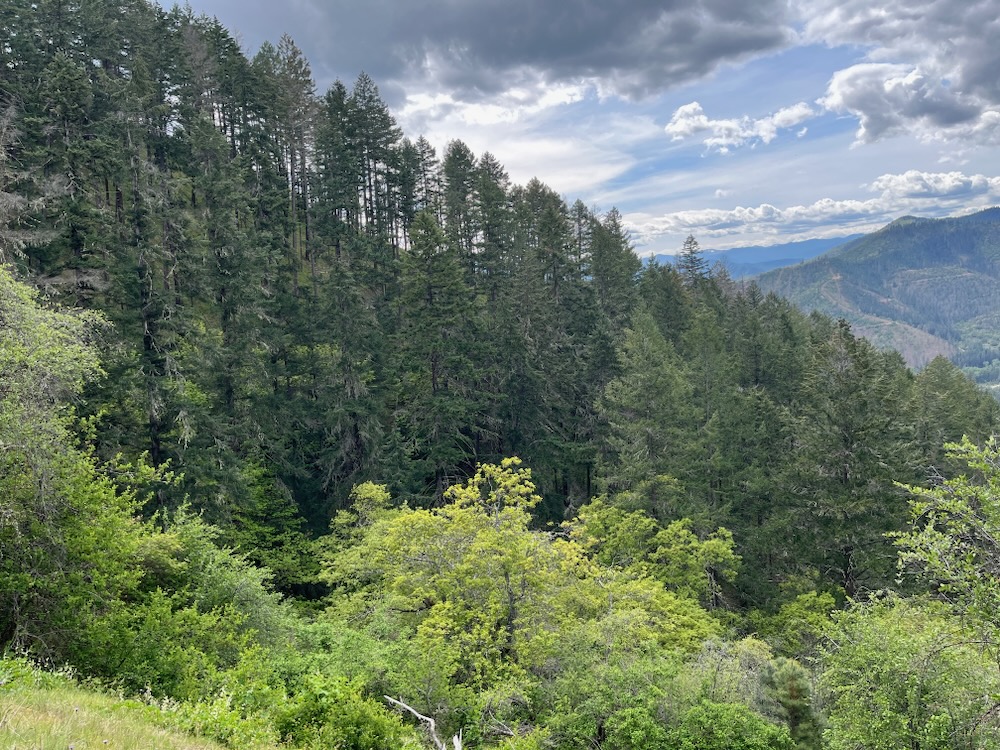
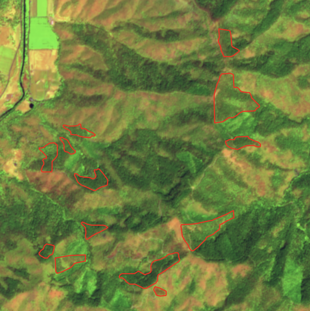
The outcome of this closed-door timber sale auction included the sale of two major Applegate Valley timber sales to the timber industry. These two Applegate timber sales are the first in a series of timber sales being proposed under BLM’s controversial SOS Project, which plans to log over 5,000 acres across the Applegate Valley, from Thompson Creek to Ruch, and east to Sterling Creek.
The Applegate Valley timber sales offered for auction included:
- The Apple Saws Timber Sale above Cantrall-Buckley Park and on the eastern face of Ben Johnson Mountain.
- The Holcomb Hollow Timber Sale surrounding Ruch and Sterling Creek, including units along and in the immediate viewshed of the popular East Applegate Ridge Trail, on the face of Woodrat Mountain, and in the mountains surrounding homes and communities in the Sterling Creek watershed.
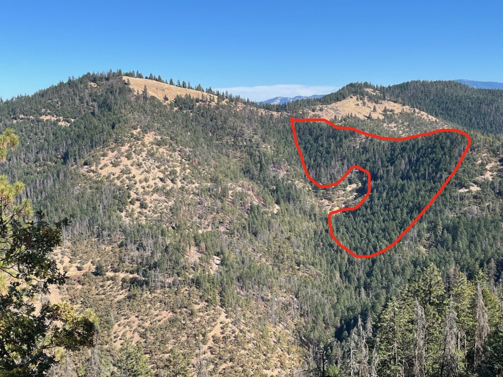
- The Chopper Styx Timber Sale in the Wellington Wildands and throughout the headwaters of China Gulch above Ruch.
Of these three timber sales, both the Apple Saws and Holcomb Hollow Timber Sales sold to private logging companies, while the Chopper Styx Timber Sale, which relied on helicopter yarding to access the timber, received no bids. So, in the immediate future, the BLM hopes to begin implementing the Apple Saws and Holcomb Hollow Timber Sales, riddling our beloved Ruch and Little Applegate Valley with fresh logging scars.
The impact will be to degrade recreational experiences on the extremely popular East Applegate Ridge Trail, as well as the adjacent Woodrat Mountain Launch Sites, where world-class paragliding competitions occur. The SOS Project, just like the previous “salvage” timber sales implemented in the Applegate Valley, will be damaging to scenic and aesthetic values adjacent to these recreational opportunities, and surrounding our homes, wineries, farms, and communities in the eastern Applegate Valley
Additionally, the BLM has already listed additional SOS “salvage” timber sales in their 2026 Timber Sale Plan, including large portions of Thompson Creek. Together, this series of timber sales proposed by the BLM under the SOS Project would combine to create one of the largest BLM timber grabs in the Applegate Valley for numerous decades.
Orwellian doublespeak, episodic beetle outbreaks, and predicted tree mortality
Using their typical Orwellian doublespeak, BLM is working to convince the public that living, green trees and forests must be logged, paradoxically to save them from future mortality. The project claims to be targeting “dead and dying” trees, but its broad interpretation of “dying” allows for the removal of whole stands of living, viable, green trees that survived recent beetle mortality outbreaks and expressed natural resilience under significant biological stress.
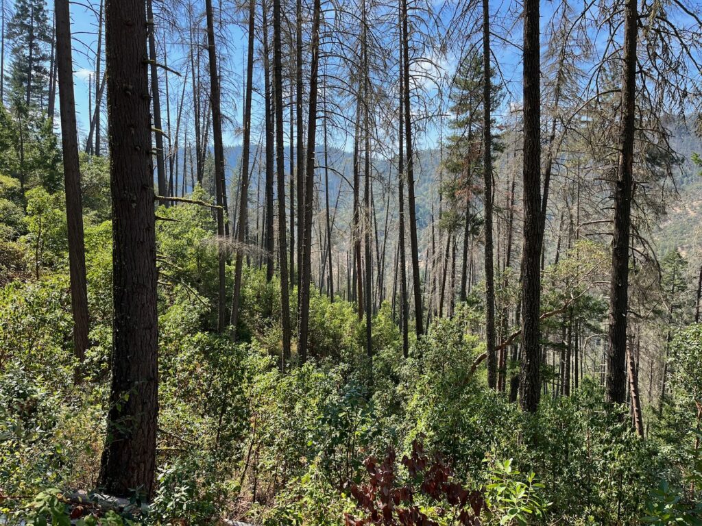
The droughts that trigger these beetle outbreaks are obviously cyclical and even under the current climate scenario, they come and go in southwest Oregon. Beetle mortality events often mirror those drought events and are considered “episodic,” meaning beetle populations often expand in direct response to the stress created by drought events, heat domes, and what some scientists are calling “hot droughts.” Under conditions of low precipitation and uncharacteristically warm temperatures—including both extended periods without sufficient winter cold and periods of extreme summer heat–beetle populations attack damaged or stressed trees en masse, build large populations, and create high levels of susceptible tree mortality. Yet, when the drought and heat subside, the beetle populations collapse and these habitats reestablish more characteristic levels of tree mortality.
The past few winters have seen a return to characteristic levels of precipitation, along with the return of more normal temperatures, and the lack of heat dome events in the region. This has dramatically reduced tree mortality across the landscape. In fact, the data collected by federal entomologists using aerial surveys and imagery, demonstrates that tree mortality in 2024 and 2025 is far less severe than in previous years and has returned to more natural background levels.
Yet when confronted with this information, BLM just moved the goal post in their Environmental Assessment, claiming: “seasonal and annual weather is variable and difficult to predict, prediction of short term (3- 5 year) mortality can be challenging, however, short-term fluctuations should not distract from the long-term trends. The mortality patterns are consistent with projected changes in suitable habitat, due to climate change (Bennet et al. 2023a). Bennett et al. 2023 discusses continued Douglas-fir mortality and modeled the mortality across highly susceptible areas out to 2055. There is an expectation of a large increase in areas considered marginal for Douglas-fir suitability by 2055 (i.e. Douglas-fir mortality would continue to intensify and expand).”
What this means is BLM could not justify their prediction of short-term mortality (3-5 years) or the idea of logging living, viable mature trees, so they just moved the goal post, expanded their definition of dead and dying, and extended the potential period of predicted mortality out to 2055.
This allows for very broad interpretation of “dead and dying” that could functionally include just about any tree on the landscape BLM chooses to log. Yet this analysis also looses all potential accuracy and credibility by predicting which trees might die in the next 30 years, which is between six and ten times longer than the 3-5 years identified in the 2016 RMP. BLM admits in their quote above that even these more short term, 3-5 year predictions are “challenging,” yet they still claim to be able to accurately predict which trees will die by 2055.
Sound absurd? It is.
Not only does the agency have no evidence or even methodology to identify such long-term mortality trends, but making these predictions is wildly inaccurate and requires logging seemingly viable, green trees today based on an unscientific and unproven theory that these trees will die potentially numerous decades in the future.
Recent history and the actual project proposal demonstrates that the BLM will be removing thousands and thousands of living, green trees across over 5,000 acres in the SOS Project. According to the BLM’s Environmental Assessment for the SOS Project, stands considered “dead and dying” may contain as little as 10% mortality, meaning 9 out of 10 trees may have survived the recent hot drought and beetle mortality events, but they will be “salvage” logged anyway.
One of the many problems with this approach is that many of the stands targeted for logging are, in fact, relatively resilient, often mature forests that would be logged to as low as 5% canopy cover. This would leave only a few scattered trees where living, viable forest once stood. Not only is it ridiculous to claim this dramatic increase in cumulative tree mortality will reduce tree mortality in the future, but some of these stands are currently suitable northern spotted owl habitat acting as dispersal or nesting, roosting, foraging habitat for this endangered forest-loving species.
Additionally, some logging units are Siskiyou Mountains salamander sites, while others provide thermal cover for deer and elk, resting and denning habitat for the Pacific fisher, and habitat for great grey owl populations that occupy low elevation mixed conifer and woodlands habitats in the Applegate Valley and on the eastern face of Ben Johnson Mountain.
The impacts of salvage logging on wildlife, wildlands, and fire risks
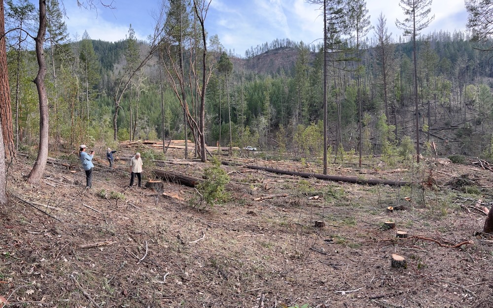
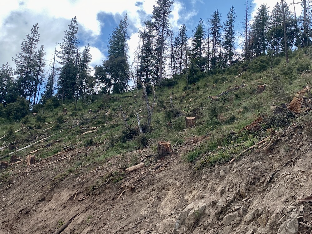
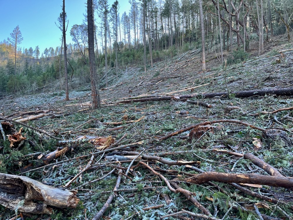
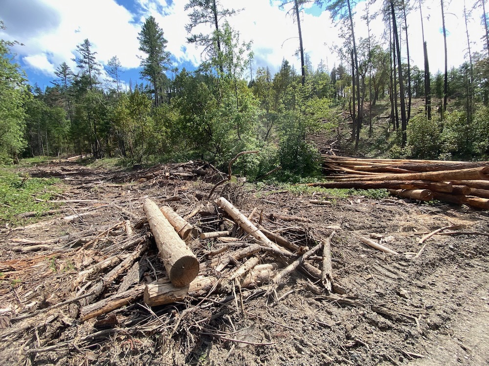
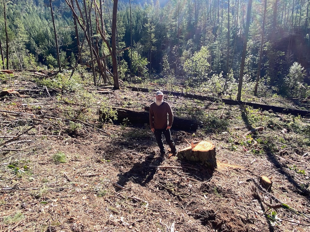
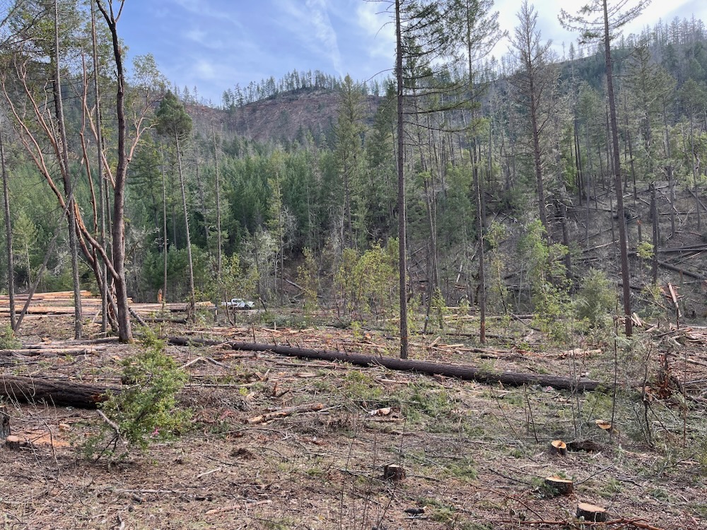
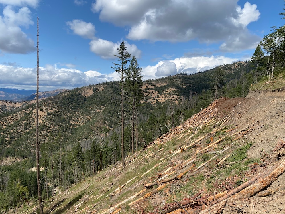
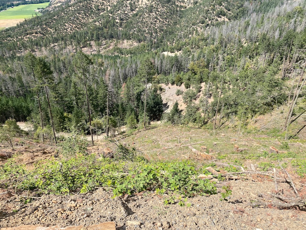
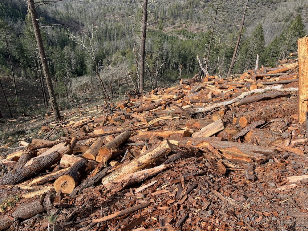
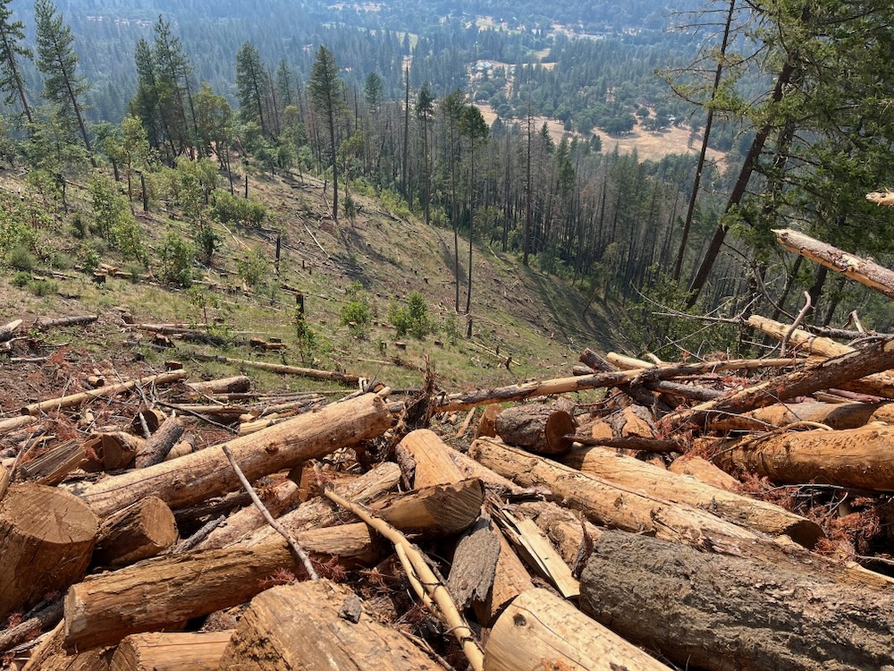
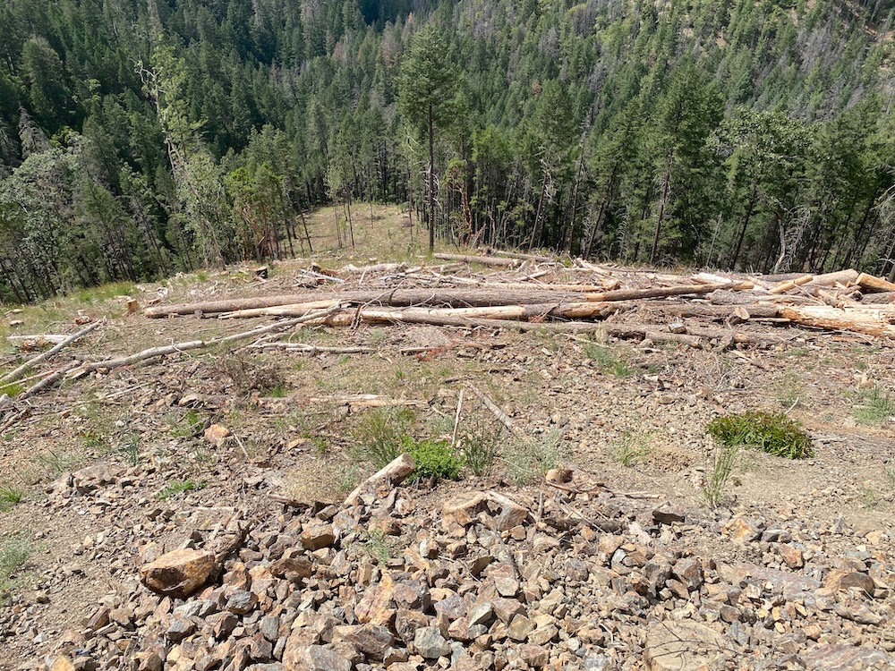
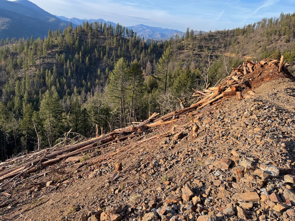
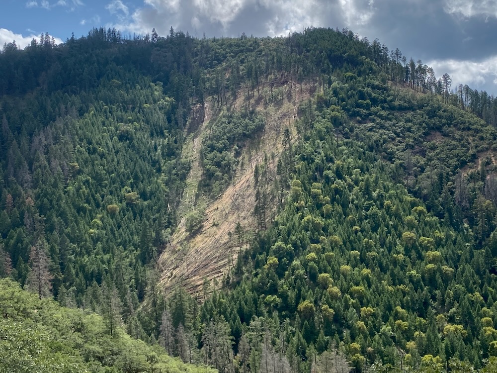
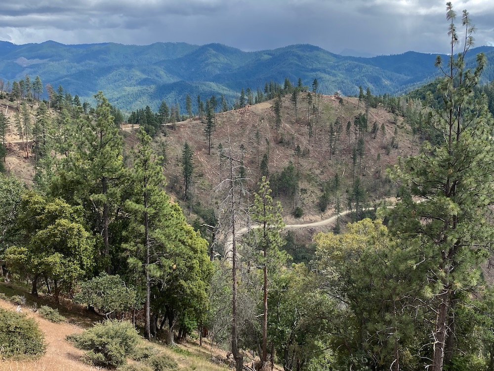
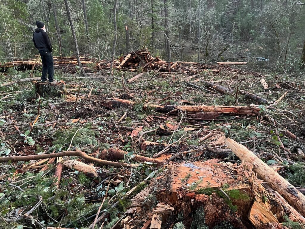
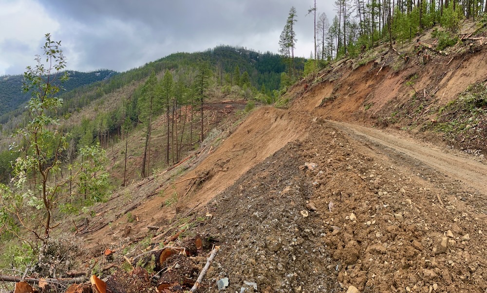
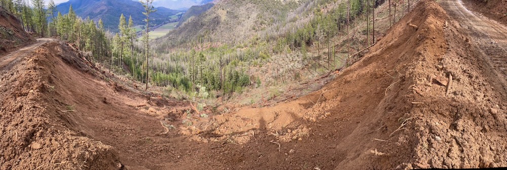
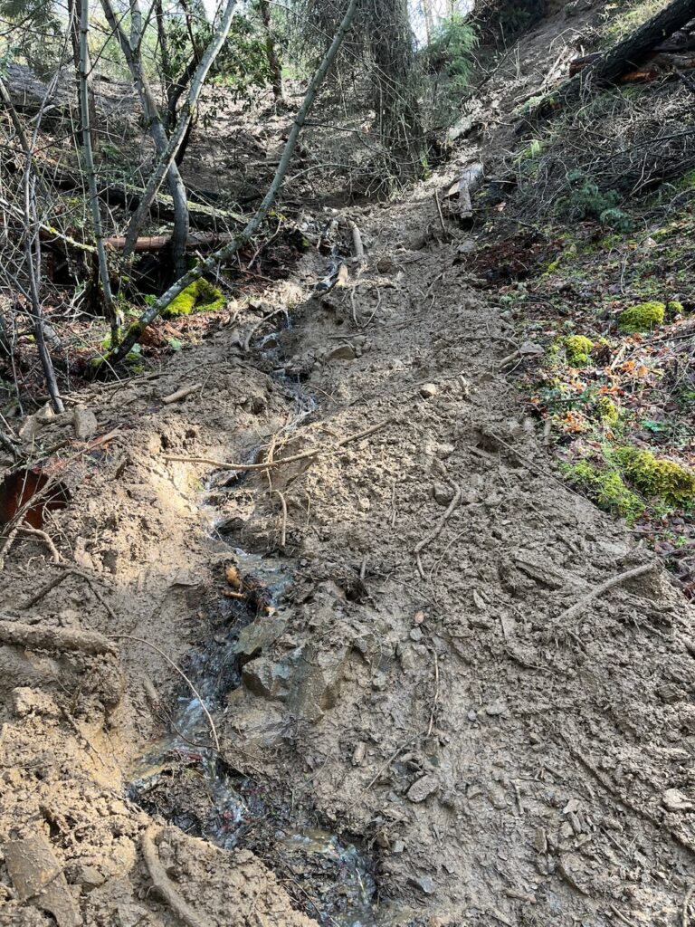
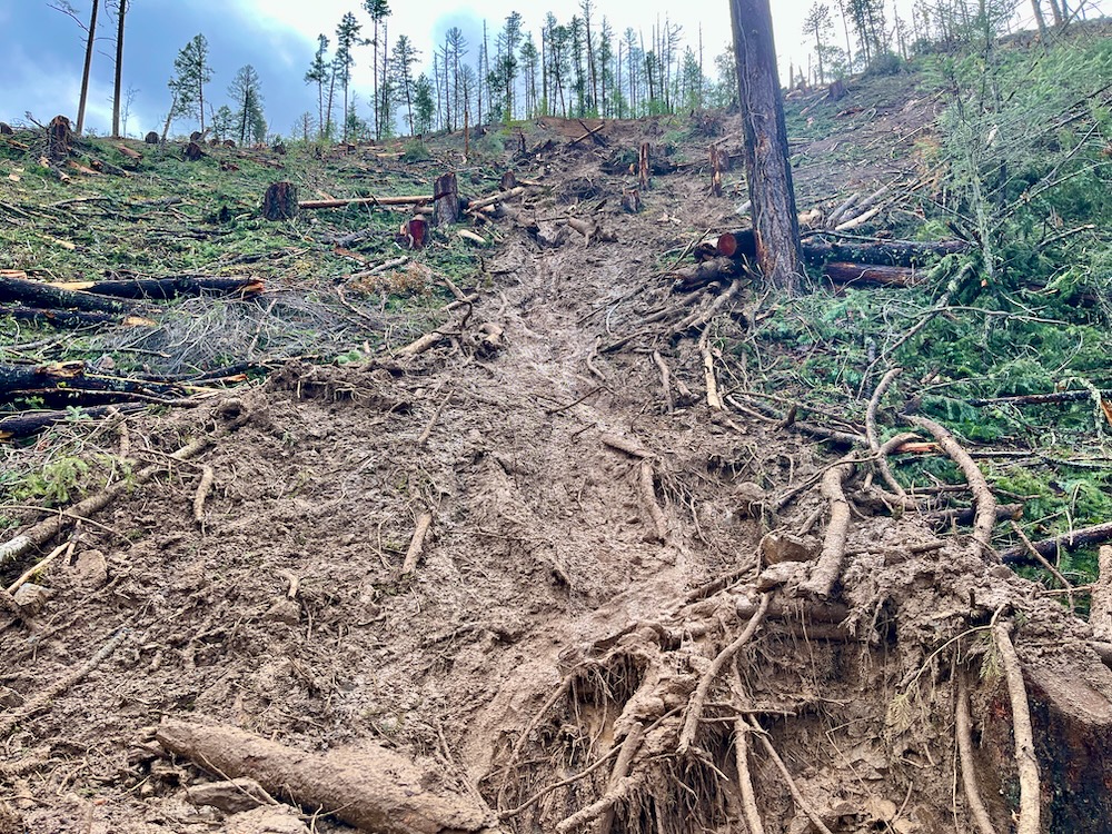
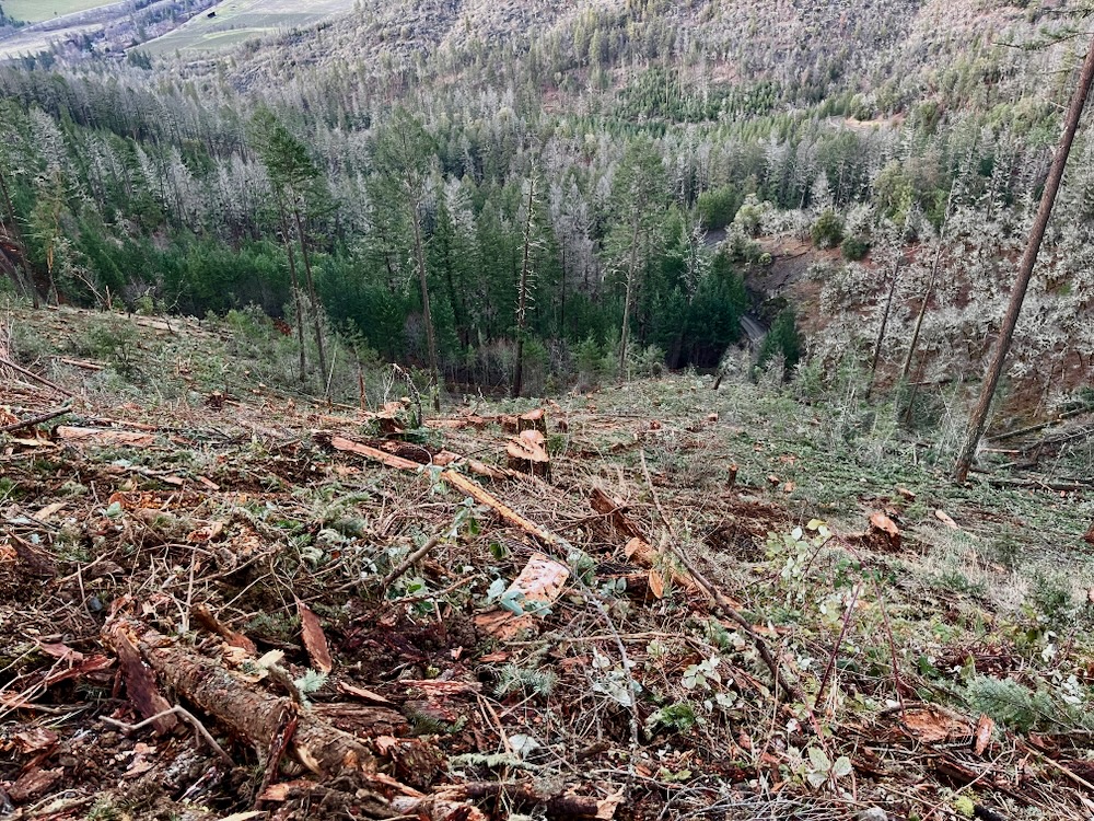
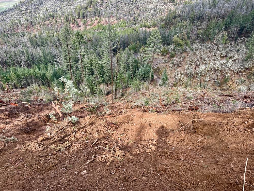
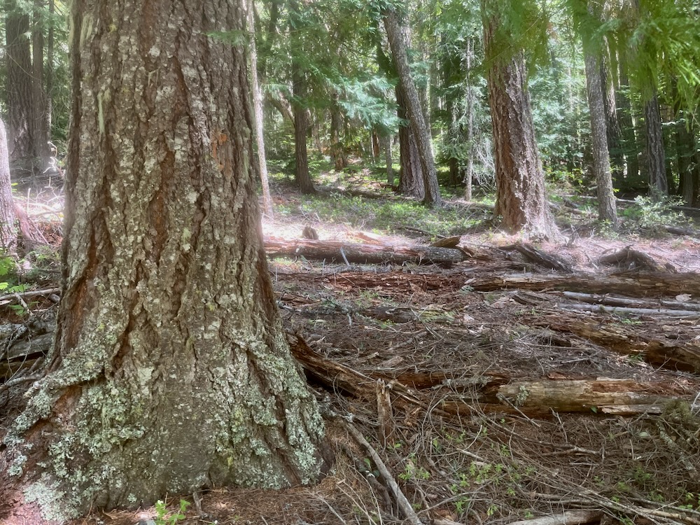
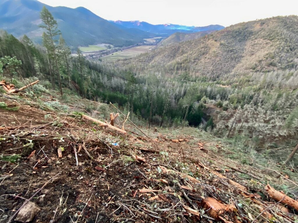
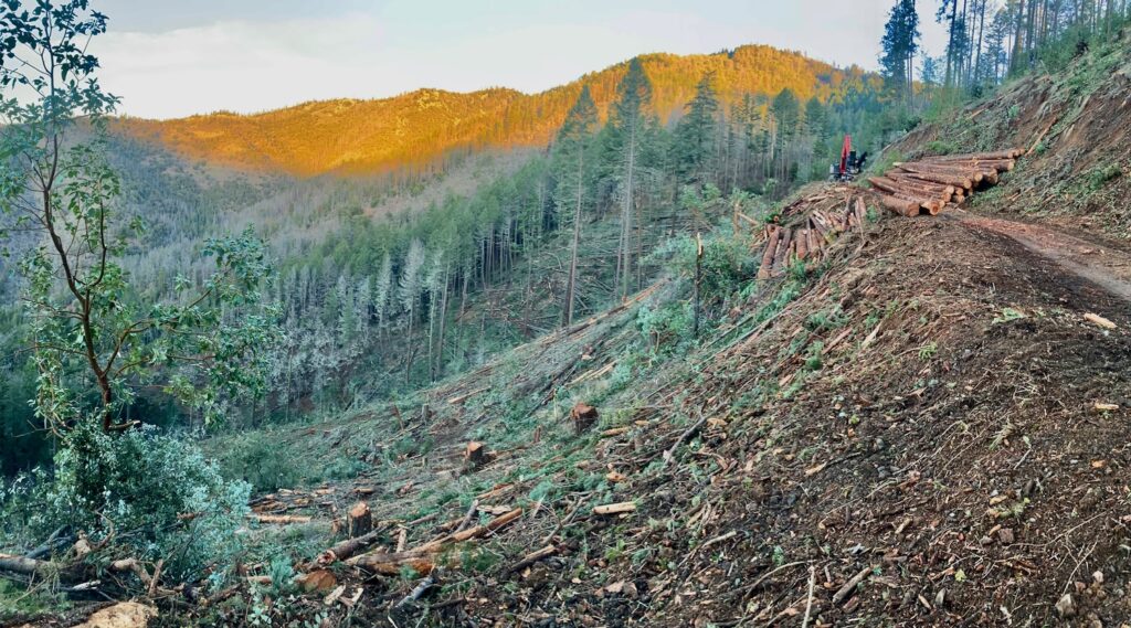
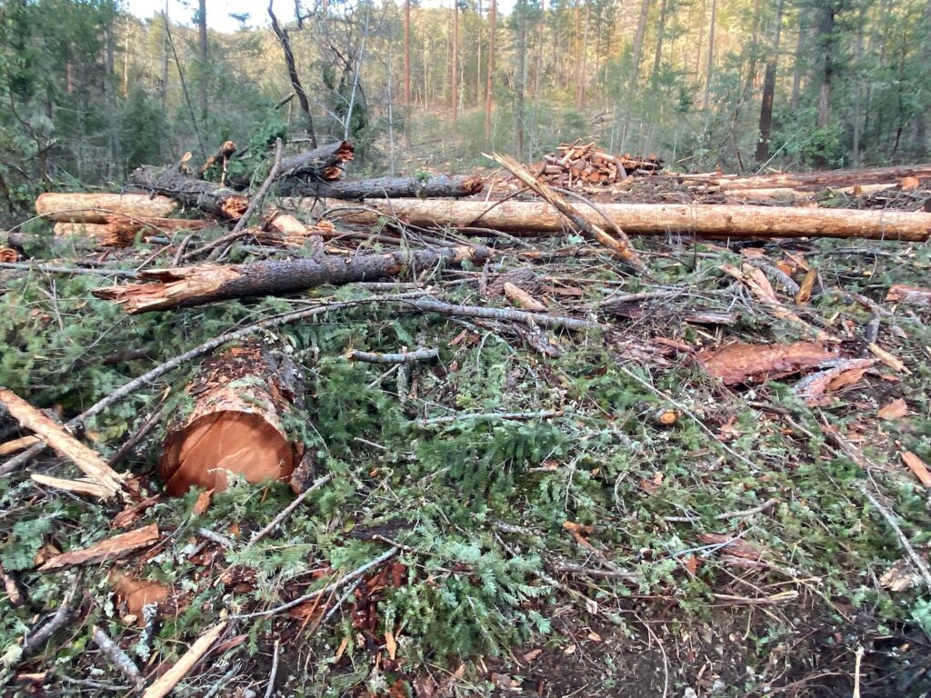
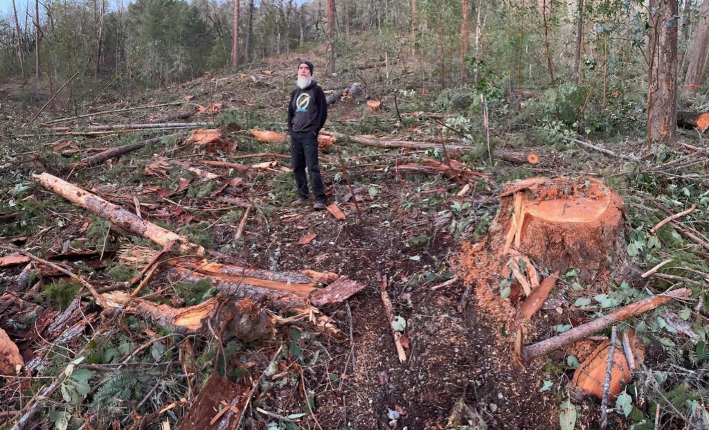
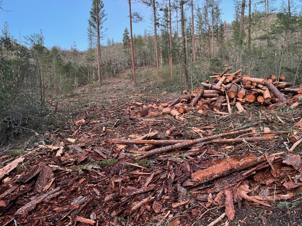
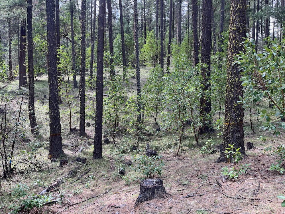
Previously implemented, BLM “salvage” logging in the Applegate Valley, including the Lower Sterling, Lickety Split, Boaz Salvage and Forest Creek Salvage Timber Sales have demonstrated that many thousands of living, green, viable trees are routinely removed as “dead and dying” trees. The result of this logging on the ground, has in many circumstances, been the removal of nearly all mature overstory trees, a near total loss of canopy cover, the retention of only a handful of trees per acre, large landslides, stream-choking debris flows, excessive stream sedimentation, the removal of northern spotted owl habitat, and the removal of Siskiyou Mountains salamander habitat, including High Priority Sites protected under the Siskiyou Mountains Salamander Conservation Agreement.
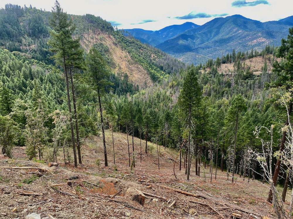
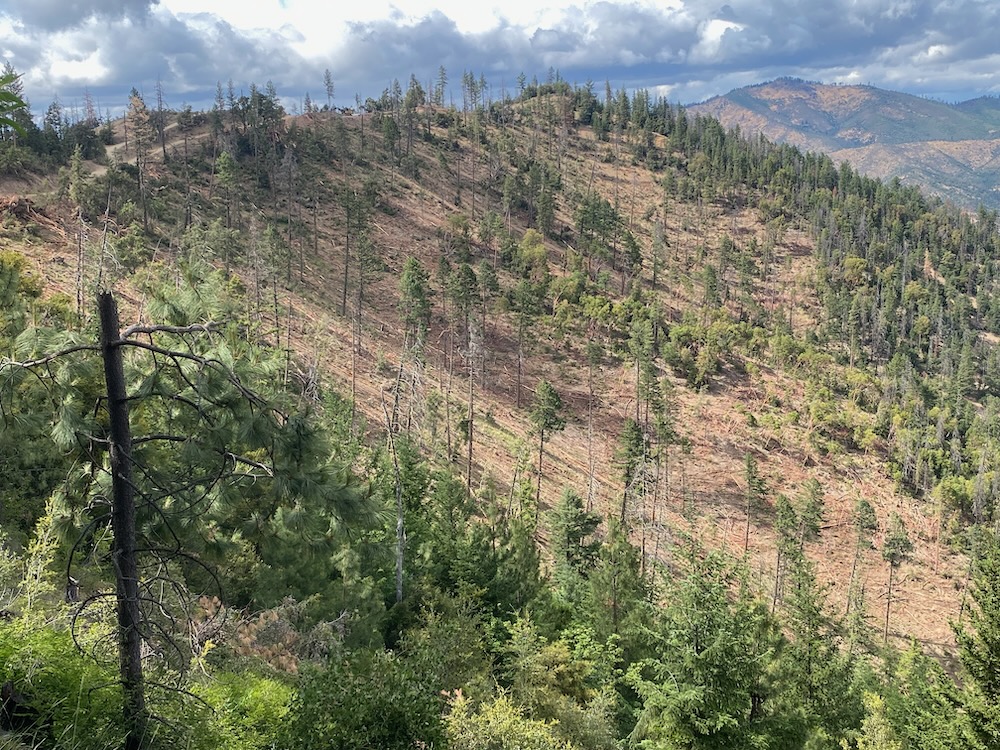
In the coming years, these heavily logged slopes will undergo a dramatic transformation and this transformation or habitat type conversion would include a significant increase in fine fuels, young tree and shrub density, and a large increase in overall fire risks due to the increasingly hot, dry, and windy environmental conditions, and the subsequent regeneration of dense, young, highly flammable tree and shrub growth wherever canopy removal and significant BLM logging occurs.
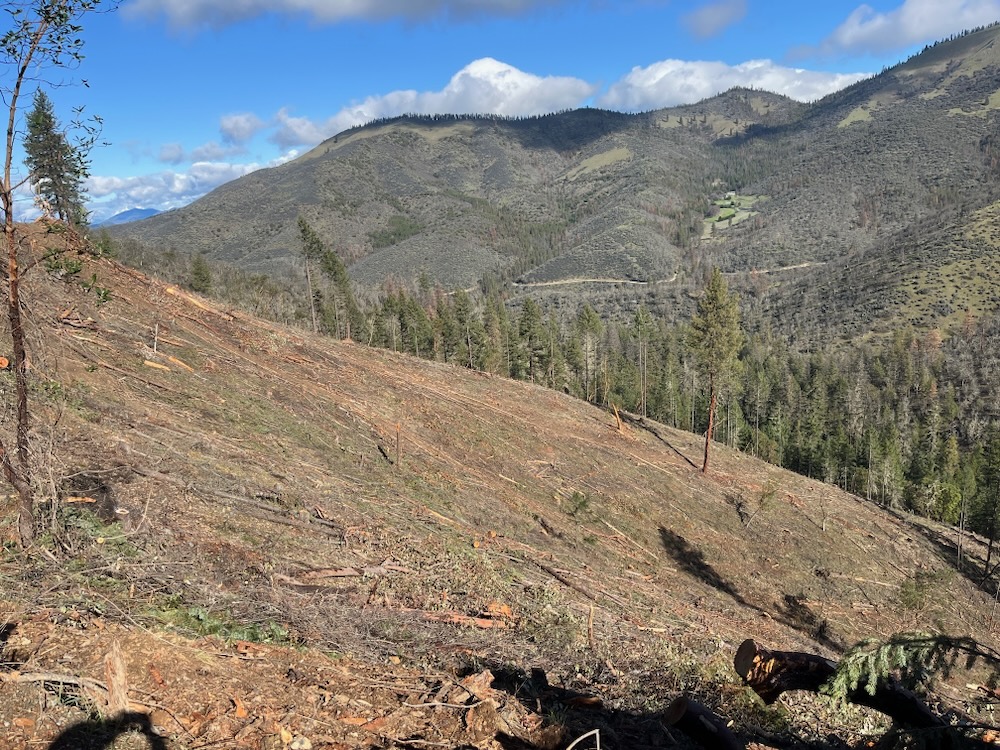
In southwest Oregon, it is undeniable that the removal of overstory canopy leads to increased fine fuel development and the regeneration of dense, young tree and shrub growth. This in turn, dramatically increases potential fire intensity, rate of spread and resistance to control. Trading mature stands, even with some level of tree mortality within them, for dense, young, even-aged growth triggered by the logging of living, green trees and forest canopy will not reduce fire risks, and is not a viable solution. Instead, it will set these habitats up for perpetually high fire risks, due to a lack of overstory forest canopy.
In our region forest canopy reduces windspeeds, reduces solar exposure, retains moisture, moderates understory growth, and maintains fire resilience. Removing large trees that are likely to survive all but the most severe wildfires, and reducing canopy cover, only replaces these currently relatively resilient conditions with young, low statured trees that support very little if any natural fire resistance.
The two timber sales currently sold by BLM, and most immediately threatening our beloved valley are explored in more detail below.
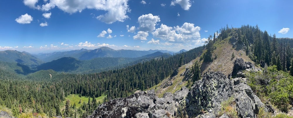
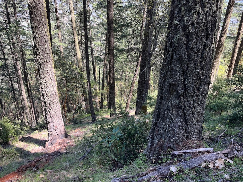
Apple Saws Timber Sale
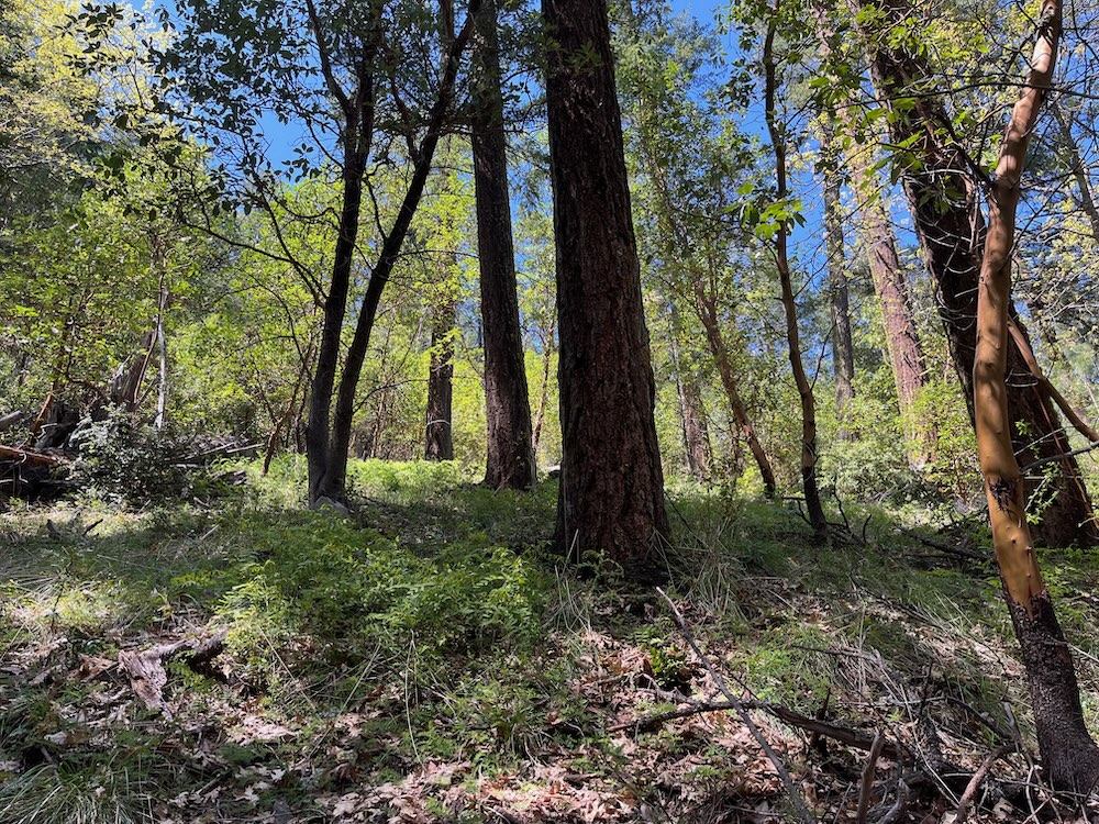
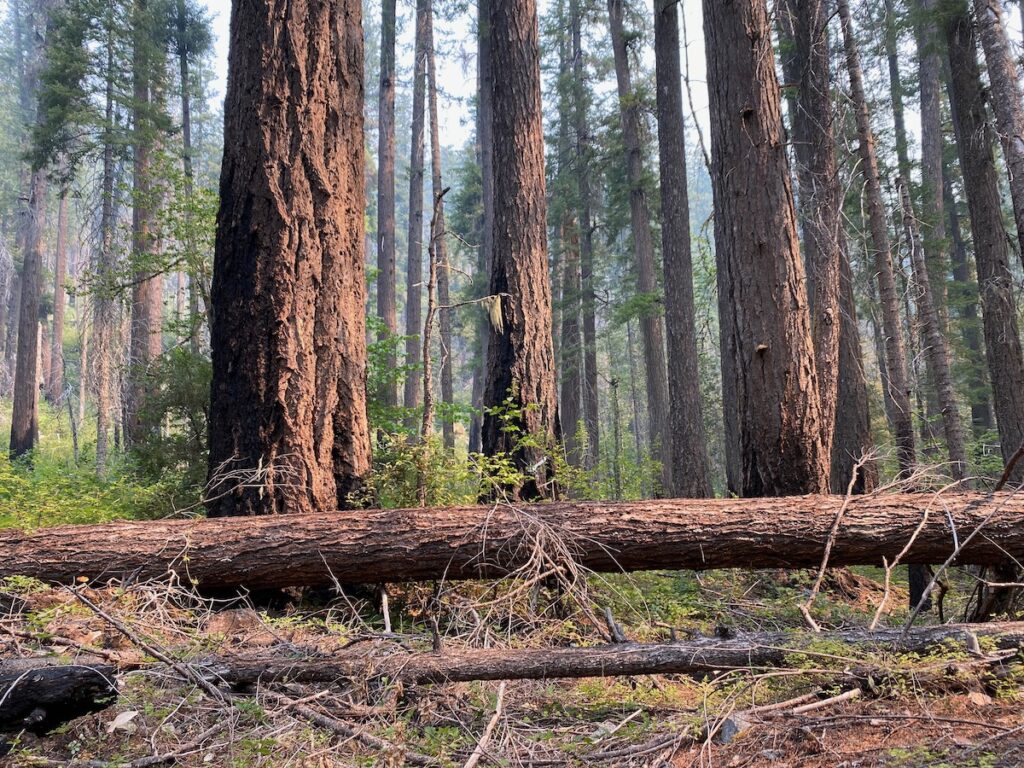
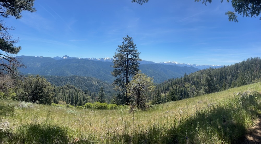
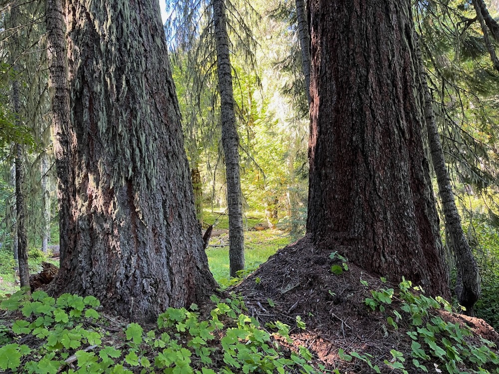
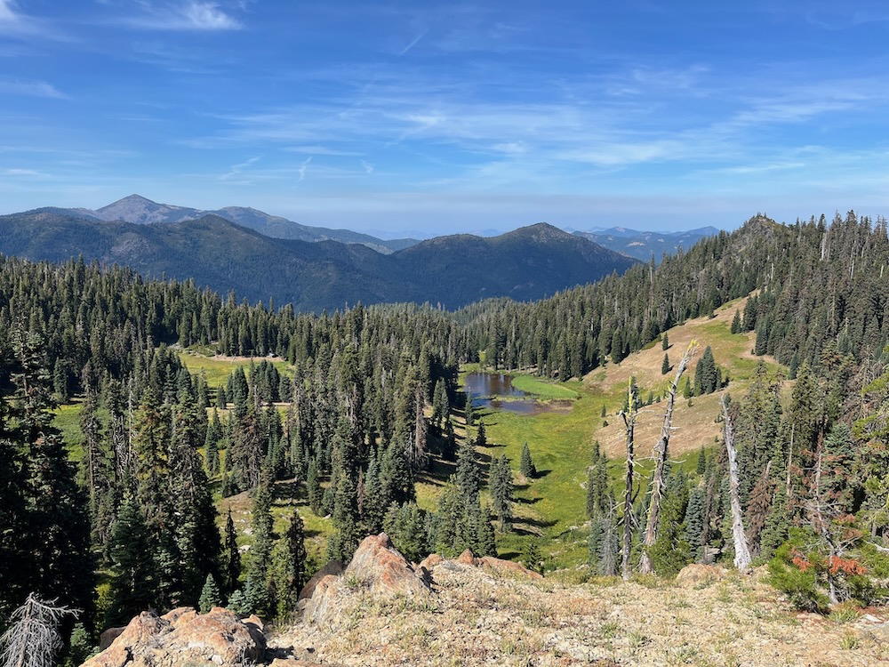
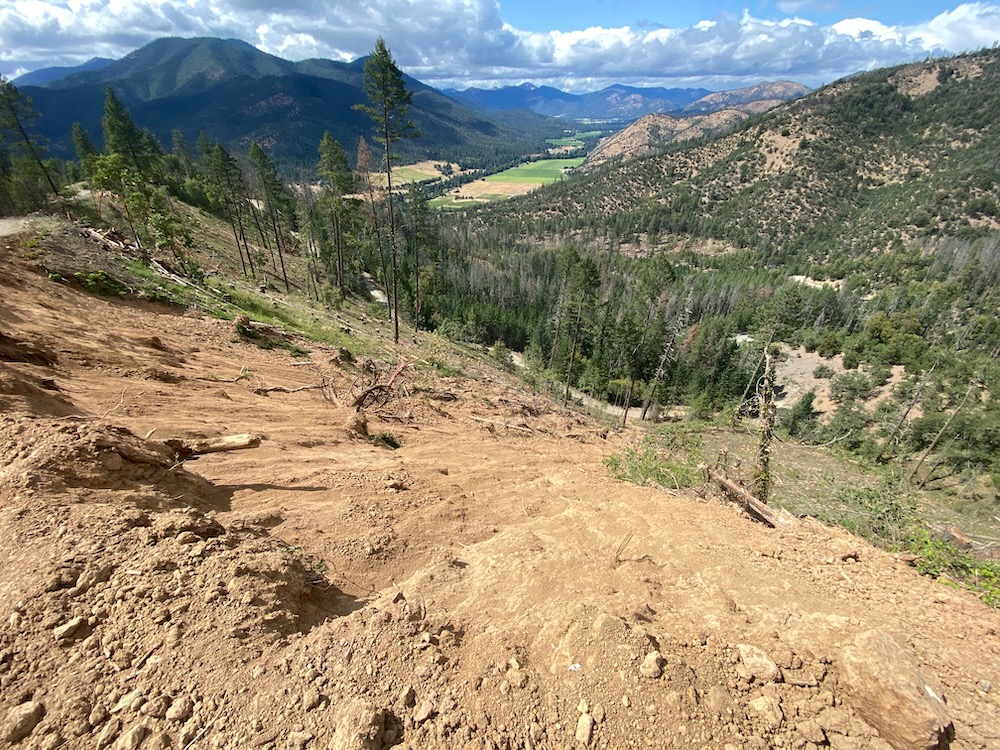
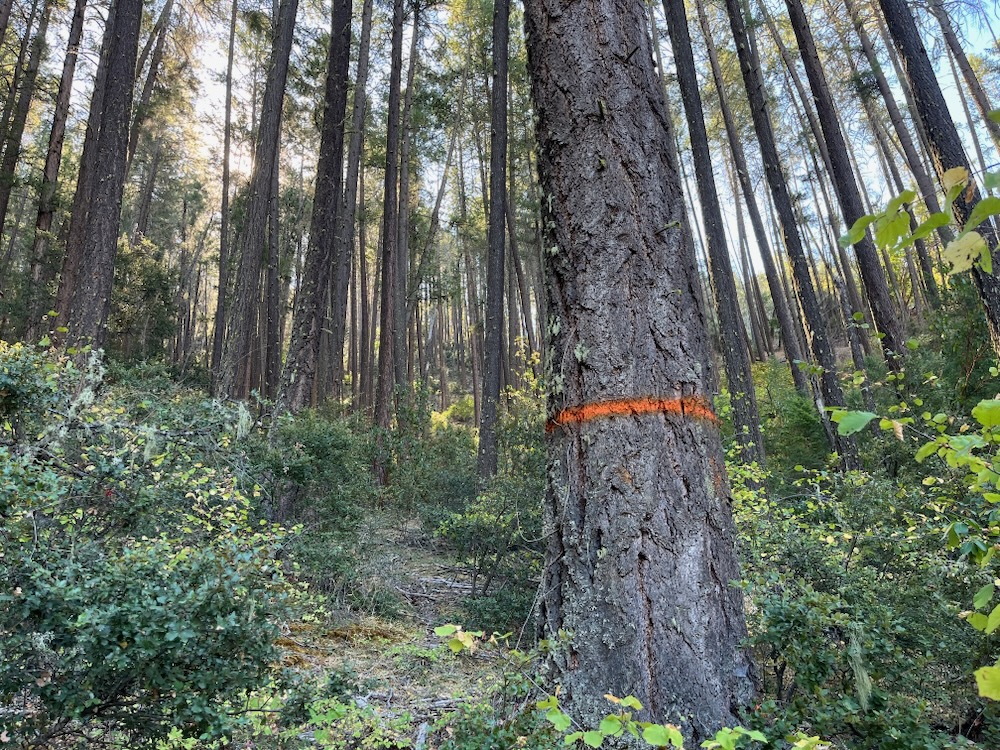
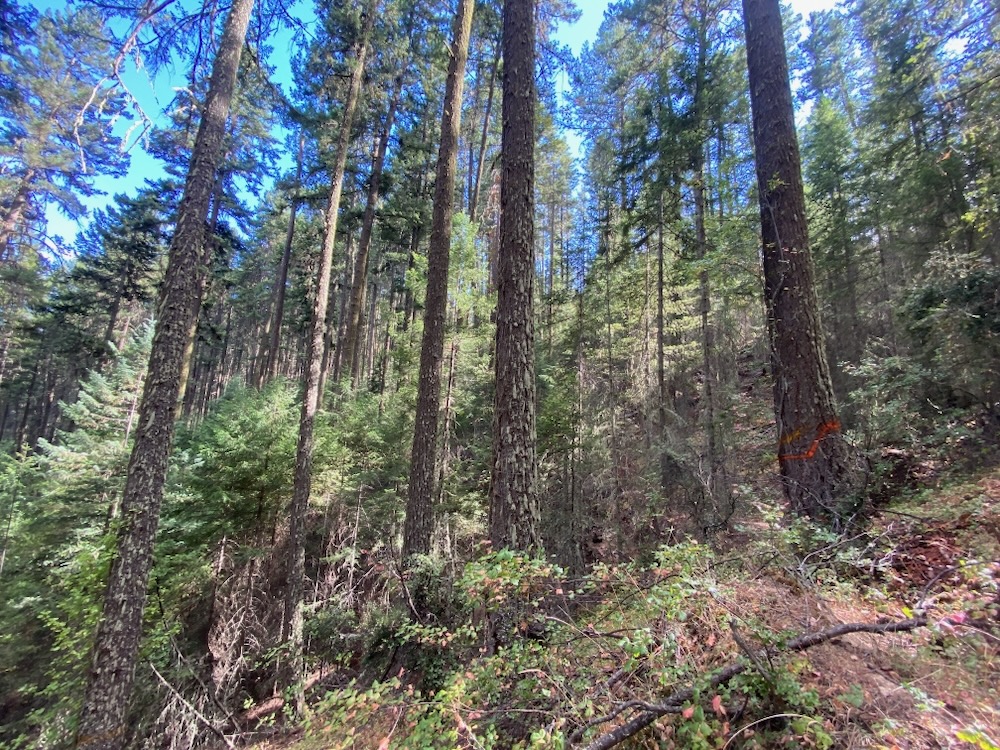
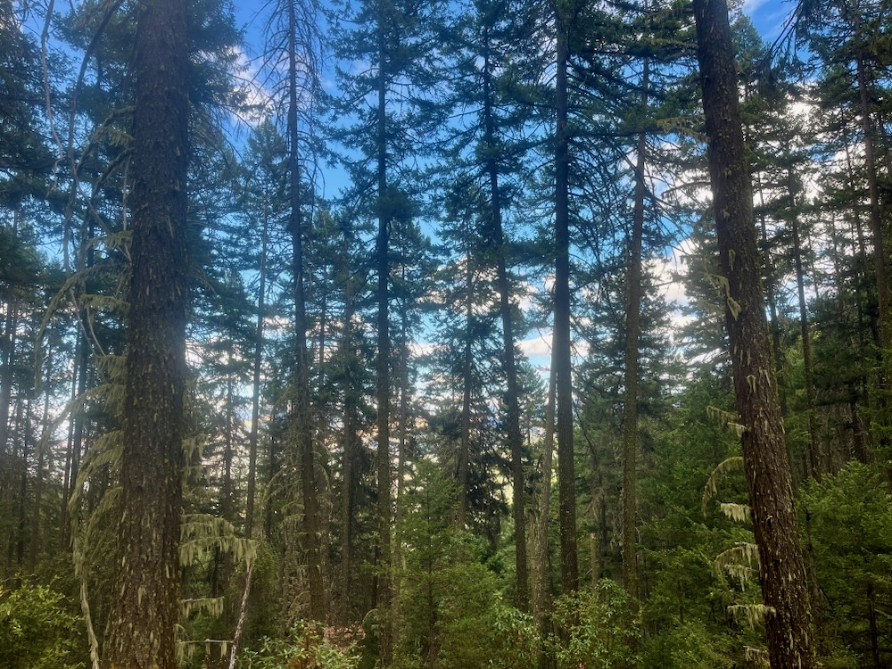
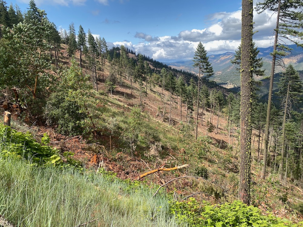
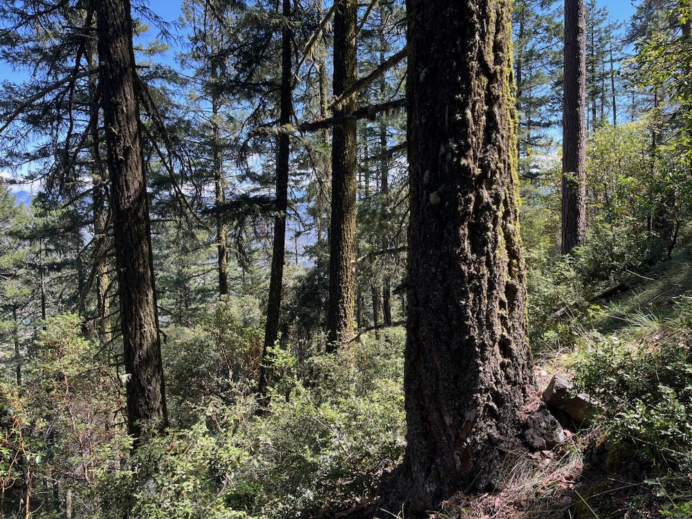
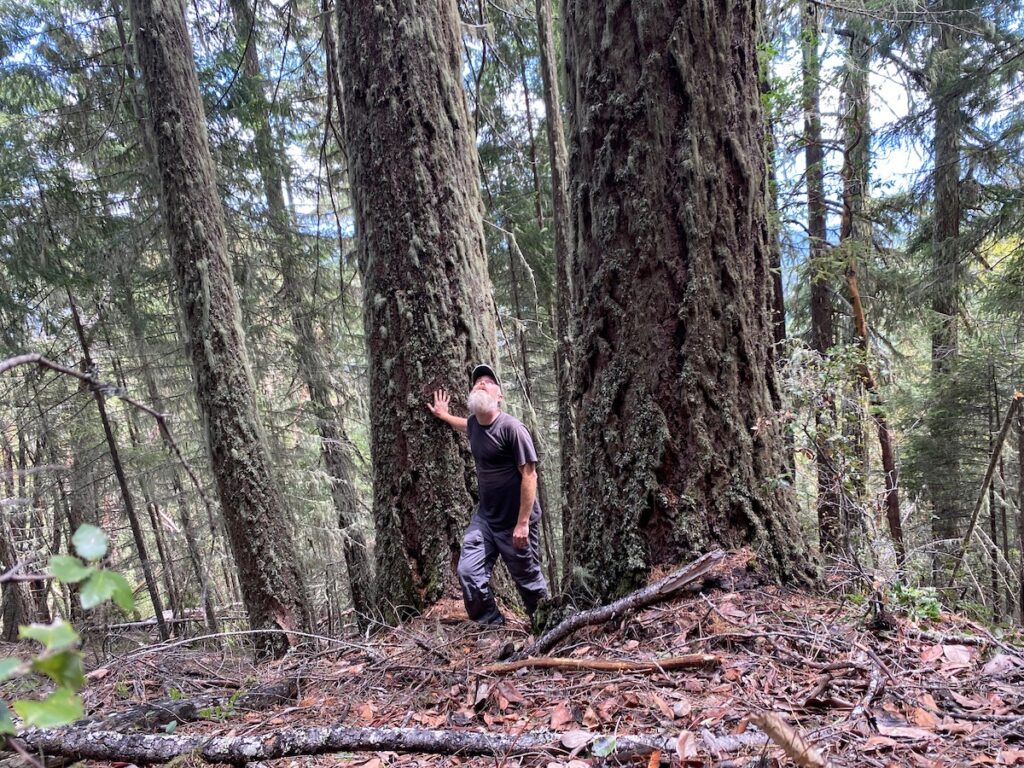
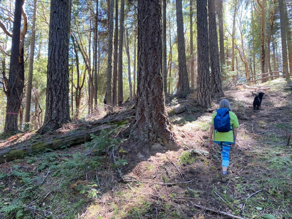
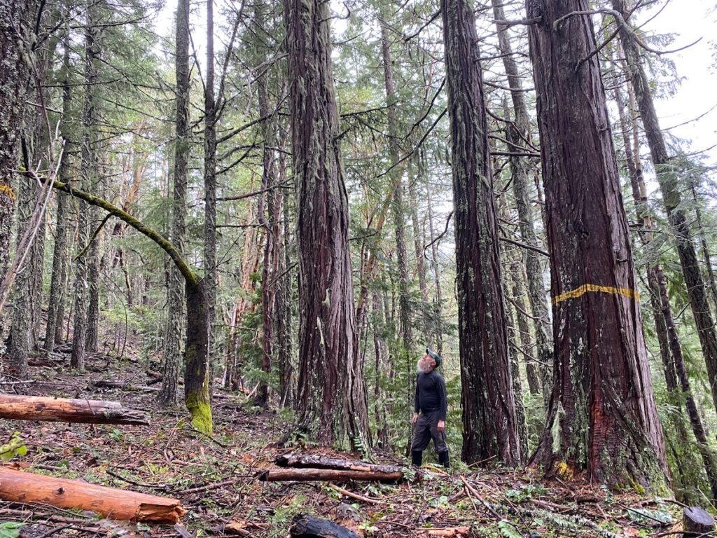
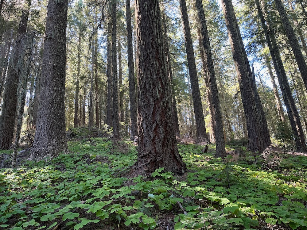
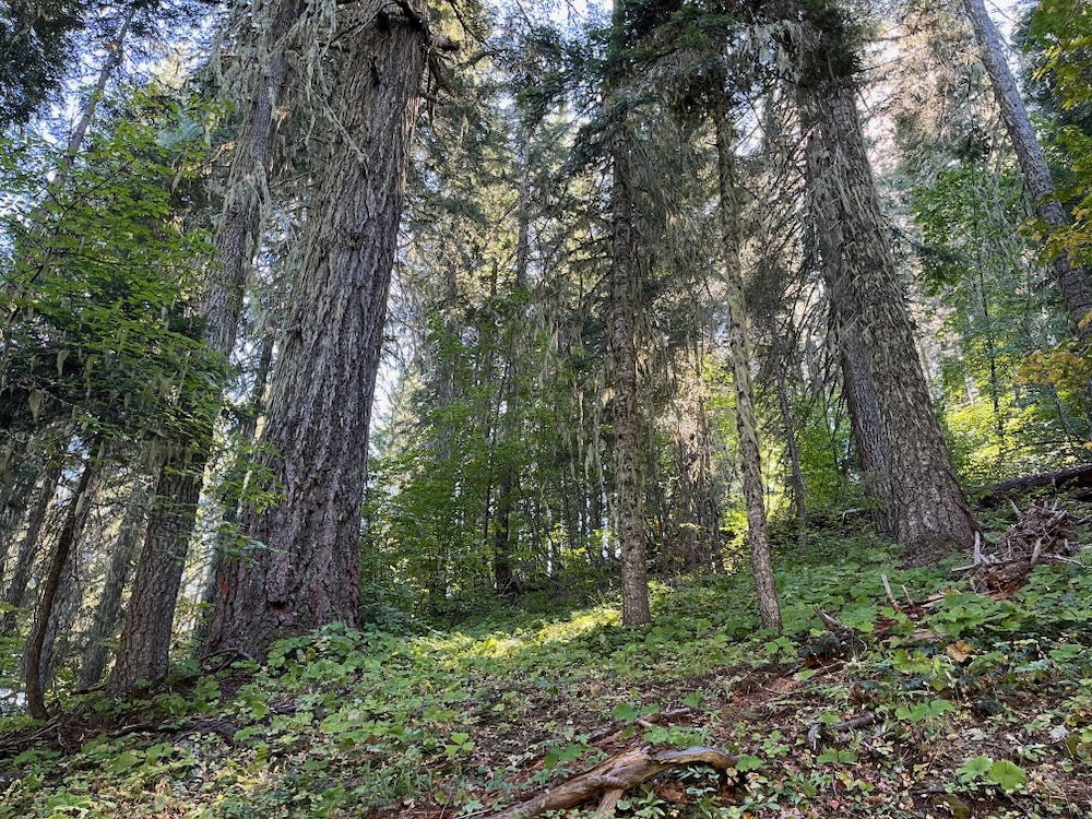
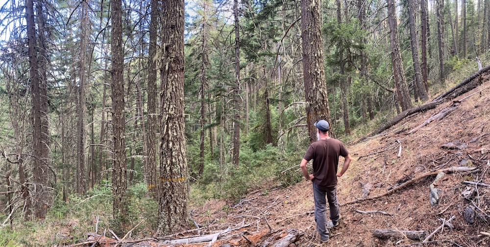
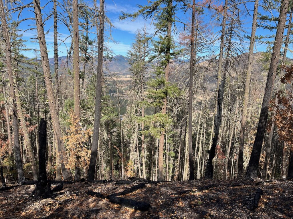
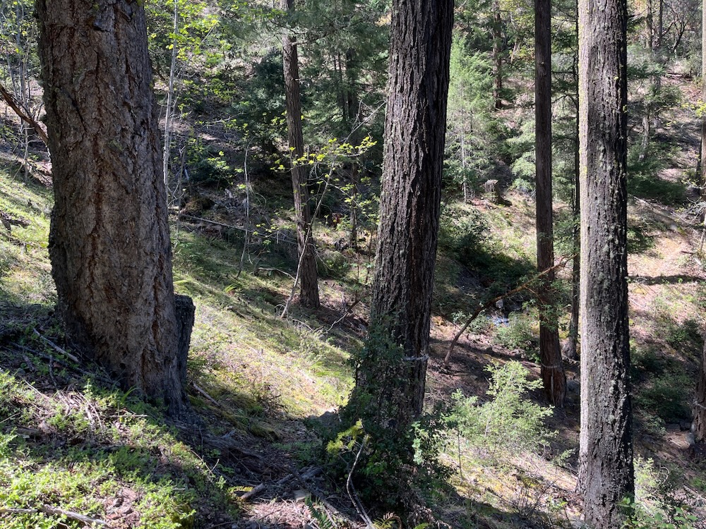
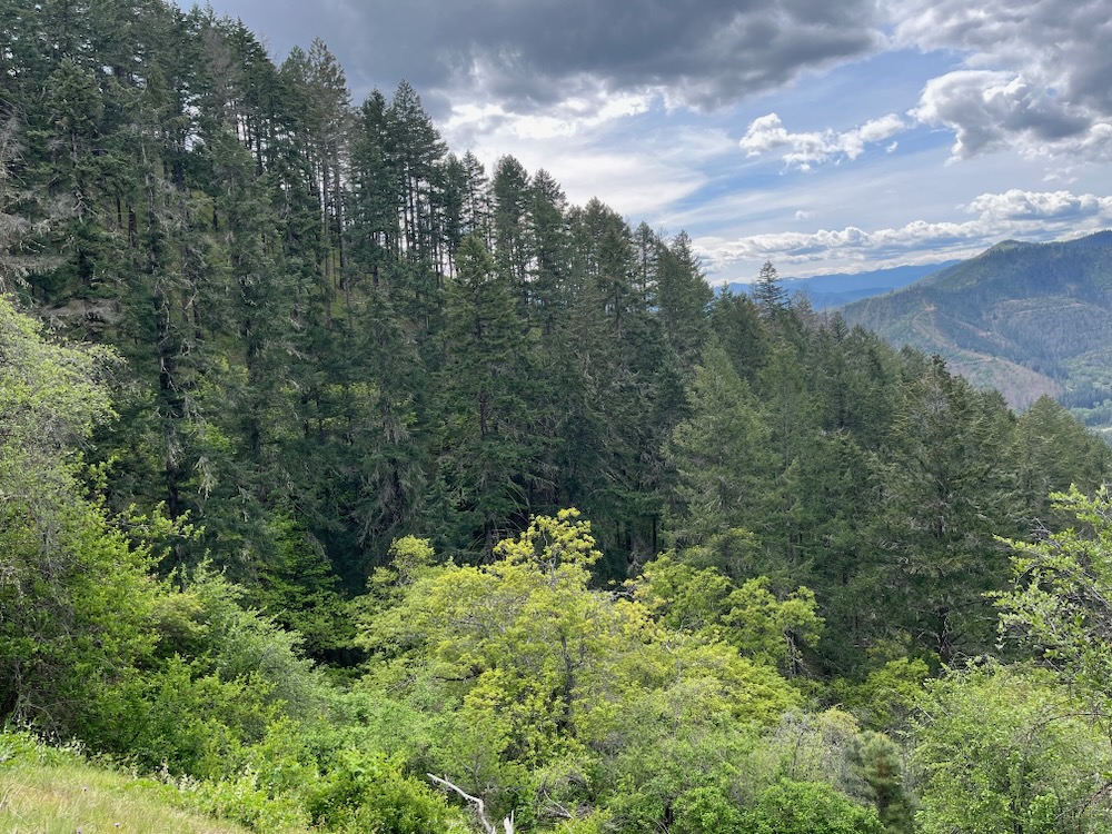
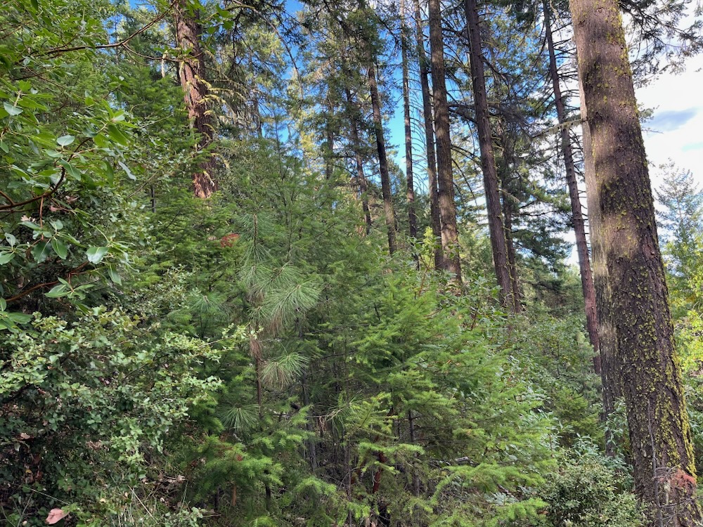
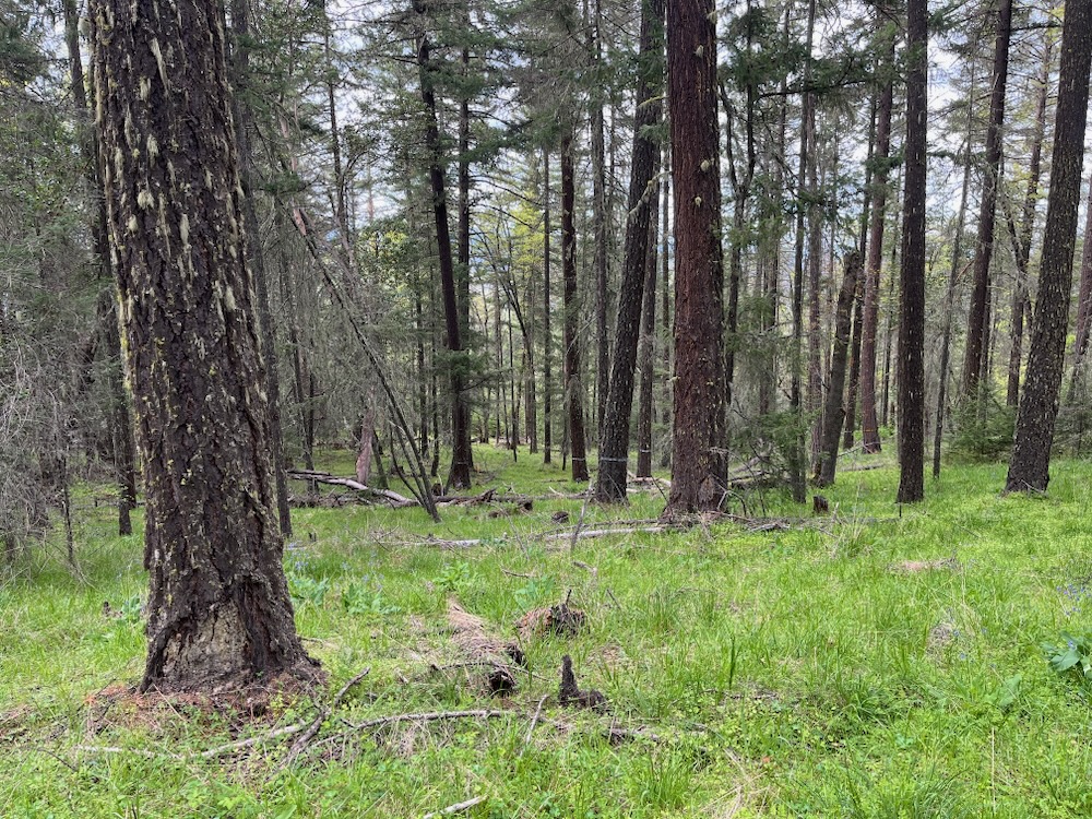
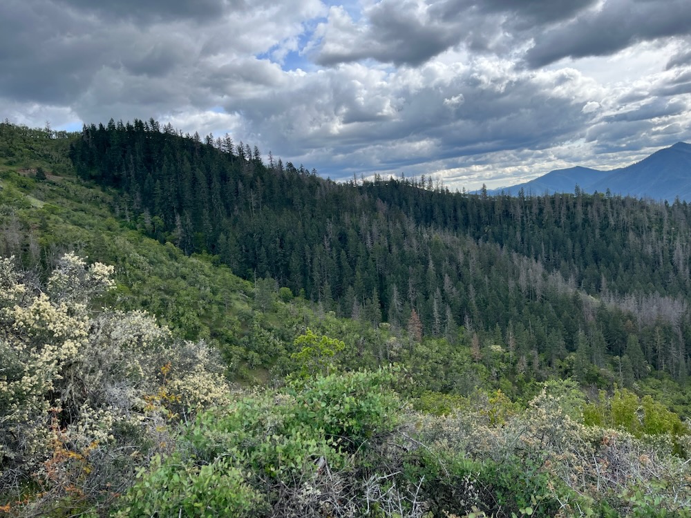
Located above Cantrall Buckley County Park and the eastern face of Ben Johnson Mountain, the mature forests and mountains of the area create the skyline for Ruch and the surrounding valley. Sheltered from the intense late afternoon heat, these east-facing slopes support some of the most persistent and resilient forests in the Ruch area. The project includes predominantly living, green, viable stands of mature forest proposed for heavy industrial logging and significant overstory canopy removal.
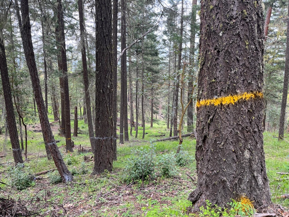
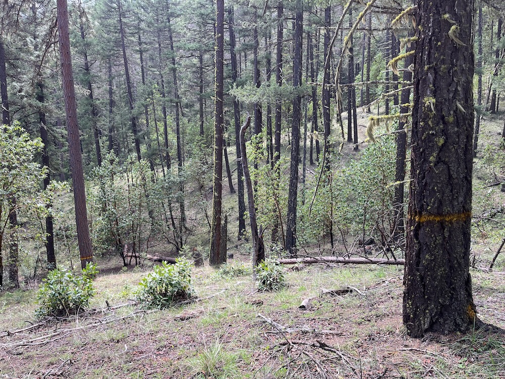
The Apple Saws Timber Sale consists of 627 acres in 24 separate units, and is estimated to log 6.5 million board feet of timber. Of the 627 acres targeted for logging, 420 acres (67%) have been marked for tree removal in 19 “area units.” The BLM’s Apple Saws Timber Sale Prospectus notes that in these 19 units, 8,679 trees have been marked with white paint for retention. This accounts for the retention of 21 trees per acre and minimal canopy cover retention. In fact, the same document identified an estimated 40,437 trees for removal, with the removal of 96 trees per acre proposed. This means that across the timber sale area almost 4.6 times as many trees are proposed for removal as are identified for retention.
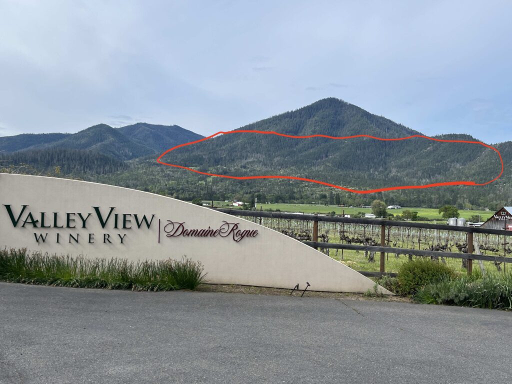
It also means that currently 117 trees per acre occupy these sites, and approximately 82% of the existing trees would be removed if implemented. So next time you enjoy the view from Ruch, Oregon, from Long Sword Vineyard, Valley View Vineyard, or from highway 238 as you drive through the Applegate Valley, image 82% of the forest removed and only scattered trees standing where currently mature forests exist on the skyline above Cantrall Buckley Park and on the eastern face of Ben Johnson Mountain.

According to the Environmental Assessment for the entire SOS project, 67% of the forest proposed for logging, approximately 3,000 acres, currently maintains a green, living tree canopy with between 40%-90% canopy cover. This demonstrates that over 2/3 of the proposed logging area is currently in a forested condition and that number is likely even higher in the Apple Saws Timber Sale, where most stands include living, green, viable forests with significant existing canopy cover, and important closed forest habitat values.
The Apple Saw Timber Sale, like much of the SOS Project is green tree logging masquerading as a “salvage” sale, and the vast majority of the Apple Saws Timber Sale is focused on logging in stands with minimal recent beetle mortality and low to moderate fire risks. Yet, the logging proposed will impact habitat values, while increasing fire risks, and creating much higher levels of cumulative tree mortality than currently exist on this landscape. The Apple Saws Timber Sale in particular, is not about mitigating safety hazards, fire risks or beetle mortality on the landscape, it is about producing board footage for the timber industry by exploiting the natural concern of local residents when tree mortality spiked a few years ago.
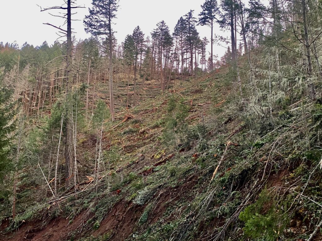
The BLM is also acknowledging in the Environmental Assessment for this project that after the heavy industrial logging proposed, many of these units will not regenerate into conifer forests, will no longer have the productivity to support forested habitats, and will be withdrawn from the timber harvest land base because a sustainable harvest is unlikely in the future. These impacts cannot be characterized as anything but deforestation, forest destruction, and unsustainable logging. It also creates what scientists call “type conversion,” and it will dramatically increase fire risks in affected stands. Type conversion has long-been been identified as a negative attribute of anthropogenic management, and it occurs when an existing habitat or ecosystem is so badly degraded that it is fully “converted” into a novel system, with no historic analog.
The type conversion proposed in the SOS Project consists of degrading currently forested, partially forested, woodland or early seral mixed conifer forest habitats into much hotter, drier, more windy habitats filled with stump sprouting, even-aged hardwoods, chaparral, and/or non-native annual grasslands. According to BLM documents in the Clean Slate, Griffin Halfmoon and Poor Windy Timber Sales, this conversion from a forested habitat to a shrub or brush fuel profile represents a significant increase in fire risks, including increased rates of spread, increased resistance to control by fire suppression crews, and increased fire severity in future fire events.
Ironically, many of these habitats directly surround rural residential communities in the Ruch and Sterling Creek areas, where communities will be directly threatened by heavy industrial logging and long-term type conversions that will increase fire risks, reduce the effectiveness of future suppression actions, and encourage the type of fast-moving wildfires that most threaten homes, infrastructure, and community safety.
The Apple Saws Timber Sale will devastate our viewsheds, degrade our forests, threaten our communities with increased fire risks, damage ecosystems by creating type conversions, spread noxious weeds and non-native annual grass species, and impact important wildlife habitats, while degrading local streams and water quality. Built on a foundation of misinformation, the SOS Project would log mature, living forests that have demonstrated resilience to climate change, fire and beetle mortality events. Indeed, these are not dead and dying forests, and the Applegate Siskiyou Alliance will continue opposing this shameless timber grab!
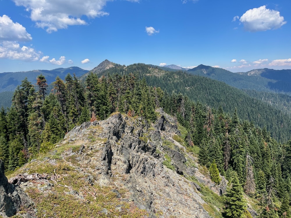
Holcomb Hollow Timber Sale
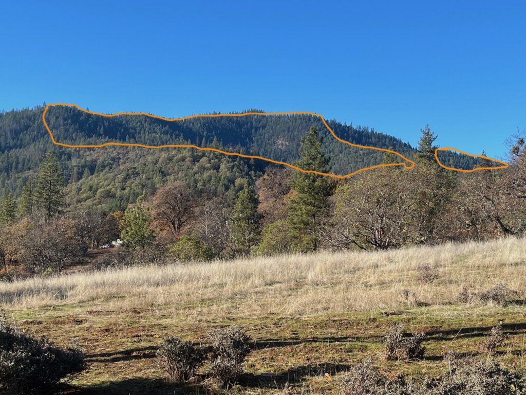
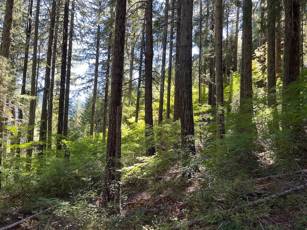
The Holcomb Hollow Timber Sale would log a mixture of living trees and dead standing snags, including stands with significant tree mortality, and stands that largely survived recent drought and beetle mortality events in the Applegate watershed. The Holcomb Hollow Timber Sale has three main project areas, including Woodrat Mountain, Sterling Creek and the forests along the beloved East Applegate Ridge Trail.
Built by the Applegate Trails Association with significant support from the local community, the East Applegate Ridge Trail has steadily become one of the most popular trails in interior southwest Oregon due to its relatively accessible trailheads, spectacular scenery, distant views, stunning spring wildflowers, and pleasant mixture of oak woodland, grassland, chaparral, and mixed conifer forest. Despite the extreme popularity of the East Applegate Ridge Trail, BLM has approved logging forests along the trail and in the immediate viewshed of the trail in the Holcomb Hollow Timber Sale. This includes logging off the majority of large old snags and living, green trees in the affected habitats. It also includes reopening multiple old roads that cross the trail for log hauling, closing the trail during logging operations, and other impacts that would lead to an overall degradation of both the recreational experience and scenic qualities of the East Applegate Ridge Trail.
The Holcomb Hollow Timber Sale consists of 679 acres in 29 separate units. In total, 5.5 million board feet would be logged. The Holcomb Hollow Timber Sale Prospectus demonstrates that in the 20 harvest units marked for tree removal, the BLM has marked 4,773 trees for retention, accounting for approximately 15 trees per acre. It also identified an estimated 27, 828 trees identified for removal. This means the BLM will be removing almost six times as many trees as they will be retaining within the project area, logging living, viable trees by the thousands in both stands that were heavily affected by beetle mortality and in stands that were not.
Either way, what these logging “treatments” would create is less forest cover, less canopy cover to reduce understory shrub regeneration, less cool, moist habitat conditions, less carbon stored on the landscape, less forest and snag habitat for wildlife, more soil disturbance, more sedimentation, more noxious weed and non-native annual grass spread, higher fire risks, hotter, drier environments, and more deforestation through BLM timber management. Current forest conditions in the Holcomb Hollow Timber Sale are already quite open and support approximately 56 trees per acre, meaning that approximately 73% of the existing trees would be removed if implemented.
To make matters worse, over half of the timber sale units (53% or 360 acres) are not being marked by BLM staff, and will instead be implemented with “Designation by Prescription” and “Designation by Description” treatments. This includes all “Roadside Vegetation Management” and “Linear Feature” logging operations and would allow the BLM to simply identify a commercial unit boundary and provide the timber purchaser with prescriptions or descriptions that would inform tree removal and stand retention levels. Loaded with conflicts of interest, this means that the timber industry purchaser, buying the timber sale from BLM will determine specifically which trees will be removed and which trees will be retained.
Obviously, when logging trees presents more profit, and leaving trees means less profit, it is easy to see the conflict of interest, and easy to see how the financial biases of the timber sale purchaser might influence project implementation far more than tree health or the probability of tree mortality.
Currently, the BLM has also marked 319 acres in “area unit” acres, accounting for 47% of the timber sale, and in these areas the BLM has identified or marked the trees for retention with yellow paint. The mark in these areas is quite heavy and would remove the majority of the trees in affected stands. It would also convert relatively fire resilient, mature forest habitats into chaparral habitats with minimal canopy cover.
In fact, “unit” logging areas currently identified for logging in the Holcomb Hollow Timber Sale are some of the last living, green forest habitats remaining in the Ruch and Sterling Creek areas.
Currently most of the landscape consists of arid grassland habitats, chaparral, hardwood stands and early seral conifer forest with a snag and open forest component. Losing or degrading these last forested stands, or even portions of these stands, to deforestation or habitat degradation associated with logging will dramatically reduce the area’s scenic qualities, habitat values, and biodiversity, while increasing fire risks directly above rural homes and communities. The result of this large tree removal and significant canopy loss will be to reduce landscape scale fire resilience, especially in areas currently maintaining forest cover.
At the same time, stands that currently maintain significant recent mortality would also be impacted in this sale through logging and yarding operations that disturb soils, create erosion and stream sedimentation, reduce habitat values, impact future water retention, impact current hardwood habitats, degrade habitat complexity, damage wildlife habitat, impact soil productivity by removing snags, and spread noxious weeds and non-native grasses across the landscape. This spread of noxious or non-native weeds has been shown in many studies to increase fine fuels, reduce opportunities for fire containment, encourage longer, more volatile fire seasons, remove natural barriers to fire spread, and permanently alter landscape integrity.
The Holcomb Hollow Timber Sale is a recipe for deforestation in some of the driest, most fragile portions of the Applegate Valley and will increase fire risks in nearby communities, while impacting recreational values along the popular East Applegate Ridge Trail and at the Woodrat Mountain Paragliding Launch Site. It will also damage the scenic qualities of this exceptional landscape, degrade forest habitats, and impact rare species like the northern spotted owl and Pacific fisher.
ASA will continue to oppose both the Apple Saws and Holcomb Hollow Timber Sales, as well as future timber sales authorized under the controversial SOS Project. These sales will impact our communities, the resilience of our forests, the scenic and recreational values of our environment, and the beauty of our beloved watershed.
Support ASA as we oppose the SOS Project and fight for the wildlands of the Applegate Valley!
The Trump Administration is slashing regulations and opening our forests to increased industrial logging, and unfortunately, our local BLM has already responded with increasingly aggressive, dishonest, and unscientific public land logging proposals. Our response will be, as it has always been, to aggressively oppose these damaging projects, to defend the wildlands of the region, and take the tough positions necessary to save the forests we love. BLM manages their lands in Western Oregon for one purpose: timber production. Meanwhile our communities and the many important non-timber related values of these wildlands, will be sacrificed if these projects are implemented.
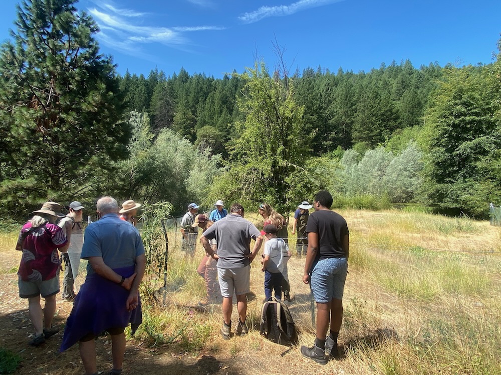
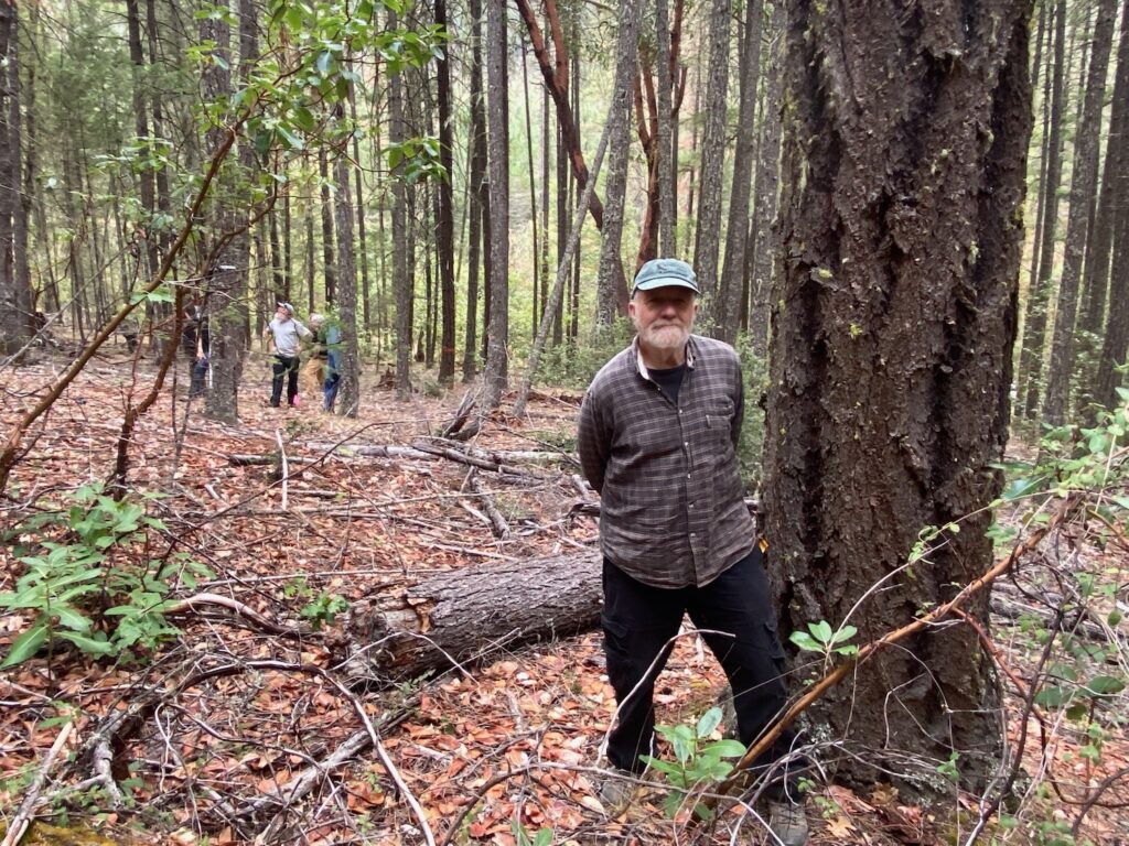
Applegate Siskiyou Alliance is reviewing the documents, monitoring these timber sales on the ground, and pursuing options to continue opposing these damaging timber sales. If you love the forests of the Applegate Valley and/or live in the Applegate Valley and are concerned about these projects, please consider supporting Applegate Siskiyou Alliance with a generous donation! Our communities, our forests, our watersheds and our wildlands are under threat like never before, and although our will to fight for these forests may appear unending, we need the resources to successfully monitor, review, and oppose projects, and to maximize our effectiveness. Help us stop the SOS Project and save the forests of the Applegate and Siskiyou Mountains!