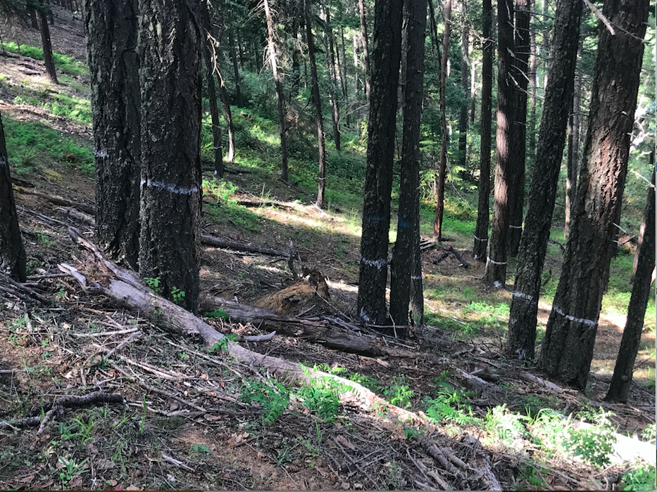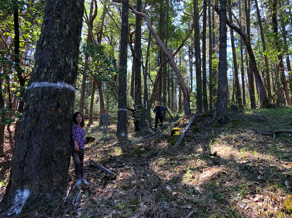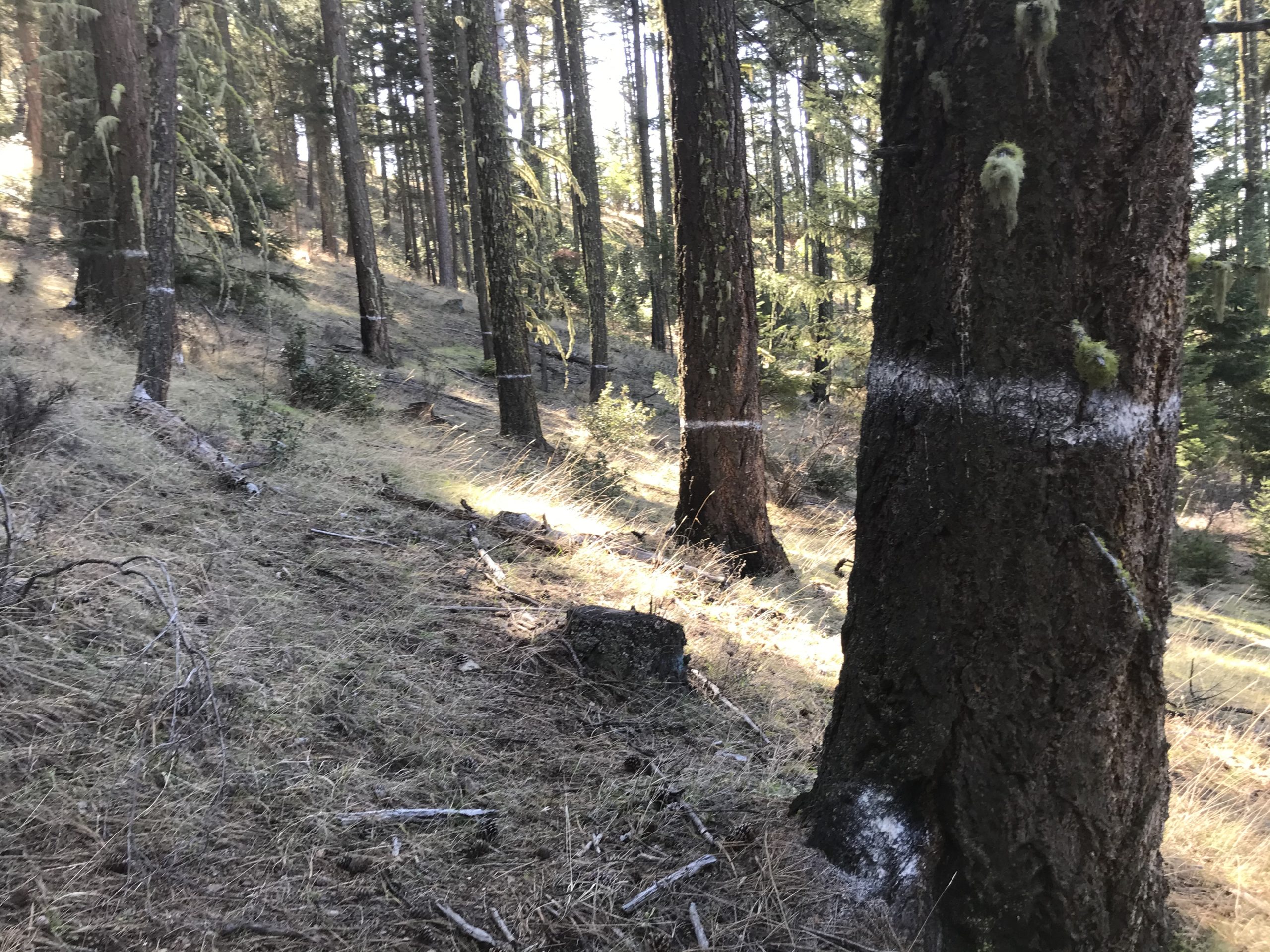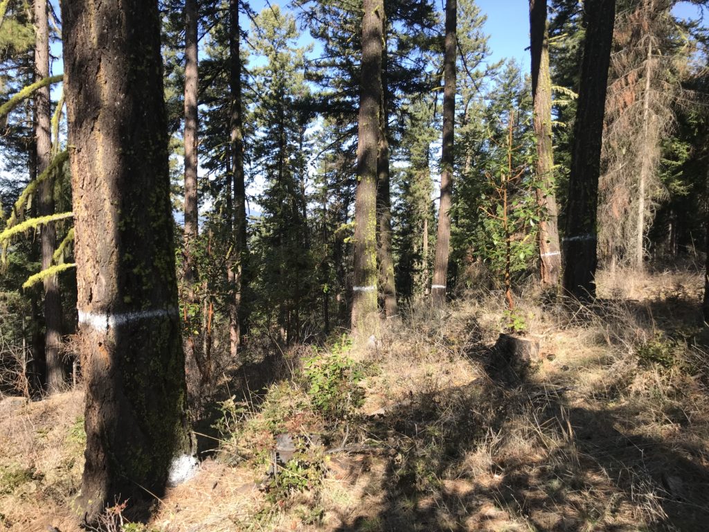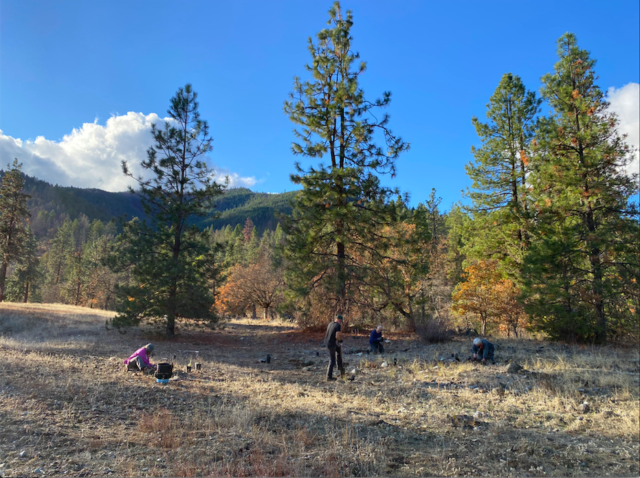
The Forest Service Proposes to Virtually Eliminate Public Involvement and Scientific Review

Many in the Applegate cherish our public lands and believe the Forest Service should maintain or strengthen the public involvement process.

Imagine a large, old-growth logging project planned next to your land and there is no way for you to voice your concerns about it. Imagine a large mining proposal next to your favorite hiking trail and you don’t have the ability to provide public comment. Imagine a road construction project planned to go through an area teeming with wildlife and wildflowers you love. Imagine the places you are connected to, that you went to as a child or took you children to, being destroyed or degraded and you have no opportunity to share your perspective or express your concern with public land managers. All these imagined scenarios may soon become reality if we don’t act now!
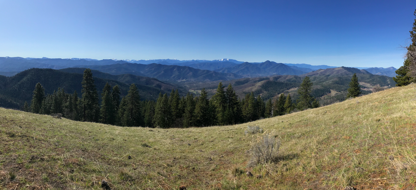
Recently the Forest Service, under pressure from the Trump Administration and its industry allies, proposed sweeping changes to the public involvement and scientific review process. These changes would affect the vast majority of public land management projects throughout the nation, including the Rogue River-Siskiyou National Forest. The proposal would undermine public involvement and responsible, science-based management on National Forest lands. It would also fast track large logging, mining, off-road vehicle developments, road construction projects and other potentially damaging activities.

The proposed changes would allow federal land managers to circumvent the currently more democratic, scientifically rigorous, and inclusive public comment and environmental review process, and replace it with an internal Forest Service process where decisions are made behind closed doors and the public is only notified of projects after they have been approved. Public comment and public collaboration would be a thing of the past, and communities like the Applegate Valley would no longer have the opportunity to actively participate in land management planning.

If approved the Forest Service would essentially shut the public out of the process and eliminate the requirements to analyze, disclose, and fully consider the social and environmental impacts of proposed management activities. To achieve this goal, the agency is proposing significant changes to the National Environmental Policy Act (NEPA).

Field trips, public meetings and other forms of public involvement are largely facilitated by the NEPA process. The local community is often heavily engaged in the Applegate Valley and opportunities for public involvement will be reduced or eliminated under the proposed NEPA changes.

The National Environmental Policy Act (NEPA)

NEPA is the foundation of almost all public involvement on federal lands, providing the public with an opportunity to comment on federal land management projects and provide input on agency proposals. It is one of the most important pieces of environmental legislation ever passed, and it protects the public interest in public lands.

NEPA also requires federal land managers to subject proposed projects to a rigorous scientific review process, analyzing the impacts of proposed actions and identifying the natural values of the lands in question. NEPA requires the agencies to disclose these impacts to the public and to solicit the public’s input before approving a federal action with potentially significant impacts to the human or natural environment.

The Current Process

Currently the Forest Service must identify a “planning area” and general descriptions of land management activities proposed within that area. This initial proposal is called Scoping, which has a 30-day public comment period. The process allows land managers to get public and scientific feedback before fully developing a proposal. Scoping is also used to inform the environmental review process by identifying relevant issues for analysis and to develop a range of alternatives designed to address both social and environmental concerns. Scoping would be largely eliminated under the Forest Service’s proposed NEPA changes.

Following the scoping comment period, the vast majority of public land management projects require the publication of an Environmental Assessment (EA) or Environmental Impact Statement (EIS). These documents are used to analyze the resources at risk, the impacts of various land management alternatives to those resources, and to provide the public with detailed information about the activities proposed on public lands. Publication of an EA or EIS is followed by another 30-day comment period, and only after considering these comments can an agency issue a Decision Notice.

Once a decision is reached, the public can object to the project or portions of the project through a formal Objection process. This allows objectors t0 inform the agency of their concerns and advocate for changes to the approved action. If an adequate resolution is not reached, as a final option the public can litigate the project in court. NEPA provides checks and balances that promote transparency, collaboration and the resolution of relevant scientific or social concerns. These provisions would also be largely eliminated under the Forest Service’s proposed NEPA changes.

The Proposed Process

The Forest Service is proposing to virtually eliminate the public NEPA process (described above) for the vast majority of federal land management projects. These changes would only require the agency to notify the public after decisions have been made — no public comment or environmental review would be conducted and project approval would be followed by a mere 15-day Objection period.

Under the proposed NEPA changes public land logging projects could be implemented without environmental review or public comment.

Barring an objection or litigation, our backyards and backcountry in the Applegate Watershed could be auctioned off to the highest bidder and logged off, designated for off-road vehicle use, or otherwise affected by federal land management activities without public input and without analyzing for environmental impacts.

The Specifics

The proposed changes to NEPA would allow land managers to approve large and environmentally damaging projects without public comment or environmental review. More specifically the proposals include:

-The ability to authorize up to 4,200 acres (or 6.6 square miles of commercial logging and 7,300 acres of manual thinning in a single project without environmental review or public comment.

-The ability to authorized up to 5 miles of new road construction and 10 miles of road reconstruction without environmental review or public comment.

-The ability to convert currently illegal and damaging off-road vehicle trails into official trails or roads without environmental review or public comment.

-The ability to authorize these projects in Inventoried Roadless Areas, Late Successional Reserves, Riparian Reserves, and other important conservation areas without environmental review or public comment.

-The proposed rule changes do not limit the number of projects that could be approved in this manner.

The proposed NEPA changes would allow logging, mining, road construction and off-road vehicle use in Inventoried Roadless Areas without public comment or environmental review.

Conclusions

Without public outcry, the Forest Service and the Trump Administration will continue to undermine the public engagement process, eliminate transparency and limit environmental review. Yet these are public lands and decision making should be accomplished in an open and transparent manner. Applegate Neighborhood Network is working to provide both the land and the people of the Applegate Watershed a voice in the federal land management process. We believe these beautiful public lands define our region and make us who we are as Applegaters. We also believe they should be managed for public benefit, which requires an open public process. Let’s keep the public in public lands.

Please comment on this project — your watershed, your public lands and our wildest landscapes need your support. Comments will be accepted until August 26, 2019.

To comment, please follow this link and click on “Comment Now.”

https://www.regulations.gov/docket?D=FS-2019-0010

What is a “temporary” road?

What looks like a road, acts like a road, was built as a road, and has similar ecological impacts as a road, but is supposedly not a road? A so-called “temporary” road!

A “temporary” road built on Bear Wallow Ridge through previously intact Forest Service land to access a Murphy Timber Company clearcut.

We often hear federal land management agencies (BLM & Forest Service) speak of “temporary roads,” but what does that mean? Temporary roads are often proposed and constructed during logging projects on public land as a way to provide access into logging units. After the logging is completed the so-called temporary road is supposed to be decommissioned and the area restored. The agencies tout temporary roads as a less ecologically damaging alternative to permanent roads; however, temporary roads have long-lasting ecological impacts that are far from temporary.

Temporary roads are often utilized by full-sized logging trucks or other large machinery to access commercial logging units or other land management activities. Although these roads were built and designed as roads, our federal land managers do not account for temporary roads when quantifying road density or considering road related impacts to nearby watersheds. This allows them to build more roads, while masking the cumulative impacts associated with the construction of temporary roads.

Although so-called temporary roads are not administratively considered roads, they have very similar impacts to soils, hydrology, native plant communities, water quality and noxious weed spread. In reality, the only thing temporary about these roads is the agency’s use of them. Temporary roads are not roads where the impact or footprint has disappeared from the landscape. Instead, the agency defines these roads as “temporary” simply because they do not intend to maintain them as open roads following the proposed land management activities.

A section of “temporary” road on Bear Wallow Ridge, one year after “restoration” and decommissioning.

Despite the lasting impacts to nearby watersheds and the supposedly temporary nature of these roads, they will be treated as roads and reopened in the next timber sale and/or fire suppression effort. Temporary roads are also often driven by off-road vehicle enthusiasts and become sources of noxious weed spread, creating a legacy of lasting impacts.

Temporary roads can also create long-term impacts to soils, ranging from compaction to increased soil erosion, and even catastrophic slope failure. When located near streams they can be a significant source of sedimentation and become chronic impacts to water quality and fisheries.

Recently ANN went up to Bear Wallow Ridge to inspect a so-called temporary road built across our publicly owned Forest Service land to access timber and property owned by The Murphy Timber Company.

The large bare clearcut at the center of the photo is land owned by the Murphy Timber Company. It burned at low severity in the 2017 Abney Fire and was quickly clearcut by Murphy Timber. A “temporary” road and log landing was built on the Forest Service land above the property.
The log landing and “temporary” road built on Bear Wallow Ridge with the Red Buttes Wilderness in the distance.

In the summer of 2017, during the Abney Fire, a small piece of private timber land in the Whisky Creek watershed burned at largely low severity. Following the Abney Fire, the Murphy Timber Company applied for a timber harvest plan to log off the fire-affected forests of Whisky Creek. The Oregon Department of Forestry promptly approved their harvest plan to clearcut a large portion of the property, despite the fact that many of trees were alive and green. The timber company then requested approval with the Forest Service to build a new “temporary” road and log landing.

Unfortunately, the Forest Service granted the Murphy Timber Company a right-of-way to build new road and a large log landing near the summit of Bear Wallow Ridge and at the margin of the Stricklin Butte Roadless Area. The area contained rock gardens filled with uncommon native wildflowers, montane chaparral and regenerating knobcone pine stands on the southern face of Bear Wallow Ridge.

The agency also approved the removal of numerous large, fire resistant trees on Forest Service land, as well as a larger number of fire-killed snags. These trees were located within the skyline yarding corridors. These corridors were cleared of both live and dead trees to facilitate the yarding of commercial timber from the private Murphy Timber land below.

To the right is the “temporary” road, while to the left the slope is recovering naturally from the 2017 Abney Fire.

At the log landing, thousands of logs were processed, leaving behind a thick mound of woody debris. When large slash piles were burned, this material caught on fire and smoldered into the earth, causing portions of the landing to collapse. The soils within the massive burn piles were burned at incredibly high intensity. The massive slash piles burned and badly damaged the soil profile, consuming the soil’s organic matter and creating vast ash and soot beds. These large piles have created hydrophobic conditions and the heat from these fires has turned the topsoil into dust — all on our public land for the profit of a private timber company.

Almost one year after building the road, and despite Forest Service “restoration” activities and decommissioning efforts, the effects of the so-called temporary road are very evident. Although the agency successfully seeded some native grasses and forbs within the decommissioned roadbed, the temporary road still consists of largely barren, churned earth. The open, disturbed soil is particularly susceptible to opportunistic noxious weed spread, which are all ready present on an existing long landing to the west. Currently large portions of the roadbed have not revegetated and it is hard to say what species will recolonize the unvegetated areas.

Below the log landing the soils have been heavily burned, leaving behind hydrophobic soils and heavily damaged soil structure. Before the logging operation some green trees survived on the slope below, but these were removed during skyline yarding operations. The yarding corridors can be seen in this photograph, but the large private land clearcut of live, green trees is out of view.

The photographs in this post demonstrate the impact of just one temporary road in the Applegate. There are literally hundreds of miles of temporary roadbeds scattered across the Applegate River Watershed and throughout southern Oregon — and more are proposed in projects each year. The land management agencies tell us that these roads and their impacts are temporary, but evidence on the landscape tells a different story. Next time they try to tell you that a proposed road is temporary, tell them that there is no such thing as a “temporary” road.

In Memory of Chris Bratt: A Fierce Advocate, a Loving Friend, and a Hero of the Applegate Valley

Chris Bratt in 2016 protesting the BLM timber auction for the Nedsbar Timber Sale. Photo credit: Tim Daw

The late Chris Bratt was an environmentalist, carpenter, musician and community advocate. He was not only a champion of the environment and of the Applegate River watershed, but also a loving and compassionate friend to many in the area. For over 40 years, Chris was an advocate for our community, but he was best known as an advocate for the water, the trees and the wildlife of our region. Chris was actively engaged in the community and in defense of our wild landscapes until the very end. Through his example and inspiration, many Applegate Valley residents have become engaged in social and environmental issues, and for his efforts the Applegate Valley is forever grateful.

Chris was born in San Francisco, California in December of 1930. He was raised in a working class family involved in social justice and labor organizing in the Bay Area. According to Chris his “younger days were raised in a pretty dynamic household; a lot of meetings, a lot of music, a lot of art..It was a wonderful background, but we were as poor as church mice.”

Chris remembered going to large labor marches in San Francisco and perhaps his first volunteer activism consisted of delivering left-wing newspapers as a boy, but continued working on social justice and labor issues throughout his life. Only after moving to the Applegate Valley did he became an active environmentalist.

Left to right, Chris’s father George Bratt, his mother Beb, and Chris on Thompson Creek in the late 1970s or early 1980s.

His father George Bratt, was an actor and writer who sometimes wrote for “The People’s World,” a socialist newspaper based out of San Francisco. The paper, founded in 1938, was funded by its 20,000 subscribers throughout the West Coast and cost 3 cents per copy. His father also ran the Unemployed Union, advocating for unemployed workers during the Great Depression of the 1930s.

His mother, Wiltrud or “Beb,” was also very progressive for her time. According to Chris, she refused to declare “blind allegiance” during the Red Scare of the 1950s and sign a “loyalty oath” to the government. She subsequently lost her long-held job as senior draftsperson for the City of San Francisco.

Chris Bratt on his porch above Jameson Creek in the late 1970s or early 1980s.

Chris worked in the boat yards of San Francisco during World War II and later joined the carpenters union, where he worked building homes in suburbs of southern San Francisco. He also played guitar and sang music at picket lines, protests, potlucks and on stage.

Chris moved to Marin County with his first wife, Nancy and their children in the early 1950s and ran Little Gem Construction (“A jewel of a job”) with two friends and business partners.

In the early 1960s, Chris sang in a semi-professional folk group called Albion Trio, who performed around the Bay Area. He also went to Mississippi in the early 1960s with the American Friends Service Committee to help rebuild African American churches burned by the KKK.

In the late 1960s Chris and Little Gem Construction built a medical clinic in Delano, California for the United Farm Workers. Little Gem Construction continued working around the Bay Area doing remodels for fancy homes and the founders including Chris, became unsatisfied and dissolved their partnership to pursue other interests.

In the early 1970s, Chris taught Industrial Arts at Tomales High School for 4 years, leaving somewhat disturbed because the school “was a place for kids, but the adults were running it on their program.” Chris left teaching and went back into construction.

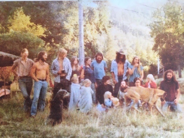
In 1976, Chris moved to the Applegate Valley with his second wife, Joan Peterson and their five children. Inspired by the back-to-the land movement, they moved onto a 160-acre property on Thompson Creek and began working to restore the old homestead, making repairs and building additions to house the family and Chris’s elderly parents.

Chris was part of the back to land movement in the 1970s and moved to Thompson Creek to “live the good life” with his wife Joan and 5 children.

Shortly after moving to the valley, Chris began working on issues involving aerial herbicide spraying on public land. At the time, federal land managers were clearcutting our old-growth forests and spraying herbicides from helicopters to kill shrubs and hardwoods competing with planted trees. The practice had very real ecological impacts and was contaminating residential water supplies leading to birth defects and other health problems for local residents.

According to Chris, after hearing about the BLM’s spraying plans his mother looked at him and said sternly “Christopher, I think you’d better do something about this.” Along with other residents from the Applegate Valley, Chris started Applegate Citizens Opposed to Toxic Sprays (ACOTS). Chris also joined the Board of Directors for the more regional organization called Citizens Against Toxic Sprays (CATS) who worked across the west on herbicide spraying issues. Together a rag-tag coalition of regional organizations ultimately succeeded in banning aerial herbicide spraying on federal land, changing timber management across the West.

For sometime, the Bratt Family raised and milked goats on Thompson Creek.

Chris then joined other residents to start Thompson Residents for Ecological Education (TREE) in the early 1980s. TREE began fighting federal timber sales in the Applegate Valley through legal and administrative action and stopped numerous BLM and Forest Service timber sales. Chris also joined the regional environmental organization Headwaters and became a force for conservation across the region. He worked on policy issues, lawsuits, timber sales, off-road vehicle issues and the utilization of small diameter trees for timber. Over the years, Chris also served on the Board of Directors for the Applegate Partnership, the Rogue Institute, the Geos Institute, the Applegate Neighborhood Network (ANN) and the Applegater Newsmagazine.

From left to right, Greeley Wells, Luke Ruediger, Chris Bratt and Marion Hadden at Red Lily Vineyard for the premiere film showing of “Saving Wellington” in the fall of 2018.

For over 40 years, Chris was often at the heart of our community and at the center of many local controversies.  Chris was the Board President for ANN, one of our most active advocates and an elder with significant experience organizing for the environment. Chris played a vital role in developing and maintaining our organization. He was also active in our campaigns, using every available opportunity to advance conservation goals in the Applegate Valley. ANN is forever grateful for the role he played in promoting and supporting conservation in our beautiful watershed. Chris was adamant that the Applegate Valley needed its own, localized environmental organization, representing the people and the land that make the Applegate Watershed so special. ANN will work to fulfill Chris’ vision and build on his lifetime of work.

Chris will be remembered for his contribution to the environment, but he will also be remembered for his laugh, his smile, his music, his undying dedication to the community and his loving friendship. Chris was a beacon of hope for his community and ANN will work hard to keep his legacy alive. Our goal is to protect, defend, and restore our public lands and the integrity of our environment. We hope to do so in the spirit of Chris Bratt, with the same courage, tenacity and perseverance that he embodied. We thank Chris for the path he traveled, the life he lived and the many years of inspiration he provided for us all. We love you Chris, we now act on your behalf,  in your memory, and on behalf of the wild.

A view into the Applegate Valley from the East Applegate Ridge Trail.

Next time you look across the mountains of the Applegate River, its forested watersheds, its sunlit oak woodlands, and its scrubby slopes of chaparral, think of Chris. For many years he was a voice for this landscape and if you listen closely you will hear him in the wind as it blows through the trees, encouraging you to get out and defend the wildlands that surround you.

  • The information and history in this memorial comes from Chris’ wife, Joan Peterson, his good friend Larry Francis, and from an oral history interview conducted with Chris Bratt in March of 2019 by ANN Program Director, Luke Ruediger. The old photographs were provided by Larry Francis.

Applegate Chaparral: A Unique, Underappreciated & Threatened Ecosystem

Flowering buckbrush below the Mule Mountain Trail in the Little Grayback Roadless Area.

Chaparral is abundant in the Mediterranean habitats of California, where it grows from the Coast Range to the foothills of the southern Cascade and Sierra Nevada Mountains. It is a shrub dominated plant community characterized by drought tolerant species, with sclerophyllous leaves. Sclerophyllous leaves are hard, thick, leathery and generally evergreen. They provide adaptations to extreme heat and drought by shielding the leaf from intense sunlight and reducing water loss from evaporation. Although ubiquitous in California, chaparral is rather rare in Oregon, with its northern range extending into interior southwestern Oregon.

Located in the rain shadow of the Siskiyou Crest, the Applegate River watershed is the driest watershed west of the Cascade Mountains in Oregon. The region’s Mediterranean climate, fire history and extended summer drought also make it a significant center of chaparral habitat. Although found throughout the entire watershed, chaparral is most abundant in the Middle Applegate between Murphy, Applegate, and Ruch, on dry south and west facing slopes and at relatively low elevations. It is also abundant in the arid foothills of the Little Applegate Valley.

An open grown manzanita in full bloom below the Sterling Ditch Trail in the Dakubetede Roadless Area in the Little Applegate.

Often underappreciated, chaparral plays a unique and important role in the ecology of southwestern Oregon by providing cover for wildlife and song birds, important winter browse for deer and elk, habitat for native pollinators, as well as hosting numerous rare plant species. Chaparral also contributes significantly to our regional biodiversity, stabilizes soils, reduces erosion, and adds to the beauty of our landscape.

Southwestern Oregon interior valley chaparral often consists of whiteleaf manzanita (Arctostaphylos viscida), buckbrush (Ceanothus cuneatus), deer brush (Ceanothus integerrimus), yerba santa (Eriodictyon californicum) and silk tassel (Garrya fremontii), with varying amounts of white oak (Quercus garryana), stump sprouting madrone (Arbutus menziesii) and the occasional open grown Ponderosa pine (Pinus ponderosa) or thicket of knobcone pine (Pinus attenuata). In the Upper Applegate, isolated stands of redberry or hollyleaf buckthorn (Rhamnus ilicifolia) are found, creating the largest of two Oregon populations.

Dense chaparral on steep south-facing slopes in the Wellington Wildlands in the Middle Applegate.

Although this northern chaparral population can be differentiated from populations further to the south by its more variable fire history, diverse fire effects, uneven-aged stand structure, and its ability to regenerate without fire, it is also very clear that chaparral is tied to fire for regeneration, to maintain its dominance, and to increase its vigor. More than adapted to wildfire, chaparral in southern Oregon and throughout its range is dependent on relatively infrequent high severity fire to renew, rejuvenate and maintain chaparral systems. In southern Oregon, the fire regime is mixed, but the mass, fire moderated regeneration is closely associated to high severity fire effects.

The blue gray gnatcatcher occupies oak and buckbrush thickets throughout the Applegate Valley. The southern Oregon population is at the northwest end of its West Coast breeding range, following the woodland and chaparral habitats up from California. Photo: Frank Lospalluto

Chaparral ecosystems have a unique relationship with fire and require fire-free periods of sufficient time (20-30 years) to allow seed set. This allows seed obligates (non stump-sprouting species) such as whiteleaf manazanita, yerba santa and buckbrush to regenerate and thrive. Species such as silk tassel, greenleaf manzanita and others assert their dominance by sprouting vigorously after fire events. Irregardless of the reproductive strategy, chaparral is adapted to relatively infrequent fires and high severity fire effects.

In southern Oregon, fire suppression has limited fire activity in many chaparral habitats, but it does not appear to have significantly altered plant community structure or its relationship to fire. In fact, the concept of reducing fuel and limiting fire severity in chaparral habitats is contrary to its fire regime, fire history and natural history. Unless directly tied to community fire safety, fuel reduction in chaparral is entirely ineffective, unnecessary and environmentally damaging.

Blooming buckbrush in the Mule Mountain Roadless Area in the Upper Applegate.

Currently, the largest threats to chaparral habitat in the Applegate Watershed are associated with the clearing of chaparral species and the conversion of natural chaparral habitats to non-native annual grasslands. This unfortunate conversion is often associated with so-called “restoration” treatments and/or fuel reduction projects. Currently this conversion is taking place most extensively on public lands, often far from homes, where it has little, if any effect on community fire protection, and where conservation values are particularly high.

Numerous scientific studies conducted in the Applegate Watershed by researchers at Oregon State University have documented the impacts associated with the widespread clearing of chaparral.

Forest Service crews removed vast buckbrush chaparral habitats in the Buncom Roadless Area during the Upper Applegate Road Project. In the proceeding years the site was invaded by cheat grass and other non-native annual grasses. Chaparral has not regenerated and composition is now largely colonized by non-native annual grasses.
Intact chaparral habitat with diverse native wildflowers on the East Applegate Ridge above Ruch.

One study found that BLM fuel reduction treatments in the Applegate Watershed increased the abundance of non-native annual grasses (Perchemlides 2008). Species such as cheatgrass (Bromus tectorum) and medusa head grass (Elymus caput-medusae) tend to spread quickly following the removal of chaparral and heavily invade sites treated for fuel reduction. This conversion has also been shown to increase fire risks, alter fire regimes by creating more frequent fire events and permanently impact native plant communities.

Another study conducted in the Applegate Watershed specifically asked if BLM fuel reduction activities constitute “restoration” in chaparral ecosystems. The findings of this study demonstrate that “current fuel treatments may be incompatible with chaparral ecology and restoration.” The study found that large-scale chaparral clearing is detrimental in numerous ways, by reducing natural levels of chaparral cover, inhibiting chaparral regeneration and failing to mimic natural fire or age class mosaics on the landscape scale. (Duren. 2010).

Finally, it is highly likely that fuel reduction treatments in chaparral are not only damaging to the ecosystem, but also ineffective at reducing fire severity. Research conducted after the 2002 Squires Fire above Ruch and the Little Applegate Valley showed that previous fuel treatments in chaparral habitats had little to no effect on fire severity or vegetation mortality (Pfaff and Hosten).

A mixture of chaparral, dry mixed conifer forest and oak woodland on the south face of Anderson Butte in the Dakubetede Roadless Area in the Little Applegate.

In California, fuel reduction and habitat clearing is also frequently associated with the invasion of non-native annual grassland species. The spread of non-native annual grasses is altering native species composition, reducing chaparral cover, creating more frequent fires, hindering chaparral regeneration and converting important native ecosystems into heavily altered, predominantly non-native grassland habitats. The collapse of chaparral habitats in California has significant implications that are receiving some attention, but are largely ignored at the northern end of chaparral’s range in southwestern Oregon.

Given the impacts of clearing chaparral, researchers recommend, “leaving chaparral untreated except where fuel loads pose an unacceptable fire hazard to human life or property (e.g. along roads or below houses).” (Duren 2010).

Instead of responsibly managing chaparral, the Medford District BLM routinely degrades habitat far from homes, in the name of fuel reduction and even “restoration.” Recently, the BLM cleared vast swaths of mature whiteleaf manzanita in the lower Yale Creek Watershed. Crews cut, piled and burned nearly every manzanita on the hillside, leaving behind only white, sunbleached manzanita stumps and black, circular”charcoal pits” from extremely hot burn piles. These highly concentrated burns sterilize the soil, destroy native plants, cook off the soil seedbed and create persistent denuded sites subject to noxious weed spread for years after implementation.

An entire ridge of whiteleaf manzanita was cleared in Lower Yale Creek by the BLM. The “treatment” will have lasting impacts by converting this site from chaparral to non-native grassland.

The so-called fuel reduction treatment on Yale Creek virtually eliminated the existing population of chaparral. The lack of broadcast fire, the removal of all chaparral seed sources, and the likely invasion of highly competitive cheatgrass, medusa head grass or hedgehog dogtail grass (Cynosurus echinatus) will inhibit the germination and growth of both chaparral and native herbaceous species. Clearing chaparral for fuel reduction does not just alter species composition by spreading non-native annual grasses, but these same grasses can also increase fire risks, fire frequency, rate of spread, and fire severity while degrading wildlife habitat.

Another view of the recent BLM manzanita massacre on lower Yale Creek.

Manzanita, in particular, provides abundant nectar flow for early season pollinators, including native bees and humming birds. It also produces abundant crops of little rust red berries. The berries are dry, tart, somewhat astringent, but rather tasty. Wildlife such as songbirds, small mammals, and especially black bears feast on these berries in the late summer, creating a critical food source in the midst of our extended summer dry season. Deer and other wildlife also often bed down in the shade and sleep in the shelter of manzanita at night. These habitats are important for wildlife, but are often eliminated in BLM fuel reduction treatments.

Manzanita blossoms are a treat to pollinators in the early spring.

ANN encourages our federal land management agencies to consider the role of chaparral in our regional ecology. Scientific research conducted here in the Applegate Valley demonstrates the current strategy of clearing vast chaparral habitats through manual thinning and pile burning is detrimental, scientifically unsound, ineffective at reducing fire severity, and a colossal waste a taxpayer dollars.

Federal land managers should only conduct fuel reduction in chaparral habitats directly adjacent to homes and communities at risk. These treatments should retain large islands of chaparral and maintain interspersed oak, madrone and pine trees for habitat, while reducing density adjacent to existing homes. In more remote areas and away from homes, treatment is not beneficial or necessary.

Chaparral is not a wasteland. It is a unique and important ecosystem that can be conserved through largely passive management. We should be putting the limited fire mitigation dollars currently available near homes and communities that might benefit from well placed, highly strategic fuel treatments, not in remote locations with little bearing on community safety and in ecosystems that will only be degraded by our fuel management activities.

The unique northernmost populations of chaparral are more than just “brush” or “fuel” for the next fire. They are, in fact, diverse, vibrant and important ecosystems we should all embrace, celebrate and preserve in the Applegate Valley.

A large white eaf manzanita with a cavity created by woodpeckers.

References:

Duren, Olivia & Muir, Patricia. 2010. Does Fuel Management Accomplish Restoration in Southwestern Oregon, USA, Chaparral? Insights from Age Structure. Fire Ecology Volume 6, Issue 2, 2010. https://link.springer.com/article/10.4996/fireecology.0602076

Perchmildes, Keith., Muir, Patricia., & Hosten, Paul. 2008. Responses of Chaparral and Oak Woodland Fuel Reduction Thinning in Southwestern Oregon. Rangeland Ecology Management 61:98-109. January 2008. https://bioone.org/journals/rangeland-ecology-and-management/volume-61/issue-1/07-026R1.1/Responses-of-Chaparral-and-Oak-Woodland-Plant-Communities-to-Fuel/10.2111/07-026R1.1.short

Pfaff, Eric & Hosten, Paul. Interaction of Squires Fire with Buncom Bowl Chaparral/Woodland Fuel Reduction Project, Applegate Valley, Southwestern Oregon. http://people.oregonstate.edu/~muirp/FuelsReductionSWOregon/ResearchReports/Research_WildfireEffects/Research_WildfireEffects.html

Bumble bee foraging on yerba santa flowers

The Wildlands of the Lower Applegate Watershed

A view west across the Round Top Roadless Area from a serpentine outcrop at the headwaters of Jackson Creek. The summit at left center is Round Top Mountain, and the broad mountain at the center of the photo is known as Manzanita Lookout.

The Lower Applegate, between Murphy and Wilderville, is known for its agricultural flats, not its wilderness habitat. As it blends into the outskirts of Grants Pass, the area is the most heavily populated portion of the Applegate Valley; however, two significant wildlands tucked into the surrounding mountains provide important habitat for wildlife. Although not remote, the wildlands are obscure and seldom visited. They support interesting serpentine habitat, clear flowing streams and dense old forests.  No recreational trails dissect these wildlands and access into their interior requires extremely difficult off-trail hiking. Those who venture into the center of these wildlands will be rewarded with solitude, spectacular forests, abundant wildflowers and long vistas across the mountains and valleys of southwestern Oregon. These last wild habitats in the Lower Applegate support a unique piece of the Applegate Valley’s biodiversity and natural heritage. They should be protected for future generations as an important refuge for wild nature.

Slate Creek Roadless Area

Darlingtonia californica growing at Cedar Log Flat Research Natural Area in the Slate Creek Roadless Area.

The unprotected Slate Creek Roadless Area is located at the headwaters of Slate Creek on the Rogue River-Siskiyou National Forest. The area is relatively small, at roughly 3,500 acres, but contains unusual serpentine habitat, completely unique to the Applegate River watershed. Embedded within the roadless area is the 386-acre Cedar Log Flat Research Natural Area, which protects the only population of the insectivorous cobra lily (Darlingtonia californica) in the Applegate River basin, and numerous rare plant populations including Waldo buckwheat, which is otherwise found only in the Illinois River Valley.

Cedar Log Creek and Port Orford-cedar.

Slate Creek is the first major tributary of the Applegate River. It supports runs of chinook salmon, steelhead and some of the Applegate River’s most abundant runs of coho salmon. The stream flows along Highway 199 through Wonder and Wilderville before dumping into the Applegate River, west of Grants Pass.

The headwaters of Slate Creek in the Slate Creek Roadless Area.

The area receives roughly twice as much rainfall as the driest portions of the Applegate Valley and supports abundant winter fog. The weather, the vegetation and the unique soils in the area are very similar to portions of the Illinois Valley with its endemic serpentine flora. Serpentine soils contain significant concentrations of various heavy metals and lack basic nutrients generally associated with plant growth. They are essentially toxic to plant life, but unique plant communities have evolved to thrive on these nutrient limited soils. The unusual soils support barren red rock openings, carpeted in low chaparral, sparse grass, abundant wildflowers and twisted Jeffrey pine. Majestic Port Orford-cedar, bay laurel, western azalea, and alder dominate the stream corridors, and boggy wetlands flow down serpentine slopes and into grassy clearings lined in cobra lily.

Round Top Mountain Roadless Area

A view east into fog-filled Applegate Valley from the Round Top Mountain Roadless Area.

The Round Top Mountain Roadless Area is located on the high, rocky ridgeline dividing the Illinois Valley from the Lower Applegate Valley. Portions of the area drain into the Deer Creek watershed near Selma, while the northernmost portions of the wildland drain into Jackson Creek, Murphy Creek, and Panther Creek in the Applegate River watershed.

The wildland is centered around 4,760′ Round Top Mountain and the flanks of nearby Manzanita Lookout. From 1959 to 2010 the Oregon Department of Forestry maintained a fire lookout at a broad summit west of Round Top Mountain, the site was known as Manzanita Lookout. After being condemned for safety concerns, the lookout tower was burned to the ground by ODF officials in 2010.

A serpentine barren at the headwaters of Case Creek.

The area is a patchwork of rock outcrops, serpentine barrens, and mixed conifer forests. Located in the western, more moist portion of the Applegate Valley, the area receives abundant rain and winter fog. On productive soils old-growth forests of Douglas fir, ponderosa pine, sugar pine, white fir, incense cedar, live oak and madrone grow in contiguous unlogged forest habitats. The vast old-growth canopy is occasionally broken by serpentine outcrops, open Jeffrey pine savanna, young forests regenerating from historic wildfires, and mixed hardwood groves.

Old-growth mixed conifer forest at the headwaters of Murphy Creek.

A portion of the intact habitat was protected in the BLM’s 2016 Resource Management Plan as the Round Top Mountain Lands with Wilderness Characteristics (LWC). This 5,295-acre LWC protects the core of the area, but significant unroaded habitats at the margins of the LWC are currently unprotected.

Bolt Mountain

A view east into the Middle Applegate Valley from the summit of Bolt Mountain.

Bolt Mountain is not quite a wildland, but it makes an interesting and beautiful hike exploring the serpentine habitats of the Lower Applegate Valley. The low, rounded butte is a unique and isolated hump of serpentine rising 1,258’ from the valley floor above Jerome Prairie and the Applegate River near Fish Hatchery Park. A 3.3 mile trail beginning at Fish Hatchery Park climbs through beautiful Jeffrey pine woodlands with spectacular views and incredible spring floral displays. The trail climbs to the 2,227’ summit and provides an accessible hike in the serpentine habitats of the Lower Applegate.

Yellow monkeyflower blooming en mass in the Jeffrey pine savanna on the lower Bolt Mountain Trail.

Mark your calendars! Applegate Neighborhood Network will be leading a hike, along with the Siskiyou Chapter Native Plant Society of Oregon, to the Cedar Log Flat Research Natural Area on May 11th. For more information: https://www.facebook.com/events/304339286907833/

To RSVP email luke@applegatesiskiyoualliance.org

A version of this article was originally printed in the Spring 2019 edition of the Applegater Newsmagazine.

Forest, Fire & Smoke Management

The effects of low severity fire in the dry mixed conifer forests of the Upper Applegate following the 2012 Lick Gulch Fire.

Information and Policy Recommendations Pertaining to Forest, Fire and Smoke Management in Southwestern Oregon

Following the fire and smoke of 2018, controversy has erupted throughout the region about forest, fire and smoke management. The timber industry and its allies have taken advantage of the situation and have begun pushing for an increase in public land logging, the weakening of important environmental regulations and a reduction of public involvement in the federal land management planning process. ANN is extremely concerned by these proposals, and together with our partners at Klamath Forest Alliance, we have prepared our own set of policy recommendations for Oregon legislators, lawmakers and land managers to consider while creating forest, fire and smoke management policies that will affect our region.

First and foremost, we believe that many of the communities at risk have been ignored during the current policy debate. Policy makers and land managers have focused their efforts on fuel reduction and commercial logging in locations that are often far from homes and communities. Not only are these “treatments” poorly located, but they provide no benefit to Oregon communities, and in many situations they may actually make fuel loads more volatile and fires more difficult to safely manage or contain.

Home to home ignition from ember cast was responsible for significant home losses in the 2018 Camp Fire in northern California. This is not a forest management problem, this is a development and home ignition problem. These issues can be addressed by focusing on homes, communities and public safety.

We support community wildfire protection policies that start from the home and move outward. It has been proven through scientific research that the most important factor predicating if a home survives a given fire is the way in which the home was constructed, the material it was built with, if it is regularly maintained to withstand a fire, and what natural and/or domestic fuels are located immediately adjacent to the home. A focus on reducing home ignition from wildfires or ember cast is the single most effective and cost efficient way to reduce home loss and increase public safety during wildfire events.

A mixed severity fire mosaic from the 2017 Abney Fire on the Middle Fork of the Applegate River.

We also believe that the natural and beneficial role of wildfire and smoke must be considered in any valid management plan. The forests of our region are adapted to wildfire and its various effects. Smoke and fire are important natural processes that cannot be safely, effectively or responsibly eliminated from our landscape. To some extent they must be embraced and managed to reduce impacts to our communities and maximize beneficial outcomes in wildland areas. In our policy paper we explore the ecology of smoke and fire in our region.

Fire is part of life in southern Oregon and has been increasingly politicized. We believe public policy surrounding wildfire and forest management must be science-based, ecologically responsible, and focused strategically on protecting homes, communities and public safety.

View our recent policy paper at this link: Information and Policy Recommendations Pertaining to Forest, Fire and Smoke Management

Anderson Butte Safety Project

Comment Now!

A view west across the Applegate watershed from the Jack-Ash Trail near Anderson Butte.

The Medford District BLM has proposed the Anderson Butte Safety Project to address concerns surrounding unsafe and irresponsible target shooting in the Anderson Butte area. To view BLM’s Scoping Notice for the Anderson Butte Safety Project click here to download the document.For many years ANN, recreationists who utilize the area, and many Applegate Valley neighbors in the region surrounding Anderson Butte have expressed concerns for public safety associated with rampant and highly irresponsible target shooting at trailheads, road pullouts, old log landings and across vast, open slopes with public hiking trails and communities below. We believe the public deserves a safe, enjoyable, natural experience on their public lands. The BLM has an obligation to provide this experience and basic public safety, but has failed to do so in many parts of the Applegate Valley.

COMMENT NOW! Comment information can be found at the bottom of this post!

As the problems on Anderson Butte grew and spread, local residents started to feel the impact of rampant, nearby public land shooting. Currently, at any time throughout a vast swath of Sterling Creek Road, Griffin Lane and Little Applegate Road, gunfire can be heard ringing out across the valley. The once quiet communities now have the “noise-scape” of a war zone with automatic weapons and tannerite explosions occurring regularly.

In January of 2016 a neighbor in the Griffin Lane area had a stray bullet lodge into her front door. Other neighbors and many hikers on the Sterling Ditch, Jack-Ash and Wolf Gap Trails have also been threatened by stray bullets while enjoying either their public lands or their own private residential property.

The newly developed Jack-Ash Trail on the southern slope of Anderson Butte.

With development of the long awaited Jack-Ash Trail the problems intensified. The Jack-Ash Trail was heavily supported by the public and required significant collaborative efforts between the Siskiyou Upland Trail Association, the public and the BLM. The project was approved by the BLM and funded through private donations, grants, extensive volunteer efforts and agency support. Despite approving the development of the Jack-Ash Trail and identifying numerous locations (namely trailheads) in the area as “closed to target shooting” in the 2016 RMP, the BLM has failed to enforce these closures and ensure public safety on the Jack-Ash Trail.

Many hikers, equestrians and mountain bikers have experienced the trauma of approaching a trailhead with excessive automatic gunfire occuring. They have felt unsafe and vulnerable to bullets raining down on designated recreational trails. The impact to trail users has been to either risk your life enjoying the Jack-Ash Trail or avoid the area altogether. After the considerable collaborative and volunteer efforts to build this beautiful non-motorized trail, public members are frustrated and upset that basic public safety has not been protected by our local land managers.

The situation is particularly problematic not only because of the level of recreational use and the number of residential properties surrounding the area, but also because of the open nature of the environment on Anderson Butte. Much of the area supports south- and west-facing slopes with broad sloping grasslands and large stands of chaparral. These areas do not provide a backstop and bullets can fly unobstructed across long distances towards homes, communities and public recreational trails. The situation is extremely dangerous and at some point someone could be killed or injured by stray bullets.

The open grasslands on the flanks of Anderson Butte in the Dakubetede Roadless Area are above the Sterling Ditch Trail and nearby residential properties.

Multiple fires have also been started in the Anderson Butte area since 2002 from irresponsible target shooting, further threatening the communities below. These human caused ignitions are preventable and can be reduced by prohibiting target shooting in the Anderson Butte area.

BLM’s Proposal: The Anderson Butte Safety Project

The BLM has finally responded with the proposed Anderson Butte Safety Project. The project would create a temporary (two year only) target shooting closure in the Anderson Additions Extensive Recreational Management Area to protect public safety in the area around Anderson Butte and the Jack-Ash Trail. Although ANN is supportive of this action, we believe it is not enough. We also encourage local neighbors and recreationists who love Anderson Butte to provide comment on this project. Below are recommendations for your comment and an outline of ANN’s position on this issue. Information on submitting public comment is listed at the end of this post.

ANN’s Proposal: Permanent Closure

A sign posted by BLM asking target shooters not to shoot our over the Jack-Ash Trail. The sign was shot off its post and garbage was hauled to the site to shoot at as well.

ANN is recommending a permanent closure on recreational target shooting in the broader Anderson Butte area. This should include the entire region between the Bear Creek Valley near Talent and Phoenix, Oregon, Wagner Gap/Wagner Creek Road, Little Applegate Road, Sterling Creek Road and Griffin Lane. This prohibition should be targeted at recreational shooting from roads, landings and trailheads. Such prohibitions would allow for backcountry hunting off existing roads, while ensuring the problem of irresponsible shooting is not simply transferred to another portion of the region.

The shooting closure should be accompanied by aggressive enforcement and monitoring efforts focused on maintaining public safety. The BLM should take this obligation seriously and take actions that will protect visitor safety and the safety of nearby residents. This should include regular patrolling by BLM law enforcement, aggressively citing violators, cleaning up and maintaining clean, garbage-free areas in previously used shooting areas. All landings in the area should also be clearly posted as closed to recreational target shooting.

ANN would like to clearly state that we take no position on the Second Amendment and understand the right of people to bear arms. We also take no position on public land hunting, although in general, we support ethical, backcountry hunting as a valid public use. What we do take a position on is irresponsible, dispersed shooting on public lands. We are extremely concerned by the impacts associated with irresponsible shooting to our communities, to public safety and to our environment.

A view across the Applegate Siskiyous from Anderson Butte.

We also believe that the BLM’s multiple use policy has been replaced in many locations by a “dominant use” policy, where the most intrusive, intimidating and dominant uses are the most prominent uses of public land and are allowed to displace other users due to safety concerns or degraded recreation and habitat values. Implementation of the BLM’s multi-use policy must, at times, mean curtailing incompatible uses to ensure public safety, and ensure enjoyable recreational opportunities are available for all public land users. The BLM must abandon this long standing free-for-all on public lands and begin managing the region as a sustainable recreational resource.

Comment Now: Public Comments will be accepted until Feb 1, 2019

Mail: BLM-Ashland Field Office
Attn: Kristi Mastrofini
3040 Biddle Road
Medford, Oregon 97504

Email:
BLM_OR_MD_Mail@blm.gov
RE: Anderson Butte Safety Project

Conifers of the Applegate

Jeffrey pine in the Red Buttes Wilderness

Happy Winter Solstice!

To celebrate winter we wanted to highlight the diversity of conifer species in the Applegate.

The Klamath-Siskiyou Mountains are known for their incredible biodiversity and contain more conifer species than any other temperate forest in North America — 35 species. The Applegate Watershed alone contains 22 conifer species! The diversity of the Klamath-Siskiyou Mountains is a result of the region’s unique geologic diversity, steep topography and pronounced microclimates, as well as dramatic elevation gradients, climatic gradients and millions of years of undisturbed evolution.

The region closest to the coast receives up to 125″ of annual rainfall, supporting dense rainforests with some of the world’s largest coastal redwoods. Roughly forty miles interior, in a pronounced rain shadow, portions of the Applegate Valley receive less than 20″ of annual rainfall, creating a unique mixture of grassland, oak woodland, chaparral, groves of western juniper and dry mixed conifer forests of pine and fir.

Forest habitats in the Siskiyou Mountains and the Applegate Valley (the Applegate Siskiyous) are widely varied depending on the soils, slope positions, aspect and elevation. Species associated with cool and moist climates cling to the canyon bottoms and north- or east-facing slopes throughout the region, while species associated with arid mixed conifer and woodland occur on south- or west-facing slopes and ridges.

Port Orford-cedar grows only in the western, more temperate portions of the Applegate Watershed.

At low elevations, the Applegate Watershed supports a mixture of moist Douglas fir and tanoak habitats on Slate Creek, Cheney Creek and the headwaters of Williams Creek, where a cool, coastal-influenced environment is maintained through abundant rain, relatively productive soils, and winter fog. These forests support Port Orford-cedar (Chamaecyparis lawsoniana), a beautiful, drooping cedar with bluish foliage and layered, silvery bark. The Port Orford-cedar is endemic to the Klamath-Siskiyou Mountains, growing along a 200-mile strip running north to south from Coos Bay, Oregon to Horse Mountain east of Eureka, California. In general, Port Orford-cedar populations are found within 40 miles of the Pacific Coast. In the Applegate, the Williams Creek population is at the eastern edge of the prevailing Port Orford-cedar range.

Juniper growing near Anderson Butte.

The low-elevation forests in the foothills of the Applegate Valley and east of Murphy, Oregon receive far less rainfall. These habitats support dry mixed conifer forests, mixed evergreen forest and oak woodland. In addition to supporting more common conifer species such as Douglas fir, sugar pine, and ponderosa pine, these dry habitats also support some of the western-most western juniper (Juniperus occidentalis) in the Siskiyou Mountains. Western juniper has a prevailing range that extends across the juniper steppe and high desert country to the east. On dry, exposed sites up the Little Applegate River and in the Dakubetede Roadless Area, groves of old growth juniper grow among oak woodlands, dry grasslands and stately open grown ponderosa pine. The western-most population of western juniper in the Siskiyou Mountains consists of a few trees on a west-facing slope in the Wellington Wildlands, above Humbug Creek.

These dry Applegate forests also support a remnant of the Rogue and Applegate Valley’s historic gray pine (Pinus sabiniana) populations. In the 1930s botanist Oliver Mathews documented gray pine populations near Ruch. Other small populations were found in the Rogue Valley near White City and Gold Hill, where a few trees remain today. Currently, a single mature gray pine tree is the last of the Applegate population. It grows in a small grassy clearing at the edge of the Little Grayback Roadless Area in the Upper Applegate, creating one of the northern-most populations of gray pine, a tree found more abundantly to the south, throughout California.

High elevation red fir forest in the Big Red Mountain Roadless Area at the headwaters of the Little Applegate on the Siskiyou Crest.

At higher elevations in the Applegate Watershed on the Siskiyou Crest, the snow forests of the Cascade Mountains and Sierra Nevada mingle in unique and interesting ways. Above 5,000′ Siskiyou Mountain forests are dominated by true fir species, including white fir (Abies concolor) and a confusing series of naturally occurring hybrid populations of shasta red fir (Abies magnifica var. shastensis), and red fir (Abies magnifica), which are common in the Sierra Nevada and southern Cascades, and noble fir (Abies procera), which is more common to the north in the Cascade Mountains. The resulting blend of genetic diversity has created unusual hybrids with characteristics of numerous species that are hard to differentiate.

Also inhabiting the higher elevations of the Applegate Siskiyous are the region’s most ancient conifer species, holdouts from the Little Ice Age, when much of the west coast was covered in vast glaciers. In most places, botanical diversity was swallowed in dense sheets of ice, but in the Siskiyou Mountains ice-free areas provided habitat refugia for temperate forests that were once widespread some 65 million years ago. These forests are referred to as Arcto-Tertirary forests, which hang on as only remnants throughout the Klamath-Siskiyou Mountains and the Siskiyou Crest.

A large diameter Brewer’s spruce in the Red Buttes Wilderness.

Species such as the iconic Brewer’s spruce (Picea breweriana) and Port Orford-cedar are “paleoendemics,” remaining only in the Klamath-Siskiyou Mountains. Some conifer species that grew alongside Brewer’s spruce and Port Orford-cedar 65 million years ago still reach their southern limit in the Siskiyou Mountains today. These species include trees common far north of the Siskiyous, such as Alaska yellow-cedar (Callitropsis nootkatensis) and Pacific silver fir (Abies amabilis). They can be found in the high country of the Applegate Siskiyous in the Red Buttes Wilderness, the Kangaroo Roadless Area, the Condrey Mountain Roadless Area and the high country of the Upper Applegate near Whisky Peak.

As time slowly passed, the climate changed, mountains continued forming and eroding, forest communities came and went, but small islands of these Arcto-Tertirary forests remain to this day in cool, protected north slopes that act as fire refugia. Being very sensitive to drought and fire these species find sites that tend to hold snow late into the season, grow on rocky substrates and cling to dark, cool slopes were fire either fails to burn or burns in a patchy, low-severity pattern. These species have survived in the headwaters of the Applegate River through droughts and fires, into a climatic region that would be inhospitable if the trees had not found the perfect microclimates.

Baker’s cypress near Miller Lake.

The rarest conifer with the most restricted range in the Siskiyou Mountains is Baker’s cypress (Hesperocyparis bakeri). Baker’s cypress has the northern-most range of any cypress in North America, and although it is also a paleoendemic species, it does not necessarily cling to cool, moist sites. Found in 11 distinct populations worldwide, each Baker’s cypress population occurs in its own unique habitat. Some grow at high elevations in the caldera of extinct volcanoes north of Mount Shasta; some occur in the relatively recent lava flows of the Pitt River, and some inhabit the nutrient deficient soils of the Klamath-Siskiyou Mountains. Of the 11 populations world-wide, eight can be found in the Klamath-Siskiyous, and only one of these populations can be found in the Applegate Watershed. The Applegate Watershed’s Baker’s cypress are found in the Kangaroo Roadless Area on the Sturgis Fork of Carberry Creek, near Miller Lake, Steve’s Peak and Iron Mountain.

The Applegate Watershed contains 22 conifer species. Below is a list of the species found in the Applegate and a photo essay that highlights their beauty and diversity. How many have you seen?

The Upper Applegate Watershed Restoration Project: Comment Now!

The Upper Applegate Valley within the UAW Planning Area.

For over three years, the Upper Applegate Watershed Restoration Project (UAW) has been collaboratively developed by ANN, Applegate Valley residents, other non-profit organizations, the Rogue River-Siskiyou National Forest and the Medford District BLM. ANN and our many supporters have contributed hundreds of hours working and volunteering to create outcomes that are beneficial for the land and the people of the Applegate Valley.

ANN has supported prescribed fire in the UAW Project as the most effective form of community fire protection.

Many of the project proposals have been identified and supported by ANN and other community partners. Together we have been instrumental in developing the innovative prescribed fire and fuel reduction treatments designed to create a more fire safe community and fire resilient forest in the Upper Applegate Valley.  We have also strongly supported the focus on thinning existing tree plantations, which create the most unnatural fuel loads and are the highest priority for habitat restoration in the entire watershed.

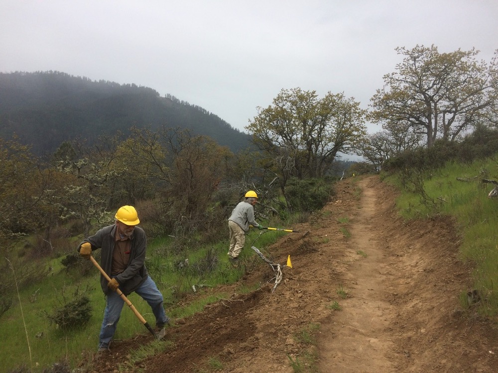
Yet, despite the focus on fuel reduction and community safety, ANN has pushed to make the project much more than your average fuel reduction project. We have been striving to provide benefits to the local community and to advocate for a more holistic and ecological land management approach. The project also proposes new non-motorized trails, the decommissioning of illegal OHV trails, road decommissioning and pollinator/native plant restoration projects.

A field trip for the UAW Project.

Throughout the early stages of the planning process we created significant agreement around the values of conservation, restoration and community fire protection. Working from this place of common ground, partners created a broadly supported and ecologically beneficial project that many in the Applegate Valley could support.

After one and a half years of productive collaboration, and over the objection of many collaborative partners, the Forest Service and BLM suddenly changed the definition of restoration we had been working off of and inserted numerous off-road vehicle trails into the project’s Proposed Action. No longer working from a place of agreement, the agencies badly damaged the collaborative process by infusing the project with conflict and controversy.

The Forest Service and BLM originally proposed new off-road vehicle trails in the Boaz Mountain Roadless Area above McKee Bridge and Beaver Creek.

ANN and many Applegate Valley residents opposed the new OHV trails. We forced the agency to analyze the ecological impact of motorized trail development, and two off-road vehicle trails originally proposed in the Boaz Mountain Roadless Area were canceled. Recently, the Forest Service and BLM published the Upper Applegate Watershed Restoration Project Environmental Assessment (EA), and despite local residents’ opposition, the EA still proposes three new off-road vehicle trails in the Beaver Creek watershed.

Many Applegate Valley community members and ANN supporters attended UAW Planning Meetings.

Many collaborating partners believe the proposed off-road trails are inconsistent with the “Purpose and Need” (the official premise from which the project is planned), as well as project objectives that seek to restore habitat and water quality. We also think that including new OHV trails in the project does not reflect the common ground we had achieved in the first year and a half of planning meetings. Although many of the collaborative partners have supported the UAW Project and its restorative approach to land management, many are also concerned by the inclusion of off-road vehicle trails under the guise of “restoration.” It is a precedent setting action and contradiction that we simply cannot ignore.

The Upper Applegate River running through the Upper Applegate Valley within the UAW planning area.

The UAW Environmental Assessment (EA) defines the need for the project as follows: “The underlying need for the action is to restore ecological and social conditions and processes in the Upper Applegate Watershed to provide for landscape conditions resilient to disturbance and climate change” ( EA p. 4).

The EA describes the Purpose of the UAW Project as follows: “The Purpose of the action is to protect and enhance the important community and agency identified values through the attainment of the following goals:

Water and Aquatic Habitat – Improve watershed conditions and reduce road-related impacts to natural resources.

Terrestrial Biodiversity – Improve ecosystem resilience and function at the landscape scale in order to sustain healthy forests and watersheds for future generations.

Community and Culture – Provide protection to communities at risk from wildland fire, provide for sustainable recreation opportunities, and to improve community involvement for stewardship of the land to foster a respect for ecosystems and the processes that maintain them.”

Instead of providing restorative or fuel reduction benefits, new off-road trails will discourage attainment of the Purpose and Need of the UAW Project by creating additional ecological impacts. For example, the proposed Hanley Gulch OHV Trail will traverse a Riparian Reserve on a previously decommissioned road bed, degrading, rather than restoring or even maintaining water quality and aquatic habitat.

The rare Gentner’s fritillary (Fritillaria gentneri).

The proposed Cinnabar Lookout Trail would provide off-road vehicles access to the Beaver Creek-Little Applegate River divide by building new OHV trails through a Fritillaria Management Area, designated to protect the endangered and highly esteemed Gentner’s fritillary (Fritillaria gentneri) and it’s habitat.

New off-road vehicle trails will degrade connectivity and biodiversity values by spreading noxious weeds, damaging native plant habitats, and disturbing wildlife. Many other ecological values will be affected, including impacts to streams and riparian areas, increased soil erosion, and sedimentation. Nearby communities will also be impacted by increased engine noise in previously quiet forests near their homes. Increased off-road vehicle use will also introduce a new wildfire ignition source in the form of hot motorcycle mufflers in dry, summer conditions near Applegate residences.

The inclusion of off-road vehicle trails is controversial, counterproductive and undermines public support for restoration and the UAW Project. New OHV trails are a damaging distraction and create conflict when so much common ground has been found.  The inclusion of OHV trails in a restoration project tarnishes authentic efforts to restore native ecosystems.

The Little Greyback Roadless Area and the mountains of the Upper Applegate watershed.

The UAW Project should be focusing on fire safety, forest restoration, the restoration of aquatic habitats and the maintenance of biodiversity as the Purpose and Need requires.

Please consider commenting on this important project. Comments are being accepted until December 20, 2018. Consider signing our form letter, amend the form letter to reflect your specific concerns, or better yet, create a your own public comment identifying your concerns and perspectives in your own voice. The agencies need to hear from you that off-road vehicle trails should not be included in a habitat restoration project.

Click Here to Sign or Amend a Form Letter

  Check out the following suggested talking points and ideas that can help with the public comment process.
  • Focus the project on common ground built during the planning process such as prescribed fire, tree plantation thinning, and fuel reduction around homes and communities.
  • Support native plant and pollinator restoration projects proposed in the UAW Project.
  • The agencies should analyze off-road vehicle use through the appropriate planning process. Analysis in the UAW EA does not adequately account for cumulative ecological impacts. The BLM is required to inventory all off-road vehicle trails and conduct Travel Management Planning across the region by 2021. They should defer off-road vehicle designations until that process is completed. The Forest Service should conduct regular reviews of their Motor Vehicle Use Map (MVUM), making decisions regarding off-road vehicle use through the appropriate public process.
  • Cancel all motorized/off-road vehicle trails currently proposed in the UAW EA. The proposed motorized trails will degrade habitat rather than restore or improve habitat and they are inconsistent with the Purpose and Need of the UAW Project.
  • Close existing unauthorized off-road vehicle trails and decommission unnecessary roads identified in the UAW EA.
  • Support the Tallowbox Trail (non-motorized) on BLM land. Currently the BLM have turned portions of the proposed non-motorized trail into an off-road vehicle route without adequate NEPA documentation or review. Ask the BLM to designate the entire Tallowbox Trail, as originally proposed, including those portions below Tallowbox Mountain as a non-motorized trail. (This will turn the old, decommissioned road on Tallowbox Mountain into a non-motorized hiking trail).
  • Support other non-motorized trails, including the Applegate Ditch Trail extending between Palmer Creek Road and the Applegate Dam, and the Brushy Gulch Ditch Trail below the Applegate Dam.
Send Comments to District Ranger Donna Mickley electronically at:

comments-pacificnorthwest-rogueriver-siskiyoumountains@fs.fed.us

or through mail to:

Siskiyou Mountains Ranger District

Attn: Upper Applegate Watershed Restoration Project,

6941 Upper Applegate Road, Jacksonville, Oregon, 97530.

Citizens in the Applegate Valley proposed the Tallowbox Trail on this decommissioned road at the edge of the Burton-Ninemile Lands with Wilderness Characteristics (LWC). The BLM has proposed to turn a large portion of the route into a motorized trail with no public disclosure and inadequate NEPA documentation. Let the BLM know you want the entire proposed Tallowbox Trail designated for non-motorized use.


2018: A Year of Conservation in the Applegate Valley

2018 was a big year for ANN. We started off in January by receiving official 501c3 certification. ANN is now an independent non-profit organization, focused entirely on the protection and restoration of wildlands, old growth forests and intact native habitats in the Applegate Watershed.

We also worked on numerous environmental campaigns in 2018 throughout the Applegate region to protect, defend and restore important natural habitats. Our campaigns extended from the headwaters of the Applegate River in the high country of the Siskiyou Crest, to the mouth of the Applegate River near Wilderville. We achieved considerable success in 2018 and look forward to more in the coming year. Please support conservation in the Applegate Valley with a year-end donation. Below are a few of the highlights from 2018.

The Black Mountain Preserve

Massive old trees were protected by Selberg Institute on the north slope of Black Mountain.

Located high on the slopes of the Siskiyou Crest in the Upper Applegate Watershed, on the heavily forested northern slope of Black Mountain, lies the beautiful Black Mountain Parcel. The Black Mountain Parcel is a 240-acre private parcel of land completely surrounded by the over 20,000-acre Condrey Mountain Roadless Area.  It was previously owned by the Fruit Growers Supply (FGS), an industrial logging company based in Hilt, California in the Colestin Valley.

The parcel contains extensive old-growth forests, one of the only stands of Pacific silver fir in the Siskiyou Mountains, numerous headwater streams, and beautiful wetlands, glades and rock outcrops. It is located at the headwaters of Dutch Creek, one of the wildest watersheds remaining in the Applegate River basin. The parcel maintains intact, wilderness-quality habitat at the heart of the Condrey Mountain Roadless Area and the Siskiyou Crest Connectivity Corridor.

The Black Mountain Parcel has been imminently threatened by logging in the past, and for decades the local conservation community has worked to protect the Black Mountain Parcel by working to secure a conservation buyout. Until this past summer, those efforts had been unsuccessful.

In 2017, the Miller Complex Fire burned through the Black Mountain parcel at low severity, burning beneath the massive old trees, creating habitat, reducing fuel loads and restoring fire to some of the most intact ancient forests in the Applegate River Watershed. Although the fire itself was beneficial, it became an excuse for FGS to clearcut the parcel under an “emergency” fire “salvage” permit.

ANN simply could not let that happen! We joined forces with the Klamath Forest Alliance and the Selberg Institute to secure a conservation buyout of the parcel, protecting its incredible habitat and conservation values for future generations. The Selberg Institute is now the proud owner of the Black Mountain Preserve and folks in the Applegate owe them a huge debit of gratitude for protecting some of our most beautiful old-growth forests in the Siskiyou Crest Connectivity Corridor. ANN was proud to help the Selberg Institute secure this incredible conservation victory for the Siskiyou Crest. May Black Mountain remain wild, forever! Stay tuned for more information about the new Black Mountain Preserve, the Applegate’s newest protected landscape!

Savage Murph Timber Sale

This beautiful stand of old, fire-adapted forest was withdrawn from the Savage Murph Timber Sale due to the monitoring and advocacy of ANN.

The Savage Murph Timber Sale was a portion of the larger Pickett West Timber Sale proposed by the Medford District BLM. In 2017, ANN organized with conservation partners across the region to oppose this egregious, old-growth logging proposal. Thousands of acres of old-growth forest were proposed for logging and local activists and community members throughout southern Oregon organized to cancel large portions of the sale on the Rogue River near Hellgate Canyon and in the mountains above Selma, Oregon.

A small subset of units from Pickett West were located in the mountains of the Applegate Valley, including forests outside Murphy, Wilderville and above North Applegate Road. This was called the Savage Murph Timber Sale — and savage, it would have been, if implemented as originally proposed. ANN successfully opposed numerous new roads and old-growth logging units, reducing the proposed timber sale from 2,229 acres to 192 acres, an 86% reduction in the total sale area. Due to the diligent and effective advocacy of ANN many new roads and old-growth logging units were excluded from the Savage Murph Timber Sale. This drastically reduced project was then approved for logging, but failed to sell at the federal timber auction. To date, no logging has occurred in the Savage Murph Timber Sale, and all of the most concerning proposals have not moved forward.

Post-Fire Logging on the Siskiyou Crest

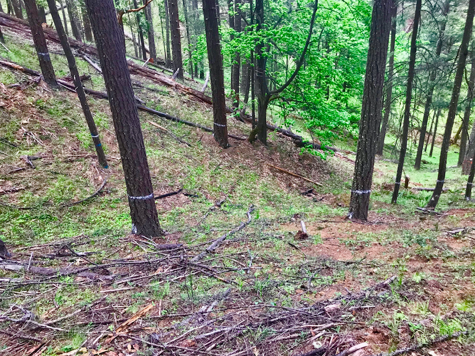
The trees marked blue are proposed for logging to within 50′ of the Pacific Crest Trail near Cook and Green Pass.

The 2017 Miller Complex Fire burned through over 36,000 acres of public land on the Siskiyou Crest, in both the Applegate and Klamath River watersheds. The fire burned in a beneficial mixed-severity fire mosaic through some of the most intact forests and wildlands in the region.

Cook and Green Pass, a high mountain saddle located on the Siskiyou Crest and traversed by the Pacific Crest Trail, is cherished by many local residents for its intact landscapes and natural, scenic qualities. Multiple Botanical Areas are located at Cook and Green Pass, adjacent to the Red Buttes Wilderness, the Condrey Mountain Roadless Area and the Kangaroo Roadless Area.

Cook and Green Pass and the surrounding area burned in the 2017 Miller Complex Fire. The Klamath National Forest responded by proposing a vast, clearcut logging proposal that would reach to nearly the Siskiyou Crest and the Pacific Crest Trail, east of Cook and Green Pass. Although located just outside the Applegate River watershed, ANN saw the proposed project as a threat to the connectivity, beauty and biodiversity of the Siskiyou Crest, so we went into action!

We conducted extensive field monitoring of proposed timber sale units and submitted detailed, site-specific public comments and administrative objections to the project. Although the project was approved, some of our field monitoring and issues identified in our public comment are being utilized by the Environmental Protection and Information Center (EPIC), Klamath Forest Alliance and KS Wild in their lawsuit to stop post-fire logging on the Siskiyou Crest. We will keep you posted on the results of that lawsuit.

Upper Applegate Watershed Restoration Project (UAW)

A view east from near the summit of Boaz Mountain and up Beaver Creek to Dutchman’s Peak. The Forest Service proposed to build new motorcycle trails through this beautiful clearing and across the Boaz Mountain Roadless Area. Due to pressure from ANN and local community members this OHV trail was canceled. 

For the last three years ANN has worked collaboratively with the Forest Service, the BLM and other interested stakeholders on the Upper Applegate Watershed Restoration Project (UAW). Although ANN has worked in a collaborative capacity on this project, we have also opposed some facets of the project and hope to see it move forward with an emphasis on truly restorative actions.

Most of the project will be beneficial, reducing fuel loads near local communities, while also restoring important habitats and ecological processes in the Upper Applegate Valley on both BLM and Forest Service land. ANN has been instrumental in ensuring this project provides both social and ecological benefits to the Applegate Valley. In that capacity we have supported numerous prescribed burning projects, plantation thinning, fuel reduction projects, pollinator and native plant restoration projects, some judicious commercial logging units with ecological sidebars and new non-motorized trails along old mine ditches and roads.

We have also opposed proposals to include new motorcycle trails in the Boaz Mountain Roadless Area and the Beaver Creek watershed. ANN and many in the local community have strongly opposed new motorized trail development in the UAW Project. Due to our efforts the motorized trail proposed through the Boaz Mountain Roadless Area has been canceled, but a few motorized trails remain in the project proposal. ANN will continue to oppose motorcycle trail creation in the UAW project and advocate for work that can truly be called habitat restoration and will have beneficial ecological outcomes.

ANN and our community supporters have continually attended public meetings and field trips advocating for conservation, restoration, and community values. Thank you to everyone in the Applegate Valley who has participated in this process. We have made a big difference!

The Environmental Assessment for the UAW Project will be coming out soon. Please join ANN in our opposition to new motorized motorcycle trails in the Applegate Valley and help us support those portions of the project that will benefit our forests, encourage biodiversity and maintain a high quality of life in the Applegate.

Our continuing programs

Wellington Wildlands west of Ruch, Oregon in the Applegate foothills.

ANN has been focusing on specific land management projects throughout the watershed, while continuing our ongoing programs that include our Timber Sale Monitoring Program, Off-Road Vehicle Monitoring Program and Wildland Protection Program.

Through our Wildland Protection Program, we worked with Applegate Valley neighbors and residents, Greeley Wells and Ed Keller, to help produce their new film, Saving Wellington. The film explores the Wellington Wildlands, west of Ruch, Oregon and highlights the beauty of the area, the threats to its ecology, and the community effort to protect it in perpetuity. Both ANN and Applegate Trails Association worked on this project. ANN hosted the premiere film showing of Saving Wellington this fall at Red Lily Vineyards in the Applegate Valley. We will also be hosting a film showing on Dec. 14 in Ashland.

Thanks to Greeley and Ed for their efforts, expertise and artistry in creating this beautiful film. We will release Saving Wellington online next spring, but for now come on out to one of our film showings and enjoy the beauty of the Wellington Wildlands on the big screen!

Looking forward to 2019

ANN looks forward to a productive year in 2019. We will continue attending many, many meetings with agencies and conservation partners, hosting events, leading hikes, walking hundreds of rugged off-trail miles for on-the-ground monitoring and field work, participating in community conservation efforts, and leading environmental action in the Applegate. Please consider making a year-end donation to ANN. Your support will help us continue our conservation efforts in the Applegate Valley. What is a wild Applegate worth to you? Support conservation in the Applegate!

https://ann.secure.force.com/donate/