Would you be concerned if your favorite backcountry trail was proposed as a 1000′ wide fuel break without adequate public involvement or environmental review? Do you think intact roadless areas, botanical areas and Forest Service recreation areas should be turned into “fuel breaks” far from homes and communities, even if they do not represent fire risks? That is exactly what is being proposed by the Rogue River-Siskiyou National Forest along the spectacular McDonald Peak and Wagner Butte Trails, the Elliott Ridge/Stein Butte Trail, and the Sevenmile Ridge Trail near Big Red Mountain.
The agency has released a Scoping Notice for the Siskiyou Mountains Ranger District Fuel Break Project which would build many miles of fuel breaks across the Applegate River watershed, on the face of some of the Siskiyou Crest’s highest peaks, and in some of the region’s most intact habitats. Proposed to take place up to 500′ on both sides of roads and backcountry trails, the fuel breaks would affect a wide variety of ecosystems from high to low elevations.
What the scoping notice does not do is describe what will be done in these sites and along these popular and well-loved recreational trails. How would these diverse ecosystems be “treated”? We simply do not know, and based on the information currently available, the Forest Service intends to approve these projects using Categorical Exclusions, meaning they will be largely excluding the public involvement process and the necessary environmental and scientific reviews, in some of the most botanically diverse places in the region.
Although these so-called treatments would include only non-commercial thinning, they would still have significant impacts to these intact ecosystems, especially in mid to low elevations in chaparral, montane chaparral, live oak woodland, oak woodland and mixed hardwood habitats. Plant communities at high elevations would also be impacted, including unique sagebrush clearings and aspen groves, ancient mountain mahogany groves, serpentine influenced Jeffrey pine woodlands, and montane snow forests, including mountain hemlock and red fir at up to over 6,800′ elevation on the face of McDonald Peak, and over 6,400′ at Wrangle Gap and around Wrangle Camp.
What little we know about the project, is that four large fuel breaks are proposed sprawling across many, many miles of National Forest land and consisting of up to 4,290 acres of public land.
This includes fuel breaks:
- Along Elliott Ridge and Yellowjacket Ridge from Silver Fork Gap to the Applegate Reservoir, including the Elliott Ridge/Stein Butte Trail;
- In the Wagner Butte/McDonald Peak area along the entire McDonald Peak Trail and the upper half of the Wagner Butte Trail;
- On Sevenmile Ridge along the Sevenmile Ridge Trail and adjacent to Big Red Mountain;
- From O’Brien Creek to Palmer Ridge in the upper portions of Carberry Creek and the Upper Applegate.
What we also know is that these proposed fuel breaks would be located on the Siskiyou Crest, and in surrounding areas far from homes or communities. They are not being proposed where they could most effectively protect communities. Yet, they are proposed in some of the most cherished recreational areas on the Siskiyou Mountains Ranger District, in some of the most intact lands, some of the most diverse plant communities, and in some of the district’s most scenic landscapes.
Below is the little we know about each individual fuel break proposed in the Siskiyou Mountains Ranger District Fuel Break Project:
Wagner Butte/McDonald Peak Fuel Break
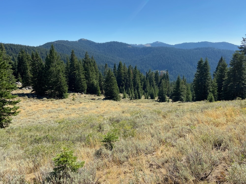
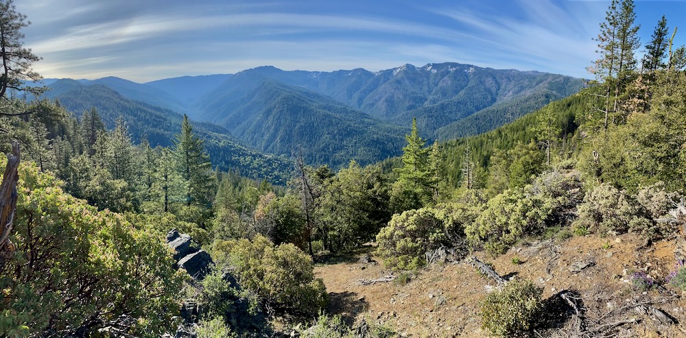
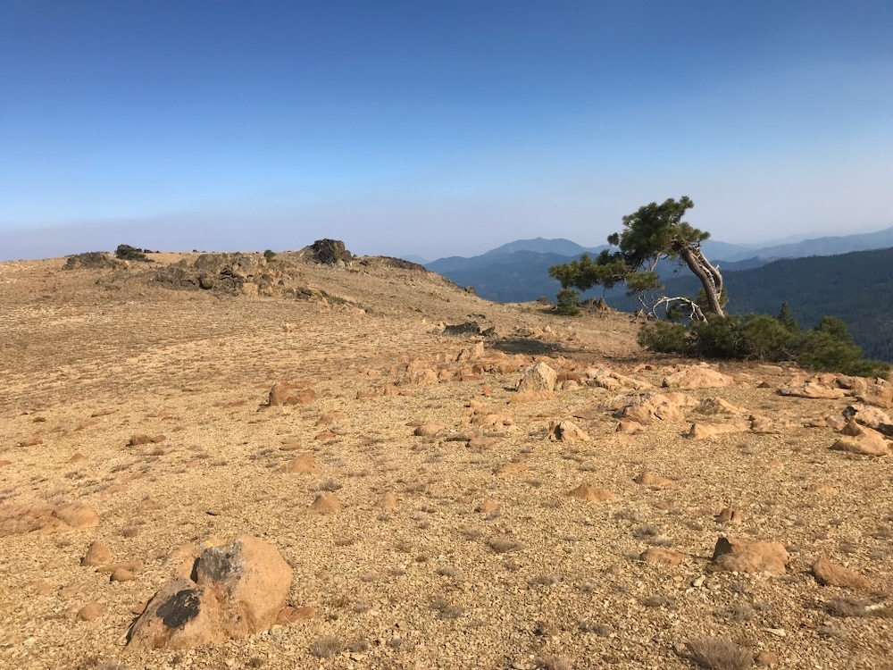
The Forest Service has proposed turning the southern slopes adjacent to the McDonald Peak Trail into a 500′ wide fuel break for the entire length of the trail, from south of McDonald Peak to the Wagner Butte Trail. This portion of the trail extends through high elevation sagebrush clearings, montane chaparral, and montane conifer forest between 6,400′ and 6800′ elevation. This includes habitats at the headwaters of McDonald Creek, Split Rock Creek, Jim Creek, Corral Creek and Greeley Creek.
We are concerned that chaparral clearing in proposed fuel breaks would damage the area’s unique ecosystem and the protected plant communities in the McDonald Peak Botanical Area, an area specifically designated to protect the area’s unique botanical resources and rare plant species. It will also impact recreational values in a large Special Interest Area intended specifically to protect the scenic values of the Siskiyou Crest.
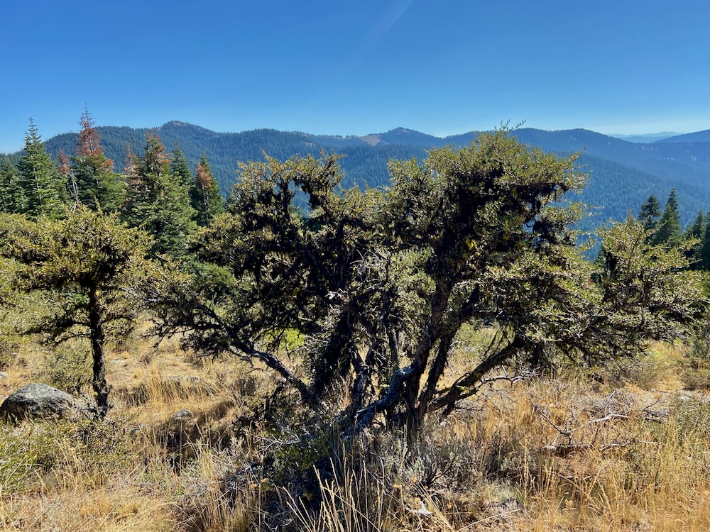
The proposal also includes a swath 500′ wide on both sides of the upper Wagner Butte Trail from Wagner Glade Gap to near the summit of Wagner Butte. This section contains unique plant communities with a significant “east side” or Great Basin influence in the Siskiyou Crest Special Interest Area. The area was also a candidate Botanical Area due to the usual east side plant communities, biodiversity and rare plant species.
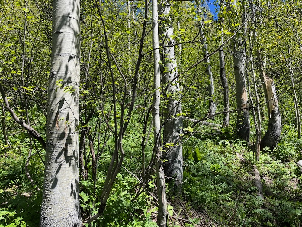
Plant communities affected would include the trail’s charismatic mountain mahogany groves, sagebrush clearings, quaking aspen groves and montane snow forests of mountain hemlock and red fir. These plant communities are the highest elevation subalpine habitats in the Siskiyou Mountains and are not well adapted to frequent fire or manual fuel treatments. Instead, these habitats are adapted to a mixed severity fire mosaic and continue to maintain very healthy, diverse and dynamic ecosystems with relatively low fire risks and abundant fire refugia. These areas do not need and will not benefit from fuel reduction treatments.
The entire length of this proposed fuel break is also located in the McDonald Peak Inventoried Roadless Area, an approximately 10,000 acre wildland at the headwaters of Ashland Creek and the Little Applegate River. This large intact area is important for habitat connectivity, contains many rare plant populations and unique plant communities, and includes some of the most beautiful and accessible high country in the Siskiyou Crest region.
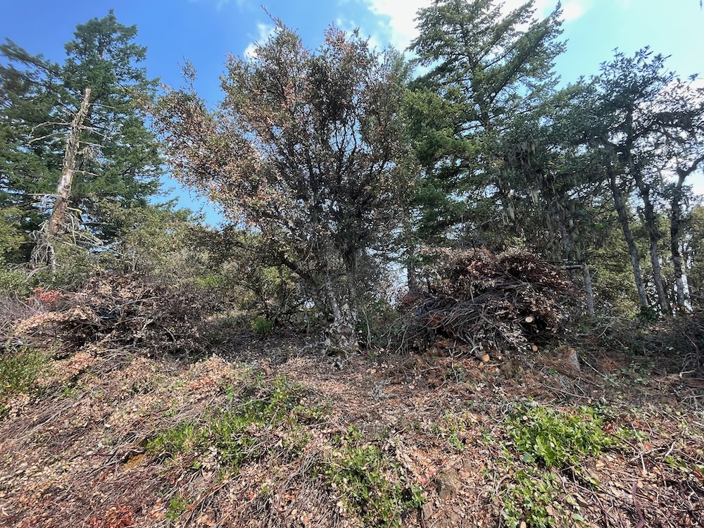
Together these two trails are among the most popular and well-loved in the region, yet the proposed fuel break would significantly impact the area’s wild, natural setting, intact scenic value and recreational qualities, while degrading unique plant communities and introducing disturbance adapted non-native plant species. It will also degrade the area by surrounding the trail in plastic covered burn piles, sterilizing the soil and destroying vegetation as the piles are burned, leaving black charcoal pits that take years to revegetate, and leaving fragments of black plastic from burn piles scattered throughout the trail corridor. This is an unfortunate, yet common site along trails in the Applegate watershed, where plastic remnants from burn piles are frequently left as garbage after “fuels treatments.”
The McDonald Peak and Wagner Butte areas have been designated specifically to promote scenic, recreational, botanical and biological values, and to many local residents they are cherished backcountry trails. They should not be managed as fuel breaks that degrade the natural habitats and scenic qualities people from across the region come to enjoy, and the agency’s Land and Resource Management Plan specifically tells the Forest Service to protect.
The McDonald Peak/Wagner Butte Fuel Break should be canceled and a more effective approach implemented that focuses directly on protecting communities, public safety and infrastructure from wildfire impacts. These efforts should be located near homes, rather than remote, high elevation, backcountry habitats far removed from the values at risk.
Elliott Ridge & Yellowjacket Ridge Fuel Break
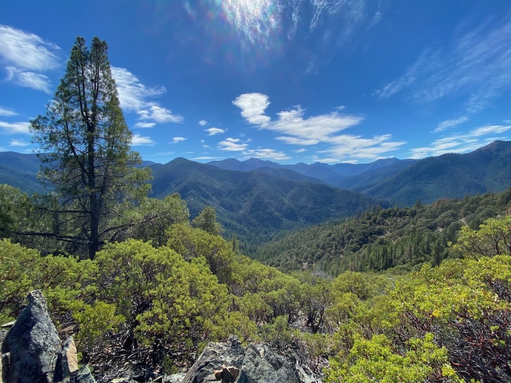
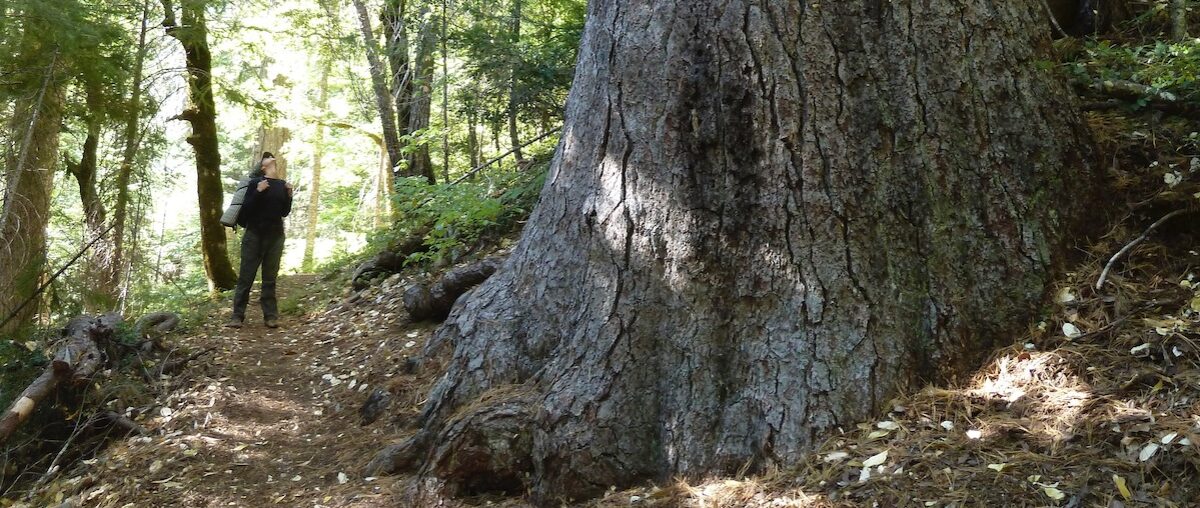
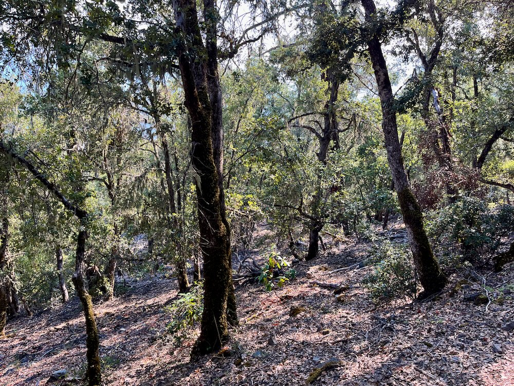
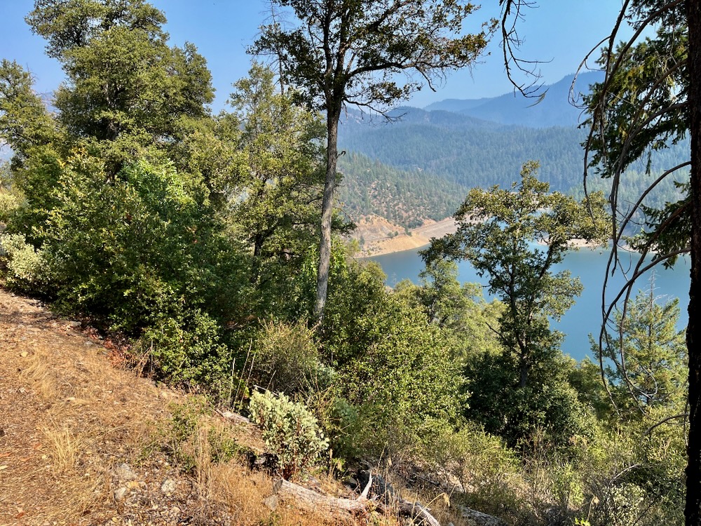
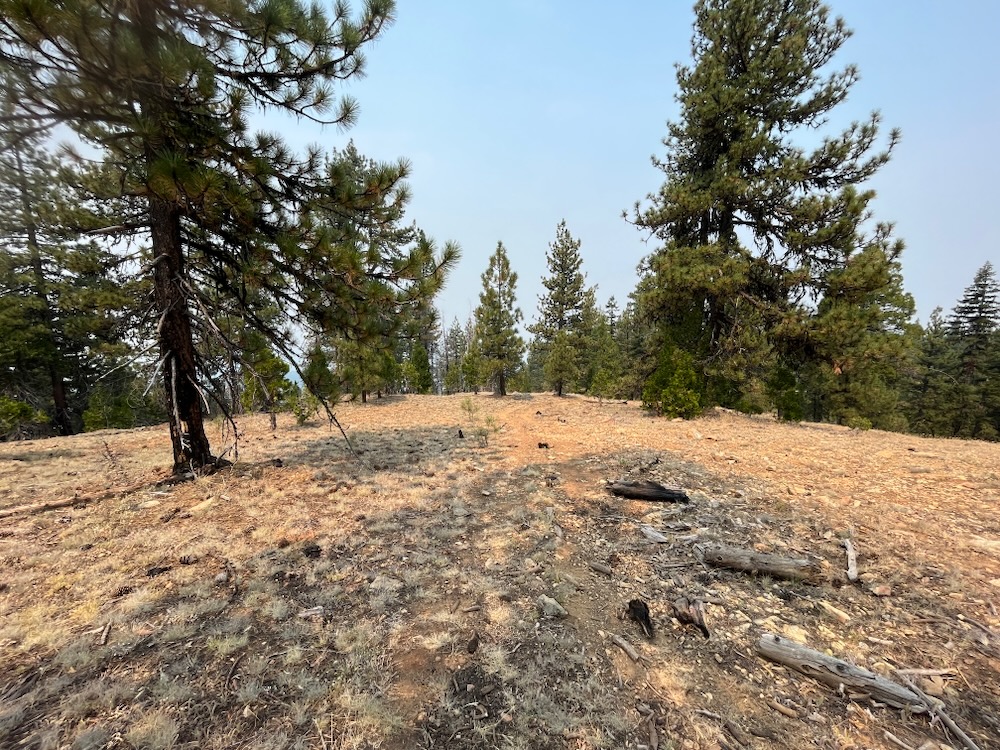
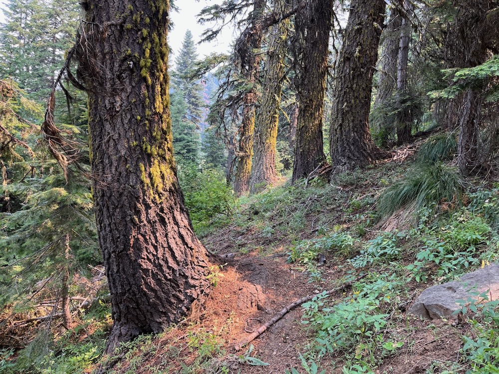
Elliott Ridge is a long east-west spur ridge dividing the Elliott Creek and Teel Creek watersheds, and an extremely popular backcountry recreation area, accessible by the Elliott Ridge/ Stein Butte Trail system. Starting at Seattle Bar and extending for many miles through the citizen identified Elliott Ridge Roadless Area, the Elliott Ridge/Stein Butte Trail is among the most popular recreational trails in the Siskiyou Mountains Ranger District.
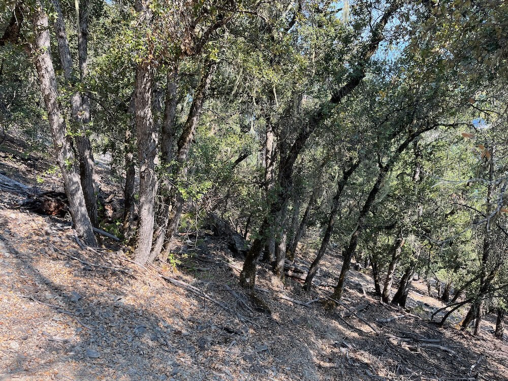
Generally accessible year-round, the trail climbs steeply up switchbacks above Seattle Bar at the south end of Applegate Reservoir through relatively open mixed conifer forest to the rocky spine of Elliott Ridge. The trail alternates back and forth from the forested north-facing slopes of Elliott Ridge to the rocky, sunbaked southern face covered in montane chaparral, stump sprouting hardwoods, live oak woodland, patches of mixed conifer forest and large stands of knobcone pine. The area is highly scenic, largely intact, and well-loved by local residents.
Due to the location of the trail, its steep switchbacks and its movement back and forth from the north to south facing slopes, it makes for a very ineffective and unsafe fireline, that in reality would never be used for fire containment. Fire managers simply would not place firefighting hand crews on fire containment lines with switchbacks or that alternate across the ridgeline. Thus, the ability of this fuel break to serve its intended purpose and act as a fire containment feature in future wildfires is both unrealistic and highly unlikely. From a practical standpoint, this fuel break provides almost no effective use.
Ironically, it also supports numerous plant communities adapted to mixed and even high severity fire that respond poorly to manual fuel reduction and “restoration” treatments. These are not plant communities adapted to frequent low severity fire and open grown vegetative conditions. In fact, rather than restoring habitat conditions through manual treatments, the opening of these habitats for fuel reduction has been shown to damage natural vegetative structure, increase non-native grasses and noxious weeds, impact wildlife habitats and have generally non-restorative effects. At the same time, damaging these plant communities will significantly impact the intact character of the land, its scenic qualities, and important recreational values.
This proposal would turn the entire Elliott Ridge Trail and 500′ on either side into a fuel break for approximately 7 miles from Seattle Bar, past Stein Butte and east to the headwaters of Mallard Gulch. Yet, the proposal does not end there, it would continue for 500′ along both sides of the road along Elliott Ridge, traversing the south slope of Elliott Ridge, then switching back to the northern face before winding back to Maple Dell Gap. From Maple Dell Gap the fuel break would continue an additional 3 miles along the southern face of Yellowjacket Ridge transitioning into montane conifer forests, serpentine influenced slopes below Yellowjacket Mountain, and ending up at Silver Fork Gap.
We believe the Elliott Ridge Trail section is an ineffective fuel break, would badly impact chaparral and woodland habitat along the trail, degrading the recreational experience for generations to come, and increasing fire risks when tree form live oak resprout into thickets and highly flammable non-native grasses invade previous chaparral and woodland sites. The Elliott Ridge Trail section of the fuel break should be canceled, and as one of the area’s most popular recreational trails, we hope the Forest Service can maintain the irreplaceable biological, scenic, and recreational qualities of the Elliott Ridge Trail.
Sevenmile Ridge Fuel Break
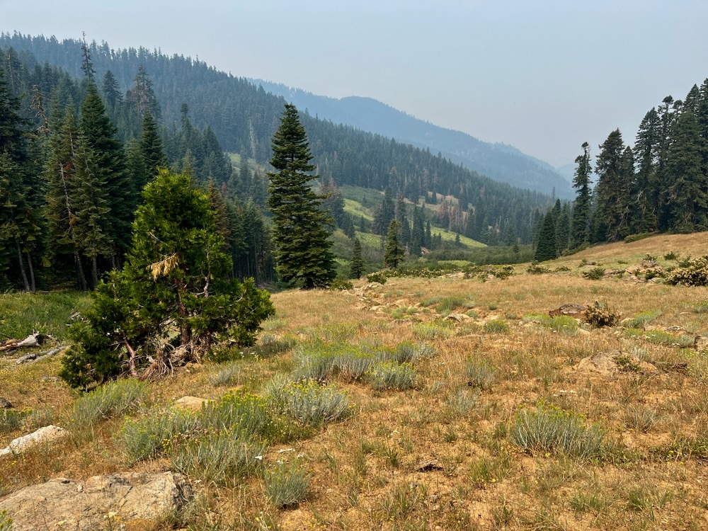
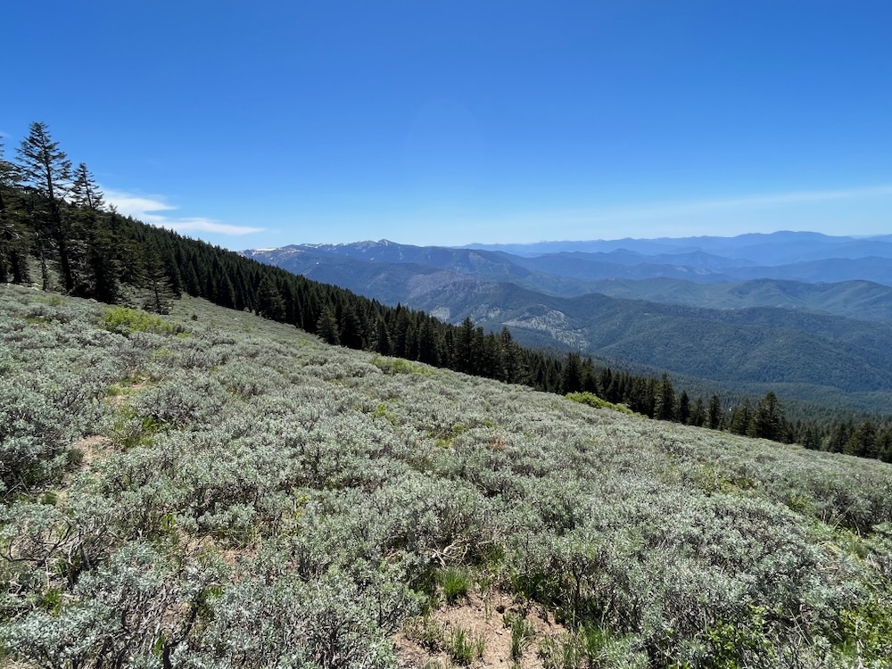
The proposed Sevenmile Ridge Fuel Break would start along the Little Applegate River, wind into Glade Creek, and climb Sevenmile Ridge to the western flank of Big Red Mountain on the old Sevenmile Ridge Trail. The proposed fuel break then switches back past Wrangle Camp to Wrangle Gap at over 6,400′ elevation on the Siskiyou Crest.
The proposal extends through mixed conifer forests and hardwood stands at mid-elevations and through high elevations and montane forest habitats, including large areas of moist meadow, high elevation bunchgrass clearings, alder glades, serpentine barrens, picturesque Jeffrey pine woodlands, and other highly fire resistant habitats near Wrangle Camp, on the western flank of Big Red Mountain.
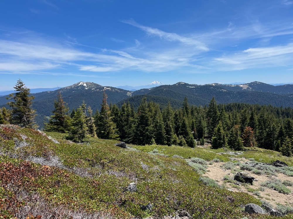
Big Red Mountain is a broad red mound of serpentine rock and supports naturally sparse montane vegetation. Covered in snow much of the year, the area sprawls across the headwaters of Glade Creek and the Little Applegate River. Already an effective natural fuel break, these habitats and the fire refugia they create cover a large area, and have refused to burn in the 1987 Quartz Fire, the 2001 Quartz Fire and the 2018 Hendrix Fire. Each fire burned on the slopes below, but was naturally “contained” in the sparse vegetation and broad, rocky slopes extending down the flanks of Big Red Mountain. The mountain is already both a natural and highly effective fuel break.
It is also a spectacular biological wonder, known for its unique serpentine geology, unusual serpentine plant communities, rare plant species, and highly scenic natural habitats. Big Red Mountain has been designated as a large Research Natural Area in the Monogram Lakes Basin, a Botanical Area, and a Special Interest Area. These areas are intended to protect the biological values, intact natural environments, unique plant communities, and recreational values of the region.
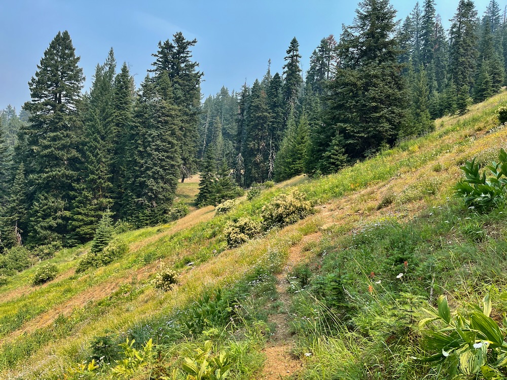
The proposal includes a 500′ fuel break on either side of the Sevenmile Ridge Trail (1,000′ total), despite large portions of the trail having very little fire risk. Much of the upper trail is proposed to run through large bunchgrass clearings, wet meadows, seeps, springs, headwater streams and moist alder glades. Additional portions extend through beautiful, fire resilient old-growth forests, montane forest, and relatively open spaced Jeffrey pine woodland. The trail and proposed fuel break would also extend through both snag forests burned at high severity and forests underburned in the 2001 Quartz Fire and the 2018 Hendrix Fire. Neither of these areas currently support significant fire risks or are heavily altered environments in need of restoration.
We believe significant trail maintenance alone this long unmaintained trail would suffice as a fuel break along the Sevenmile Ridge Trail. This would provide as much of a fuel break as the typical handline used to suppress wildfires. Given the fire refugia and minimal fire risks on this section of trail, it would be a potentially successful and appropriate treatment for the area, while enhancing public access to the important scenic, recreational and biological values of the Sevenmile Ridge Trail.
The lower portions of the proposed fuel break would follow road systems on lower Sevenmile Ridge down to the Little Applegate River near Brickpile Ranch. These portions include both plantation stands and mature, relatively open pine, fir and cedar forests growing on serpentine influenced soils. These areas have already largely been “treated” with non-commercial fuel reduction thinning and also maintain fairly minimal fire risks. In the years since the initial treatment, shrubs and regenerating trees have recolonized the understory and could be burned in a patchy prescribed fire intended to reduce, but not eliminate this young vegetation. This would create a mosaic of vegetation, would reduce the flammable fuels in the forest floor, regenerate native herbaceous vegetation and restore fire as a long suppressed natural process in these forests.
The lower section of Sevenmile Ridge could benefit from some strategic maintenance burning and manual thinning around the private inholding at Brickpile Ranch. These areas have been logged, leaving dense patches of skinny young trees, scattered old trees and large, open spaces filled with stumps from previous commercial logging operations and dense shrub species. These areas have not burned in recent history, and having been both heavily logged and lie adjacent to the private land inholding at Brickpile Ranch, they would be a far more appropriate location for fuel reduction than the intact lands above on the Sevenmile Ridge Trail.
We recommend trail maintenance on the Sevenmile Ridge Trail and judicious, non-commercial thinning in the lower sections of Sevenmile Ridge where heavy historic logging and unnatural habitat conditions surround the residence at Brickpile Ranch.
Grayback Fuel Break
The proposed Grayback Fuel Break would start at the O’Brien Creek Trailhead on O’Brien Creek Road and extend downstream along road 1005 to its intersection with Carberry Creek Road. The proposed fuel break would then drop into Carberry Creek and climb back up road 1010 to Youngs Gap, a low saddle between Carberry Creek and Brush Creek near Steamboat Mountain. The fuel break would then again drop back into Trail Creek and extend along the Brush Creek canyon before again climbing to the ridgeline dividing Thompson Creek from the Upper Applegate.
Winding along backcountry roads, this fuel break does not follow natural, containment features that would be utilized as fireline during future wildfire events. Instead, this proposed fuel break would be ineffective and dangerous from a fire suppression standpoint, being both unsafe for fire crews and difficult to hold as fireline. In reality, no fire manager would use this fuel break as a fireline, although some portions of it could be utilized in smaller fire events.
The area contains montane conifer forests and intact mixed conifer forests on O’Brien Creek in the Kangaroo Inventoried Roadless Area, low elevation conifer forests on Brush Creek, large knobcone pine stands, live oak woodlands, mixed hardwood stands and unique chaparral communities.
The manual thinning treatments proposed would badly damage the non-forest plant communities found near Youngs Gap, in the Brush Creek watershed, and on the ridgeline divide. Like in some many other locations these plant communities are naturally dense and support a mixed severity fire regime with a significant high severity fire component. Treating these communities to open habitats for fuel break construction will degrade these naturally resilient plant communities.
Additionally, large portions of the proposal are located in Riparian Reserves along O’Brien Creek, Trail Creek and Brush Creek in locations where fire danger is already relatively low compared to the surrounding terrain.
We recommend altering this proposed fuel break to eliminate the extensive riparian reserve thinning and either exclude areas of chaparral, hardwood groves and live oak stands or treat them to maintain canopy cover and reduce stump sprouting by minimizing tree removal. In many locations, previous fuel reduction treatments on the Siskiyou Mountains Ranger District have increased fire risks, reduced scenic values, and damaged important habitats in these ecosystems. We hope the agency will not repeat these mistakes.
Conclusion:
At Applegate Siskiyou Alliance, we question the strategy and effectiveness of backcountry fuel breaks, when unprepared communities are burning to the ground. We also question the utility of fuel reduction treatments in high elevation fire refugia, areas with low fire risks, far from communities, and in some of our last intact environments. Fuel reduction and community fire safety efforts should be focused on homes, communities and critical infrastructure. This project fails to address the critical concerns surrounding home ignition and community wildfire safety during fire events. Fiddling in the backcountry while our communities burn is unacceptable, and a more effective, nuanced, appropriate approach should be taken on the Rogue River Siskiyou National Forest.
We are concerned that the Forest Service is proposing this massive, fuel break project in extremely intact areas and conservation/recreation based land use allocations on the Siskiyou Crest. We are also concerned that the agency is “scoping” all these projects at once and will not be doing either a full public involvement process or environmental analysis to analyze our concerns, disclose potential impacts and consider the potential environmental effects. This means that treatments implemented in some of the most cherished wildland habitats and most popular backcountry trails would be done with less analysis and less public involvement than regular federal land projects.
The Forest Service is also considering the declaration of a wildfire emergency in the Siskiyou Mountains Ranger District, despite currently having no large wildfires and only two large wildland fires in the last 22 years (2017 Abney Complex and 2001 Quartz Fire. This “emergency declaration” would serve to eliminate administrative remedies, shield the project from regular legal processes and expedite the project’s implementation, while minimizing public involvement. We do not believe this approach is honest, acceptable, or collaborative and should be withdrawn from further consideration.
Please comment on this project (by October 9, 2023) at the following link, where maps and the limited information available can be reviewed: https://www.fs.usda.gov/project/?project=63141&exp=overview
Talking Points for Public Comment
- The Wagner Fuel Break along McDonald Peak and the Wagner Butte Trail should be canceled.
- The trail sections of the proposed Sevenmile Ridge Fuel Break should be canceled and trail maintenance implemented instead.
- The western portions of the proposed Elliott Ridge Fuel Break on the Elliott Ridge/ Stein Butte Trails should be canceled.
- The agency must fully analyzed and disclose the impact of proposed project activities on Inventoried Roadless Areas, Botanical Areas, Special Interest Areas, wildlife habitat, native plant communities, wildland habitats, connectivity, rare plant species and other issues of concern in an Environmental Assessment.
- Declaring a wildfire emergency to eliminate public involvement, environmental analysis and legal processes is unacceptable and creates incentives for the Forest Service to circumvent normal legal and administrative processes.
- A Categorical Exclusion would not allow for sufficient public involvement, does not adequately address the broad range of potential impacts, the importance of the lands proposed for treatment, or the consistency of proposed project activities with the regulations and land use allocations in existing management plans. At a minimum an Environmental Assessment should be prepared individually for each proposed fuel break.
- The use of emergency declarations and Categorical Exclusions for this project is inconsistent with the mandates of the Applegate Adaptive Management Area (AMA) which promotes and encourages community based collaboration and robust public involvement. The approach taken on this project is inconsistent with the mandates of the Applegate AMA and should be restructured to maximize, not minimize public involvement.
- Chaparral, oak woodland, live oak woodland and madrone stands must be protected from project activities that are not restorative and either increase non-native grasses and/or increase understory fuels through excessive stump sprouting. This requires maintaining hardwood canopies and retaining large, dense patches of contiguous chaparral.
- The Forest Service should be conducting fuel reduction near homes and communities where it is both needed and effective, not in remote backcountry habitats.