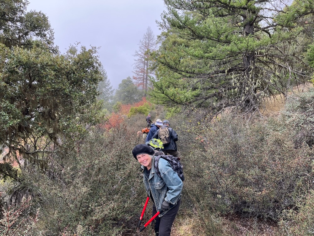
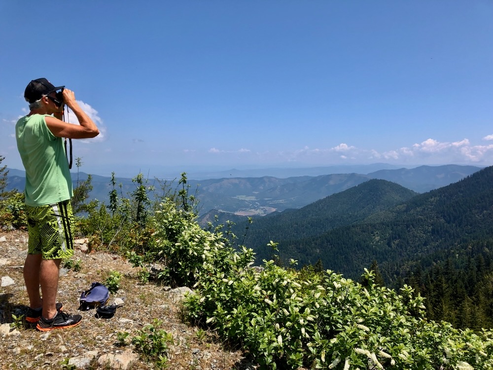
Applegate Siskiyou Alliance worked this past winter with volunteer crews and funding from the Ashland Food Co-op Community Grant Program to build the Tallowbox Trail. We recently opened the trail to the public with a grand opening ceremony, a hike on the trail, and a side trip to the summit of Tallowbox Mountain.
Applegate Siskiyou Alliance is excited to open this new trail in the BLM’s Burton-Ninemile Lands with Wilderness Characteristics (LWC) and is grateful to all the volunteers who helped build the trail—we had one hell of a buckbrush clearing crew! We are also grateful to John MacKenzie for building the beautiful wooden Tallowbox Trail signs, the Ashland Food Co-op for additional funding, and Josh Weber from Green Path Landworks for helping with more technical sections of trail construction. It was a great community effort, is now a great community asset, and provides the Applegate with yet another beautiful hiking trail to enjoy the region’s spectacular beauty.
Below is a detailed trail description followed by detailed directions to both the lower Ladybug Gulch Trailhead along Star Gulch Road and the upper Tallowbox Trailhead above Cantrall Buckley Park.
The trail can be hiked from top to bottom as a relatively strenuous 4.2 mile hike (one way) and over 2000′ elevation gain. As a shuttle from trailhead to trailhead, or in smaller chunks from either the (lower) Ladybug Gulch or (upper) Tallowbox Trailheads.
Tallowbox Trail
The Tallowbox Trail is the Applegate Valley’s newest backcountry trail and a beautiful hike through forests, woodlands, grasslands, and thickets of chaparral, with commanding views across the Siskiyou Crest and the Upper Applegate River watershed.
The trail begins along Star Gulch deep in a forested canyon. A small cascade tumbles over bedrock in vine maple thickets along Star Gulch, while the trail starts up across the road on Ladybug Gulch. Pass the wooden Tallowbox Trail sign and hike onto an old road built historically to access the old Tallowbox Mountain fire lookout (burned by vandals in 2007 and never replaced). Today, this old road has been decommissioned and re-contoured by the BLM to reduce sedimentation and hydrological impacts on the stream, and to the fisheries of Star Gulch. Most recently, the old road has been converted into a non-motorized hiking trail by Applegate Siskiyou Alliance and now serves as the beginning of the Tallowbox Trail.
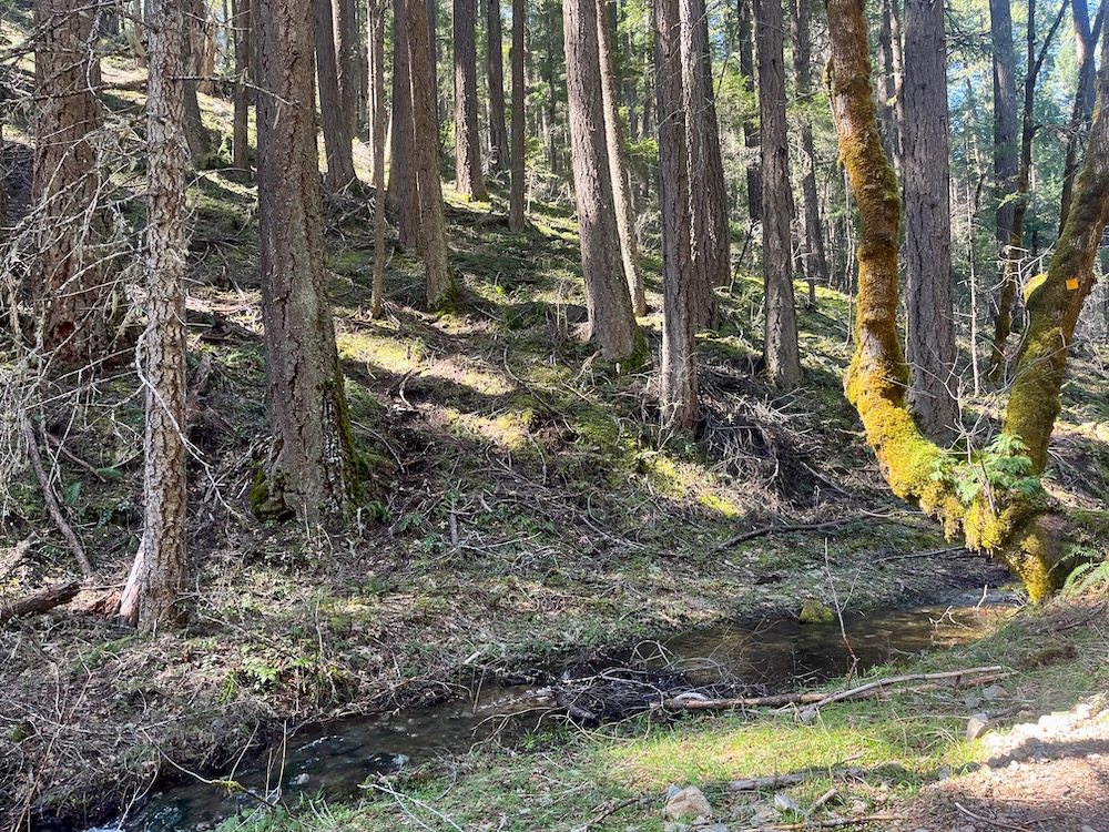
Ladybug Gulch is a beautiful seasonal stream surrounded in mature Douglas fir forest, stately canyon live oak, bright orange madrone, and a riparian area lined in alder, maple, and beaked hazel. The trail winds up this pleasant, shaded stream on a gentle grade, making a leisurely hike through wonderful mixed conifer forests. The trail crosses the small stream twice (just a step over the creek) and continues upstream to a final crossing where it then winds around a motor vehicle closure and onto an old road a little less than a mile from the trailhead. Follow the brown carsonite TRAIL signs up the old roadbed and into the upper Ladybug Gulch canyon through forested habitat with a few scattered openings of oak and chaparral.
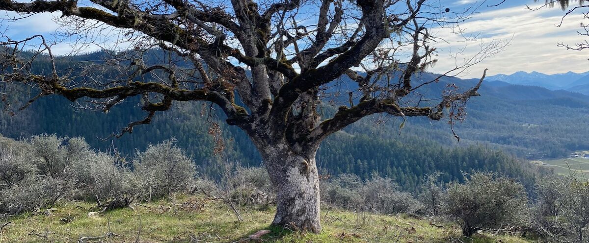
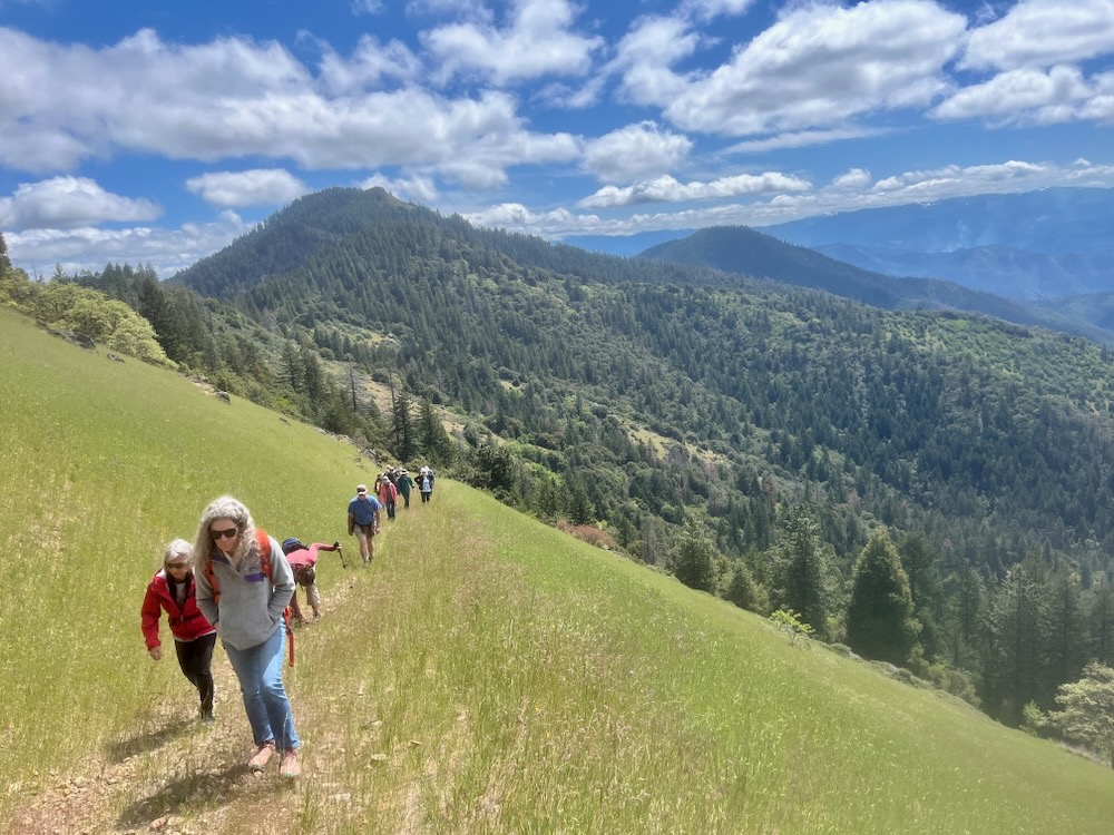
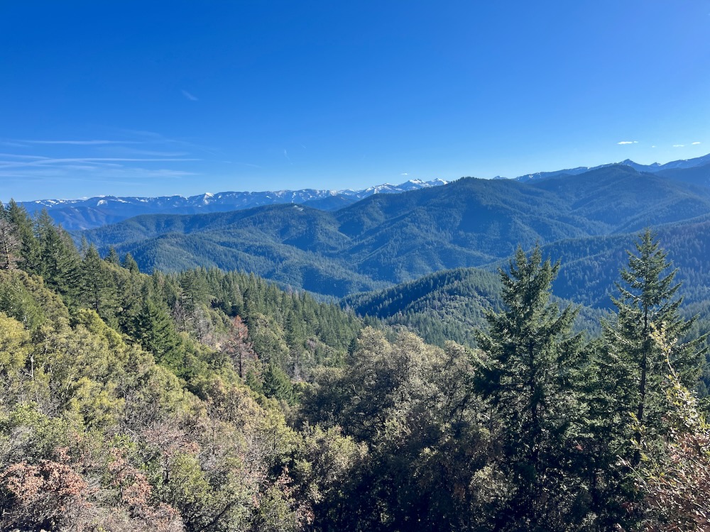
Reaching a major saddle and road intersection, follow brown carsonite TRAIL signs to the right. As you climb the view broadens, the soils become more rocky, and the forest slowly gives way to live oak and madrone woodland. At about 2.5 miles from the trailhead and after a relatively gradual 2000′ climb, the Tallowbox Trail reaches a small grassy clearing directly below the summit of Tallowbox Mountain. The clearing dotted in rabbitbrush, silver lupine, and twisted oak trees can be quite colorful in the spring and early summer with beautiful wildflowers. As you continue hiking, the summits of the Siskiyou Crest can be seen in the distance, dominated by the rugged skyline of the Red Buttes Wilderness.
Shortly you will reach an intersection with the Tallowbox Mountain Lookout Road and the remainder of the Tallowbox Trail. The Tallowbox Trail is marked with another wooden Tallowbox Trail sign on your right. This is the highest point of the Tallowbox Trail at 4,600′. At this point, you can also make a detour up to the peak of Tallowbox Mountain. Although this is a detour off the official Tallowbox Trail, it is a worthy side trip (described at the end of this trail description).
If you remain on the Tallowbox Trail, it quickly enters an isolated stand of large Douglas fir and ponderosa pine trees with charcoal covered trucks from a previous prescribed burn. The stand is relatively spacious and dominated by large, old trees. A canopy shades the forest floor, which is subsequently open and relatively clear, creating picturesque stands that merge below with groves of live oak. The trail them drops past a narrow band of white oak woodland and into a sweeping, grassy clearing punctuated by a few tufts of dark bedrock and fields of California poppy.
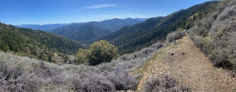
The prairie-like slope offers dramatic views to the south and east across the Upper Applegate and Little Applegate River watersheds. In the winter and spring the line of distant snow-capped summits can be quite impressive, extending from Wagner Butte, Big Red Mountain and Dutchman Peak, to the rugged Condrey Mountain Roadless Area, and the dramatic Red Buttes Region. Star Gulch descends below in a long forested canyon, while Mount Baldy and Burton Butte rise dramatically to the east, looming above the Applegate Valley and the surrounding foothills.
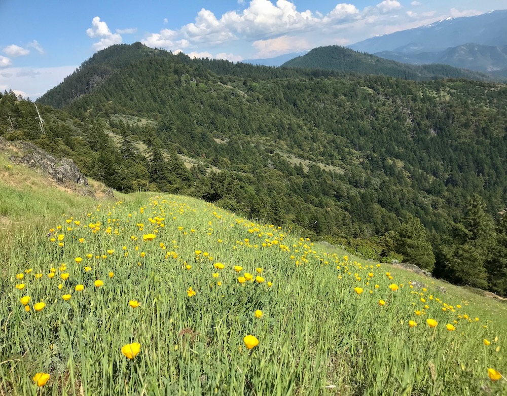
Dropping steeply, the trail continues down this old road bed then reaches a more gentle ridgeline and traverses the slopes to the east through thickets of chaparral and openings filled with wildflowers in the late spring and early summer. This includes California poppy, California lomatium, fernleaf lomatium, large patches of cobwebby thistle, and populations of the rare giant death camas.
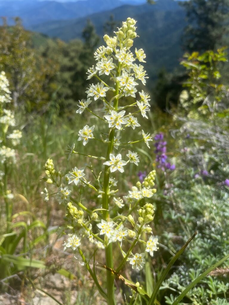
In the state of Oregon, giant death camas is found only sporadically in the mountains of the Upper Applegate Valley. The large white and yellow flowers of giant death camas grow in a relatively open panicle from large, green, strap-shaped foliage. Populations of this species are more abundant in California where it grows in the mountains and foothills adjacent to the Central Valley, but in Oregon the species is known from only a handful of populations in the Upper Applegate Valley, with the largest, most robust population being found on Tallowbox Mountain.
The beautiful views, wildflowers and chaparral continues to the upper Tallowbox Trailhead, located in a low saddle between Tallowbox Mountain and Mount Baldy at roughly 4,000′.
Optional Tallowbox Mountain summit detour:
From the high point on the Tallowbox Trail, instead of following the trail, turn north along the roadbed and quickly reach an intersection. Walk to the left, passing through a locked gate and continue along the lookout road through mature forests of white and Douglas fir. These more lush and productive forests on the mountain’s north and eastern slope contain patches of red flowering current, Oregon grape, and Rocky Mountain maple, along with western bleeding heart blossoms in the spring. The road hits a major switchback then enters more open slopes with blooming groundsel and balsamroot. The road then climbs to the summit, communication site and former lookout site. The summit although altered by lookout and communication site construction, contains robust populations of giant death camas, pink mats of spreading phlox, bright yellow carpets of sulphur buckwheat, clumps of pale yellow bigseed lomatium, and the rather non-distinct, pale pink Holboell’s rock cress.
The former one room lookout built on a 30 foot tower was originally built in 1918, but was damaged irreparably by vandals and arsonists in 2007, and removed. Although the lookout no longer exists and a communication site has been developed on top of Tallowbox Mountain, it remains interesting botanically and the view is incredible across the Applegate Valley, the Rogue Valley and the Siskiyou Crest region.
From the summit, you can gaze across the Siskiyou Crest From Mt. Ashland and Wagner Butte to Grayback Mountain, across the scenic Applegate Foothills and Applegate Valley below. To the south is a seemingly endless horizon of rugged ridges and canyons rising to the dramatic spine of the Siskiyou Crest. To the north and northwest, rugged foothills line the narrow Applegate River Valley, while the broad Rogue Valley to the northeast is bound by the Cascade Mountains, including views all the way out to the Crater Lake rim, the Sky Lakes Wilderness and the conical peak of Mt. McLaughlin.
Shorter Options on the Tallowbox Trail
Tallowbox Trailhead to Tallowbox Mountain section: Drive to the upper Tallowbox Trailhead above Cantrall Buckley Park. This option consists of a 1.5 mile hike and about 1000′ elevation gain (one-way) from the upper trailhead to the summit of Tallowbox Mountain. The hike offers exceptional views, diverse vegetation, and beautiful wildflowers.
Ladybug Gulch section: Drive to the (lower) Ladybug Gulch on Star Gulch. This option includes a roughly 1 mile hike with about 350′ elevation gain (one-way) in a shaded canyon of mature forest along Ladybug Gulch. The hike offers solitude, a relatively easy walk among mature conifer forest, and a beautiful seasonal stream.
Directions to trailheads
Directions to the upper Tallowbox Trailhead:
Starting from Ruch, Oregon, drive highway 238 west about one mile and turn left on Hamilton Road. In about one more mile turn right onto Cantrall Road. You will drive past Cantrall Buckley County Park, and through a residential area. Staying on the paved Cantrall Road up to the ridge and beyond as it winds around the eastern flank of Ben Johnson Mountain. Almost 6 miles from Cantrall Buckley Park the pavement ends. Continue along this relatively well graded, well maintained gravel road approximately 1.5 miles to a small pullout on the left, marked with a wooden “Tallowbox Trail” sign along the road.
Directions to the lower Ladybug Gulch Trailhead:
Starting from Ruch, Oregon drive Upper Applegate Road south to Star Gulch Road (just before Star Ranger Station). Turn right onto the paved Star Gulch Road and continue immediately over a concrete bridge. Drive 5.8 miles Up Star Gulch Road to the Tallowbox Trailhead, marked by a wooden Tallowbox Trail sign on the right side of the road. Parking is in a wide pullout across from the trailhead and just below a small concrete bridge over Ladybug Gulch.