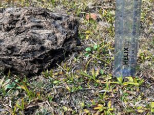
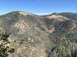
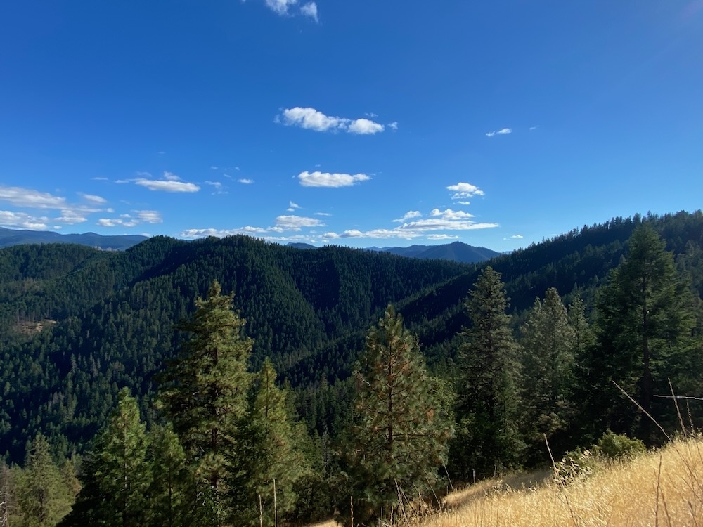
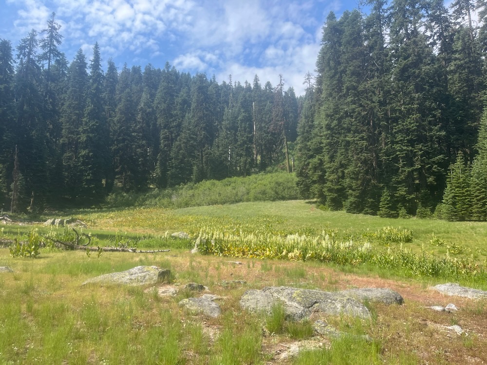
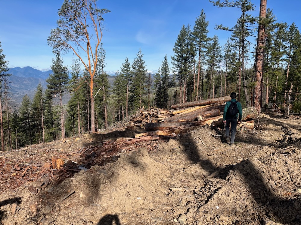
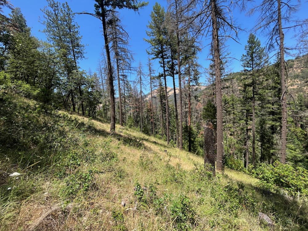
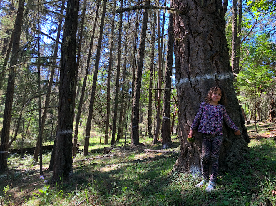
A proposed timber sale unit in the Cedar Flat Timber Sale along the Grayback Mountain Trail.
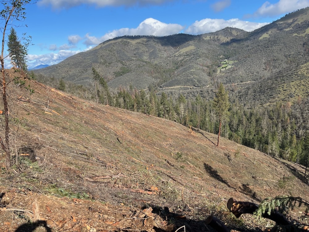
For the past number of months, ASA has been out on the ground monitoring proposed timber sale units in the BLM’s Cedar Flat Timber Sale in the upper Williams Creek watershed. The sale proposed to log 3,222 acres, including 2,493 acres in Late Succcessional Reserve forest designated to protect habitat for the northern spotted owl. This proposal would have logged significant mature, old-growth and primary unlogged forests on the flank of Grayback Mountain, in upper Rock Creek, Glade Fork, West Fork Williams Creek, on Little Sugarloaf Peak, and on the eastern flank of Holcomb Peak.
ASA was publicly opposing these mature and old-growth logging units, had visited every proposed logging unit in the timber sale, was working to draft technical comments on this project, and had begun organizing a public campaign; however, the Medford District BLM just canceled this controversial timber sale!
Although a significant, but perhaps short-lived victory, the BLM has indicated they hope to reconsider this timber sale in early 2025. We invite our supporters to contact BLM and ask them to cancel the mature and old-growth logging units previously proposed in the Cedar Flat Timber Sale. Please let them know that these units should not move forward in future BLM timber sales.
Talking Points:
Although we support the cancellation of the Cedar Flat Timber Sale, we are concerned that controversial mature and old-growth logging units may be included in future timber sales proposed in the area. If the Cedar Flat Timber Sale, or a new project based on this timber sale is proposed, we suggest that the BLM focus on the abundant plantation stands found in the area.
The Cedar Flat Timber Sale proposed logging units that included some of the last mature and old-growth forest in the Williams Creek watershed. These forests must be withdrawn from further consideration and should not be proposed for logging in any future timber sale.
Located in Late Successional Reserve forest, designated to protect habitat for the northern spotted owl, these mature and old-growth forests should be deferred from treatment due to their important habitat values. This includes proposed logging units on the flank of Grayback Mountain, along the Grayback Mountain Trail, on upper Rock Creek, Glade Creek, West Fork Williams Creek, and upper Bill Creek, on Sugarloaf Peak, and on the eastern flank of Holocomb Peak.
Ask the BLM to institute a 20″ diameter limit, require the retention of at least 60% canopy cover, limit commercial logging to plantation stands, focus non-commercial thinning adjacent to homes and communities, remove all stands over 80 years of age from logging treatments, and build no new roads if timber sales are proposed in the future.
Contact:
District Manager, Elizabeth Burghard: eburghar@blm.gov
Grants Pass Resource Area Manager, Heidi Lowrey: hlowery@blm.gov
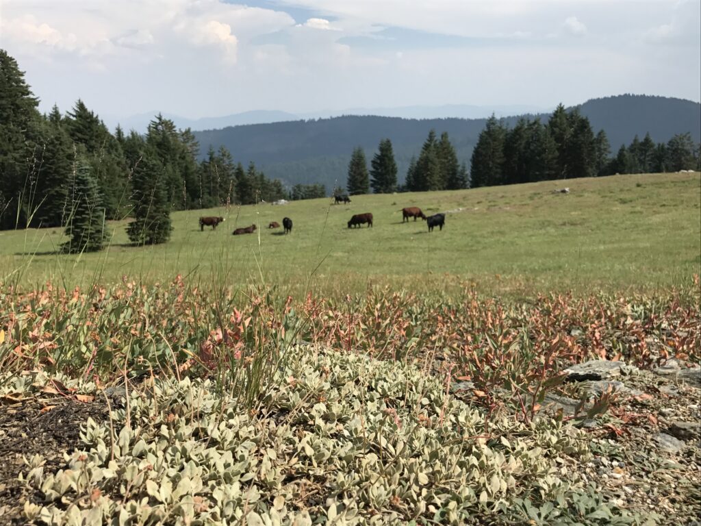
With the fall weather comes the end of the public land grazing season on the Siskiyou Crest. Fall is a good time to go out and monitor the impact of grazing allotments on the public lands of the Siskiyou Crest, including the headwaters of the Applegate River, located on the northern slope of the Siskiyou Crest. The area is filled with sensitive wetlands, meadows, seeps, springs, and headwater streams that become heavily damaged each season by unmanaged cattle, utilizing what the agency calls “passive season long grazing.”
Spectacular headwater basins like Alex Hole on the north slope of the Siskiyou Crest and at the headwaters of the Applegate River, are heavily degraded by poorly managed cattle grazing operations.
What this means is that cattle are dropped off in the spring and allowed to forage largely unmanaged throughout the grazing season, congregating in wetlands and meadows, along streams and other areas that are sensitive to livestock grazing. The result is the degradation of water quality, impacts to the spongy headwater basins that support water flows during the summer in the Applegate River, damage to willow wetlands, trampling of streambanks, the lowering of water tables, impacts to native vegetation, impacts to wildlife habitat, and increased competition between cattle and native grazing species such as elk and deer.
Each summer there are at least 10 active grazing allotments on the Siskiyou Crest on both the Rogue River-Siskiyou National Forest and the Klamath National Forest, and although stocking levels may change from year to year, there can be up to 2,000 cows permitted on the different allotments on the Siskiyou Crest each year, resulting in long-term ecological impacts.
Cattle grazing on the Siskiyou Crest with the rare and edemic Jaynes canyon buckwheat in the foreground.
The Forest Service often claims that historic overgrazing is responsible for the dramatic impacts we see today. Although historic grazing impacts were severe all across the eastern Siskiyou Crest in the historic era, these effects are compounded and reinforced by the overgrazing that continues to occur on public land grazing allotments to this day.
This past October, we visited the Silver Fork Basin in the Beaver-Silver Allotment and Alex Hole basin in the Upper Elliott Allotment, two of the most overgrazed meadow systems and headwater basins in the Applegate River watershed and on the eastern Siskiyou Crest. We found both areas heavily overgrazed.
Watch ASA’s new video about public land grazing on the Siskiyou Crest.
In particular, we found Alex Hole and the surrounding meadows heavily trampled and “over utilized,” meaning palatable vegetation had been eaten down to the nub, precluding both flower production and seed production for many species. Denuded to ground-level, the meadows and streams in the Alex Hole basin support almost no forage for native ungulates such as deer and elk, and cannot provide stream shade due to heavy browsing by cattle in the summer and fall.
Earlier this summer we had visited Alex Hole on the second day of grazing season and found it to have already been significantly overgrazed, just two days into the season, meaning the cows had been there before they were permitted to be there.
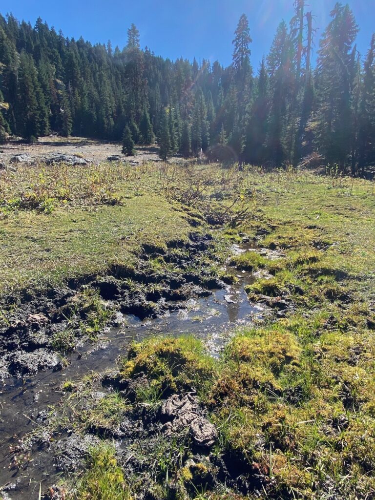
Currently riparian habitats throughout the watershed within federal grazing allotments are collapsing, streams are downcutting, noxious or non-native weeds are spreading, and native riparian vegetation, such as willow, is being denuded across entire stream reaches. Waterways and springs are also filled with cow excrement, and deep “punching” where cattle hooves sink deep (6″-10″) into moist soils, damaging wetlands, seeps, springs and streams through excessive trampling, excessive soil disturbance, damage to native vegetation, hydrological impacts, downcutting and the slow, steady de-watering of these habitats through the compounding impacts.
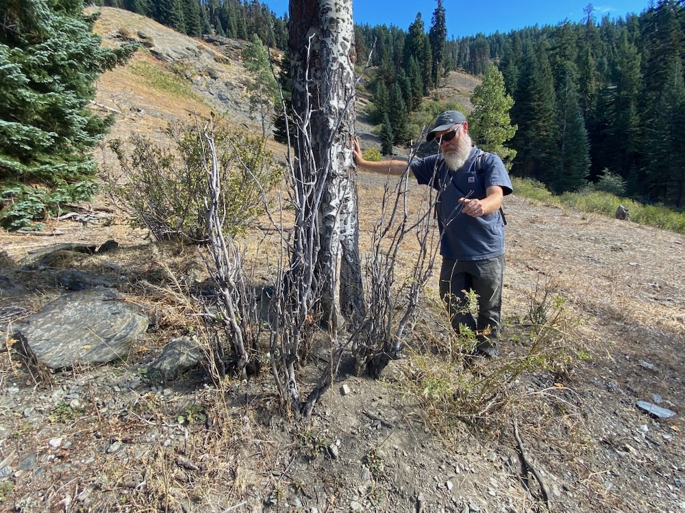
Quaking aspen groves in the Alex Creek drainage are being heavily impacted by grazing cattle, precluding almost all natural regeneration, limiting stand health, and damaging existing trees. The level of grazing in this basin may lead to the localized extirpation of unique quaking aspen stands in the basin.
In many favored grazing sites, cattle have eaten sedges, grasses and other herbaceous species to the ground, leaving little for wildlife, including deer and elk that also forage on these same native plants and in these same native plant communities. Additionally, aspen habitats have been heavily impacted on Alex Creek, including some of the region’s only tree-form aspen stands which are now heavily degraded, unable to regenerate, and slowly dying out due to extreme and continuous grazing impacts to aspen groves on Alex Creek.
Numerous sensitive wildlife species, such as the willow flycatcher, a small song bird that utilizes mature willow stands for nesting and foraging are also being impacted by overgrazing on the Siskiyou Crest at the Applegate’s headwaters. Willow flycatcher habitat requires dense, continuous willow stands, which are heavily fragmented by cows within the tiered meadow system of the Alex Hole basin, as well as in Silver Fork basin, and in some areas the willows have been entirely extirpated from specific stream reaches due to heavy trampling and grazing.
This stream was once colonized by dense willow thickets which have been trampled and eaten to death by cattle. The stream is now being heavily trampled, polluted with cow feces, and has begun downcutting, which in turn damages the water table.
Sensitive species like the Sierra Nevada blue butterfly utilize the high elevation alpine shooting stars (Dodecatheon alpinum) as a larval host plant; however, cattle trample these larvae, eat the larvae while gazing, and target shooting star flowers and stalks as a favored species to eat early in the season. This precludes flower production and seed production of alpine shooting stars, limiting the geographic extent of this species and hindering its natural regeneration process, thereby impacting the ability of the Sierra Nevada blue butterfly to live in these meadows because they can’t complete their lifecycles without their larval host plant.
In fact, the federal livestock grazing program is heavily subsidized by the public. In 2015 resource economists studied the costs of livestock grazing on public lands. They found that the federal lands grazing program generated $125 million less than what the federal government spent on the program in 2014. Further, they found that federal grazing fees are 93 percent less than fees charged for non-irrigated Western private grazing land, or just $1.69 per animal per month for each cow and calf that grazes the public land. It costs more to feed a house cat, and this year’s fees are even less — in 2024 the fee was a paltry $1.35.
Prolific growth in ungrazed sedge wetland near Alex Hole.Overgrazing of high meadow habitat in a grazed sedge wetland near Alex Hole.
Public land grazing has many impacts, both contemporary and historic, but the negative effects of current public land grazing practices are clear to see on the Siskiyou Crest. These public lands contain important biological, recreational, scenic, and watershed values; yet, they are being managed as private feedlots, for federal grazing permittees, who both benefit from and significantly impact federal lands. Who does not benefit is the public, who is forced to socialize both the costs and impacts of this management.
Please help us bring public land grazing in the Applegate into the 21st century. This begins first and foremost, with the Siskiyou Mountains Ranger District completing an Environmental Impact Statement for all grazing allotments in the Applegate, utilizing the best available modern science and research. It also begins with your advocacy, asking Forest Service managers to adopt and implement site specific Best Management Practices (BMPs) for each grazing allotment, along with publicly available Annual Operating Instructions (AOIs), that:
Incorporates the new mandates of the North Coast Water Quality Control Board that now requires Annual Operating Instructions (AOI) for all federal grazing allotments within its management area, including the headwater streams of the Applegate on the Siskiyou Crest. The Rogue River-Siskiyou National Forest must comply with the Clean Water Act management requirements adopted by the North Coast Water Board in its Federal lands Permit.
Requires electronic (virtual) fencing for cattle on the Siskiyou Crest to allow land managers to better track their location, manage their movements, document cattle “drift” or trespass into unauthorized areas, and to help reduce impacts to sensitive habitats and species by herding cattle that congregate in specific habitats, especially wet meadows and rare plant populations.
Mandates site specific BMPs the grazing permit holder must implement to prevent unacceptable levels of water quality, riparian and wetland degradation, including but not limited to, instructions on rotating grazing among different areas, and the frequency and type of herding needed to avoid unacceptable levels of degradation.
Requires the agency to commit to a number of monitoring visits to each allotment on an annual basis. The agency should document the number of times and time periods that Forest Service staff will check each allotment to verify that the required grazing management actions specified in the AOI are being adequately implemented.
Requires mitigation in basins and watersheds that are listed as “impaired” due to sediment, water temperature or nutrient conditions. Mitigation measures should require at least a year of rest for watersheds in which the annual Multiple Indicator Monitoring (MIM) reading finds bank disturbance equal to or greater than 10%.
Mandates protections for rare and unusual plant species and Botanical Areas on the Siskiyou Crest, including both sensitive plants and unique plant communities like quaking aspen stands.
Mandates protections for the Pacific Crest Trail, its trail side camps, water sources, and scenery.
Requires additional protections and mitigation measures that benefit wildlife, including deer and elk.
Some of the local grazing allotments have not been meaningfully reviewed or received updates to their management plans since 1964, clearly it is time for an update and a shift towards more a modern, responsible approach to federal land management. The current management plans are badly outdated and the allotments are badly damaging habitats.
Finally, any new management plans developed by the the Rogue River-Siskiyou National Forests should allow buyout options for federal grazing allotments and permits. This would allow grazing allotments to be publicly bought out and retired to protect and restore the biological, scenic and recreational values of the Siskiyou Crest region.
What was once a thriving wet meadow with tall vegetation is now a sparse, dried out and trampled feedlot area for cows that eat the vegetation down to the ground level.
With both a warming climate and a looming biodiversity crisis, we should be protecting, not trampling and degrading our headwater streams. We should also be protecting our rare plant populations and designated Botanical Areas, our native pollinators, wildlife and aquatic species from unnecessary degradation. The current grazing program has significant impacts to the land, no benefit to American taxpayers, and acts as a subsidy for specific economic interests and individual families who benefit financially from the massive handouts, and leaves behind significant impacts for the public to address.
Contact the following Forest Service employees and help us support the many important values of the Siskiyou Crest. Our public lands should be managed as far more than a feedlot for private grazing interests!
Contact the following Forest Service employees with your concerns surrounding the public land grazing program and your support for updates to grazing management plans in the Applegate River watershed and in the spectacular high elevation habitats of the Siskiyou Crest.
District Ranger Jen Sanborn: Jennifer.Sanborn@usda.gov
Impacts from public land grazing allotments aren’t limited to Forest Service land in the Applegate, they happen on BLM land too. Additionally, contact Senator Wyden’s office and tell him not to cosponsor the Operational Flexibility Grazing Management Program Act (S.4454, 118th Congress), which would remove the administrative control the BLM has over the grazing of livestock on 155 million acres of federal public lands. The Applegate has one grazing allotment on BLM land, the Lower Big Applegate Alloment, that could be affected by this legislation, but the impacts to BLM land throughout the West would be huge if this legislation passes.
Senator Ron Wyden (D-OR) is the sole cosponsor of a bill by Senator John Barrasso (R-WY) that would give Bureau of Land Management (BLM) grazing permittees and lessees even more free rein than they have now to (ab)use the public lands. The Barrasso-Wyden bill, the Operational Flexibility Grazing Management Program Act (S.4454, 118th Congress), would effectively remove any administrative control the BLM has over the grazing of livestock on 155 million acres of federal public lands.
This stand of living, green forest at the headwaters of Grouse Creek would be virtually clearcut in the BLM’s Boaz Salvage Timber Sale unit 35-5. The BLM would retain only 3.3 trees per acre and only trees marked with orange paint. Notice that nearly every tree in this photo would be removed except two trees in the right corner.
The Medford District BLM has been busy spinning false narratives about their proposed “salvage” logging projects in the Applegate Valley. Claiming to be targeting “dead and dying” stands and trees with the Boaz Salvage Timber Sale, the actual tree removal mark tells a very different story. Yet the BLM simply declaring living, green trees and stands that were largely unaffected by the recent flatheaded fir borer mortality events as “dead and dying,” does not change the reality on the ground — these trees survived the recent beetle outbreaks and have demonstrated either genetic or microsite related resilience.
The BLM has told the public that they must clearcut these stands — leaving, on average, 3.3 trees per acre — and kill these trees to save them from mortality. We find that logic backwards, Orwellian and wildly dishonest. In fact, both the BLM’s blatant lies and the impact of the project to forest habitats in the area are unacceptable. Only by removing all accountability, analysis and public involvement could such clearly false statements be used to justify this project.
Dead and dying? The BLM is claiming that unit 35-3 at the headwaters of Boaz Gulch is “dead and dying” forest that must be salvage logged to address elevated levels of mortality. The photo on the left shows unit 35-3 from across the drainage, the snags in the foreground are outside the timber sale units, while the green, living canopy in the background would be clearcut, retaining only a few trees per acre. The photo on the right shows unit 35-3 in red, identifying its location as an isolated conifer habitat that was largely resilient to the recent beetle mortality outbreak. Ironically, the Boaz Salvage Timber Sale will log off this entire stand to ensure it doesn’t succumb to mortality.
Unfortunately, despite significant public opposition, the BLM recently proposed, retroactively approved, and sold the Boaz Salvage Timber Sale in the Applegate Valley to Mineral Creek Logging and Hauling currently based out of Eagle Point, Oregon.
The public is outraged that BLM can announce a timber sale to the industry and fully design it in a timber sale prospectus before even approving a project or disclosing the effects of the project to the public. People are also outraged that after many years of conflict with the Applegate community over its timber management program, the agency is now resorting to deception and Categorical Exclusions to increase timber production in the face of public opposition.
Unit 34-3 on the northern slope of Boaz Mountain contains mature and old-growth groupings of living Douglas fir trees. BLM approved the area for heavy industrial logging and new road construction in the Boaz Salvage Timber Sale. For example, only one of the large, living trees in this photograph is marked for retention, while the rest would be logged.
Medford BLM District Manager, Elizabeth Burghard, committed, in writing, back in 2016, to move forward with projects in the Applegate working in the “spirit of the Applegate Adaptive Management Area (AMA).” The Applegate AMA required community-based collaboration and adaptive management; however, Elizabeth has gone back on her word and has instead dismantled collaboration in the Applegate. In fact, in this project the BLM has used exclusionary NEPA processes specifically to avoid any level of public input or accountability.
While the BLM tries to deceive the public, Applegate Siskiyou Alliance will continue bringing you the truth and fighting for the land. The ecological integrity of the Applegate is our highest priority, and our goal is to challenge projects that damage our environment, like the Boaz Salvage Timber Sale. Please support our work as we expose this damaging timber project and oppose its implementation!
Despite sustaining living, green canopies, these large trees would be logged in the Boaz Salvage Timber Sale unit 35-5.
The Boaz Salvage Timber Sale is another shameful timber grab by the BLM. It is also being justified using misleading information, unfounded assumptions, and by cutting the public out of the process. Contact your elected officials and the BLM to express your opposition to the Boaz Salvage Timber Sale.
Get involved! Two things you can do to help us stop the Boaz Salvage Timber Sale:
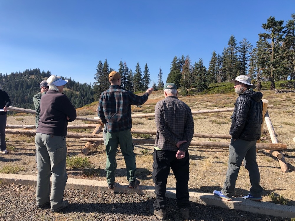
ATTEND A FIELD TRIP! Join Applegate Siskiyou Alliance (ASA) as we lead a field trip to the proposed timber sale units. See the misleading narrative of the BLM firsthand and visit the threatened Boaz Salvage Timber Sale with ASA.
Boaz Salvage Timber Sale Field Trip with ASA
When: October 20, 2024 10:00 AM
Where: Meet up in Ruch in the Sunshine Plaza parking lot for the carpool.
What: We will carpool up to the Boaz Salvage Timber Sale where we will stop to look at the proposed timber sale units and discuss the project. Field trip participants can look into most units from the side of the road, but we will also provide optional off-trail opportunities to walk into the units to experience these beautiful forests more closely. Bring trekking poles if you want to walk into the units, as some are fairly steep. Any walk into a unit will be short and less than an 1/8th of a mile.
Please RSVP at the following email to attend the field trip: luke@applegatesiskiyou.org
2. CONTACT BLM land managers and your elected officials!
Medford District Manager, Elizabeth Burghard: eburghar@blm.gov
Field Manager, Lauren Brown: lpbrown@blm.gov
Talking Points:
—Ask BLM to cancel the Boaz Salvage Timber Sale and other so-called logging projects that target living, green trees and stands. Many stands proposed for “salvage” logging are mischaracterized as “dead and dying.”
—Withdraw the inappropriately applied Categorical Exclusion used to authorize the Boaz Salvage Timber Sales. Logging the resilient trees and stands that survived the recent beetle outbreaks is counterproductive, unacceptable, and irresponsible.
—Implement land management activities on BLM lands that respect public involvement, and conduct appropriate levels of scientific and environmental analysis. A Categorical Exclusions does not provide adequate public involvement, analysis, or public disclosure of the project’s environmental effects.
—The BLM must not circumvent the NEPA process to avoid public accountability, the public disclosure of impacts, or to avoid public comment and input. Public lands should be managed with transparency and accountability, and projects of this scope, scale and intensity should be analyzed with at least an Environmental Assessment.
—The environmental impact of proposed project activities are simply too high and should not be approved. The retention of only 3.3 trees per acre and the removal of existing forest canopy, including large diameter trees, will increase fire risks, damage habitat values, and contribute to climate change.
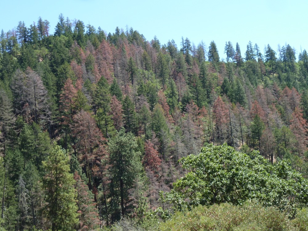
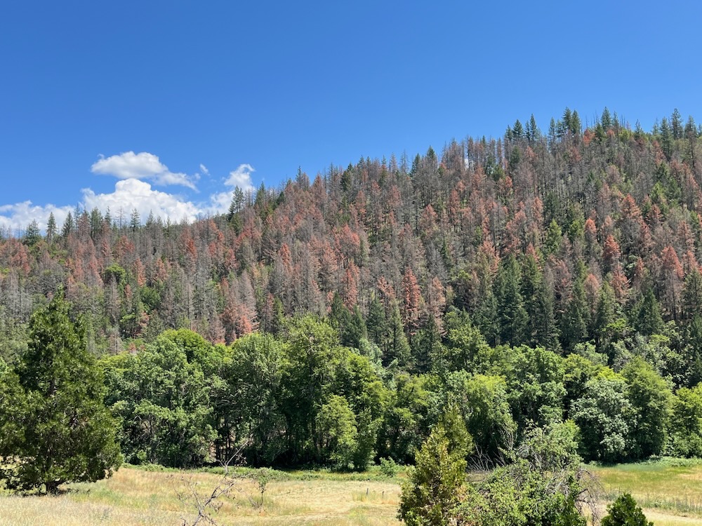
In the spring and summer of 2023, portions of the Applegate Valley experienced a significant, episodic flat headed fir borer mortality event. These native beetles chew into Douglas fir trees, disrupt the flow of water and nutrients and kill drought and/or heat stressed trees as beetle populations grow. Although historically a rather benign wood boring beetle that unobtrusively killed some trees here and there, in recent years, droughts, heat domes, and other manifestations of climate change have triggered fairly large-scale outbreaks in portions of the Applegate River watershed. Although the most recent outbreak has largely subsided due to more favorable local climatic conditions, and because the most susceptible trees have already been affected, the BLM has continued using this mortality event to promote unsustainable, environmentally damaging clearcut logging in the Applegate Valley.
Watch this video to see the reality of BLM’s proposal, and the dishonest narrative being used to clearcut our public lands.
The Medford District BLM recently identified two new logging projects that claim to focus on the “salvage” of beetle killed trees in the Applegate Valley. These projects include the Boaz Salvage Timber Sale and the Forest Creek Salvage Timber Sale. Both timber sales are being proposed under the false pretense that the stands and trees targeted for removal are “dead and dying.” In many units proposed for logging this is clearly not the case, and instead the BLM is targeting many living, green stands that did not sustain significant mortality during the recent beetle outbreaks.
Shockingly, the BLM is scheduled to auction off these timber sales on September 26, despite not having provided the public with the proper notification or appeal opportunities. The Timber Sale Notices for these projects were released and advertised on September 5th and 6th, yet the Categorical Exclusion document authorizing the Boaz Salvage Timber Sale was signed just two days ago (9/13/24), and the Forest Creek Salvage Timber Sale Categorical Exclusion simply has not been posted on the BLM’s E-Planning website at the time of publishing of this blog post. The Medford District BLM was advertising these timber sales without official approval, and they plan to sell the timber sales before the appeal period has even ended.
So what does this all mean? It means the BLM is scheduled to auction off the Boaz Salvage Timber Sale just 13 days after they signed the decision document — the “decision document” being the signed Categorical Exclusion — and they still haven’t posted a signed Categorical Exclusion for the Forest Creek Salvage Timber Sale on their E-Planning site, even though they have it scheduled for auction on September 26th. It also means that the BLM announced the timber sale auctions to the timber industry before project approval!
Unit 35-5 of the Boaz Salvage Timber Sale consists of living, green stands largely unaffected by recent beetle mortality. Literally every tree in this photograph is proposed for removal, clearcutting this stand supposedly to save it from tree mortality.
The Categorical Exclusion used by the BLM is authorized for post-disturbance mortality salvage, yet these so-called “salvage” projects target many forest stands that survived the recent flatheaded fir borer outbreak and they remain living, green canopied forests. The beetle outbreak came and went, leaving the most resilient trees unscathed — perhaps they are trees with genetic adaptation to better resist drought and insects, or they were growing in more productive, moist or sheltered locations that help them withstand drought and beetle events. These surviving habitats are essentially refuges from drought and beetles, where even under heat domes, extended droughts, and less frequent cold snaps, these forests can and will maintain significant cover, especially on north- and east-facing slopes, in drainages, on lower slope positions, and at mid to high elevation habitats.
That is not to say that beetle mortality events will not occur in the future. Beetle mortality will most likely occur in response to future climactic events, but the BLM will be limiting the available host species, perhaps concentrating beetle mortality during those events and compounding whatever mortality does occur.
For example, according to the Timber Sale Prospectus for both the Boaz and Forest Creek Timber Sales, they will log tens of thousands of mature, living trees that survived the recent beetle outbreaks, leaving behind only between 3.3 (Boaz) and 4.9 (Forest Creek) trees per acre when they are done with the logging — equivalent to clearcuts.
This means, if beetles, wind throw, fire, drought, extreme heat and other natural disturbances kill those 3 or 4 trees over time, the agency will have entirely removed the conifer component, and shifted the once mature, fire and beetle resilient stands into young, more flammable and far less fire resilient vegetation types. It also makes these few remaining trees more exposed to the elements and more susceptible to wind throw, extreme heat, drought, snow damage and other forms of mortality or tree stress.
The BLM is not saving the forests of the Applegate, they are finishing them off. They are not protecting against forest loss, they are creating it.
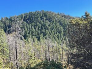
This photo, taken last week, looks across the headwaters of Grouse Creek, an area that BLM dishonestly claims consists of “dead and dying” forest habitats. The agency has proposed to clearcut large swaths of living forest to “salvage” the supposedly dying trees. BLM records show that thousands of living trees will be logged at the headwaters of Grouse Creek in the Boaz Salvage Timber Sale. The recent Lickety Split Salvage Timber Sale in the Little Applegate Valley clearcut vast acreages directly across the drainage from the Sterling Mine Ditch Trail and above the Little Applegate River in spring 2024. The project was approved using the same inappropriate Categorical Exclusion and the same misleading narrative used to justify the Boaz Salvage and Forest Creek Salvage Timber Sales. The results of the Lickety Split Timber Sale demonstrate the outcome of clearcutting both live and standing dead trees under this false narrative. Does this look like ecological forestry? BLM thinks it does.
Boaz Salvage Timber Sale
The Boaz Salvage Timber Sale is located on Cinnabar Ridge and near Boaz Mountain in the Boaz Gulch and Neds Gulch watersheds in the Upper Applegate Valley, and at the headwaters of Grouse Creek, as well as directly above Buncom in the Little Applegate Valley.
Every large overstory tree in this photo survived the recent beetle outbreak and would be logged in the BLM’s Boaz Salvage Timber Sale. This photo shows conditions in the supposedly “dead and dying” stand identified as unit 35-5.
The timber sale contains some areas affected by beetle mortality, but large portions of the timber sale target living, green trees in stands that did not sustain elevated levels of fir mortality. These are not dead or dying stands as the BLM claims, they are drought and beetle resistant stands that survived the most recent beetle outbreak and continue to provide important forested habitat for wildlife, wildfire resistance, and climate resilience. In this project the BLM proposes to log an estimated 22,199 merchantable trees on 250 acres, and identified only 849 trees for retention. This translates to the retention of only 3.3 trees per acre and the clearcutting of vast swaths of green, living forest on the ridge above Buncom in the Little Applegate and above Eastside Road in the Upper Applegate.
Additionally, many of the units were previously included in the Nedsbar Timber Sale, which was highly controversial in the community and ultimately withdrawn by the BLM. The BLM is now targeting these same stands by claiming they are “dead and dying,” which is entirely untrue, and are trying to implement the logging under a Categorical Exclusion. The BLM has decided to avoid the public accountability that a full NEPA process entails, avoid creating an Environmental Assessment, and they are refusing to include any meaningful scientific analysis, public input, or public involvement.
Dwarf snow bramble is found only in cool, moist habitats insulated from drought and beetle mortality like unit 35-5 of the Boaz Salvage Timber Sale.
Although many living stands are targeted with logging in this timber sale, unit 35-5 is a particularly troubling example. Located in a large swath of mature forest at the headwaters of Grouse Creek on a north-facing slope and along a cool, moist drainage dominated by large, living trees, the area contains cool, moist habitat associations and represents clear climate refugia. In fact, on the boundary of the timber sale unit grows the only known population of dwarf snow bramble (Rubus nivalis) in the low elevations of the Applegate Valley, representing one of the most unusual populations known for this species, and it is located at the southern end of its range. Dwarf snow bramble is very uncommon in the Siskiyou Mountains and only survives this far south in cool, moist habitats, usually in high elevation subalpine forests. This population of dwarf snow bramble demonstrates that this specific forested stand contains some of the most resilient climate refugia in the Applegate Valley foothills, and is one of the most persistent, drought and beetle resilient conifer forests adjacent to the Applegate Valley on BLM land. It is exactly the type of forest we need to protect in the face of climate change.
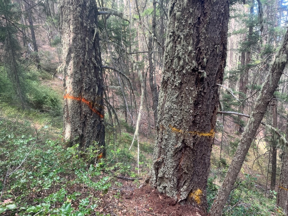
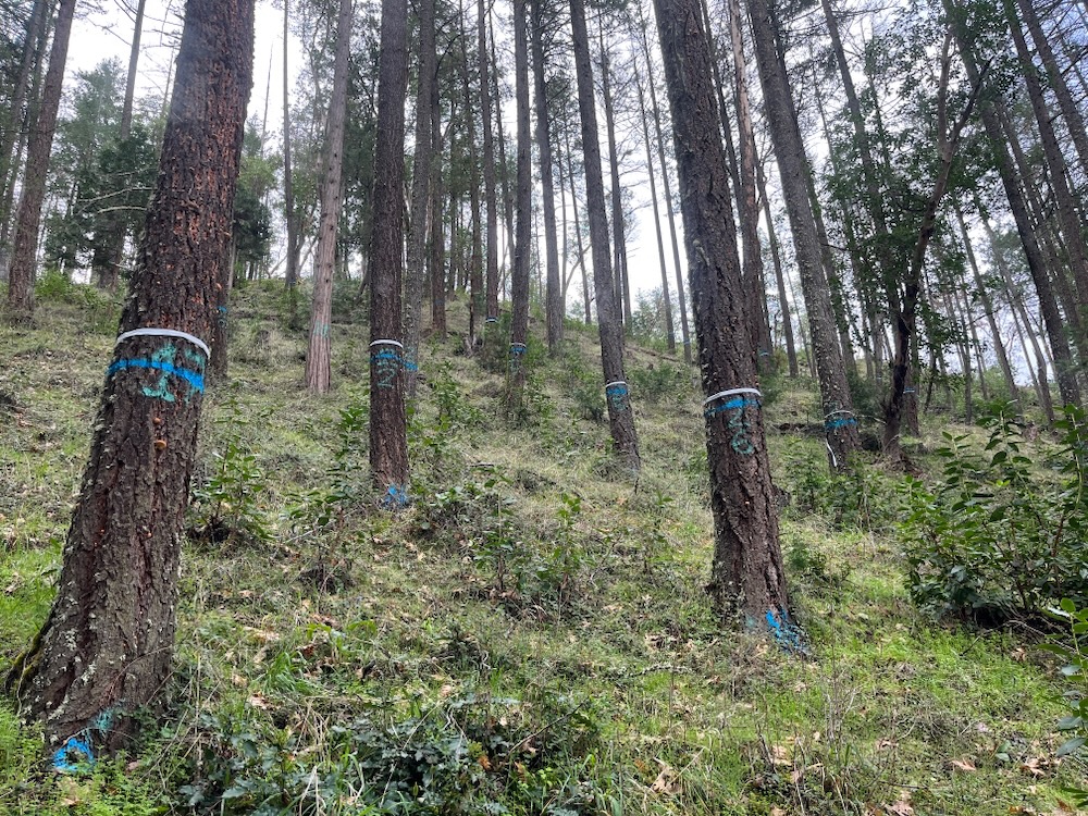
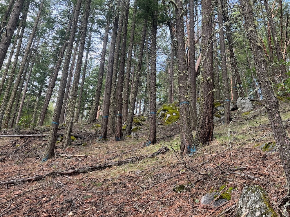
Timber sale marking crews marked trees with orange paint for retention in unit 35-5. With that in mind you can see that every large tree in this photo, except the tree on the right marked orange, would be logged. Leaving only approximately 3.3 trees per acre, the BLM would remove the mature overstory canopy, increase fire risks, degrade habitat values, reduce climate refugia, and release carbon stored in these large, old trees. Ironically, while claiming to want to reduce tree mortality, the BLM would log almost all of this resilient, old, cool, moist stand of trees.
In unit 35-5, nearly the entire stand of mature, old trees would be removed, leaving only a few scattered trees, where a forest once stood. The BLM reports that 3,371 trees will be removed in unit 35-5, and nearly all of those trees are living trees, located in a refuge from climate and beetles. The currently cool, moist habitat would be opened in logging operations, exposed to the climatic extremes, and converted to a much younger, drier, sun baked, and more flammable plant community with abundant brush, stump-sprouting hardwoods and even-aged conifer regeneration.
Canopy conditions in unit 35-5, which according to the BLM is a “dead and dying” stand. As you can see this forest is very much alive, but the BLM has proposed logging almost every tree in this photograph leaving as few as 3.3 trees per acre.
To make matters worse the BLM’s Timber Sale Prospectus for both timber sales calls for “lop and scatter” treatments, meaning slash from these clearcut logging operations will be left on site across all 450 acres of logging units, increasing fuels in the Boaz/Cinnabar Ridge region and on Forest Creek. The conditions created will exacerbate fire intensity, rates of spread, and fire severity during fire events, while the current stand conditions would moderate fire behavior and support fire resistance.
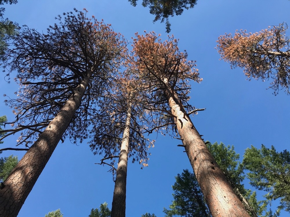
The BLM claims this stand and others are facing imminent mortality, yet the conditions on the ground show otherwise. In fact, the only signs of imminent mortality in some of these stands are the BLM timber sale markers.
Although unit 35-5 has sustained very little mortality from beetles in recent years, the BLM claims this mature stand, with a significant legacy tree component, is facing imminent mortality. Ironically, the only sign of imminent tree mortality is the BLM’s timber sale mark. In this photograph, only the orange marked tree would be retained and the nearly 40″ diameter tree adjacent would be logged.
Forest Creek Salvage Timber Sale
Last week we also monitored proposed logging units in the Forest Creek Salvage Timber Sale and found many of the stands contained significant living, green tree components that would be heavily logged under this so-called “salvage” logging operation.
The pattern was similar to the Boaz Salvage Timber Sale, where many of the trees that survived the beetle outbreak would be logged, leaving only a few trees exposed to the harsh, post-clearcut elements per acre. In fact, according the BLM’s own records, this project would remove 10,641 merchantable trees, while retaining only 983 trees on 200 acres. This translates to only 4.9 trees per acre remaining after the proposed industrial logging operations in living, green canopied stands on lower Forest Creek.
This large tree in unit 15-5 of the Forest Creek Salvage Timber Sale is over 36″ diameter and was originally marked for retention with orange paint. The tree was later blacked out for removal despite having a healthy green crown and growing in a stand that was largely unaffected by beetle mortality. Every tree in this photograph is proposed for logging.
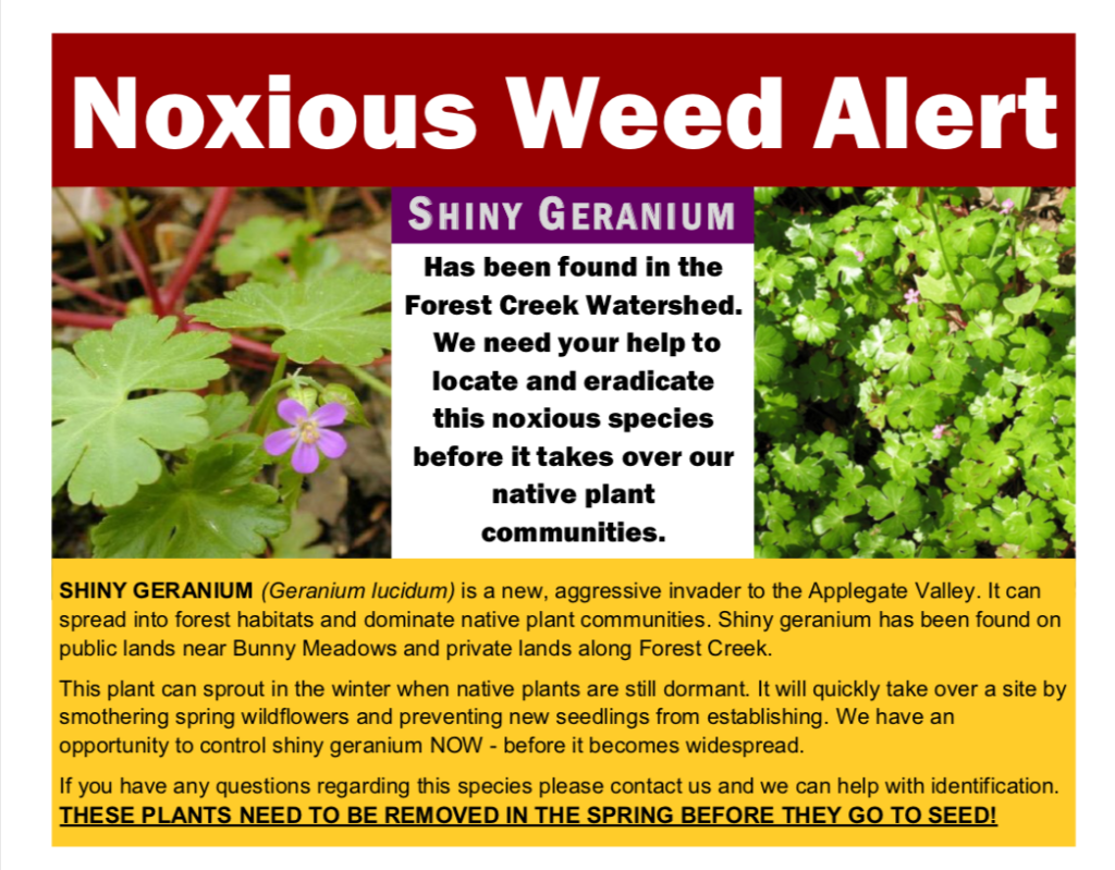
To make matters worse, unit 22-1 on the lower end of Forest Creek contains the only population of the incredibly invasive, non-native shiny geranium (Geranium lucidum) in the Applegate Valley. The species is known to spread quickly and smother native understory vegetation in forest and woodland habitats, suffocating native grasses and wildflower species, and creating dense monocultural populations. The problem is becoming very pronounced in the Willamette Valley, where shiny geranium has spread quickly and is decimating native plant habitats.
Clearly brought in through illegal off-road vehicle use on BLM lands, (the initial populations are all located on unauthorized dirt bike trails), the BLM has long refused to close these trails despite knowing the highly invasive nature of shiny geranium, and as a result it has spread quickly, covering at least 70 acres before BLM began any meaningful attempt to control the infestation.
In numerous recent timber sale proposals the BLM identified this area for logging, but later dropped the unit when environmental analysis and public input identified the potential problems with invasive weed spread. Yet, hungry for more timber, the BLM has decided to exclude meaningful environmental analysis and entirely exclude the public while planning the Forest Creek Salvage Timber Sale, thus ensuring that the spread of this noxious weed is not adequately considered.
Is the BLM so adamant that every acre be logged in the Applegate that they can’t even exclude 70 acres of a highly invasive plant from their logging plans?
Unit 22-1 is the location of the only infestation of the noxious shiny geranium in the Applegate watershed. This invasive plant problem will be compounded with the proposed logging and soil disturbance, and logging trucks and equipment are a major risk for weed spread. The unit proposes to log off nearly all the living trees in the stand, supposedly to reduce mortality from future beetle outbreaks. So, BLM will be killing trees to ensure they don’t die?
Unit 22-1 is a 52-acre logging unit proposed for cable yarding, which will drag logs up the steep slopes, disturbing soils and potentially moving shiny gernanium all around the site. Any disturbed soil is a vector for spread of shiny geranium. After being dragged though the soil, the logs will be loaded onto trucks, contaminated with soil and weed seeds. The tires of the log trucks and the machinery used to yard logs and slash can, and most likely will, become contaminated, creating a significant risk for spread throughout SW Oregon.
In unit 22-1 of the Forest Creek Salvage Timber Sale, all trees except the one large tree at the right-center would be logged, converting this forest into a dry grassland with a few savanna-form trees. Without forest cover and canopy the understory will likely regenerate into dense, young, highly flammable woody vegetation over time, including young conifer trees, hardwoods and shrub species. Replacing the mature trees for young growth will undoubtedly increase fire risks in this stand.
The BLM will also conduct road upgrades and maintenance in the timber sale area, which has a high potential to further spread shiny geranium in the area. Logging this unit is incredibly irresponsible, and it facilitates additional weed spread, potentially damaging to habitats throughout SW Oregon.
Other units proposed for logging in the Forest Creek Salvage Timber Sale include living, green trees that survived the recent beetle outbreaks. The BLM is tipping “salvage” logging on its head, in many cases focusing its logging prescriptions in the areas that survived the beetle outbreak and/or by targeting the trees within a stand that survived the recent outbreaks.
Using the fear of beetles, rampant misinformation, and purposefully misleading narratives of “restoration” and “resilience,” the agency is taking advantage of the recent beetle mortality to clearcut living forests, which in turn contributes to the climate crisis, degrades forest habitat, removes climate refugia and increases fire risks. Although the BLM claims to be public servants, it is clear that no one will benefit from these logging projects except for the BLM’s only real partners in SW Oregon: the timber industry.
Bring accountability back to federal land management and please, help us oppose this appalling, dishonest and damaging timber grab by the BLM!
Contact BLM land managers and your elected officials
Medford District Manager, Elizabeth Burghard: eburghar@blm.gov
Field Manager, Lauren Brown: lpbrown@blm.gov
Senator Wyden’s Natural Resource Staff, Jacob Egler: Jacob_Egler@wyden.senate.gov
Senator Merkley’s SW Oregon staff, Dahna Black: Dahna_Black@merkley.senate.gov
Talking Points:
—Cancel the Forest Creek Salvage and Boaz Salvage Timber Sales and the logging of living, green trees. Many stands proposed for “salvage” logging are mischaracterized as “dead and dying.”
—Withdraw the inappropriately applied Categorical Exclusions used to authorize the Boaz Salvage and the Forest Creek Salvage Timber Sales. Logging the resilient trees and stands that survived the recent beetle outbreaks is counterproductive and unacceptable.
—Do not allow logging in existing population of shiny geranium in the Forest Creek watershed. The risk of weed spread and environmental damage is simply too high.
—Implement land management activities on BLM lands that respect public involvement and conduct appropriate levels of scientific and environmental analysis. The current Categorical Exclusion does not provide adequate public involvement, analysis, or public disclosure of the project’s environmental effects.
—The BLM must not circumvent the NEPA process to avoid public accountability, the public disclosure of impacts, or to avoid public comment/input. Public lands should be managed with transparency and accountability, and projects of this scope, scale and intensity should be analyzed with at least an Environmental Assessment.
—The impact of proposed project activities are simply too high and should not be approved. The retention of only 3.3-4.9 trees per acre and the removal of existing forest canopy, including large diameter trees, will increase fire risks, damage habitat values, and contribute to climate change.
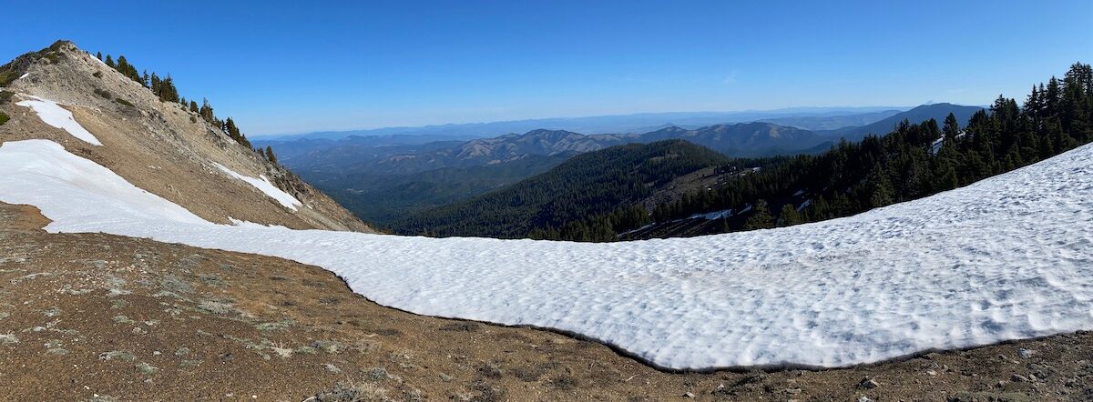
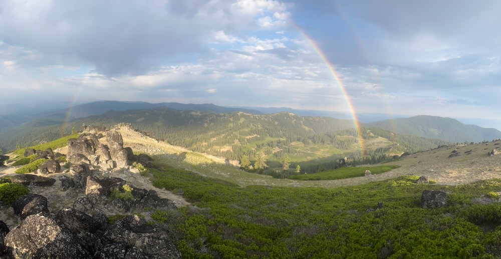
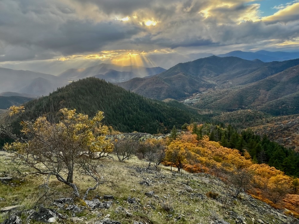
A double rainbow framing the Siskiyou Crest from the summit of Mt. Ashland
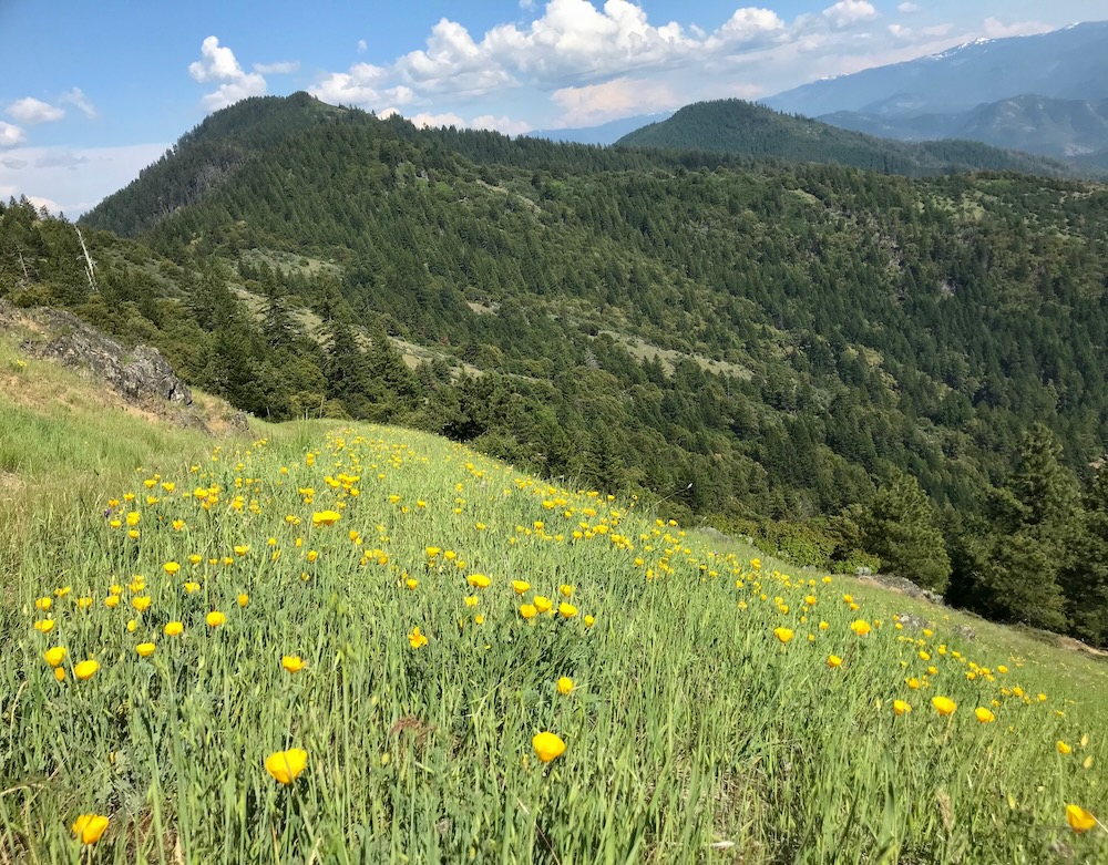
As the tallest summit on the Siskiyou Crest, Mt. Ashland is a sky island rising above the surrounding ridgelines and high above the Rogue and Colestin Valleys. Standing on the divide between the Ashland Creek Watershed, which ultimately drains into the Rogue River, and Cottonwood Creek, which drains into the Klamath River near Hornbrook, California, the Mt. Ashland area supports extensive subalpine forest, flower-filled meadows, colorful rock gardens, high elevation bunchgrass habitats, sagebrush clearings, and quaking aspen groves.
Although extremely popular for outdoor recreation and generally well known, the mountain also contains many obscure and little visited meadows, spectacular old-growth forests, rushing streams, and rare conifer species.
Many have been to Mt. Ashland hiking the PCT, mountain biking on local trails, driving road 20, cross-country skiing over deep winter snow, exploring the Grouse Basin and Grouse Gap Shelter, camping at the Mt. Ashland Campground, and visiting the mountain’s windswept summit, but have you explored Mt. Ashland’s truly wild side? You have a chance to on August 3rd for the final hike of the Siskiyou Crest Conifer Field Trip Series! The field trip is an opportunity to see Mt. Ashland in a new light though an informative and potentially adventurous hike on Mt. Ashland’s wild northern flank in the McDonald Peak Roadless Area.
Our off-trail hike to the Engelmann spruce will visit this beautiful meadow in the McDonald Peak Roadless Area, high in the Ashland Creek watershed.
Join us as we explore the wild side of Mt. Ashland, north of Road 20, west of the ski resort, and at the headwaters of Ashland Creek. We will visit and view Mt. Ashland’s rare conifer species, botanize the mountain’s dramatic summit filled with rare and unusual plants, thickets of montane chaparral, barren subalpine habitats, and massive granitic boulders.
A view across the Ashland Creek watershed and McDonald Peak Roadless Area from near the summit of Mt. Ashland. The scrubby conifer trees in the foreground are subalpine fir.
At the summit, we will see one of only two stands of subalpine fir (Abies lasiocarpa) in the Siskiyou Mountains. The largest population on the Siskiyou Crest is found near the summit of Mt. Ashland, where stunted krummholz-form trees grow in blue-green mats surrounded by rock gardens and sparse subalpine flowers not more than a few inches high. More common to the north and east in the Rocky Mountains, Cascade Mountains and Blue Mountains, where heavy winter snow creates ideal conditions for subalpine fir, the Mt. Ashland population is disjunct from the majority of the species’ range .
We will also peer down from the summit into “the bowl,” a deeply scoured basin of granite, with mats of greenleaf manzanita and stunted conifer groves consisting of mountain hemlock, western white pine, and red fir. Within this habitat one can also find the last mature whitebark pine (Pinus albicaulis) tree on Mt. Ashland and in the Siskiyou Mountains. Although we do not know what the historic impact of ski resort development and/or communication tower development was on either subalpine fir or whitebark pine, we do know that whitebark pine was known to occur on the mountain in 1969, and as recently as 2003, only three mature whitebark pine trees remained on Mt. Ashland, along with a few planted seedlings.
The only mature whitebark pine remaining on Mt. Ashland and in the entire Siskiyou Mountain range.
Currently, only one mature whitebark pine is surviving on Mt. Ashland due to a combination of unfortunate factors, including a naturally small population size, the loss of winter snowpack, the non-native white pine blister rust, and bark beetles that have become more virulent and damaging throughout the range of the whitebark pine in recent years. With nowhere to escape at higher elevations, the whitebark pine is highly susceptible to climate change and remains precariously close to extinction in the Siskiyou Crest region.
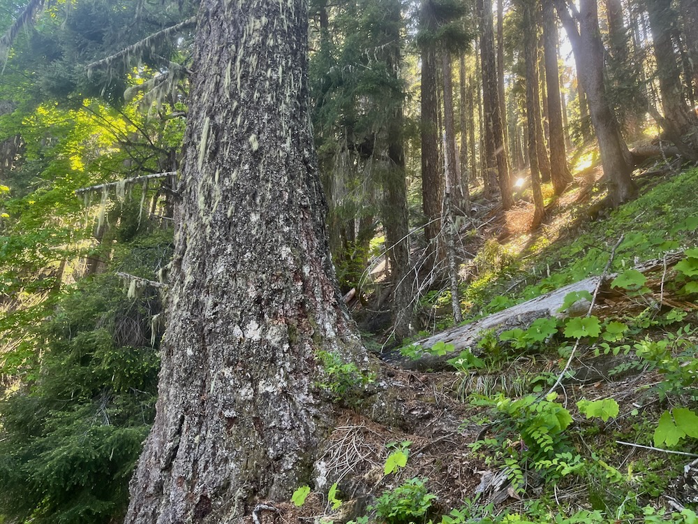
Old-growth Engelmann spruce on East Fork Ashland Creek.
After visiting the summit, we will drive down the mountain where the field trip offers two separate options. These options include a leisurely hike along the PCT and/or Rabbit Ears area with expert botanist Julie Kierstead, or a difficult and adventurous off-trail hike onto the wild side of Mt. Ashland through moist mountain meadows, intact bunchgrass clearings, and montane forests. The off-trail hike will lead to a meadow and wetland system on the East Fork Ashland Creek that supports beautiful stands of Engelmann spruce (Picea engelmannii).
Engelmann spruces is found only on Mt. Ashland in the Siskiyou Crest region, and in a few locations further south in the Russian Wilderness at the headwaters of the Salmon and Scott Rivers. Engelmann spruce is a tree of the Rocky Mountains, the Cascade Mountains, and the Blue Mountains, and is often associated with deep, snow and moist montane habitats. At Mt. Ashland, Engelmann spruce grows along meadows, wetlands and springs in the East Fork Ashland Creek watershed.
These beautiful meadows are the off-trail hike’s final destination. The area contains intact meadow and wetland habitats, as well as robust populations of Engelmann spruce.
The journey in the McDonald Peak Roadless Area will show you the most remote, intact, and little visited corners of Mt. Ashland, along with some of the rarest conifers in the Siskiyou Mountains. We think it will also give you a whole different perspective of Mt. Ashland and its surrounding wildlands.
Join us on the wild side with an off-trail hike to spectacular meadows and Engelmann spruce groves, or botanize more accessible portions of the mountain with expert botanist Julie Kierstead.
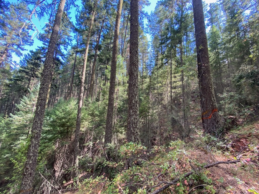
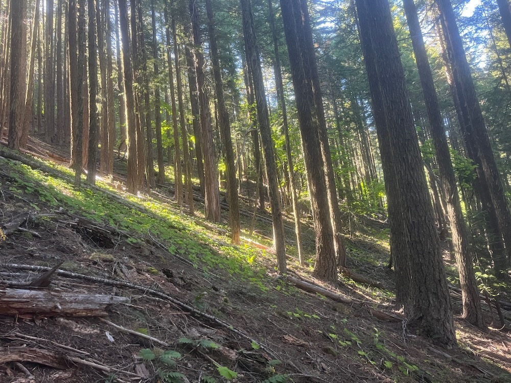
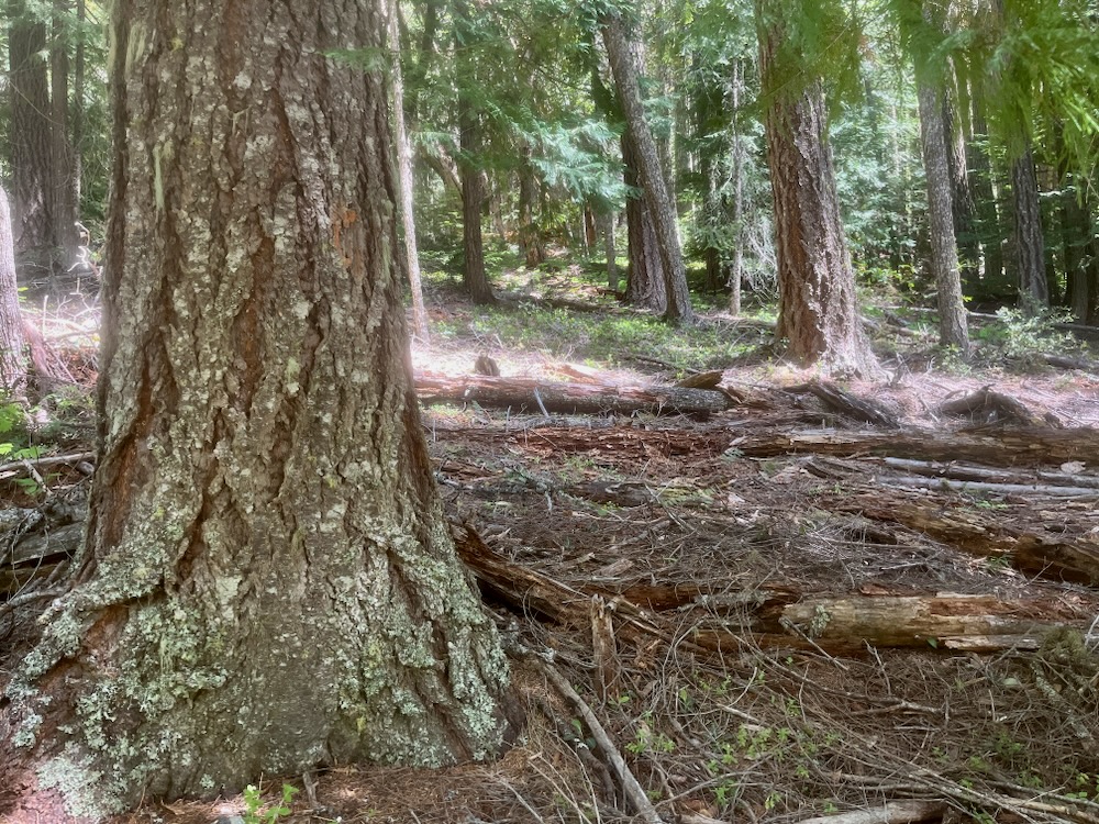
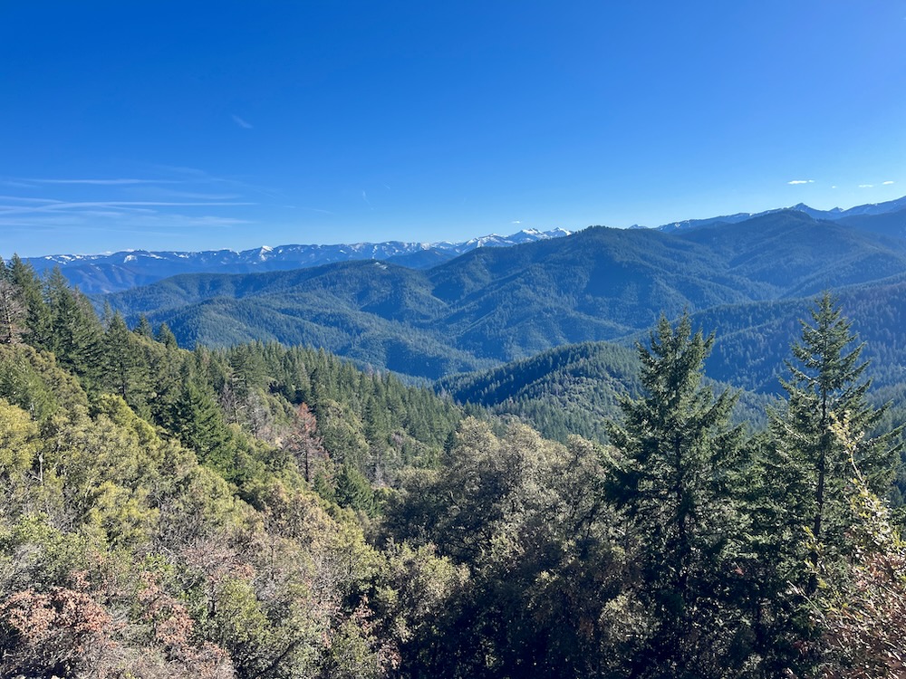
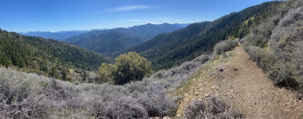
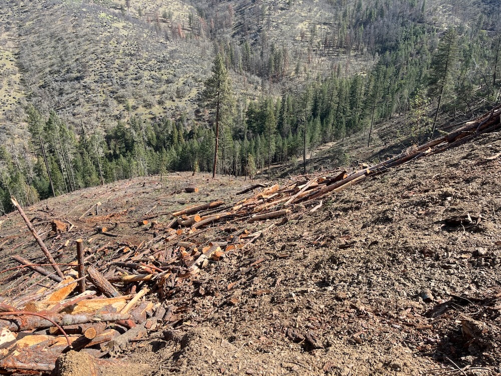
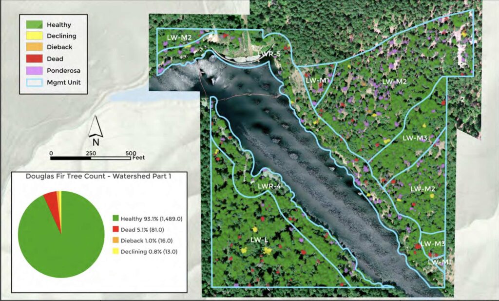
Old-growth forest targeted for logging in the Cedar Flat Timber Sale below the Grayback Mountain Trail.
Rising above the pastoral Williams Valley, Grayback Mountain is the signature peak of the area and holds a special place in the hearts of many local residents. Reaching epic proportions in local lore and revered by those who live at the mountain’s base, Grayback Mountain and the vast wildlands to the south, the Kangaroo Inventoried Roadless Area, tie directly into the Red Buttes Wilderness Area at the headwaters of the Applegate River. A north-south spur ridge of the Siskiyou Crest, the “Grayback Range” also connects the forests of the Applegate Valley directly to the Siskiyou Crest and its world-class botanical diversity and habitat connectivity.
The Grayback Range also divides the Applegate from the Illinois River watershed and contains the last significant block of uncut, old-growth forest visible from the Williams Valley. As the wild, forested backdrop to the Williams area, Grayback Mountain is flanked by Big Sugarloaf Peak, a broad forested knob dropping steeply into the headwaters of the Williams Creek watershed.
Grayback Mountain is cherished by local communities for the clean, cold water it provides, the ancient forests it still supports, the wildlife it harbors, and for the scenic backdrop and views. In fact, as an acknowledgment of their love for the mountain, community members have fought for these forests, including large-scale civil disobedience protests and mass arrests at the Sugarloaf Timber Sale in 1995 on Forest Service land, where massive old growth trees over 400 years old were logged by Boise-Cascade timber company. This was followed by spirited campaigns to stop the China Left Timber Sale (on Forest Service lands) further south and west in the Grayback Range between 1996 and 1997. During this campaign activists from Williams and throughout southern Oregon blockaded forest roads and set up the Sucker Creek Free State, protesting for two years to stop, slow and ultimately cancel the timber sale after many of the units had been logged.
Following the Sucker Creek Free State, community activist fought off the Scattered Apples Timber Sale on BLM lands in the Williams Creek watershed, and most recently Applegate Siskiyou Alliance and other environmental organizations across the region successfully challenged the BLM’s Late Mungers and Penn Butte Timber Sales in Williams Creek’s western tributaries.
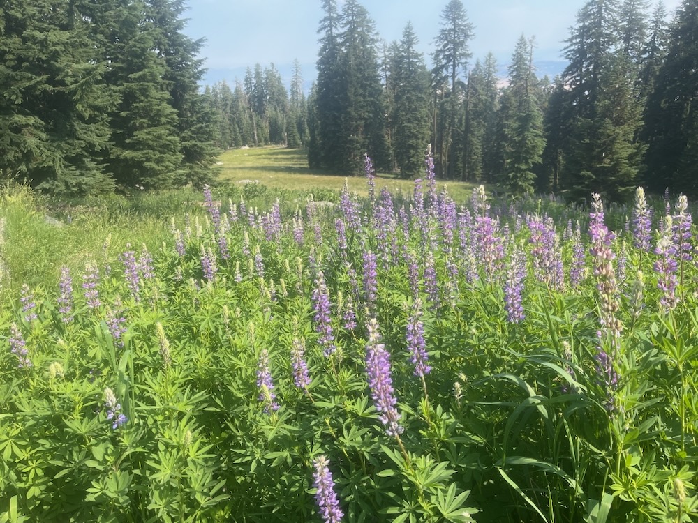
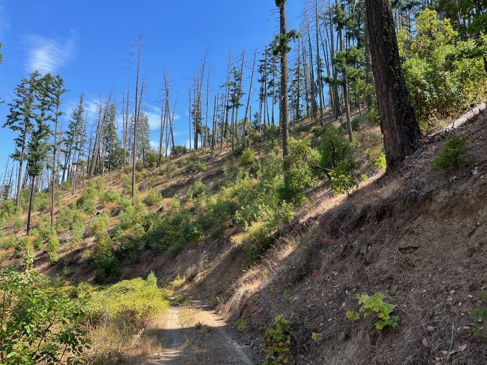
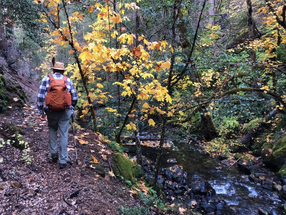
A proposed logging unit in Section 29 along the Grayback Mountain Trail.
In another expression of their love for this place, residents in the Williams Valley spent over 15 years working as dedicated volunteers to build the Grayback Mountain Trail. After years of backbreaking labor, sweat, sore muscles, and BLM red tape, the Grayback Mountain Trail is now a community asset and one of the region’s most popular backcountry hiking trails. The trail traverses old-growth forests on the flanks of Big Sugarloaf Peak and in the upper reaches of Williams Creek that are now threatened with the BLM’s Cedar Flat Timber Sale.
The Cedar Flat Timber Sale extends across BLM lands at the headwaters of Williams Creek, including both the East and West Forks. It also contains old-growth logging units surrounding the Grayback Mountain Trail. Recently ASA, set out for upper Williams Creek to monitor BLM logging units in the area and are outraged, but not surprised by what we found.
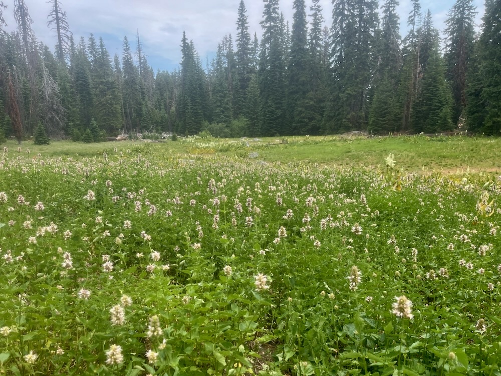
The Cedar Flat Timber Sale targets some of the last old stands remaining in the Williams Creek watershed, including the headwaters of Rock Creek and Glade Fork on the productive north-facing slopes of Big Sugarloaf Peak. These units contain moist forest associations, including lush Douglas fir forests, Port Orford cedar stands, massive old pines, beautiful wide-branching hardwoods and forests carpeted in understory species more common in the coast range than the interior Siskiyou Mountains. At the eastern portion of Port Orford cedar’s range in Oregon, the area represents a wet pocket of coastal forest, a significant climate refuge, and a massive concentration of carbon stored in forest soils, trees, snags, and downed wood.
The BLM’s proposal includes 3,222 acres of potential commercial logging, including 2,493 acres of Late Successional Reserve (LSR) forest, set aside specifically to protect old forest habitat for the northern spotted owl and other forest dwelling species. The logging proposed is likely to include a mixture of heavy commercial logging, group selection logging, Riparian Reserve logging, new road construction, and the logging of large overstory trees that support complex old forest canopies, important wildlife habitat, and high levels of fire resilience.
Based on what we have found so far in the Cedar Flat Timber Sale units, we believe significant mature, late successional and old-growth forest will be targeted with damaging commercial logging prescriptions. We also believe the controversy this sale sparks will ignite opposition, outrage, and protest like the BLM has never seen before!
Rock Creek/Grayback Mountain Trail Units
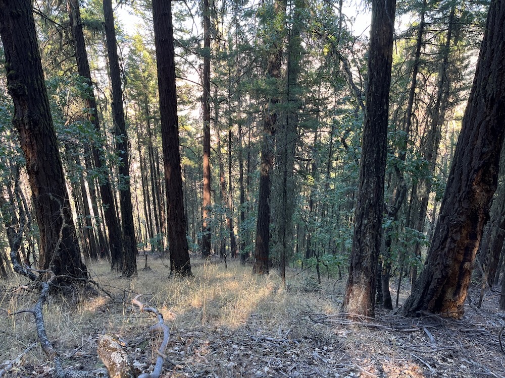
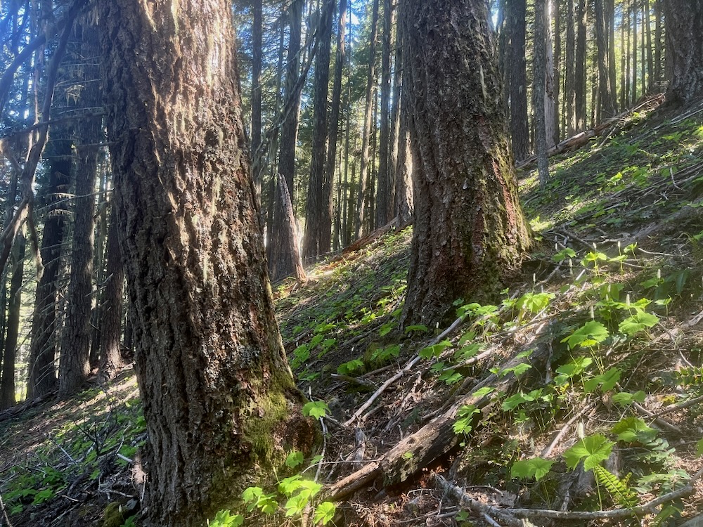
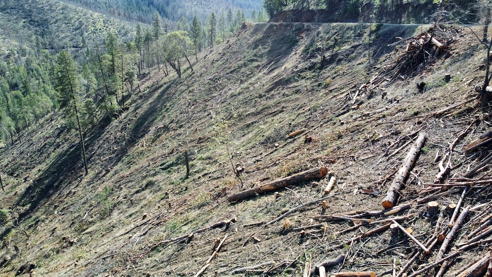
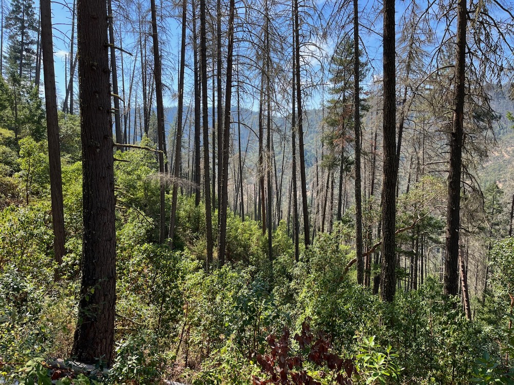
Old-growth forest targeted for logging on Rock Creek below the Grayback Mountain Trail. The proposed logging unit contains mature and old-growth forests with minimal fire risks, large old trees, and important wildlife habitat.
The so-called Cedar Flat Forest Management Project (i.e. timber sale) map provided with the recent scoping notice identifies a large sprawling “treatment area” in Section 29, below the summit of Big Sugarloaf Peak and at the edge of the Grayback Glades Research Natural Area (RNA). The proposed logging unit extends across the community built Grayback Mountain Trail and drops down the flank of the ridge into old-growth forests in both the headwaters of Rock Creek and the West Fork Williams Creek.
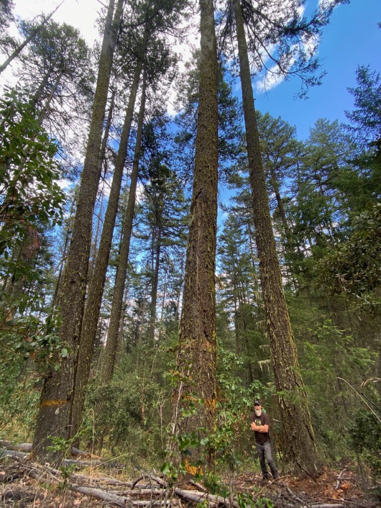
Although not technically inventoried as roadless by the BLM, these stands are contiguous with old-growth forests flanking Big Sugarloaf Peak in the vast Kangaroo Inventoried Roadless Area on adjacent Forest Service lands. The proposed treatment area includes large blocks of relatively moist old-growth forest, including ancient Douglas fir trees up to 4 and 5 feet diameter. Diverse, complex, and important for numerous old-growth species, including the northern spotted owl, pacific fisher and perhaps, even the coastal marten. These ancient, closed forests are also important to the surrounding communities for their scenic and recreational value.
Mature forest proposed for logging on Rock Creek below the Grayback Mountain Trail.
After years of effort working with the BLM to build the Grayback Mountain Trail, the community of Williams is outraged by the agency’s old-growth logging proposal along the trail and on the slopes below. These forests constitute some of the last old-growth forests remaining on BLM lands, and one of the largest blocks of old forest remaining in the area.
To log these forests is unconscionable, and in the era of climate change, profoundly irresponsible. They are treasures in the local community, islands of biodiversity, sources of clean, cold water for downstream watersheds, and by far the most resilient, diverse, and complex forests remaining on BLM lands in the Williams Creek watershed. These are not forests in need of restoration, fuel reduction or timber management, rather they should be managed for their biodiversity, their scenic qualities, and their carbon storage.
ASA has proposed these lands for protection as an expansion of the existing Grayback Glades Research Natural Area (RNA), and as part of a large addition to the Red Buttes Wilderness, including the entire Kangaroo Inventoried Roadless Area and adjacent, unprotected BLM lands.
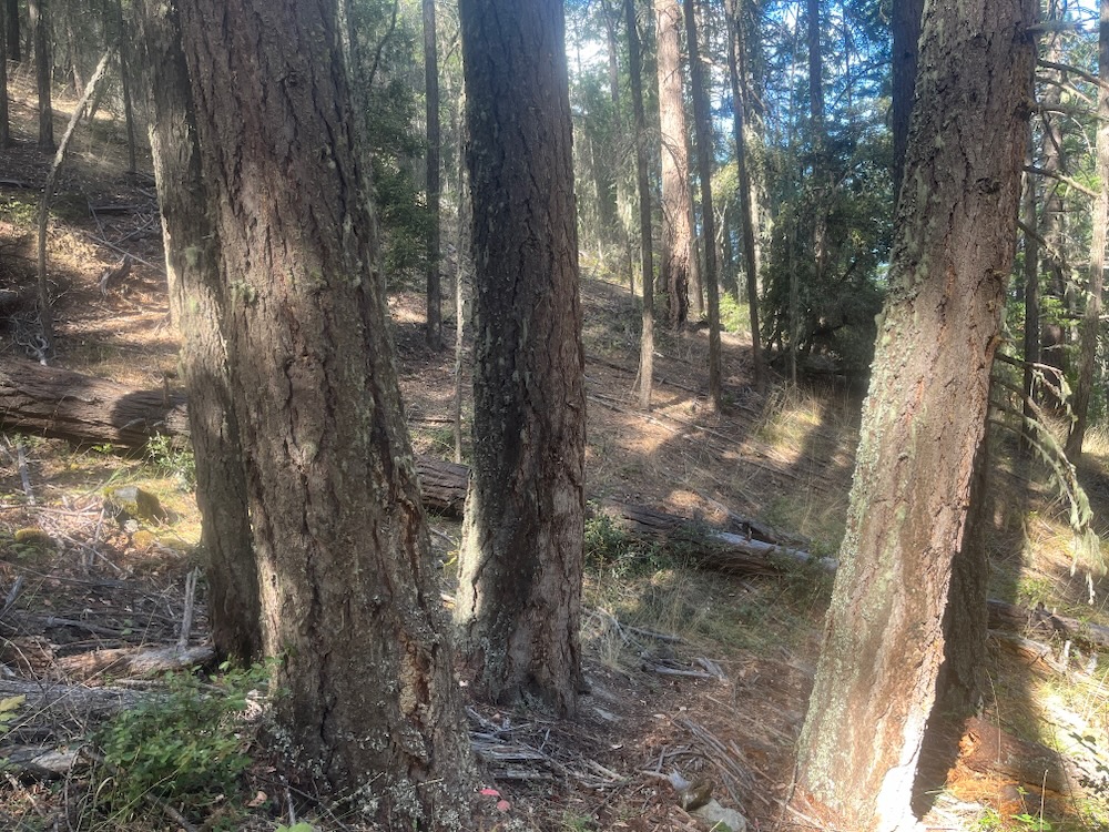
Old growth trees below the Grayback Mountain Trail and within the BLM’s sprawling “treatment area” in section 29.
The BLM has given the public until the end of 2024 to comment on this project. ASA would start by asking that all treatment units proposed in Section 29 and along or adjacent to the Grayback Mountain Trail be canceled, and added to the Grayback Glades RNA.
Glade Creek Units
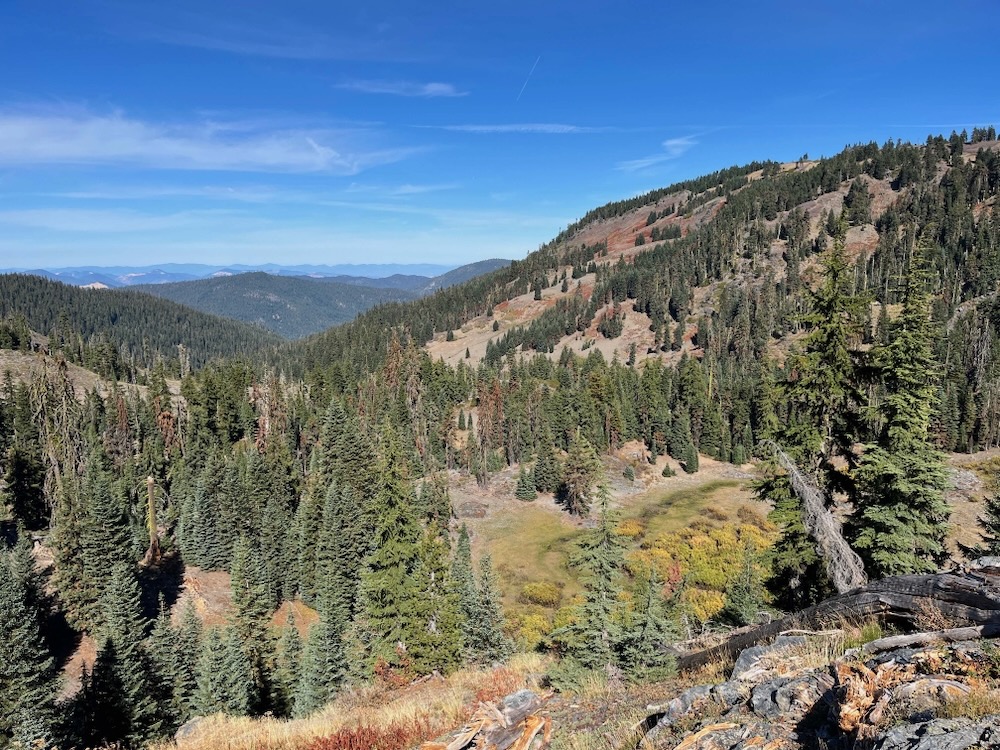
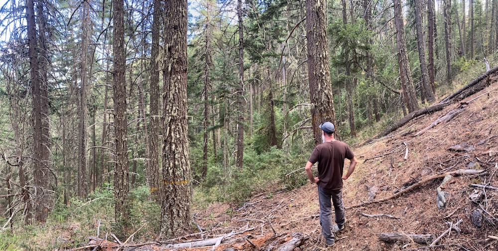
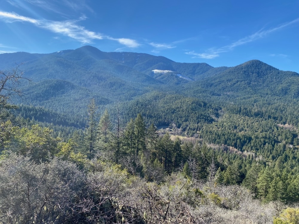
A view from the Layton Ditch Trail to Big Sugarloaf Peak, Glade Fork and Rock Creek where significant old forest logging is proposed in the BLM’s Cedar Flat Timber Sale.
At the headwaters of Glade Creek the BLM has also identified a series of logging units that include unroaded and unlogged forest habitat contiguous with the beautiful old-growth forests on Pipe Fork, the Grayback Glades Research Natural Area, and with the vast Kangaroo Inventoried Roadless Area to the south. Although not technically inventoried as roadless by the BLM, these stands are among the most intact in the Glade Creek watershed and provide connectivity from the Williams area to the wildlands of the Siskiyou Crest.
Starting at roughly 4200′ in elevation, these units extend into montane forest associations containing significant stands of white fir and lush high mountain understory communities. These primary, unlogged forests are foundational to the Glade Creek watershed, and create some of the most important wildlife habitat in the area. Consisting of mature, largely closed forests, they are currently developing naturally into late successional or old growth forests. Patches of mortality have begun generating large diameter snags capable of supporting significant cavity habitat, and large downed trees hold moisture and provide habitat complexity.
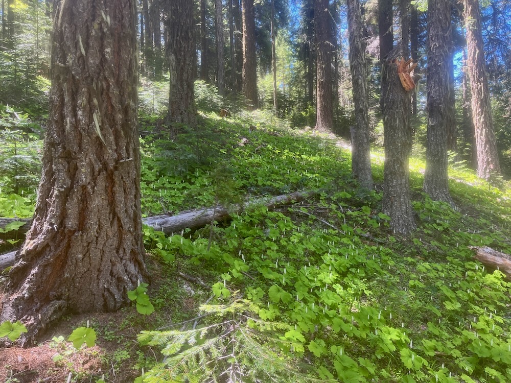
Intact, unlogged forest at the headwaters of Glade Creek adjacent to both the Kangaroo Inventoried Roadless Area and the Grayback Glades Research Natural Area has been targeted for logging in the BLM’s Cedar Flat Timber Sale. An understory of vanillaleaf indicates a moist forest.
The trajectory of this beautiful forest is towards old-growth conditions and logging provides absolutely no benefit. Not in need of restoration or fuel reduction, we believe these stands deserve protection as part of an expanded Grayback Glades Research Natural Area. We also ask that BLM cancel the large “treatment area” in the southern portion of Section 34 and at the headwaters of Glade Fork. These forests are worth more standing!
Units 34-01, 34-02, & 34-03
The BLM has also begun marking unit boundaries on Glade Creek and has identified three timber sale units including 34-01, 34-02, and 34-03. These units contain a variety of forest and stand conditions, including younger plantation-like stands, high graded forests with dense young stands, and older forests with more complex habitat conditions. Portions of these stands have been heavily logged while others are primary forest with intact biological legacies.
Old forest proposed for logging in unit 34-01 of the Cedar Flat Timber Sale.
For example, unit 34-03 shows clear signs of historic high severity fire with big fire scarred snags and downed trees. It also supports dominant overstory trees that have regenerated since the last wildfire. The lower end of 34-01 also contains mature and late successional forest and unit 34-02 contains mature forests with stands of Port Orford cedar. These mature stands are in need of protection and should be removed from the timber sale.
Conclusion
Residents in southern Oregon have fought lawless logging on Grayback Mountain and Big Sugarloaf Peak before, and will do so again if necessary. In fact, the Sugarloaf Timber Sale in 1995 kickstarted a series of timber sale protests across the region that became known as the “timber wars.” Enraged by the old-growth logging occurring on public lands, the public at large revolted, occupied National Forest lands, put their bodies on the line, got arrested en mass, and fueled a movement across the West to defend these last old forests. Some of us from ASA were there and remember this controversy well.
In spite of the history, BLM has never moved on or changed its ways, and like clockwork, after the local community and conservation organizations successfully sued on the IVM Project, as well as the Late Mungers and Penn Butte Timber Sales above Williams, BLM came back with yet another controversial old-growth timber sale, this time near our beloved Big Sugarloaf Peak, which many of us have worked hard to protect in the past.
Based on the BLM’s insistence on proposing illegal and highly controversial timber sales, they have been stymied by lawsuits and subjected to multiple rounds of recent protests in the Applegate Valley, including against the Bear Grub and Late Mungers/Penn Butte Timber Sales. They have also recently been subjected to tree sitting actions in the Poor Windy and Rogue Gold Timber Sales. The Medford District BLM appears poised to reopen the wounds still only partially healed after the timber wars of the 1990s by proposing late successional and old-growth logging projects throughout the region.
Steering recklessly towards conflict, the BLM is once again planning to target some of southern Oregon’s most beloved forests and will surely provoke a response. ASA will be working to stop the Cedar Flat Timber Sale and its old-growth logging proposals at the headwaters of Williams Creek and on the lush northern face of Grayback Mountain and Big Sugarloaf Peak. Please join us as we save Grayback Mountain from the BLM’s newest old-growth logging proposal.
Comments are being accepted until the end of 2024. ASA will be providing information to the public as we monitor the timber sale units. We encourage you to comment and will share information throughout the process. Save Grayback Mountain! Stop the Cedar Flat Timber Sale!
Hikers at the Tallowbox Trail Grand Opening about 1 mile from the upper Tallowbox Trailhead in the mountains above Cantrall Buckley Park.
Applegate Siskiyou Alliance worked this past winter with volunteer crews and funding from the Ashland Food Co-op Community Grant Program to build the Tallowbox Trail. We recently opened the trail to the public with a grand opening ceremony, a hike on the trail, and a side trip to the summit of Tallowbox Mountain.
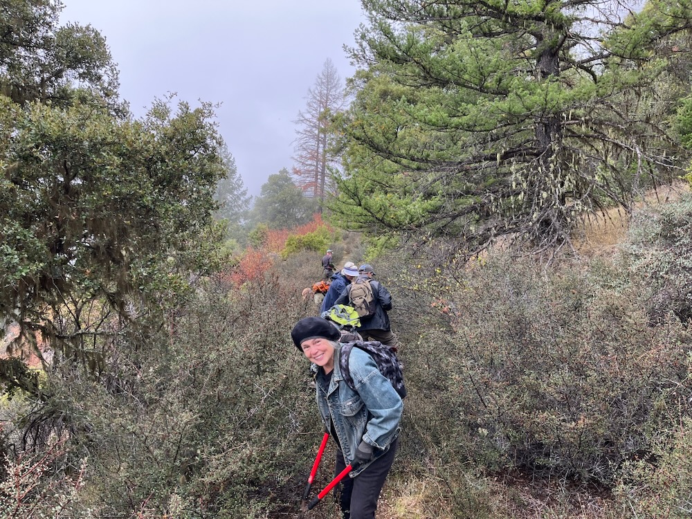
Applegate Siskiyou Alliance is excited to open this new trail in the BLM’s Burton-Ninemile Lands with Wilderness Characteristics (LWC) and is grateful to all the volunteers who helped build the trail—we had one hell of a buckbrush clearing crew! We are also grateful to John MacKenzie for building the beautiful wooden Tallowbox Trail signs, the Ashland Food Co-op for additional funding, and Josh Weber from Green Path Landworks for helping with more technical sections of trail construction. It was a great community effort, is now a great community asset, and provides the Applegate with yet another beautiful hiking trail to enjoy the region’s spectacular beauty.
Our volunteer buckbrush trail clearing crew on a cloudy October day.
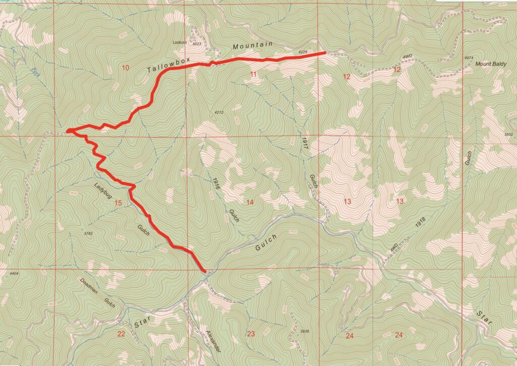
Below is a detailed trail description followed by detailed directions to both the lower Ladybug Gulch Trailhead along Star Gulch Road and the upper Tallowbox Trailhead above Cantrall Buckley Park.
The trail can be hiked from top to bottom as a relatively strenuous 4.2 mile hike (one way) and over 2000′ elevation gain. As a shuttle from trailhead to trailhead, or in smaller chunks from either the (lower) Ladybug Gulch or (upper) Tallowbox Trailheads.
Tallowbox Trail
The Tallowbox Trail is the Applegate Valley’s newest backcountry trail and a beautiful hike through forests, woodlands, grasslands, and thickets of chaparral, with commanding views across the Siskiyou Crest and the Upper Applegate River watershed.
The trail begins along Star Gulch deep in a forested canyon. A small cascade tumbles over bedrock in vine maple thickets along Star Gulch, while the trail starts up across the road on Ladybug Gulch. Pass the wooden Tallowbox Trail sign and hike onto an old road built historically to access the old Tallowbox Mountain fire lookout (burned by vandals in 2007 and never replaced). Today, this old road has been decommissioned and re-contoured by the BLM to reduce sedimentation and hydrological impacts on the stream, and to the fisheries of Star Gulch. Most recently, the old road has been converted into a non-motorized hiking trail by Applegate Siskiyou Alliance and now serves as the beginning of the Tallowbox Trail.
Ladybug Gulch flows through the Burton-Ninemile LWC along the lower end of the Tallowbox Trail.
Ladybug Gulch is a beautiful seasonal stream surrounded in mature Douglas fir forest, stately canyon live oak, bright orange madrone, and a riparian area lined in alder, maple, and beaked hazel. The trail winds up this pleasant, shaded stream on a gentle grade, making a leisurely hike through wonderful mixed conifer forests. The trail crosses the small stream twice (just a step over the creek) and continues upstream to a final crossing where it then winds around a motor vehicle closure and onto an old road a little less than a mile from the trailhead. Follow the brown carsonite TRAIL signs up the old roadbed and into the upper Ladybug Gulch canyon through forested habitat with a few scattered openings of oak and chaparral.
Reaching a major saddle and road intersection, follow brown carsonite TRAIL signs to the right. As you climb the view broadens, the soils become more rocky, and the forest slowly gives way to live oak and madrone woodland. At about 2.5 miles from the trailhead and after a relatively gradual 2000′ climb, the Tallowbox Trail reaches a small grassy clearing directly below the summit of Tallowbox Mountain. The clearing dotted in rabbitbrush, silver lupine, and twisted oak trees can be quite colorful in the spring and early summer with beautiful wildflowers. As you continue hiking, the summits of the Siskiyou Crest can be seen in the distance, dominated by the rugged skyline of the Red Buttes Wilderness.
A view from near the intersection with the Tallowbox Lookout Road.
Shortly you will reach an intersection with the Tallowbox Mountain Lookout Road and the remainder of the Tallowbox Trail. The Tallowbox Trail is marked with another wooden Tallowbox Trail sign on your right. This is the highest point of the Tallowbox Trail at 4,600′. At this point, you can also make a detour up to the peak of Tallowbox Mountain. Although this is a detour off the official Tallowbox Trail, it is a worthy side trip (described at the end of this trail description).
If you remain on the Tallowbox Trail, it quickly enters an isolated stand of large Douglas fir and ponderosa pine trees with charcoal covered trucks from a previous prescribed burn. The stand is relatively spacious and dominated by large, old trees. A canopy shades the forest floor, which is subsequently open and relatively clear, creating picturesque stands that merge below with groves of live oak. The trail them drops past a narrow band of white oak woodland and into a sweeping, grassy clearing punctuated by a few tufts of dark bedrock and fields of California poppy.
The prairie-like slope offers dramatic views to the south and east across the Upper Applegate and Little Applegate River watersheds. In the winter and spring the line of distant snow-capped summits can be quite impressive, extending from Wagner Butte, Big Red Mountain and Dutchman Peak, to the rugged Condrey Mountain Roadless Area, and the dramatic Red Buttes Region. Star Gulch descends below in a long forested canyon, while Mount Baldy and Burton Butte rise dramatically to the east, looming above the Applegate Valley and the surrounding foothills.
Prairie slopes with big views on the Tallowbox Trail .
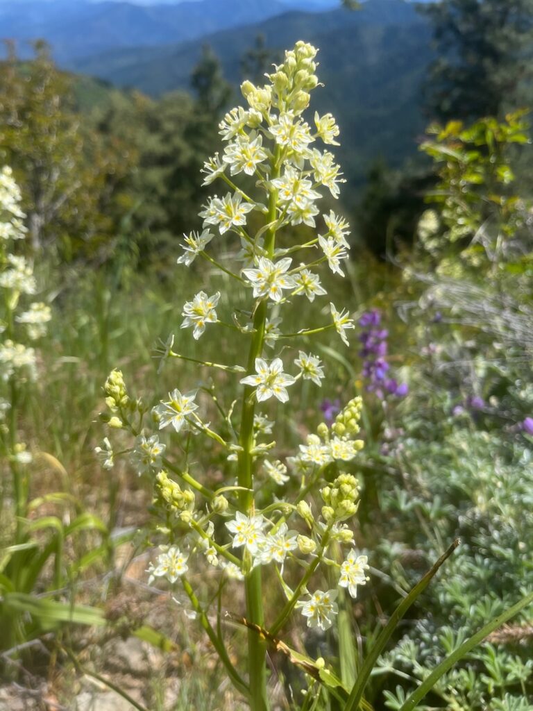
Dropping steeply, the trail continues down this old road bed then reaches a more gentle ridgeline and traverses the slopes to the east through thickets of chaparral and openings filled with wildflowers in the late spring and early summer. This includes California poppy, California lomatium, fernleaf lomatium, large patches of cobwebby thistle, and populations of the rare giant death camas.
Giant death camas (Toxicoscordion exaltatum)
In the state of Oregon, giant death camas is found only sporadically in the mountains of the Upper Applegate Valley. The large white and yellow flowers of giant death camas grow in a relatively open panicle from large, green, strap-shaped foliage. Populations of this species are more abundant in California where it grows in the mountains and foothills adjacent to the Central Valley, but in Oregon the species is known from only a handful of populations in the Upper Applegate Valley, with the largest, most robust population being found on Tallowbox Mountain.
The beautiful views, wildflowers and chaparral continues to the upper Tallowbox Trailhead, located in a low saddle between Tallowbox Mountain and Mount Baldy at roughly 4,000′.
Optional Tallowbox Mountain summit detour:
From the high point on the Tallowbox Trail, instead of following the trail, turn north along the roadbed and quickly reach an intersection. Walk to the left, passing through a locked gate and continue along the lookout road through mature forests of white and Douglas fir. These more lush and productive forests on the mountain’s north and eastern slope contain patches of red flowering current, Oregon grape, and Rocky Mountain maple, along with western bleeding heart blossoms in the spring. The road hits a major switchback then enters more open slopes with blooming groundsel and balsamroot. The road then climbs to the summit, communication site and former lookout site. The summit although altered by lookout and communication site construction, contains robust populations of giant death camas, pink mats of spreading phlox, bright yellow carpets of sulphur buckwheat, clumps of pale yellow bigseed lomatium, and the rather non-distinct, pale pink Holboell’s rock cress.
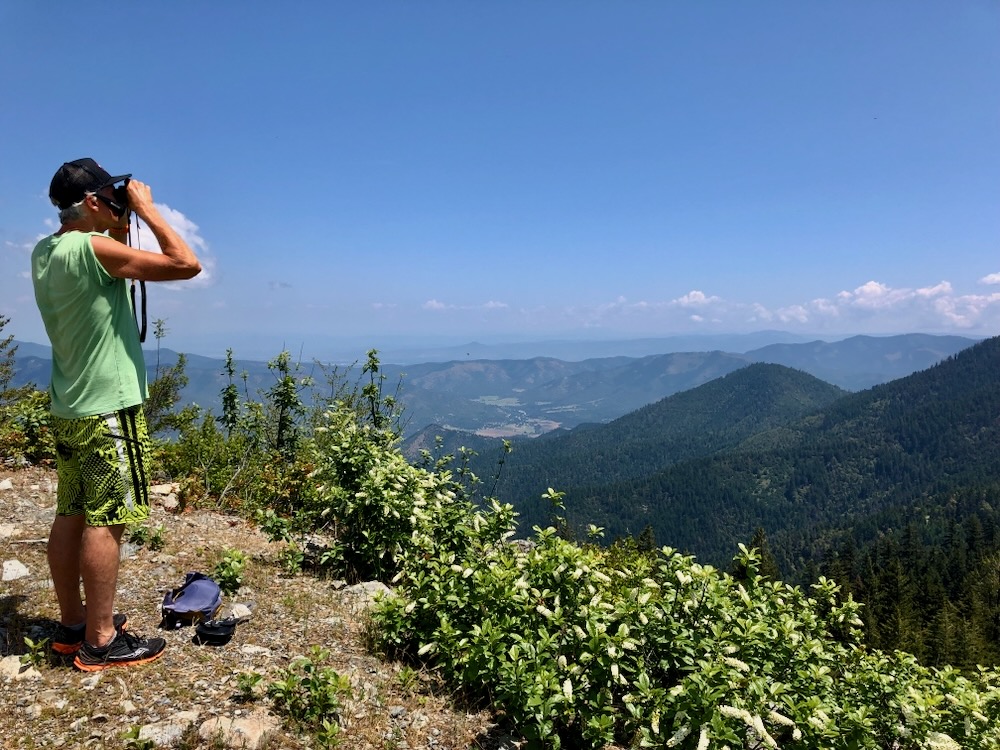
A hiker on the summit of Tallowbox Mountain enjoying the views.
The former one room lookout built on a 30 foot tower was originally built in 1918, but was damaged irreparably by vandals and arsonists in 2007, and removed. Although the lookout no longer exists and a communication site has been developed on top of Tallowbox Mountain, it remains interesting botanically and the view is incredible across the Applegate Valley, the Rogue Valley and the Siskiyou Crest region.
From the summit, you can gaze across the Siskiyou Crest From Mt. Ashland and Wagner Butte to Grayback Mountain, across the scenic Applegate Foothills and Applegate Valley below. To the south is a seemingly endless horizon of rugged ridges and canyons rising to the dramatic spine of the Siskiyou Crest. To the north and northwest, rugged foothills line the narrow Applegate River Valley, while the broad Rogue Valley to the northeast is bound by the Cascade Mountains, including views all the way out to the Crater Lake rim, the Sky Lakes Wilderness and the conical peak of Mt. McLaughlin.
Shorter Options on the Tallowbox Trail
Tallowbox Trailhead to Tallowbox Mountain section: Drive to the upper Tallowbox Trailhead above Cantrall Buckley Park. This option consists of a 1.5 mile hike and about 1000′ elevation gain (one-way) from the upper trailhead to the summit of Tallowbox Mountain. The hike offers exceptional views, diverse vegetation, and beautiful wildflowers.
Ladybug Gulch section: Drive to the (lower) Ladybug Gulch on Star Gulch. This option includes a roughly 1 mile hike with about 350′ elevation gain (one-way) in a shaded canyon of mature forest along Ladybug Gulch. The hike offers solitude, a relatively easy walk among mature conifer forest, and a beautiful seasonal stream.
The Tallowbox Trail near the upper Tallowbox Trailhead with a view across the Siskiyou Crest region.
Directions to trailheads
Directions to the upper Tallowbox Trailhead:
Starting from Ruch, Oregon, drive highway 238 west about one mile and turn left on Hamilton Road. In about one more mile turn right onto Cantrall Road. You will drive past Cantrall Buckley County Park, and through a residential area. Staying on the paved Cantrall Road up to the ridge and beyond as it winds around the eastern flank of Ben Johnson Mountain. Almost 6 miles from Cantrall Buckley Park the pavement ends. Continue along this relatively well graded, well maintained gravel road approximately 1.5 miles to a small pullout on the left, marked with a wooden “Tallowbox Trail” sign along the road.
Directions to the lower Ladybug Gulch Trailhead:
Starting from Ruch, Oregon drive Upper Applegate Road south to Star Gulch Road (just before Star Ranger Station). Turn right onto the paved Star Gulch Road and continue immediately over a concrete bridge. Drive 5.8 miles Up Star Gulch Road to the Tallowbox Trailhead, marked by a wooden Tallowbox Trail sign on the right side of the road. Parking is in a wide pullout across from the trailhead and just below a small concrete bridge over Ladybug Gulch.
The Tallowbox Trail shown in red follows single track hiking trail and old road through the Burton-Ninemile Lands with Wilderness Characteristics.
In our last blog post, we explored the connection between BLM logging operations in the Applegate Valley and elevated levels of beetle mortality in recent drought events. We also examined the BLM’s currently proposed SOS Project which would log up to 5,000 acres of beetle affected forests throughout southwestern Oregon. This logging would include the removal of both live and dead standing trees, and in many cases will result in large-scale clearcut logging.
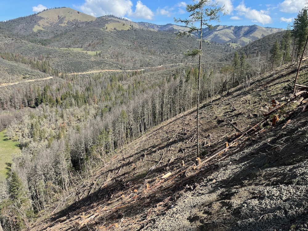
The slopes in the foreground were clearcut in unit 27-1 of the Lickety Split Timber Sale, a BLM salvage logging project in the Little Applegate Valley. Despite the rhetoric and greenwash, this is what salvage logging looks like when implemented by the Medford District BLM.
As a follow up to this previous post, we are now exploring two recent examples of so-called “salvage” logging in stands with varying levels of beetle mortality. Although you often hear land managers claim that these salvage logging treatments are focused on “fuel reduction” and “forest health,” the timber sale marks and the actual timber sale outcomes tell a very different story.
Salvage logging, by definition, is about recovering the economic value of dead trees, and most scientific studies have proven salvage logging to be ecologically damaging.
Below we will explore the actual result of these commercial logging, and often clearcut logging operations. Our case studies will include the Lickety Split Timber Sale implemented by the Medford District BLM in the Little Applegate Valley, and the helicopter logging recently approved by the city of Ashland, Oregon on city owned forest and park lands.
Lickety Split Timber Sale, Little Applegate Valley
Clearcut logging in unit 28-2 of the Lickety Split Timber Sale.
While the BLM recently led a public field trip to greenwash their SOS Project logging proposals, they have at the same time, been clearcutting and otherwise heavily logging large swaths of public land in the Little Applegate River watershed in the Lickety Split Timber Sale. This salvage logging project removed both dead standing, beetle killed trees, and large, green trees that survived the beetle outbreaks.
These living, green trees support favorable genetic traits that could naturally regenerate or reforest the beetle affected stands with drought and beetle resistant trees; however, in the case of the Lickety Split Timber Sale, the BLM logged many of these surviving trees, removing the naturally resistant seed trees and undermining the selective pressures and evolutionary processes that build future resilience in our local forests.
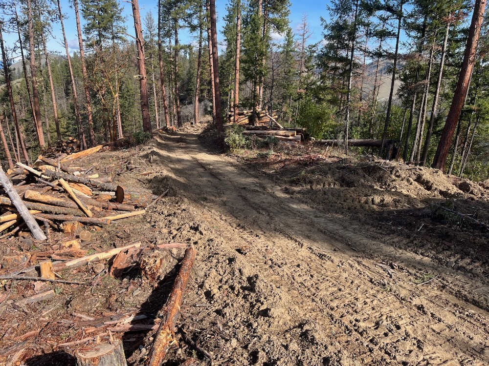
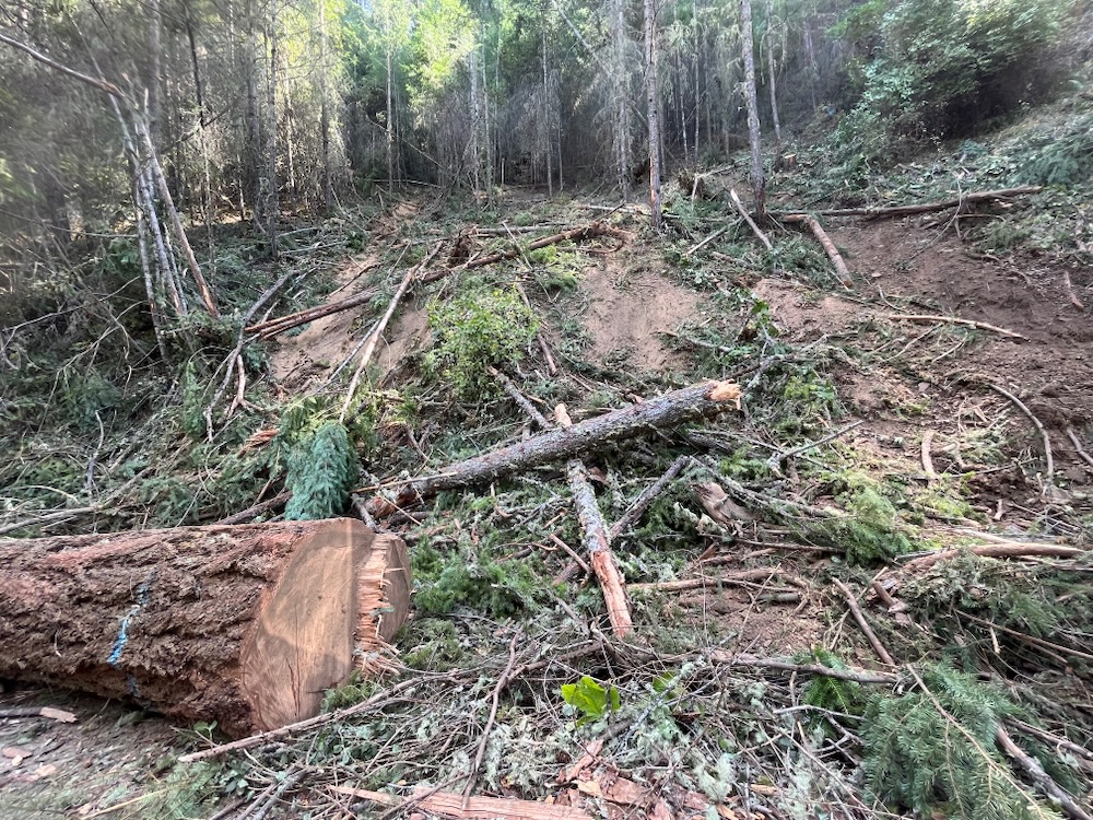
A “temporary” road built to access unit 36-2 of the Lickety Split Timber Sale. So-called “temporary” roads have permanent impacts.
In response to the most recent mortality in these stands, the BLM has removed nearly all overstory canopy, and in many locations, has clearcut both dead standing and living green trees. The result of the Lickety Split Timber Sale in many units looks like a clearcut, functions like a clearcut, will be replanted in plantation stands like a clearcut, and will both damage habitats and increase fire risks like a clearcut.
Although the BLM often claims these salvage logging operations will favor and encourage hardwoods, oaks, pines and more drought resistant native vegetation, again, when you compare their claims to the actual outcome of their projects, it’s a very different story. In the Lickety Split Timber Sale, the agency removed not only living and dead standing conifer trees, but also cut, damaged, or otherwise destroyed nearly every hardwood (madrone, black oak, white oak, etc.) in the timber sale units. This left virtually nothing to replace the beetle killed stands. Additionally, the widely spaced and heavily isolated conifer trees, or very occasional hardwood tree that survived the logging operation, are now highly susceptible to increased windthrow during high winds or heavy snow events.
Salvage logging in the Lickety Split Timber Sale clearcut vast acreages, including the residual hardwoods and surviving conifer trees in many “treated” stands.
In addition to projects like the Lickety Split Timber Sale, the Medford District BLM is administratively reclassifying many beetle killed stands as “young stands.” This allows the BLM to treat these stands using “pre-commercial” thinning prescriptions which remove virtually all hardwoods and purposefully reintroduces even-aged, plantation style forestry, instead of allowing the more resilient hardwoods, residual conifers, and naturally regenerating forests to develop after the beetle mortality events. Both the removal of more resilient, but less commercially valuable species, and the artificial reforestation or tree planting that follows such heavy industrial logging, will degrade habitats, simplify forest structure, reduce stand resilience and dramatically increase fire risks.
Don’t be fooled by the BLM’s rhetoric, the Lickety Split Timber Sale demonstrates exactly what the BLM’s proposed salvage logging in the SOS Project will create: clearcuts, heavy logging slash, extensive soil damage, stream sedimentation, an impediment to natural regeneration, new plantation stands and significantly decreased habitat values across broad landscapes. Fire risks will also increase in many of the forests that surround our communities due to the even-aged regeneration practices associated with clearcut logging and salvage logging operations.
Unit 27-1 of the Lickety Split Timber Sale was clearcut under the guise of salvage logging and is an example of the logging treatments being promoted by the BLM in beetle affected stands. Photo credit: Chas Rogers/Williams Community Forest Project
The result of this project is quite literally clearcut, and the so-called benefits BLM speaks of are simply not part of the actual outcome from these logging operations. Rather than encouraging a natural, diverse, dynamic vegetative recovery following the recent mortality outbreaks, BLM is degrading habitats, developing plantations, and releasing naturally stored carbon through tree and snag removal operations. Rather than making our forests more resilient, the BLM and its salvage logging practices are fueling the climate and biodiversity crisis.
Similar to the salvage logging projects recently proposed or approved by the BLM, this project will “salvage” tree mortality that has occurred since previous “forest health” logging operations were implemented. Most of this project is proposed in previously “treated” stands, many of which were commercially thinned with helicopters during the Ashland Forest Resiliency Project.
Tree mortality during the recent beetle outbreak has been elevated in previously logged stands on city of Ashland lands. This photo shows a heavy tree removal mark above Lithia Park on the Bandersnatch Trail. Whole groves of dead standing trees are being logged (like the blue marked trees in this photo) and heavy thinning is being implemented in live, green stands that survived the recent beetle outbreak. The cumulative affect of previous and current logging activities in the Ashland Forest Resiliency Project has been to kill far more trees than the recent beetle outbreak.
Although often characterized as a beetle mortality or “salvage” logging project, the city has marked acres and acres of live, green trees that survived the recent beetle outbreaks. In fact, in our monitoring of the project it appears that more live trees will be logged than those that were recently killed by beetle infestation.
In fact, the timber sale mark (implemented for the city of Ashland by the Lomakatsi Restoration Project) did not appear to achieve overtly ecological objectives. Large snags with potential commercial value, often including the largest snags in a stand, are marked for removal. This often includes the biggest, most important wildlife snags and isolated snags that pose no risk to public safety or future fuel loading. In many cases, snags would be clearcut, or virtually clearcut, and stands of live, green trees would be heavily thinned, leaving them susceptible to the same problems, and suffering from the same fragility that the original Ashland Forest Resiliency Project thinning operations have created.
Significant green tree logging in the Acid Castle parcel demonstrates that live stands of trees that survived the beetle outbreak are being targeted with heavy commercial thinning and canopy reduction.
Recently, the Ashland City Council approved the logging of the Reeder Reservoir area to offset the extensive public cost of this largely unnecessary project. According to recent city drone surveys 93% of the Douglas fir trees in this area are healthy. Not exactly an emergency, the logging around Reeder Reservoir, the city of Ashland’s water supply, is being conducted to enhance the economic, not the biological value, of this shortsighted timber sale. Other areas supporting between 68% and 78% healthy Douglas fir trees would also be logged in this proposal, including Ashland’s beloved Siskiyou Mountain Park, along the White Rabbit Trail, along the Bandersnatch, Snark, and Red Queen Trails, in the Hitt Road/Acid Castle area, and on other portions of city owned land.
A map from the aerial drone survey recently conducted by the city of Ashland. The map shows the Reeder Reservoir area, which will be logged to offset the cost of project activities. Notice that 93% of the trees are healthy and very little mortality (5.1% or 81 trees) was documented on site.
This pulse of beetle mortality would, if left unlogged, provide a necessary input of snags and downed wood in forests that are currently largely deficient in both. The beetle mortality naturally thinned forest stands, created gaps for hardwood and conifer regeneration, provides important habitat values, and significantly contributes to habitat heterogeneity.
Utilizing what we call “fear based forestry,” Chris Chambers has been quoted in local newspapers stating that beetle mortality threatens public safety, will increase fire risks, and even that dead standing trees may fall into Ashland Creek, somehow threatening downstream communities. He has also claimed that beetle mortality is threatening to convert the forests of the Ashland Watershed into grassland or shrubland habitat. Unfortunately, neither the science that has studied beetle mortality events, the severity of this particular beetle event, nor the facts of this project support this narrative.
An isolated wildlife snag approximately 30″ in diameter being targeted for removal in the Acid Castle area.
Ironically, despite the claims of “firmageddon” in the media and the fear-based messaging of project partners, the cumulative mortality created by previous commercial thinning operations in the Ashland Forest Resiliency Project, and the additional green tree logging proposed in the Ashland watershed under the guise of timber salvage, has killed or will kill, far more trees than the recent beetle outbreak in the Ashland watershed.
The natural disturbance (in this case beetle mortality), although potentially accelerated by climate change and drought, is within the range of variability for this landscape and has likely happened before. Habitats in the transitional climate of southwestern Oregon are significantly influenced by natural disturbance episodes including drought, beetles, fire, snowloads, wind storms, and even native pathogen outbreaks. Plant communities shift in response to these disturbance episodes and mortality leaves important biological legacies that provide habitat, support complexity, hold moisture, build soil, and maintain continuity between habitats and successional stages.
Additionally, while the beetle mortality event killed genetically susceptible, less resilient trees and forests, the logging proposed will remove green, living trees that demonstrated significant resilience by surviving these droughts and subsequent beetle mortality events. These survivors may contain significant genetic adaptations important for building future resilience to drought and beetle outbreaks in our local forests, but unfortunately, the City of Ashland plans to remove many of them in helicopter logging operations.
Green tree logging in previously thinned stands along the White Rabbit Trail in Siskiyou Mountain Park.
Instead of focusing on legitimate hazard tree removal along forest roads, at trailheads, around public infrastructure and directly adjacent to communities, snag and live tree removal will be widespread throughout the watershed and will occur in relatively remote portions of these city owned properties. In many cases this will include stands far from trails, trailheads, or developed infrastructure. In these locations, public safety risks are either very minimal or non-existent. In fact, the Reeder Reservoir parcel is largely closed to the public and thus, no public safety risk can be credibly claimed. Instead, the logging proposed on the Reeder Reservoir property is purely economically driven and the live, green timber will be used to subsidize and/or offset the removal of dead standing snags throughout city owned land.
Furthermore, tree and snag removal will impact the scenic value of local recreational trails turning portions of these trails like the Bandersnatch Trail and White Rabbit Trail into extensive stump fields. Snag and tree removal will reduce wildlife habitat in the area, remove important biological legacies, leave future stands deficient in snags and downed wood, and open stands up to both increased aridity, increased drought stress and increased fire risks.
Snag and tree removal will also impact future soil stability, soil productivity, and soil moisture availability by removing snags or low vigor trees that would provide for the recruitment of coarse downed wood. Coarse downed wood is a critical component of old-growth forests, and if we want old forest habitats, we need both downed wood and big standing snags.
As for the concerns of snags falling in Ashland Creek, the science shows that has been happening for thousands and thousands of years, and is indisputably a good thing for the creek, for fisheries, and for aquatic species of all types. The reason watershed councils across the region spend millions placing large logs into streams, is because it’s good for riparian health and fish! The recent beetle outbreak provided a pulse of mortality recruiting snags, downed trees and instream wood which supports soil, wildlife and watershed health.
Green tree logging proposed in already relatively open stands of Douglas fir along the Red Queen Trail in the Ashland watershed.
Conclusions
Despite the claims of logging proponents, a heavy dose of greenwash, and a persistent public relations campaign, the current push to “salvage” beetle killed timber in southwestern Oregon comes with significant environmental consequences and climate impacts, and very few benefits. Most definitely not a restoration or fuel reduction treatment, the logging currently being implemented and proposed across the region will simplify, degrade, and diminish the resilience, beauty, and biodiversity found in southwestern Oregon’s unique, highly diversified forests.
Soil damage and habitat destruction from clearcut salvage logging in unit 36-2 of the Lickety Split Timber Sale.
Neither the logging approved in the Ashland watershed or the Applegate Valley has positive biological outcomes; neither will meaningfully reduce fire risks; neither will restore ecosystem function, and neither will achieve the lofty objectives claimed by the city or by the BLM. These projects and their numerous undesirable outcomes should inform the conversation about future salvage logging in the BLM’s proposed SOS Project and similar projects likely to be proposed by both the BLM and other land managers.
Despite the forest health rhetoric, salvage logging is the worst form of industrial logging, with perhaps the most significant and lasting environmental impacts because it is often implemented as clearcut or heavy industrial logging. It is also often rushed to the mill and poorly designed without sufficient site specific analysis or adequate design features to mitigate impacts. In the case of the Lickety Split Project, it was also implemented during the rainy season maximizing the projects impact on soils, hydrology, sedimentation and watershed health.
We encourage folks to get out when the logging is finished in the Ashland watershed, or go for a drive up Lick Gulch Road in the Little Applegate River watershed. The consequences of salvage logging, the singular economic focus, and the false narrative spun by its supporters will quickly become evident.
Directions to Lick Gulch Road and the Lickety Split Timber Sale: Drive highway 238 to beautiful Ruch, Oregon and turn south onto Upper Applegate Road. Follow Upper Applegate Road 2.9 miles to the intersection of Little Applegate Road. Turn left on Little Applegate Road and continue 4.9 miles to the pavements end and turn right on Yale Creek Road. Drive past a row of mailboxes, cross the Little Applegate River on a bridge and immediately turn left on the signed “Lick Gulch Road”, also known as BLM road 39-2-28 (denoted by a large brown BLM road sign). Follow this road past a few residences and onto BLM land. Immediately you will see Lickety Split Timber Sale units. Continue driving and turn right at the next intersection. You can drive this road for 3-4 miles driving in and out of timber sale units.
Flat headed fir borer mortality on Ferris Gulch in an area commercially thinned for “forest health” in the 1990s. Previous “forest health” thinning operations throughout the Applegate Valley are now sustaining high levels of beetle mortality.
Flat headed fir borers, engraver beetles, and other wood and bark boring insects
Triggered by extended droughts, a significant lack of persistent winter cold snaps, stifling summertime heat domes, and a changing climate, flat headed fir borers and fir engraver beetles have become very active across interior southwestern Oregon. In fact, populations of these native wood boring beetles have exploded in recent years, creating significant Douglas fir mortality throughout the region.
Flat headed fir borer mortality in the Little Applegate Valley.
A visceral sign of climate change, the mortality reached epidemic proportions in 2022 and 2023, when flat headed fir borers could literally be heard chewing through stands of Douglas fir in the foothills of southwestern Oregon.
Mortality was occurring in large patches at lower elevations, especially on droughty sites, harsh exposures, sites with poor soils, sites more conducive to oak woodland, chaparral, or mixed hardwood stands, and in many previously implemented “forest health” logging or commercial thinning projects.
Since the 1990s, the Medford District BLM and Rogue River-Siskiyou National Forest have been implementing landscape-scale logging, or commercial thinning projects, intended specifically to increase “forest health” and resilience to both drought and beetle mortality; however, in many locations these “restoration” thinning projects have had the opposite effect, and both the false claims used to justify the logging, and the forested habitats they have “treated” have begun to unravel.
Old-growth ponderosa pine killed by pine beetles in a unit commercially thinned during the Ashland Forest Resiliency Project by the Lomakatsi Restoration Project. Located in the Ashland Research Natural Area, an area designated to study old-growth pine habitats, the units were logged to supposedly increase resilience to drought, beetles and fire, yet many of the stand’s old-growth pine have succumbed to beetle mortality and significant drought stress since the logging has occurred.
At best, the previous commercial thinning treatments failed to create the resilience or restoration predicted by the BLM and USFS in each timber sale’s scientific analysis and approval documents (e.g. Environmental Analysis, Decision Record, etc.), and the agencies need to stop promising outcomes they can’t actually create through logging.
At worst, the logging was actually responsible for the scale of the beetle outbreak by weakening whole stands of trees, and the agencies need to stop large-scale commercial logging that is contributing to the loss of regional forests.
The reality is likely somewhere in between. Climate conditions can trigger the outbreak, while in some places previous commercial thinning or logging operations have damaged soils, damaged trees, increased aridity, increased edge effect, increased air temperatures, made stands more susceptible to beetle impacts, encouraged beetle populations to expand, and contributed quite significantly to the mortality event.
Flat headed fir borer mortality is extensive in units thinned in the Lick Stew Project by the Lomakatsi Restoration Project. Implemented to “increase stand health and resilience,” the area is now being logged in the Lickety Split Salvage Project by the BLM. Over the course of a decade, this once forested stand was heavily logged using “restoration forestry,” sustained significant beetle mortality following the logging treatments, is now being subjected to post-disturbance logging, and has been deforested and/or converted to grassland.
In many ways, the BLM has been an active contributor to both the current climate crisis and the recent beetle mortality event, by creating extensive logging related carbon emissions that fuel climate change. Recent research found that commercial logging and timber manufacturing is the largest contributor of greenhouse gas emissions in the state of Oregon (Law. 2018), while regional research shows that commercial logging is responsible for 80% of the Forest loss in Oregon and Washington combined. It also found that logging in Oregon and Washington constitutes 67% of all forest loss in the 11 Western states where fire and beetle mortality are most acute. This makes logging, not beetle mortality, the most significant threat to the forests of the West, and in particular the most significant threat to forests in the Pacific Northwest. (Berner. 2017).
BLM’s Response: The SOS Project
The impact of post-disturbance or “salvage” logging of dead and “dying” trees on Ferris Gulch in the Applegate Valley.
Currently the BLM has identified a massive planning area sprawling across the BLM lands surrounding both the Rogue and Applegate Valley. Unfortunately, what the agency has not done, is identify where within this vast landscape that post-disturbance logging would actually occur. According to the Scoping Notice for the Strategic Operations for Safety Project (SOS Project), the BLM would log approximately 5,000 acres in still undisclosed locations.
The SOS Project and its proposed post-disturbance logging would take place somewhere in the area identified on the map above. No site-specific units have been identified, making both credible scientific analysis and meaningful public comment nearly impossible.
These operations could occur along BLM roads, in what the BLM calls Potential Operational Delineation (POD) areas, and within 1 mile of developed areas or homesteads. They could also be implemented in Riparian Reserves, Late Successional Reserve (LSR) forests, along hiking trails and in recreation management areas, degrading the values these areas were designated to protect.
The agency claims this logging is benign or even beneficial, and is necessary for both public safety and future fire containment. Yet, the agency proposes logging over 500′ on either side of BLM roads and so-called POD areas, far beyond what can be credibly called “hazard tree” logging, and far beyond what is necessary for future fire containment. As currently designed the project is an excuse to log, not a valid public safety or fire risk reduction project.
The BLM also proposes logging both dead standing, beetle killed snags, and live, green trees that survived the beetle outbreak. Yet, these surviving trees contain either high genetic resistance, or grow in favorable microclimate conditions, allowing for their survival and persistence. Removing these trees will generate short-term profits for the industry, and provide board footage for the BLM’s annual timber quota, but will undermine long-term forest and climate resilience.
These photo above was taken adjacent to the photo below on Ferris Gulch in the Applegate Valley. The stand depicted above supports structurally complex, early seral habitat subjected to severe flat headed fir borer mortality, but not post-disturbance logging. The stand supports abundant hardwood regeneration, important biological legacies, snag habitat, and the building blocks for future forest or woodland complexity. The stand in this photo lacks structure and diversity, resembles a clearcut, contains few biological legacies, supports far less regeneration than the stand above, and will lack complexity for many decades following the removal of dead and supposedly dying trees. The stand was “salvage” logged in the Squishy Bug Salvage Project on Ferris Gulch in the Applegate.
Snags provide important wildlife habitat and are the foundation of both stand recovery and future forest or woodland complexity. In fact, research conducted in southwestern Oregon following the 1987 Galice Fire found that large downed wood retained “tremendous quantities of water… Even after 77 days without rain and an intense wildfire.” The researchers literally wrung water out of downed logs which had 25 times more moisture on a weight basis than did soil samples. Researchers suggested that this moisture “may help pioneering plants become established where soil moisture is low,” making it “a requisite for maintaining long term forest growth” in the region. The author explains, “in the Klamath Mountains conifer seedling performance can depend on the ability of the soil to retain moisture and support nitrogen fixing and ectomycorhizal organisms. Removal of large amounts of organic material may result in difficult reforestation of these thin, droughty, and infertile sites.” (Amaranthus, 1990)
Following a significant mortality event, snags become the only large wood this system will produce for decades or even centuries, creating structure, diversity, habitat and favorable growing conditions for young, regenerating forests. Large, relatively rot resistant species can persist, provide continuity, and play functional roles in the regenerating ecosystem for centuries, if not removed in post-disturbance logging operations.
The reality is, that the BLM has a stocking requirement after “regeneration” logging. This usually means that they have to plant trees after clear cutting an area. This means that the “regeneration” logging proposed in the SOS project will be followed by tree planting and plantation development, creating dense, young, heavily simplified, and highly flammable vegetation that has been proven in multiple regional wildfires to increase fire severity and spread.
As currently designed the SOS Project will leave a lasting biological impact, provides little public safety benefit, and will produce low value timber that can only be implemented at a deficit to the taxpayer. Our forests and climate are sending out an SOS, and unfortunately, the BLM is responding in the only way it knows how: with a new timber sale to supposedly “fix” the problems the last one created. An endless cycle that needs to end for the sake of our forests and climate.
COMMENT NOW on the SOS Project.
Talking points for public comment:
The project proposal lacks specificity, precluding meaningful public comment, agency analysis, and the disclosure of impacts as required by the National Environmental Policy Act (NEPA). Site specific unit boundaries must be identified to conduct a valid scientific and public analysis.
The proposed logging of dead or dying trees up to 500′ from roads and PODS serves no public safety purpose. No trees in our area grow 500′ tall, and therefore, cannot pose a safety risk to roads 500′ away. Tree and snag felling for public safety and fire suppression purposes should occur no more than 150′ from main system, high-use BLM roads.
Logging dead or dying trees up to 1 mile from developed areas serves no public safety purpose and will not reduce fire risks unless the the tree felling is limited to areas within 150′ of homes or developed areas, and within 150′ of ingress/egress roads.
Tree removal from the site is unnecessary and serves no public safety purpose. Once felled, a valid hazard tree 150′ or less from a high-use BLM road has been fully mitigated of all public safety risks. Trees that pose actual public safety risks could be felled, but tree yarding and removal is necessary, especially because much of the low value dead standing material will be sold at a loss to the public. Trees felled into the road could be removed if necessary, but trees felled onto the slopes should be retained and left on site for biological values.
Standing snags and large downed trees are important for carbon storage, soil development, forest and woodland regeneration, habitat, water retention, and are the foundation for future forest complexity. These biological legacies should be retained on site whenever possible. Large downed wood has been show to be essential for stand regeneration and serves to dampen fire activity.
No live trees that survived the recent beetle outbreaks should be felled or removed in the project area. These trees likely contain genetic or situational advantages, that allow for beetle and drought resilience. These are the most site-adapted trees, will encourage resilience and are preferable for forest or woodland reestablishment. The BLM should maintain these living trees for seed production and regeneration as well as habitat value.
Tree felling and removal should not take place in Riparian Reserves, and only valid hazard tree felling within 150′ of high-use BLM roads should be considered in Late Successional Reserve (LSR) forest.
The BLM should not build new roads in the SOS Project.
Over the past year Applegate Siskiyou Alliance (ASA) has been working hard to address the immediate threats of today while building a vision for the future of the Applegate Siskiyou region. As an organization, we have focused on increasing our capacity, outreach and impact, while actively organizing within the community and through various environmental coalitions to support campaigns for permanent protection, and to stop projects proposed on federal lands that threatened the area’s unique biodiversity, spectacular wildlands, intact watersheds, and important wildlife habitats.
An ASA led hike to Lily Pad Lake and the Red Buttes Wilderness for the Siskiyou Crest Festival.
This includes monitoring federal land management activities across the region, reviewing those projects on the ground, writing detailed public comments and objections, and preparing for litigation if necessary. It also includes organizing local communities; leading public campaigns; hosting educational opportunities; lobbying in Washington DC; engaging elected officials, and increasing awareness for both the threats to this spectacular region and its incredible biological values.
While working to protect these wildlands from immediate threats, we also understand that we need a long-term strategy and a comprehensive vision for the Applegate Siskiyou region. This strategy includes permanent habitat protections, broad shifts in federal land policy, and strong grassroots support for conservation in the area. To achieve these goals, we have begun working on a local, national and regional level through environmental coalitions and by organizing our local communities to more actively support the permanent protection of wildlands in our region.
Below are major projects undertaken in 2023 by ASA and our supporters in southwestern Oregon.
Addressing the Threats of Today
IVM/Late Mungers
These 37″ and 40″ diameter Douglas fir trees are proposed for logging in unit 5-1 of the Late Mungers Timber Sale.
For the past three years ASA has been opposing the massive IVM Project which would approve a series of timber sales allowing up to 20,000 acres of commercial logging and 90 miles of new road construction per decade on BLM lands. In particular, the project would target Late Successional Reserve forests set aside to protect habitat for the threatened Northern spotted owl. These reserves contain mature and old-growth forests with complex, closed canopy conditions, cool, moist habitat associations, large trees, large snags and large downed wood, important for carbon storage and climate moderation. They also provide vital habitat for the northern spotted owl.
Yet instead of protecting and maintaining old forest habitat for the owl, the BLM has proposed to log these areas using heavy industrial logging prescriptions that would downgrade or remove northern spotted owl habitat by logging large trees up to 36” in diameter and reducing canopy to as low as 30%. The proposal would also approve group selection logging, a form of staggered clearcut logging, that removes whole groves of mature forest, in patches up to 4 acres at a time and on up to 20% of a forest stand. To make matters worse, projects could be implemented with no meaningful public involvement and with very minimal, if any site-specific scientific analysis.
The first major timber sales proposed under the IVM Project are located above the communities of Williams and Murphy in the western Applegate Valley, and would log large old trees in some of the last old forests remaining in the Williams and Murphy Creek watersheds.
In opposition to both the IVM Project and the Late Mungers/Penn Butte Timber Sales above Williams and Murphy we filed suit on August 10, 2023 challenging this project in the Oregon District Court, Medford Division. ASA is being represented in the lawsuit by the Colorado University Natural Resource, Energy and Environmental Law Clinic, with local Applegate and Williams residents as standing declarants in the case.
Our suit brings forward claims that the BLM violated the National Environmental Policy Act (NEPA) and the Federal Lands Policy and Management Act (FLPMA) by failing to provide sufficient site specific NEPA analysis, failing to comply with the BLM’s 2016 Resource Management Plan (RMP), and failing to adequately consider numerous relevant issues. We hope to prevail in court and protect the last old forests above Williams and Murphy, as well as old forests throughout the Medford District BLM that could be targeted for logging under the IVM Project.
Bear Grub Timber Sale
A large, dominant tree marked for logging in the Bear Grub Timber Sale.
Unfortunately, after three years of opposition and the cancellation of the Bear Grub Timber Sale in response to official Administrative Objections filed by ASA and our allies, Bear Grub is back! In June 2023, the Medford District BLM again proposed the Bear Grub Timber Sale in all the same inappropriate locations, in all the same mature and old-growth stands and with the same damaging group selection logging prescriptions.
The project proposes logging in mature, fire resistant forests dominated by large, old trees directly adjacent to or in the immediate viewshed of the popular East Applegate Ridge Trail (East ART), in the Wellington Wildlands (an over 7,000-acre roadless area), as well as in the forests of Sterling Creek, the Little Applegate River, and around Ruch, at the heart of the Applegate Valley.
We expect BLM to make a final decision on this project sometime in 2024 and will remain vigilant in our efforts to save these spectacular forests, wildlands and important recreation areas from staggered clearcut forestry, euphemistically called “group selection” logging.
Siskiyou Mountains Fuel Break Project
On a field trip with the Forest Service on Elliott Ridge.
The Rogue River-Siskiyou National Forest has proposed a large scale fuel break project in the mountains of the Applegate River watershed, including some of the most intact roadless areas, Special Interest Areas, and Botanical Areas in the region, and along some of the area’s most beloved hiking trails.
The Siskiyou Mountains Fuel Break Project would conduct manual thinning treatments on 4,290 acres along the entire Stein Butte/Elliott Ridge Trail above the Applegate Reservoir in the citizen-identified Elliott Ridge Roadless Area, along the McDonald Peak and Wagner Butte Trails in the McDonald Peak Inventoried Roadless Area and McDonald Peak Botanical Area, and along the Sevenmile Ridge Trail in the citizen-identified Big Red Mountain Roadless Area. These treatments would take place from the canyon bottoms to over 6,800’ on the Siskiyou Crest in very sensitive habitats that neither contain a significant fire risk nor would benefit from manual thinning treatments.
ASA visited thousands of acres of public land monitoring this project, attended three field trips with the Forest Service, submitted an extensive 108-page public comment on the project, and proposed our own alternative that would reduce impacts on wildland areas, while focusing more appropriately on low elevation habitats adjacent to private residences or communities, and in previously impacted ecosystems that might benefit from thoughtful and strategically implemented restoration treatments.
In 2024, we will continue monitoring this fuelbreak project and advocating for the protection of wildland habitats, intact plant communities, undisturbed non-motorized recreational values, Botanical Areas, Roadless Area and other important values found throughout the Siskiyou Mountains Fuel Break Project. We believe we can make this project better with direct and strong engagement during the planning process and will continue to do so in 2023.
Off-Road Vehicle Closures
Visiting an off-road vehicle closure site in the Mt. Ashland/Siskiyou Peak Botanical Area with the Forest Service
For the past decade ASA has been monitoring off-road vehicle damage throughout the public lands of the Applegate River watershed and the Siskiyou Crest region. We have been using this monitoring information to advocate for the closure of illegal motorized routes in designated Botanical Areas, in sensitive habitats, and in areas that impact the Pacific Crest Trail along the Siskiyou Crest.
In 2023 this work finally began to pay dividends with closures being installed at the Klamath Meridan Overlook in the Mt. Ashland/Siskiyou Peak Botanical Area, and with the initial supply of large boulders being delivered that will create additional closures near Bearground Springs on the northeastern flank of Big Ridge, at Sheep Camp Spring in the Observation Peak Botanical Area, at Mud Springs near Condrey Mountain, and in other areas on the Siskiyou Crest. We are also in the process of working with partners to secure additional closures near Big Red Mountain in the Big Red Mountain Botanical Area, near Observation Peak in the Observation Peak Botanical Area and at other locations on the Siskiyou Crest.
In 2024, we will continue both our monitoring and advocacy and hope to secure additional off-road vehicle closures on both BLM and Forest Service lands in the Applegate watershed and Siskiyou Crest regions.
Building a Vision for the Future
Siskiyou Crest Coalition
An ASA hike on the Butte Fork Applegate River in the Kangaroo Inventoried Roadless Area.
The Siskiyou Crest is a regionally significant connectivity and climate migration corridor, with world-class biological diversity and significant wildland habitats. Yet the region remains both underappreciated and under-protected. Working with the Siskiyou Crest Coalition, we are taking a very active role in the campaign to protect the Siskiyou Crest region, and this past summer, along with numerous conservation partners, we helped organize the Celebrating the Siskiyou Crest Festival. The festival was organized to bring attention to the region, it’s incredible biodiversity, and the need for increased habitat protections. ASA is working with the Siskiyou Crest Coalition to build support for these protections in the grassroots, with elected officials, within the conservation movement, and in local communities. Our ultimate goal is the permanent protection of deserving portions of the Siskiyou Crest region.
Wild and Scenic River Designation
An ASA hike down Butte Fork Applegate River trail, along what should be a Wild and Scenic River.
For almost four years now, ASA has been working to support the designation of new Wild and Scenic River segments on tributaries of the Applegate River under Senator Wyden’s River Democracy Act. Working with the Oregon Wild and Scenic River Coalition, we nominated streams in the Applegate River watershed and are working to secure protection for these streams under the Wild and Scenic River Act. Streams currently proposed for protection in the River Democracy Act include public lands at the headwaters of Slate Creek, on Pipe Fork, in the Little Applegate River canyon, on tributaries of the Upper Applegate River, and portions of Carberry Creek. Unfortunately, the wild California portions of the watershed are not included in this legislation and we are seeking other opportunities to protect these stream under California-based Wild and Scenic River legislation.
Non-Motorized Trail Development
A volunteer trail crew building the Tallowbox Trail.
ASA is currently working to build the Tallowbox Trail, a hiking trail that would extend from Ladybug Gulch, a tributary of Star Gulch, to a ridgetop saddle east of Tallowbox Mountain. It would also be the only official trail in the Burton-Ninemile Lands with Wilderness Characteristics (LWC).
We have conducted multiple volunteer trail building events with residents from the surrounding communities. We have also secured a small grant from the Ashland Food Coop to fund more technical segments of trail construction. Currently, the trail is cleared and tread construction is approximately half finished. We hope to open this trail in time for spring wildflowers in 2024, but will need local volunteers to get this done. Watch for opportunities to participate in the construction of the Tallowbox Trail.
We are also working on additional trail proposals in the Wellington Wildlands, known as the Wellington Mine Trail. This non-motorized trail would convert old mine road on the north-facing slope of Wellington Butte into a community trail. Please sign our petition to support this trail.
Federal Rulemaking
ASA Executive Director, Luke Ruediger, at the Department of Interior in Washington DC in March 2023, lobbying for the protection of mature and old-growth forests.
ASA has been engaging in federal rulemaking processes affecting all National Forest and BLM lands. Currently, the Biden Administration has released Executive Orders to both protect mature and old forests for climate mitigation and carbon storage, and to support the 30X30 Initiative, which proposes to protect 30% of our nation’s land and waters by 2030. To implement these Executive Orders, federal land managers are preparing new federal policy intended to protect mature and old forests on public lands, and these policies would be implemented through new federal rulemaking processes to protect forests and other intact, natural habitats.
We have been working closely with numerous non-profit organizations and nationwide coalitions to inform these proposals and to support policies that would protect mature and old forests from commercial logging and our nation’s last intact wildland habitats. We have submitted extensive, detailed public comments and documented local mature and old forest logging proposals in our region, which in turn have been identified as some of the worst commercial logging projects currently proposed in the entire nation. We have also traveled to Washington DC and the halls of our Capital to lobby for these protections with senate and congressional staffers, at the Department of Interior, and at the Council for Environmental Quality.
In 2024, we will continue working towards durable, long-lasting protections for intact natural environments and mature or old-growth forests on federal lands. We will also continue documenting local timber sales, opposing those timber sales through both local and national campaigns, and working to promote better policies to protect them from future logging projects and for future generations.
Siskiyou Ecological Research Project
ASA is working to document rare and endemic species in our area, such as the Applegate stonecrop (Sedum oblanceolatum).
This past year, ASA started the Siskiyou Ecological Research Project, a citizen-based science project documenting the biodiversity of the Siskiyou Mountains. More specifically, we have started publishing the Siskiyou Crest White Paper Series to disseminate information about the region’s biodiversity and unique natural habitats.
The goal is to fill in the gaps in the current academic literature, contribute to scientific knowledge surrounding the incredible biodiversity found in the region and build more appreciation for the area’s biodiversity. Due to the area’s rugged, remote terrain, distance from population centers and academic institutions, much of the region’s unbelievable biodiversity remains undocumented, poorly documented, or underappreciated. We hope to change that by documenting unique species, habitats, and biological values in the area. We also hope to attract interest from academic institutions, universities, non-profit organizations and government agencies who might contribute to the exploration and documentation of the region’s biodiversity and other biological values.
The program is volunteer-based, and our goal is to make the reports both academically meaningful and accessible to the general public. We are interested in working with citizens, botanists, naturalists and biologists of all sorts to highlight the biodiversity of the region through the Siskiyou Crest White Paper Series. If you would like to participate, please contact us at: luke@applegatesiskiyou.org
Siskiyou Crest Festival
David Rains Wallace delivering his keynote presentation at the Siskiyou Crest Festival.
This past summer, we worked with our partners at the Siskiyou Crest Coalition to sponsor the Celebrating the Siskiyou Crest Festival. The festival focused on the arts, culture and science of the Siskiyou Crest region with a large multimedia art show, music, a series of 10 hikes and field trips, and excellent speakers from across the region. The event was held at Pacifica Gardens in Williams, with hikes being offered from the Illinois, Rogue and Applegate watersheds.
The festival included extremely high quality presentations by top scientists and naturalists around the region. This included excellent keynote speakers such as longtime advocate for the region, David Rains Wallace, author of the Klamath Mountain classic book, The Klamath Knot. Additional keynote speakers included Joe Scott, a Siletz tribal member and active cultural practitioner, Michael Kauffman and Justin Garwood, biologists and editors of the The Klamath Mountains: A Natural History, and ASA’s own Executive Director, Luke Ruediger. The event was a huge success and we believe it enhanced the public’s understanding and appreciation for this spectacular region. We also believe it helped increase interest in protecting the region and its unique natural values.
Looking ahead in 2024
Our focus in 2024 will be on both opposing projects that damage the biological values of the region and working to better protect those values in the future. We will continue working towards creative, proactive solutions to achieve these goals, while also addressing immediate threats as they arise throughout the Applegate Siskiyou region and on our local public lands.
Please support our work with a generous year-end donation. To continue growing and expanding our programs, our influence, and our effectiveness throughout the region, we need increased financial support in 2024. Please make a tax-deductible donation. Any donation helps, and all are highly appreciated, but reoccurring donations made monthly, quarterly or annually are particularly helpful. In addition, larger donations of over $1000 will help us build the capacity we need to achieve our broad, bold goals for the Applegate River watershed. Join us as we work to protect the Applegate Siskiyou!